New Rochelle (/ˌnuːrəˈʃɛl/ NEW-Rə-SHEL; older French: La Nouvelle-Rochelle) is a city in Westchester County, New York, United States, in the southeastern portion of the state. In 2020, the city had a population of 79,726, making it the seventh-largest in the state of New York. Some residents refer to the city as New Ro or New Roc City.
| Name: | New Rochelle city |
|---|---|
| LSAD Code: | 25 |
| LSAD Description: | city (suffix) |
| State: | New York |
| County: | Westchester County |
| Elevation: | 85 ft (26 m) |
| Total Area: | 13.14 sq mi (34.05 km²) |
| Land Area: | 10.29 sq mi (26.64 km²) |
| Water Area: | 2.86 sq mi (7.40 km²) |
| Total Population: | 79,726 |
| Population Density: | 7,750.92/sq mi (2,992.62/km²) |
| Area code: | 914 |
| FIPS code: | 3650617 |
| GNISfeature ID: | 958451 |
Online Interactive Map
Click on ![]() to view map in "full screen" mode.
to view map in "full screen" mode.
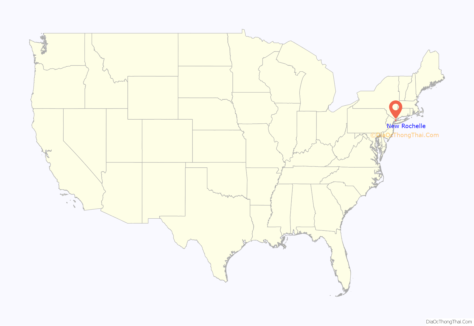
New Rochelle location map. Where is New Rochelle city?
History
Etymology and early history
The European settlement was started by refugee Huguenots (French Protestants) in 1688, who were fleeing religious persecution in France (such as Dragonnades) after the king’s revocation of the Edict of Nantes. Many of the settlers were artisans and craftsmen from the city of La Rochelle, France, thus influencing the choice of the name of “New Rochelle”.
17th and 18th centuries
Some 33 families established the community of La Nouvelle-Rochelle (French pronunciation: [la nuvɛl ʁɔʃɛl]) in 1688. A monument containing the names of these settlers stands in Hudson Park, the original landing point of the Huguenots. Thirty-one years earlier, the Siwanoy Indians, a band of Algonquian-speaking Lenape (also known as the Delaware by English colonists) sold their land to Thomas Pell. In 1689, Pell officially deeded 6,100 acres (25 km) for the establishment of a Huguenot community. Jacob Leisler is an important figure in the early histories of both New Rochelle and the United States. He arrived in America as a mercenary in the British army and later became one of the most prominent merchants in New York. He was subsequently appointed acting-governor of the province, and it was during this time that he acted on behalf of the Huguenots.
Of all the Huguenot settlements in America founded with the intention of being distinctly French colonies, New Rochelle most clearly conformed to the plans of its founders. The colony continued to attract French refugees until as late as 1760. The choice of name for the city reflected the importance of the city of La Rochelle and of the new settlement in Huguenot history and distinctly French character of the community. French was spoken, and it was common practice for people in neighboring areas to send their children to New Rochelle to learn the language.
In 1775, General George Washington stopped in New Rochelle on his way to assume command of the Army of the United Colonies in Massachusetts. The British Army briefly occupied sections of New Rochelle and Larchmont in 1776. Following British victory in the Battle of White Plains, New Rochelle became part of a “Neutral Ground” for General Washington to regroup his troops. After the Revolutionary War ended in 1784, patriot Thomas Paine was given a farm in New Rochelle for his service to the cause of independence. The farm, totaling about 300 acres (1.2 km), had been confiscated from its owners by state of New York due to their Tory activities.
The first national census of 1790 shows New Rochelle with 692 residents. 136 were African American, including 36 who were freemen; the remainder were enslaved.
19th and 20th centuries
Through the 18th century, New Rochelle had remained a modest village that retained an abundance of agricultural land. During the 19th century, however, New York City was a destination from the mid-century on by waves of immigration, principally from Ireland and Germany. More established American families left New York City and moved into this area. Although the original Huguenot population was rapidly shrinking in relative size, through ownership of land, businesses, banks, and small manufactures, they retained a predominant hold on the political and social life of the town.
The 1820 Census showed 150 African-Americans residing in New Rochelle, six of whom were still enslaved. The state abolished slavery by degrees: children of enslaved mothers were born free, and all enslaved people were freed by 1827.
In 1857 the Village of New Rochelle was established within the borders of the Town of New Rochelle. A group of volunteers created the first fire service in 1861. In 1899, a bill creating the New Rochelle City Charter was signed by Governor Theodore Roosevelt. It was through this bill that the Village and Town of New Rochelle were joined into one municipality. In 1899, Michael J. Dillon narrowly defeated Hugh A. Harmer to become New Rochelle’s first mayor. The recently established city charter designated a board of aldermen as the legislative unit with two members to be elected from each of four wards and 10 elected from the city at-large.
By 1900, New Rochelle had a population of 14,720. Throughout the city, farms, estates, and wooded homesteads were bought up by realty and development companies. Planned residential neighborhoods such as Rochelle Park, one of the first planned communities in the country, soon spread across the city, earning New Rochelle the sobriquet “City of Homes”. In 1909, Edwin Thanhouser established Thanhouser Film Corporation. Thanhouser’s Million Dollar Mystery was one of the first serial motion pictures. In 1923, New Rochelle resident Anna Jones became the first African-American woman to be admitted to the New York State Bar.
Poet and resident James J. Montague captured the image of New Rochelle at the time in his 1926 poem “Queen City of the Sound”.
In 1930, New Rochelle recorded a population of 54,000, up from 36,213 only ten years earlier. During the 1930s, New Rochelle was the wealthiest city per capita in New York state and the third wealthiest in the country.
By the end of the century, the Metro North railroad station was rebuilt along with a $190 million entertainment complex, nicknamed New Roc City, which featured a 19-screen movie theater, an IMAX theater, an indoor ice-hockey arena, mini-golf, go karts, an arcade, restaurants, a hotel, loft-apartments and a mega supermarket. The complex was built on the site of the former New Rochelle Mall, which had opened in 1968.
21st century
In 2014, New Rochelle’s planning board approved $149 million in developments to three major sections of the city. The developments include restaurants, stores, hotels, an entertainment area, theaters and a mixed-use waterfront area, and are expected to be completed within 10 years. Additional tax breaks ranging in the tens of millions of dollars have since been awarded by the city government to further the redevelopment of the downtown area.
In March 2020, New Rochelle became one of the first reported centers for COVID-19 transmission in New York state during the 2019–20 coronavirus outbreak. On March 10, 2020, Governor Andrew Cuomo ordered components of the New York Air National Guard and New York Army National Guard to institute a one-mile radius containment area centered around the Young Israel of New Rochelle synagogue in the Wykagyl section of the City in an attempt to stem the spread of the virus. The implementation of this containment area, which covered multiple neighborhoods in New Rochelle and extended into parts of the neighboring Town of Eastchester, marked the first use in the state of New York of social distancing measures and the closure of schools, houses of worship, and other institutions to combat the spread of the pandemic. Large gathering places including schools and places of worship were declared closed, while National Guard troops were deployed to provide logistical support such as assistance with the distribution of food and the disinfection of public areas.
Historic sites
- Columbia Island – a small island (approx. 150 feet (46 m) square) situated between Davids Island and Pea Island. Up until 1940 it was known as Little Pea Island. CBS purchased it and built a concrete foundation to support a transmitter building topped by a 410-foot (120 m) tall antenna tower for WCBS-AM. The transmitter remained in operation until the 1960s, when the station was moved to nearby High Island.
- Execution Rocks Lighthouse – centered in the middle of Long Island Sound, just south of Davids Island. The structure was built in 1849 and includes a 55-foot (17 m) tall tower and the ‘keeper’s house’. It is rumored that the lighthouse’s site got its name before the American Revolutionary War when British colonial authorities executed people by chaining them to the rocks at low tide and allowing the rising water to drown them. In reality, the name was chosen to reflect the historically dangerous shipping area created by the rocks exposure during low tides.
- Huckleberry Island – a 10-acre (40,000 m) island owned by the Huckleberry Indians, Inc., a club within the New York Athletic Club. The island is an important nesting site for waterbirds such as egrets and night herons.
- Leland Castle – a 19th-century Gothic Revival castle built as the summer residence of Simeon Leland, a wealthy New York City hotel entrepreneur. It has since been acquired by the College of New Rochelle and is used as an art gallery available to the public.
- St. John’s Wilmot Church – a historic Episcopal parish located in the northern end of the City at the intersection of North Avenue and Wilmot Road, formerly referred to as “Cooper’s Corner”.
- Thomas Paine Historical Site – a historical nexus within the city, the site comprises: the country home of the American pamphleteer and Revolutionary War hero Thomas Paine, his burial site, monument, and a museum. Paine’s Cottage was built in 1793 and is a National Historic Landmark. The Thomas Paine Memorial Building, built in 1925, houses the library and museum collection of the Thomas Paine National Historical Association. Also on the site is the Brewster Schoolhouse, one of the oldest structural relics in Westchester County.
- Trinity-St. Paul’s Episcopal Church – added to the National Register of Historic Places in 2006. It is located at the northwest corner of Huguenot Street (also known as the Boston Post Road) and Division Street. This church represents the body of the majority group of New Rochelle’s founding Huguenot French Calvinistic congregation that conformed to the liturgy of the established Church of England in June 1709. King George III gave Trinity its first charter in 1762. After the Revolutionary War, Trinity became a parish of the Protestant Episcopal Church of America.
New Rochelle Road Map
New Rochelle city Satellite Map
Geography
New Rochelle is located at the southeastern point of continental New York State. It lies on the Long Island Sound, bordered on the west by Pelham, Pelham Manor and Eastchester, by Scarsdale to the north and east, and Mamaroneck and Larchmont to the east. The city lies 2 miles (3.2 km) north of the New York City border (Pelham Bay Park in The Bronx). According to the United States Census Bureau, the city has a total area of 13.2 square miles (34.3 km). The city has a roughly triangular shape, approximately 10 miles (16 km) from north to south and 1.5 miles (2 km) from east to west at its widest point.
See also
Map of New York State and its subdivision:- Albany
- Allegany
- Bronx
- Broome
- Cattaraugus
- Cayuga
- Chautauqua
- Chemung
- Chenango
- Clinton
- Columbia
- Cortland
- Delaware
- Dutchess
- Erie
- Essex
- Franklin
- Fulton
- Genesee
- Greene
- Hamilton
- Herkimer
- Jefferson
- Kings
- Lake Ontario
- Lewis
- Livingston
- Madison
- Monroe
- Montgomery
- Nassau
- New York
- Niagara
- Oneida
- Onondaga
- Ontario
- Orange
- Orleans
- Oswego
- Otsego
- Putnam
- Queens
- Rensselaer
- Richmond
- Rockland
- Saint Lawrence
- Saratoga
- Schenectady
- Schoharie
- Schuyler
- Seneca
- Steuben
- Suffolk
- Sullivan
- Tioga
- Tompkins
- Ulster
- Warren
- Washington
- Wayne
- Westchester
- Wyoming
- Yates
- Alabama
- Alaska
- Arizona
- Arkansas
- California
- Colorado
- Connecticut
- Delaware
- District of Columbia
- Florida
- Georgia
- Hawaii
- Idaho
- Illinois
- Indiana
- Iowa
- Kansas
- Kentucky
- Louisiana
- Maine
- Maryland
- Massachusetts
- Michigan
- Minnesota
- Mississippi
- Missouri
- Montana
- Nebraska
- Nevada
- New Hampshire
- New Jersey
- New Mexico
- New York
- North Carolina
- North Dakota
- Ohio
- Oklahoma
- Oregon
- Pennsylvania
- Rhode Island
- South Carolina
- South Dakota
- Tennessee
- Texas
- Utah
- Vermont
- Virginia
- Washington
- West Virginia
- Wisconsin
- Wyoming
