Farmingdale is an incorporated village on Long Island within the Town of Oyster Bay in Nassau County, New York, United States. The population was 8,189 as of the 2010 Census.
The Lenox Hills neighborhood is adjacent to Bethpage State Park and the rest of the town is within a fifteen-minute drive of the park. It is also approximately 37 mi (59 km) southeast of Midtown Manhattan and can be reached via the Ronkonkoma Branch of the LIRR. The Long Island Expressway and Seaford Oyster Bay Expressway are the best way to reach Farmingdale from the city and the mainland.
| Name: | Farmingdale village |
|---|---|
| LSAD Code: | 47 |
| LSAD Description: | village (suffix) |
| State: | New York |
| County: | Nassau County |
| Elevation: | 69 ft (21 m) |
| Total Area: | 1.09 sq mi (2.83 km²) |
| Land Area: | 1.09 sq mi (2.83 km²) |
| Water Area: | 0.00 sq mi (0.00 km²) |
| Total Population: | 8,466 |
| Population Density: | 7,738.57/sq mi (2,987.43/km²) |
| ZIP code: | 11735 |
| Area code: | 516 |
| FIPS code: | 3625384 |
| GNISfeature ID: | 0949918 |
| Website: | www.farmingdalevillage.com |
Online Interactive Map
Click on ![]() to view map in "full screen" mode.
to view map in "full screen" mode.
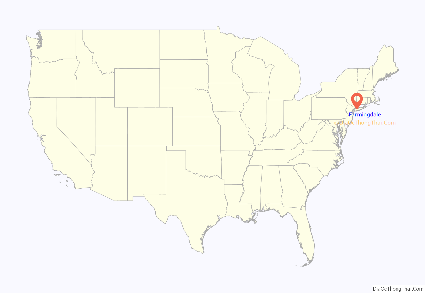
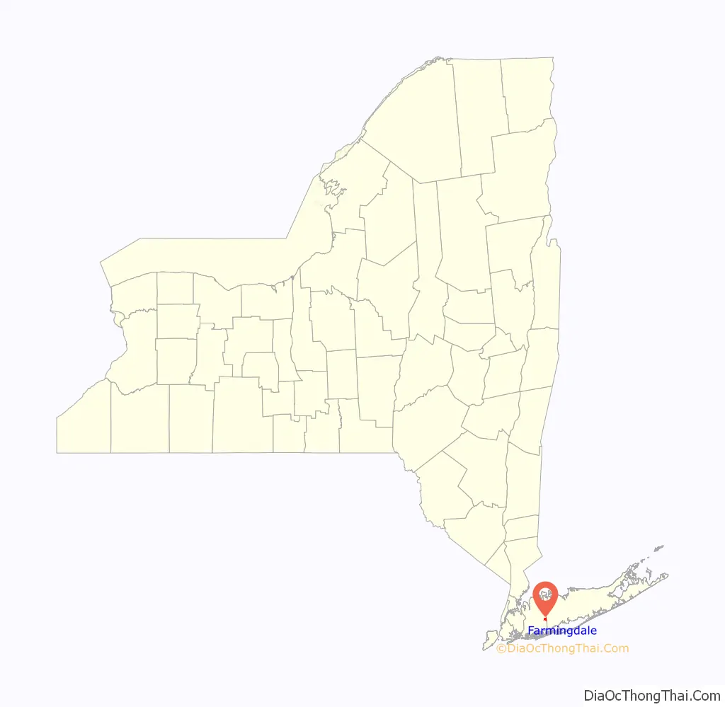
Farmingdale location map. Where is Farmingdale village?
History
The first European settler in the area was Thomas Powell, who arrived in 1687. On October 18, 1695, he purchased a 15-square-mile (39 km) tract of land from three Native American tribes. This is known as the Bethpage Purchase and includes what is now Farmingdale, as well as Bethpage, Melville, North Massapequa, Old Bethpage, Plainedge, and Plainview. One of two houses he built in the area (circa 1738) still stands on Merritts Road in Farmingdale.
In the 1830s, anticipating construction of the Long Island Rail Road (LIRR), land developer Ambrose George purchased a large tract of land between a community then known as Bethpage and an area in Suffolk County known as Hardscrabble. He built a general store in the western part of this property which he named Farmingdale. When the LIRR started service to the area in October 1841, it used the name Farmingdale for its latest stop, here, on the line it was building to Greenport. Stagecoaches took people from the Farmingdale station to Islip, Babylon, Patchogue, Oyster Bay South, and West Neck (Huntington area).
In 1886 a fire department was organized. The Village of Farmingdale was incorporated in 1904. In 1912, the State Agricultural and Technical school was established. The Lenox Hills Country Club, an 18-hole private golf course designed by Devereux Emmet, was developed north of the community in 1923 and was owned and operated by Benjamin F. Yoakum. This golf course was purchased by the State of New York, was greatly expanded, and then re-opened as Bethpage State Park in 1932, with much of the golf design work carried out by golf architect A.W. Tillinghast, later inducted into the World Golf Hall of Fame. The original 1920s era Lenox Hills subdivision and later adjacent subdivisions, located between the Bethpage State Park golf courses and the Long Island Railroad trackage, encompassing rolling hills and a wide boulevard, are known as the more upscale part of Farmingdale Village. Later, Farmingdale became a locus for the aircraft industry, notably Republic Aviation Company.
In 1899, Mile-a-Minute Murphy rode a bicycle along the Long Island Rail Road’s Central Branch through the Farmingdale area at a mile a minute. For many years, the town celebrated its birth with the annual Hardscrabble Fair, with music, food and games. It was normally held in May.
As of 2020, the mayor was Ralph Ekstrand.
Usage of name
Farmingdale is also associated with several unincorporated areas outside the village limits, including South Farmingdale (also in the Town of Oyster Bay within Nassau County), and East Farmingdale (in the Town of Babylon within Suffolk County). Many nearby places not within the village limits have Farmingdale as their postal address and the same 11735 ZIP code. Residents of East Farmingdale must use Farmingdale as their mailing address, and residents of South Farmingdale can use either Farmingdale or South Farmingdale. Bethpage State Park, which is mostly in Old Bethpage, also has a Farmingdale mailing address. Farmingdale Union Free School District (UFSD 22) includes parts of both Nassau County and Suffolk County and the southernmost part of Bethpage State Park, where the clubhouse is located. A road sign on Main Street in the south-east section of South Farmingdale (and over a mile from the Village of Farmingdale) welcomes travelers to Farmingdale. Farmingdale is also the name of the local Farmingdale Water District and Farmingdale Fire District, both of which also include areas outside the boundaries of the Village of Farmingdale. Farmingdale State College and Republic Airport are in East Farmingdale, both with Farmingdale mailing addresses.
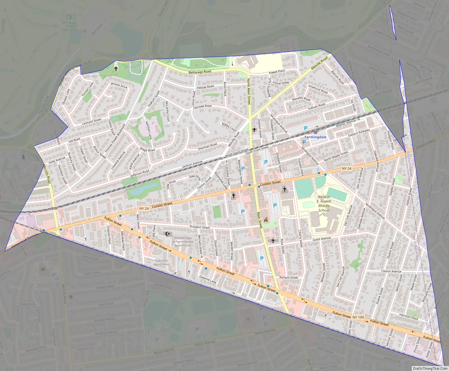
Farmingdale Road Map
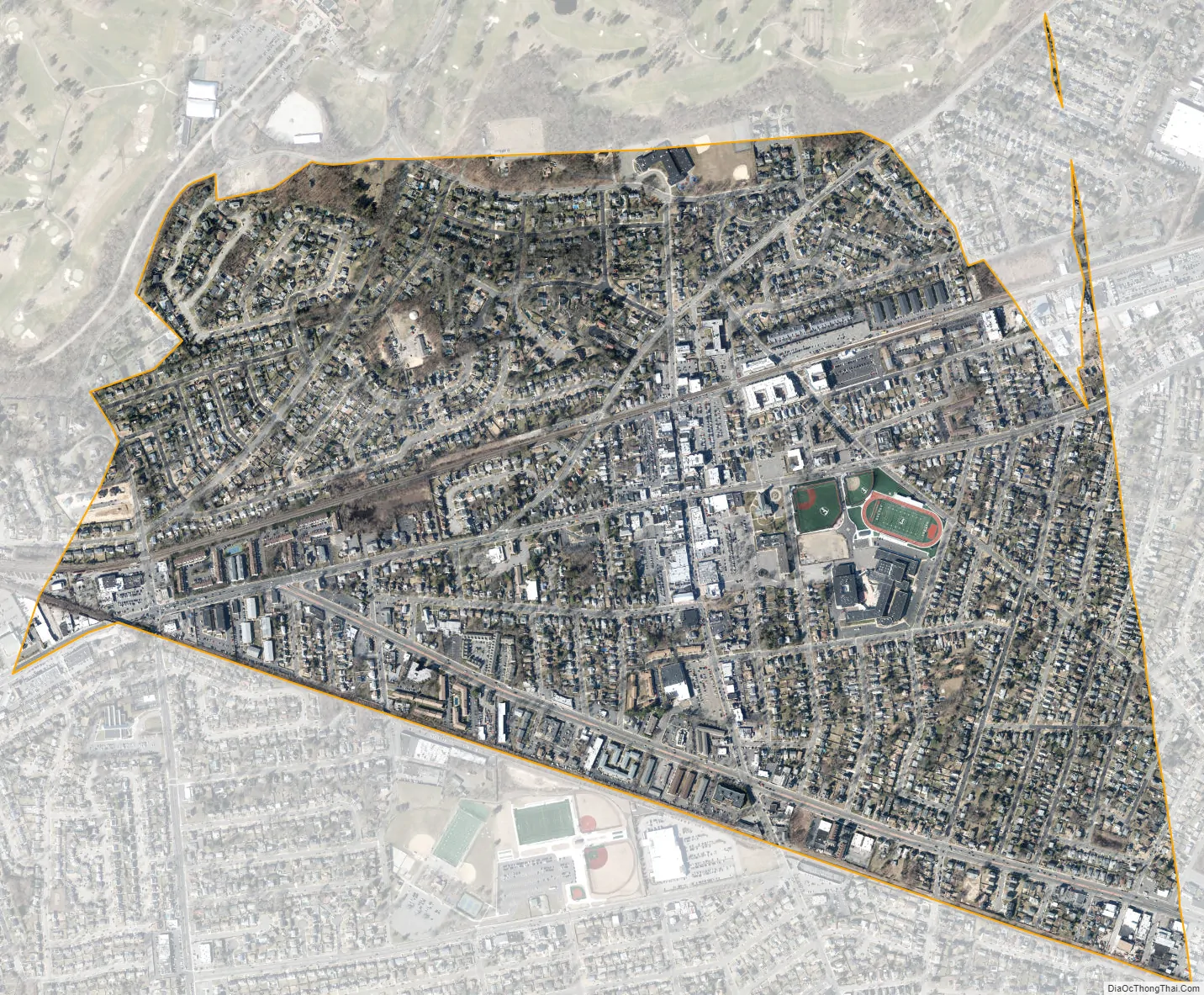
Farmingdale city Satellite Map
Geography
According to the United States Census Bureau, the village has a total area of 1.1 square miles (2.8 km), all land.
Between the 1990 Census and the 2000 census, the village gained territory.
Climate
According to the Köppen Climate Classification system, Farmingdale has a humid subtropical climate, abbreviated “Cfa” on climate maps. The hottest temperature recorded in Farmingdale was 102 °F (38.9 °C) on July 6, 2010 and July 22, 2011, while the coldest temperature recorded was −1 °F (−18.3 °C) on January 4, 2014.
See also
Map of New York State and its subdivision:- Albany
- Allegany
- Bronx
- Broome
- Cattaraugus
- Cayuga
- Chautauqua
- Chemung
- Chenango
- Clinton
- Columbia
- Cortland
- Delaware
- Dutchess
- Erie
- Essex
- Franklin
- Fulton
- Genesee
- Greene
- Hamilton
- Herkimer
- Jefferson
- Kings
- Lake Ontario
- Lewis
- Livingston
- Madison
- Monroe
- Montgomery
- Nassau
- New York
- Niagara
- Oneida
- Onondaga
- Ontario
- Orange
- Orleans
- Oswego
- Otsego
- Putnam
- Queens
- Rensselaer
- Richmond
- Rockland
- Saint Lawrence
- Saratoga
- Schenectady
- Schoharie
- Schuyler
- Seneca
- Steuben
- Suffolk
- Sullivan
- Tioga
- Tompkins
- Ulster
- Warren
- Washington
- Wayne
- Westchester
- Wyoming
- Yates
- Alabama
- Alaska
- Arizona
- Arkansas
- California
- Colorado
- Connecticut
- Delaware
- District of Columbia
- Florida
- Georgia
- Hawaii
- Idaho
- Illinois
- Indiana
- Iowa
- Kansas
- Kentucky
- Louisiana
- Maine
- Maryland
- Massachusetts
- Michigan
- Minnesota
- Mississippi
- Missouri
- Montana
- Nebraska
- Nevada
- New Hampshire
- New Jersey
- New Mexico
- New York
- North Carolina
- North Dakota
- Ohio
- Oklahoma
- Oregon
- Pennsylvania
- Rhode Island
- South Carolina
- South Dakota
- Tennessee
- Texas
- Utah
- Vermont
- Virginia
- Washington
- West Virginia
- Wisconsin
- Wyoming


