Pawling is a village in Dutchess County, New York, United States. The population was 2,347 at the 2010 census. It is part of the Poughkeepsie–Newburgh–Middletown, NY Metropolitan Statistical Area as well as the larger New York–Newark–Bridgeport, NY-NJ–CT–PA Combined Statistical Area. The John Kane House, a registered historic place, is situated in the village. The village was portrayed as the fictional town of Denning, New York, in the TV series Elementary.
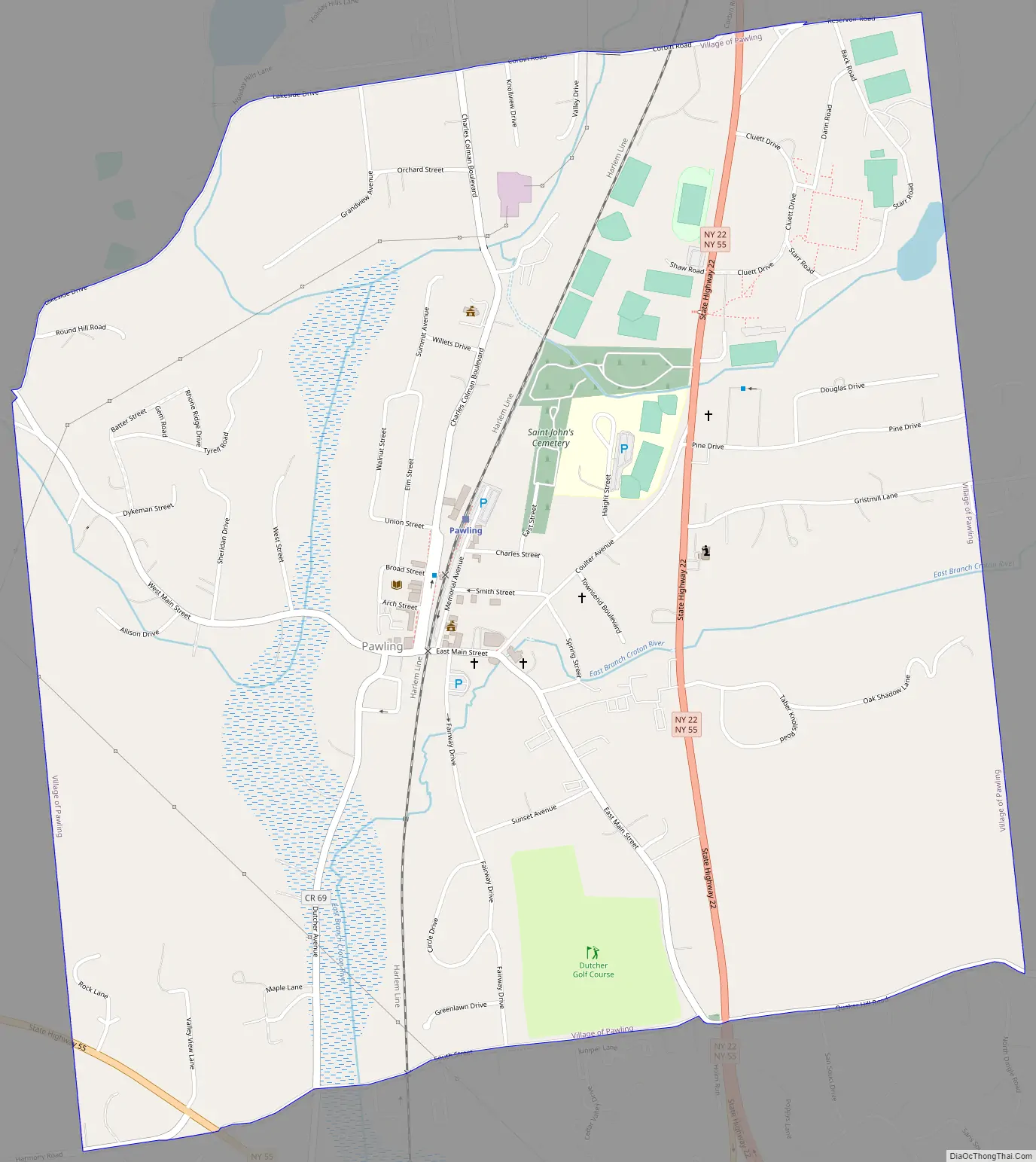
The village of Pawling is centrally located in the town of Pawling by the junction of Routes 22 and 55.
| Name: | Pawling village |
|---|---|
| LSAD Code: | 47 |
| LSAD Description: | village (suffix) |
| State: | New York |
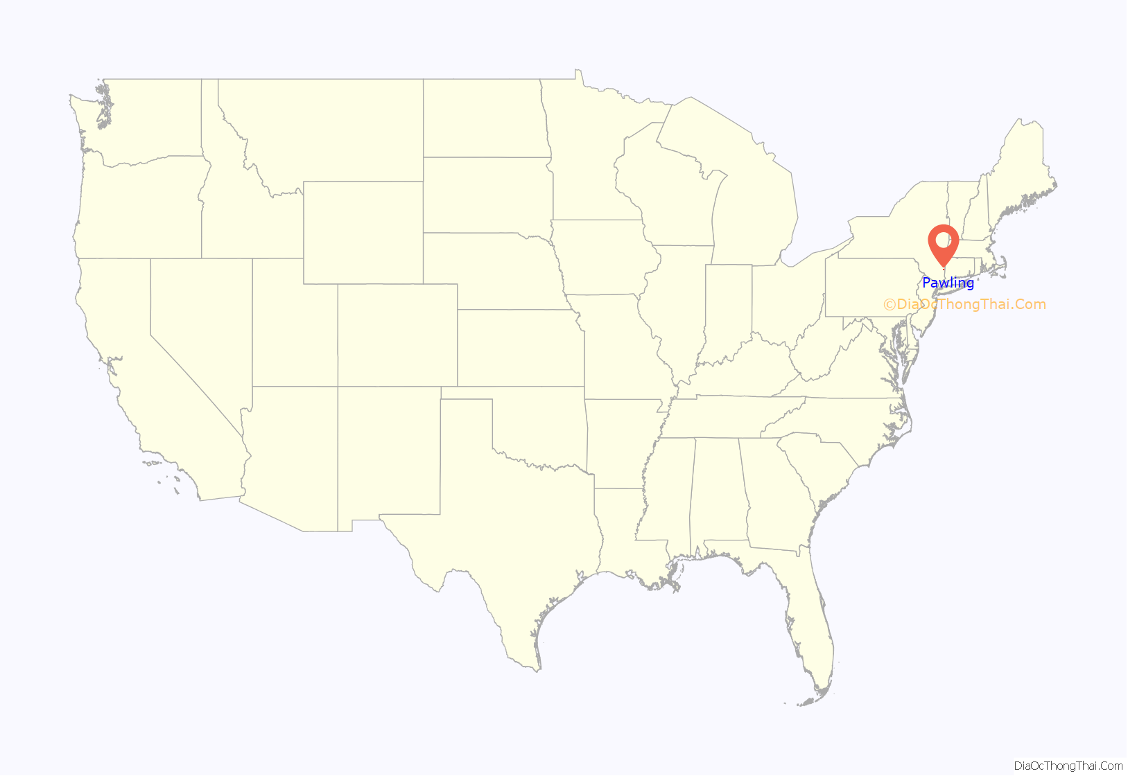
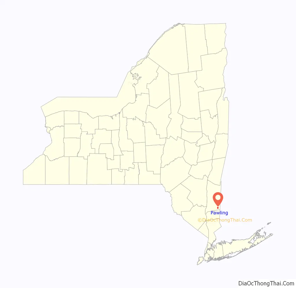
| County: | Dutchess County |
| Elevation: | 463 ft (141 m) |
| Total Area: | 1.95 sq mi (5.06 km²) |
| Land Area: | 1.95 sq mi (5.06 km²) |
| Water Area: | 0.00 sq mi (0.00 km²) |
| Total Population: | 1,995 |
| Population Density: | 1,020.98/sq mi (394.18/km²) |
| ZIP code: | 12564 |
| Area code: | 845 |
| FIPS code: | 3656814 |
| GNISfeature ID: | 0960006 |
| Website: | www.villageofpawling.org |
Online Interactive Map
Click on ![]() to view map in "full screen" mode.
to view map in "full screen" mode.
Pawling location map. Where is Pawling village?
History
The village was incorporated in 1893.
Pawling is also host to the world’s shortest St. Patrick’s Day parade. The annual parade is held on Broad Street in the village of Pawling at a length of 223 feet.
Pawling Road Map
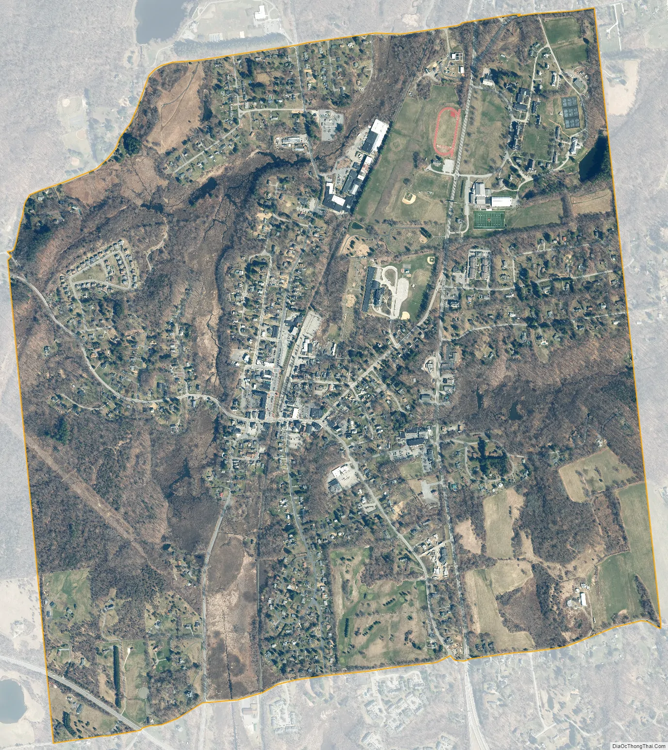
Pawling city Satellite Map
Geography
Pawling is located in southeastern Dutchess County at 41°33′43″N 73°35′54″W / 41.56194°N 73.59833°W / 41.56194; -73.59833 (41.562053, -73.598503).
According to the United States Census Bureau, the village has a total area of 2.0 square miles (5.2 km), all land.
See also
Map of New York State and its subdivision:- Albany
- Allegany
- Bronx
- Broome
- Cattaraugus
- Cayuga
- Chautauqua
- Chemung
- Chenango
- Clinton
- Columbia
- Cortland
- Delaware
- Dutchess
- Erie
- Essex
- Franklin
- Fulton
- Genesee
- Greene
- Hamilton
- Herkimer
- Jefferson
- Kings
- Lake Ontario
- Lewis
- Livingston
- Madison
- Monroe
- Montgomery
- Nassau
- New York
- Niagara
- Oneida
- Onondaga
- Ontario
- Orange
- Orleans
- Oswego
- Otsego
- Putnam
- Queens
- Rensselaer
- Richmond
- Rockland
- Saint Lawrence
- Saratoga
- Schenectady
- Schoharie
- Schuyler
- Seneca
- Steuben
- Suffolk
- Sullivan
- Tioga
- Tompkins
- Ulster
- Warren
- Washington
- Wayne
- Westchester
- Wyoming
- Yates
- Alabama
- Alaska
- Arizona
- Arkansas
- California
- Colorado
- Connecticut
- Delaware
- District of Columbia
- Florida
- Georgia
- Hawaii
- Idaho
- Illinois
- Indiana
- Iowa
- Kansas
- Kentucky
- Louisiana
- Maine
- Maryland
- Massachusetts
- Michigan
- Minnesota
- Mississippi
- Missouri
- Montana
- Nebraska
- Nevada
- New Hampshire
- New Jersey
- New Mexico
- New York
- North Carolina
- North Dakota
- Ohio
- Oklahoma
- Oregon
- Pennsylvania
- Rhode Island
- South Carolina
- South Dakota
- Tennessee
- Texas
- Utah
- Vermont
- Virginia
- Washington
- West Virginia
- Wisconsin
- Wyoming


