Peekskill is a city in northwestern Westchester County, New York, United States, 35 miles (56 km) from New York City. Established as a village in 1816, it was incorporated as a city in 1940. It lies on a bay along the east side of the Hudson River, across from Jones Point in Rockland County. The population was 25,431 at the 2020 US census, an increase over 23,583 during the 2010 census. It is the third largest municipality in northern Westchester County, after the towns of Cortlandt and Yorktown.
The area was an early American industrial center, primarily for iron plow and stove products. The Binney & Smith Company, now named Crayola LLC and makers of Crayola products, is linked to the Peekskill Chemical Company founded by Joseph Binney at Annsville in 1864, and succeeded by a partnership by his son Edwin and nephew Harold Smith in 1885.
The well-publicized Peekskill Riots of 1949 involved attacks and a lynching-in-effigy occasioned by Paul Robeson’s benefit concerts for the Civil Rights Congress, although the main assault following the September concert properly took place in nearby Van Cortlandtville. Nevertheless, the city of Peekskill has since had multiple African American mayors since 1984.
| Name: | Peekskill city |
|---|---|
| LSAD Code: | 25 |
| LSAD Description: | city (suffix) |
| State: | New York |
| County: | Westchester County |
| Elevation: | 128 ft (39 m) |
| Total Area: | 5.57 sq mi (14.43 km²) |
| Land Area: | 4.34 sq mi (11.25 km²) |
| Water Area: | 1.23 sq mi (3.18 km²) |
| Total Population: | 25,431 |
| Population Density: | 5,854.28/sq mi (2,260.30/km²) |
| ZIP code: | 10566 |
| Area code: | 914 |
| FIPS code: | 3656979 |
| GNISfeature ID: | 0960097 |
| Website: | www.cityofpeekskill.com |
Online Interactive Map
Click on ![]() to view map in "full screen" mode.
to view map in "full screen" mode.
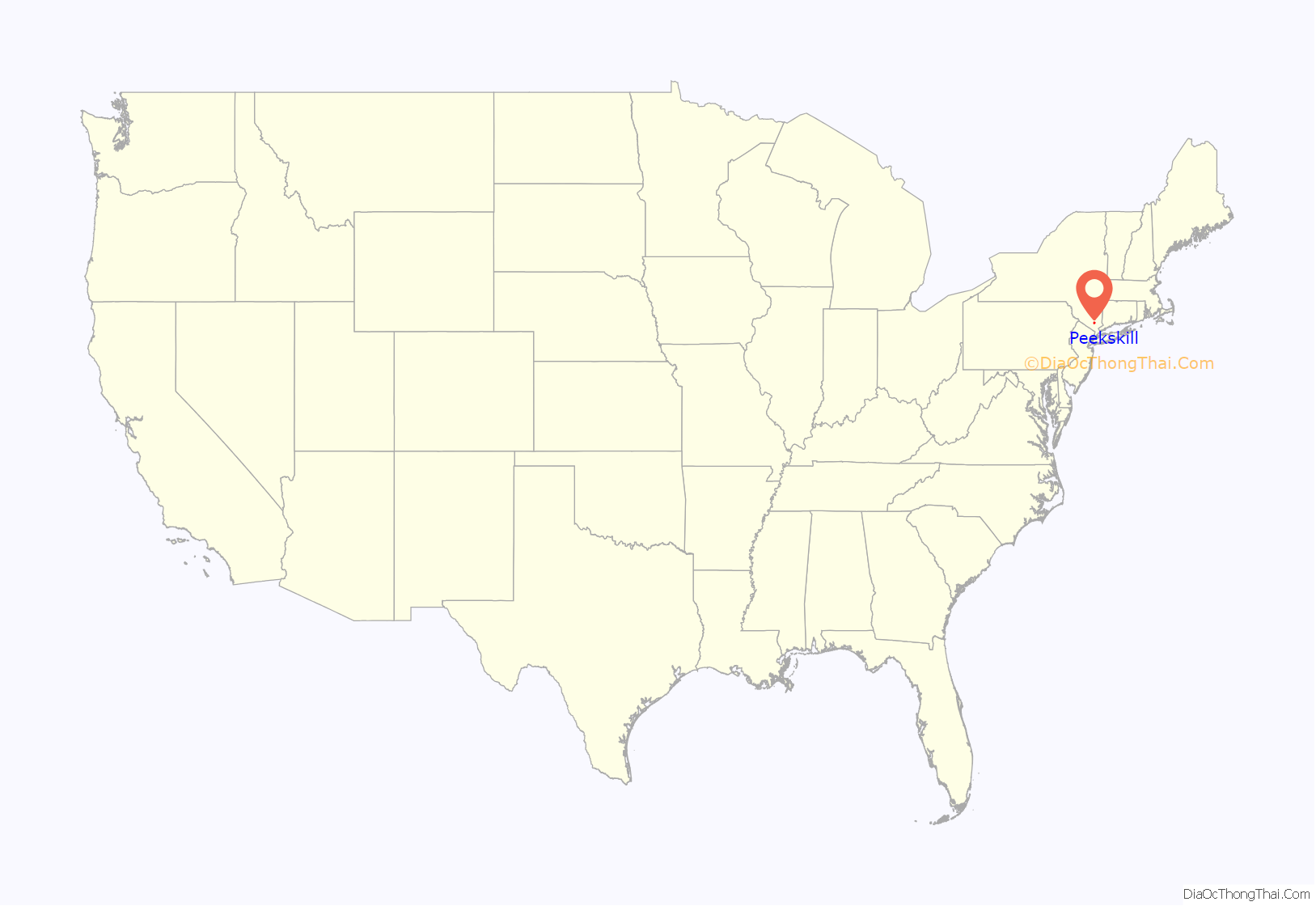
Peekskill location map. Where is Peekskill city?
History
Pre-Revolution
In September 1609, Dutch explorer Henry Hudson, captain of the Half Moon, anchored along the reach of the Hudson River at Peekskill. His first mate noted in the ship’s log that it was a “very pleasant place to build a town”. After the establishment of the province of New Netherland, New Amsterdam resident Jan Peeck made the first recorded contact with the Lenape people of this area, then identified as “Sachoes”. The date is not certain, (possibly early 1640s), but agreements and merchant transactions took place, formalized in the Ryck’s Patent Deed of 1684. The name Peekskill derives from a combination of Mr. Peeck’s surname and the Dutch word for stream, kil or kill.
Fort Independence
Located on the north bank of the Annsville Creek as it empties into the Hudson, Fort Independence combined with Forts Montgomery and Clinton to defend the Hudson River Valley. Fort Independence was built in August 1776, while Forts Montgomery and Clinton were started in June. Fort Hill Park, the site of Camp Peekskill, contained five barracks and two redoubts.
Settlement was slow in the early 18th century. By the time of the American Revolution, the tiny community was an important manufacturing center, which made it attractive to the Continental Army, which established an outpost here in 1776. Several creeks and streams powered mills which provided gunpowder, leather, planks, and flour. Slaughterhouses provided fresh meat, easily shipped from docks along the river. Much was needed to support several other forts and garrisons located to support the Hudson River Chains placed between Bear Mountain Bridge and Anthony’s Nose during the Revolution to prevent British naval passage upriver.
Though Peekskill’s terrain and mills were beneficial to the Patriot cause, they also made tempting targets for British raids. The most damaging attack took place in early spring of 1777, when an invasion force of a dozen vessels led by a warship and supported by infantry overwhelmed the American defenders. On leaving New Windsor in June, 1781, Washington established his quarters, for a short time, at Peekskill.
Post-Revolution
Peekskill’s first legal incorporation of 1816 was reactivated in 1826 when Village elections took place. The Village was further incorporated within the Town of Cortlandt in 1849 and remained so until separating as a city in 1940.
In 1859 Rev. Henry Ward Beecher bought a thirty-six acre farm at Peekskill. Beecher made many improvements and established a summer home for his family. In 1902 the locally prominent McFadden family bought the property. In 1987 the Beecher-McFadden Estate was added to the National Register of Historic Places.
In August 1949, following reports misquoting Paul Robeson’s speech to the World Peace Conference in Paris as stating that African Americans would not fight for the United States in any prospective war against the Soviet Union, a planned benefit concert for the Civil Rights Congress in Peekskill had to be cancelled amid White Nationalist and anti-communist violence. An effigy of Robeson was lynched in the town. The artists were able to plan a second concert in nearby Van Cortlandtville on a farm owned by a Holocaust survivor. (His house was subsequently shot into and brickbats thrown through his windows.) The publicity drew a crowd of around 20,000, and two men with rifles were discovered and removed prior to any violence during the concert itself. It was one of the earliest performances of Pete Seeger’s “If I Had a Hammer”; Robeson sang surrounded by union guards and volunteers from the audience as protection against other snipers. Following the event, area police and state troopers directed exiting traffic down a single road into an ambush where rocks were thrown through car windows (even at cars with small children). Some were overturned and their occupants beaten without police intervention. These Peekskill Riots were subsequently well-publicized in news report and folk songs and formed a major event in E.L. Doctorow’s historical fiction novel The Book of Daniel.
Peekskill was the landing point of a fragment of the Peekskill Meteorite, just before midnight on October 9, 1992. The meteoric trail was recorded on film by at least sixteen individuals. This was only the fourth meteorite in history for which an exact orbit is known. The rock had a mass of 27.7 pounds (12.6 kg) and punched through the trunk of Peekskill resident’s automobile upon impact.
The Peekskill Evening Star and the Peekskill Highland Democrat were two of the city’s daily newspapers through much of the city’s history. The Evening Star published under various mastheads from the 19th century on, and as the Evening Star from 1939 until 1985 when the paper folded into what would become the nexus of the Journal News, a conglomeration of local papers from throughout Westchester County. The Journal News focused more on statewide and New York City issues, however, which led to the founding of the Peekskill Herald in 1986. Although numerous prominent citizens came together to try to keep the paper afloat after a series of New York Times articles about the paper’s foundering fiscal situation, it folded in 2005, being replaced by the Peekskill Daily in 2009.
The Centennial Firehouse, built in 1890, was located under a U.S. Route 9 bridge. During the original construction of the bridge in 1932 part of the roof of the firehouse was removed. As part of a 2008 highway reconstruction project it was to be relocated to a new historic district. The city spent $150,000 in grant money in preparing the building. Unfortunately a mechanical failure during a turn caused the building to collapse.
In 1984, Richard E. Jackson would become Peekskill’s first African American mayor.
Peekskill Road Map
Peekskill city Satellite Map
Geography
Peekskill is located at 41°17′N 73°55′W / 41.283°N 73.917°W / 41.283; -73.917 (41.2889, −73.9200) in northwestern Westchester County.
According to the United States Census Bureau, the city has a total area of 5.5 square miles (14 km), of which 4.3 square miles (11 km) is land and 1.1 square miles (2.8 km) (20.99%) is water. The city’s eastern border is the Town of Cortlandt and its western border is the Hudson River.
See also
Map of New York State and its subdivision:- Albany
- Allegany
- Bronx
- Broome
- Cattaraugus
- Cayuga
- Chautauqua
- Chemung
- Chenango
- Clinton
- Columbia
- Cortland
- Delaware
- Dutchess
- Erie
- Essex
- Franklin
- Fulton
- Genesee
- Greene
- Hamilton
- Herkimer
- Jefferson
- Kings
- Lake Ontario
- Lewis
- Livingston
- Madison
- Monroe
- Montgomery
- Nassau
- New York
- Niagara
- Oneida
- Onondaga
- Ontario
- Orange
- Orleans
- Oswego
- Otsego
- Putnam
- Queens
- Rensselaer
- Richmond
- Rockland
- Saint Lawrence
- Saratoga
- Schenectady
- Schoharie
- Schuyler
- Seneca
- Steuben
- Suffolk
- Sullivan
- Tioga
- Tompkins
- Ulster
- Warren
- Washington
- Wayne
- Westchester
- Wyoming
- Yates
- Alabama
- Alaska
- Arizona
- Arkansas
- California
- Colorado
- Connecticut
- Delaware
- District of Columbia
- Florida
- Georgia
- Hawaii
- Idaho
- Illinois
- Indiana
- Iowa
- Kansas
- Kentucky
- Louisiana
- Maine
- Maryland
- Massachusetts
- Michigan
- Minnesota
- Mississippi
- Missouri
- Montana
- Nebraska
- Nevada
- New Hampshire
- New Jersey
- New Mexico
- New York
- North Carolina
- North Dakota
- Ohio
- Oklahoma
- Oregon
- Pennsylvania
- Rhode Island
- South Carolina
- South Dakota
- Tennessee
- Texas
- Utah
- Vermont
- Virginia
- Washington
- West Virginia
- Wisconsin
- Wyoming
