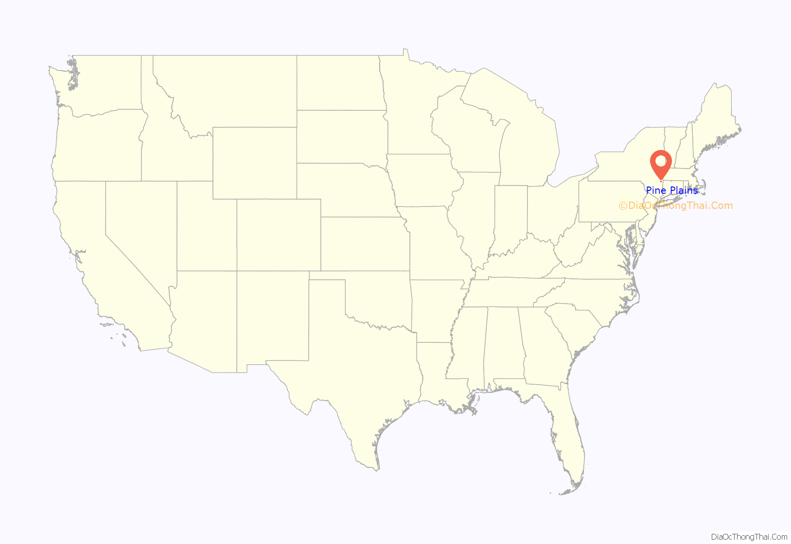
Pine Plains is a hamlet and census-designated place (CDP) in Dutchess County, New York, United States. The population was 1,142 at the 2020 census. It is part of the Poughkeepsie–Newburgh–Middletown, NY Metropolitan Statistical Area as well as the larger New York–Newark–Bridgeport, NY-NJ–CT–PA Combined Statistical Area.
The community of Pine Plains is in the town of Pine Plains.
| Name: | Pine Plains CDP |
|---|---|
| LSAD Code: | 57 |
| LSAD Description: | CDP (suffix) |
| State: | New York |
| County: | Dutchess County |
| Elevation: | 469 ft (143 m) |
| Total Area: | 2.30 sq mi (5.96 km²) |
| Land Area: | 2.08 sq mi (5.39 km²) |
| Water Area: | 0.22 sq mi (0.57 km²) |
| Total Population: | 1,142 |
| Population Density: | 549.04/sq mi (211.94/km²) |
| ZIP code: | 12567 |
| Area code: | 518 |
| FIPS code: | 3658145 |
| GNISfeature ID: | 0960532 |
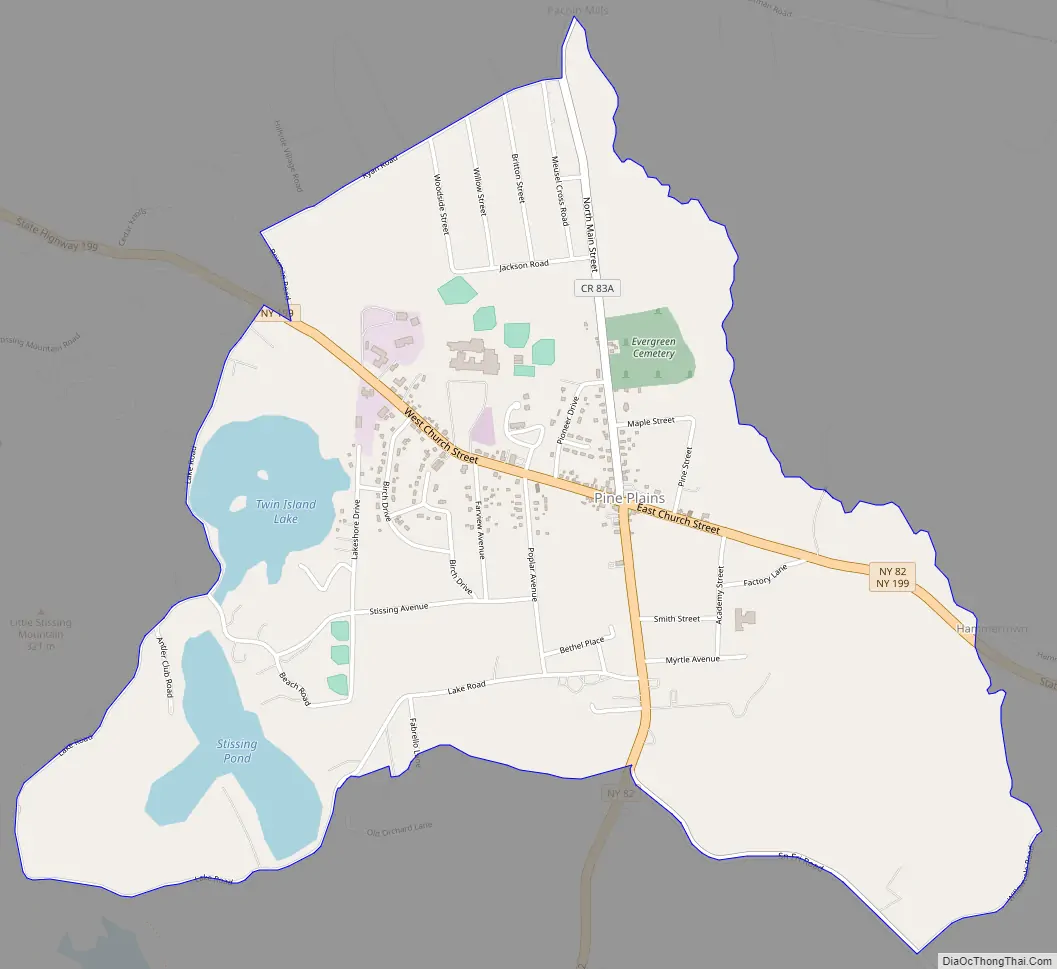
Online Interactive Map
Click on ![]() to view map in "full screen" mode.
to view map in "full screen" mode.
Pine Plains location map. Where is Pine Plains CDP?
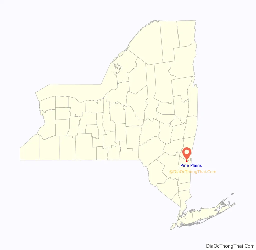
Pine Plains Road Map
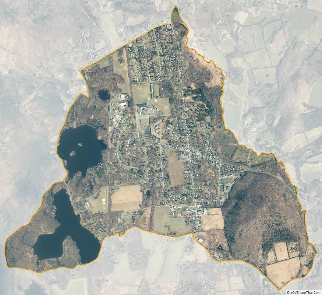
Pine Plains city Satellite Map
Geography
Pine Plains is located near the northern edge of Dutchess County at 41°58′43″N 73°39′40″W / 41.97861°N 73.66111°W / 41.97861; -73.66111 (41.97882, -73.661254), in the central portion of the town of Pine Plains. It is bordered to the northeast by Shekomeko Creek, a tributary of the Roeliff Jansen Kill, which flows northwest to the Hudson River.
New York State Routes 199 and 82 pass through the community. NY 199 (Church Street) leads east 9 miles (14 km) to Millerton and west 14 miles (23 km) to Red Hook. NY 82 enters the community as South Main Street, then turns east on Church Street with NY 199. NY 82 leads south 9 miles (14 km) to Stanfordville and north 9 miles (14 km) by a winding route to Ancram. Poughkeepsie, the Dutchess County seat, is 27 miles (43 km) to the southwest via NY 82 and U.S. Route 44.
According to the United States Census Bureau, the Pine Plains CDP has a total area of 2.3 square miles (6.0 km), of which 2.1 square miles (5.4 km) is land and 0.23 square miles (0.6 km), or 9.73%, is water. The CDP includes two water bodies, Stissing Pond and Twin Island Lake, southwest of the center of town.
See also
Map of New York State and its subdivision:- Albany
- Allegany
- Bronx
- Broome
- Cattaraugus
- Cayuga
- Chautauqua
- Chemung
- Chenango
- Clinton
- Columbia
- Cortland
- Delaware
- Dutchess
- Erie
- Essex
- Franklin
- Fulton
- Genesee
- Greene
- Hamilton
- Herkimer
- Jefferson
- Kings
- Lake Ontario
- Lewis
- Livingston
- Madison
- Monroe
- Montgomery
- Nassau
- New York
- Niagara
- Oneida
- Onondaga
- Ontario
- Orange
- Orleans
- Oswego
- Otsego
- Putnam
- Queens
- Rensselaer
- Richmond
- Rockland
- Saint Lawrence
- Saratoga
- Schenectady
- Schoharie
- Schuyler
- Seneca
- Steuben
- Suffolk
- Sullivan
- Tioga
- Tompkins
- Ulster
- Warren
- Washington
- Wayne
- Westchester
- Wyoming
- Yates
- Alabama
- Alaska
- Arizona
- Arkansas
- California
- Colorado
- Connecticut
- Delaware
- District of Columbia
- Florida
- Georgia
- Hawaii
- Idaho
- Illinois
- Indiana
- Iowa
- Kansas
- Kentucky
- Louisiana
- Maine
- Maryland
- Massachusetts
- Michigan
- Minnesota
- Mississippi
- Missouri
- Montana
- Nebraska
- Nevada
- New Hampshire
- New Jersey
- New Mexico
- New York
- North Carolina
- North Dakota
- Ohio
- Oklahoma
- Oregon
- Pennsylvania
- Rhode Island
- South Carolina
- South Dakota
- Tennessee
- Texas
- Utah
- Vermont
- Virginia
- Washington
- West Virginia
- Wisconsin
- Wyoming


