Rye Brook is a village in Westchester County, New York, United States, within the town of Rye. The population was 9,347 at the 2010 census.
Rye Brook has been designated as a Tree City USA for 14 years.
| Name: | Rye Brook village |
|---|---|
| LSAD Code: | 47 |
| LSAD Description: | village (suffix) |
| State: | New York |
| County: | Westchester County |
| Elevation: | 249 ft (76 m) |
| Total Area: | 3.45 sq mi (8.94 km²) |
| Land Area: | 3.43 sq mi (8.88 km²) |
| Water Area: | 0.02 sq mi (0.06 km²) 0.29% |
| Total Population: | 10,047 |
| Population Density: | 2,930.86/sq mi (1,131.48/km²) |
| ZIP code: | 10573 |
| Area code: | 914 |
| FIPS code: | 3664325 |
| GNISfeature ID: | 0979940 |
| Website: | http://www.ryebrook.org |
Online Interactive Map
Click on ![]() to view map in "full screen" mode.
to view map in "full screen" mode.
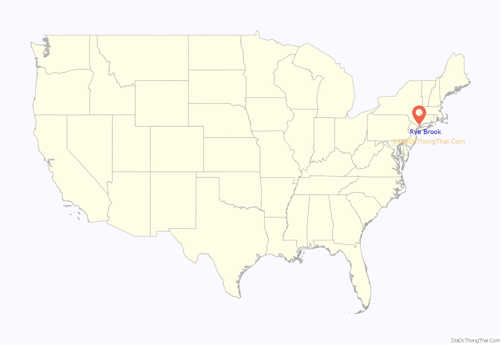
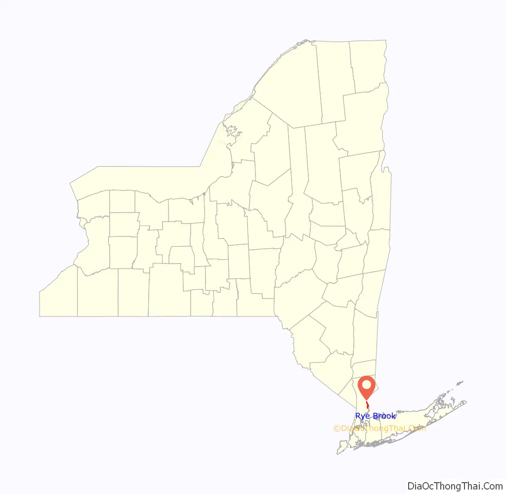
Rye Brook location map. Where is Rye Brook village?
History
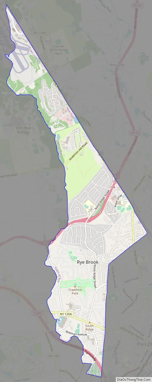
Rye Brook is located in southeastern Westchester County and shares its eastern border with Greenwich, Connecticut. The village was an unincorporated section of the town of Rye until its incorporation as a village on July 7, 1982.
In 1982, 150 residents of the unincorporated area proposed to establish the village of Rye Brook and organized a petition containing 1,536 signatures. The petition drive, which contained the signatures of approximately 36% of the registered voters in the unincorporated area, was organized by the Independent Civic Association. It was reported by The New York Times that one resident commented, “There is a time for a community to redefine itself,” further stating that residents of the unincorporated area “should be able to elect their own officers” and “protect their tax base.”
The residents of the unincorporated area voted on June 23, 1982 to create the Village of Rye Brook. It was the first village created in New York State in 54 years. The referendum to create the new political identity passed with 58% of the voters in favor (1,991 to 1,434). The first election in the Village’s history was held to elect a mayor and four trustees. The first village official was Lee Russillo, who was sworn in as Rye Brook’s first Village Clerk, and was responsible for the first election day.
The village is home to the William E. Ward House, which was added to the National Register of Historic Places in 1976. Also known as Ward’s Castle, it was the home of the National Cartoon Museum, established by Mort Walker, the creator of Beetle Bailey, from 1976 to 1992.
In 1983, 800 Westchester Avenue, described as the “Taj Mahal of Rye Brook” and the “contemporary equivalent to the classical villa,” was constructed as the General Foods Corporate Headquarters.
Rye Brook Road Map
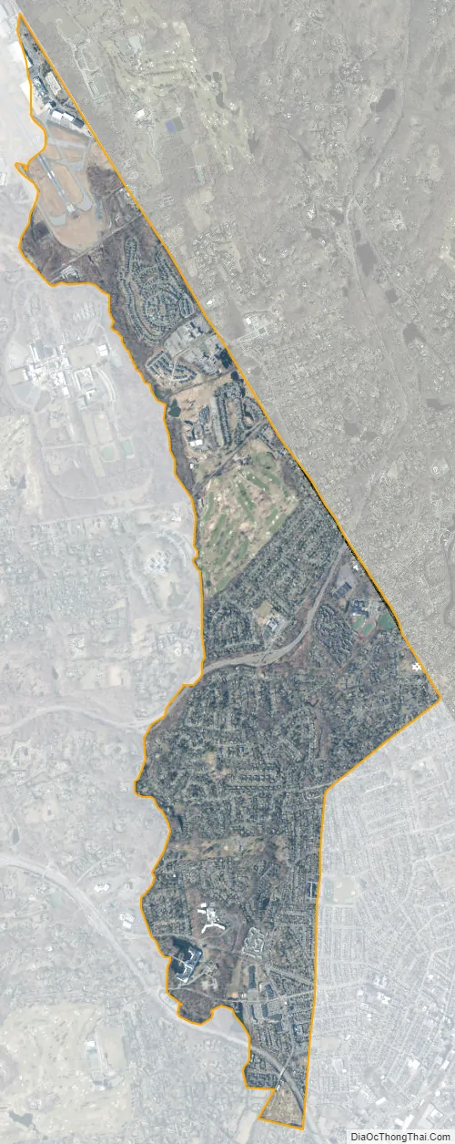
Rye Brook city Satellite Map
Geography
Rye Brook is located at 41°1′11″N 73°41′0″W / 41.01972°N 73.68333°W / 41.01972; -73.68333 (41.019767, -73.683419).
According to the United States Census Bureau, the village has a total area of 3.5 square miles (9.1 km), all land.
See also
Map of New York State and its subdivision:- Albany
- Allegany
- Bronx
- Broome
- Cattaraugus
- Cayuga
- Chautauqua
- Chemung
- Chenango
- Clinton
- Columbia
- Cortland
- Delaware
- Dutchess
- Erie
- Essex
- Franklin
- Fulton
- Genesee
- Greene
- Hamilton
- Herkimer
- Jefferson
- Kings
- Lake Ontario
- Lewis
- Livingston
- Madison
- Monroe
- Montgomery
- Nassau
- New York
- Niagara
- Oneida
- Onondaga
- Ontario
- Orange
- Orleans
- Oswego
- Otsego
- Putnam
- Queens
- Rensselaer
- Richmond
- Rockland
- Saint Lawrence
- Saratoga
- Schenectady
- Schoharie
- Schuyler
- Seneca
- Steuben
- Suffolk
- Sullivan
- Tioga
- Tompkins
- Ulster
- Warren
- Washington
- Wayne
- Westchester
- Wyoming
- Yates
- Alabama
- Alaska
- Arizona
- Arkansas
- California
- Colorado
- Connecticut
- Delaware
- District of Columbia
- Florida
- Georgia
- Hawaii
- Idaho
- Illinois
- Indiana
- Iowa
- Kansas
- Kentucky
- Louisiana
- Maine
- Maryland
- Massachusetts
- Michigan
- Minnesota
- Mississippi
- Missouri
- Montana
- Nebraska
- Nevada
- New Hampshire
- New Jersey
- New Mexico
- New York
- North Carolina
- North Dakota
- Ohio
- Oklahoma
- Oregon
- Pennsylvania
- Rhode Island
- South Carolina
- South Dakota
- Tennessee
- Texas
- Utah
- Vermont
- Virginia
- Washington
- West Virginia
- Wisconsin
- Wyoming


