Spackenkill (/ˈspækənˌkɪl/) is a hamlet and census-designated place (CDP) in Dutchess County, New York, United States. The population was 4,123 at the 2010 census. It is part of the Poughkeepsie–Newburgh–Middletown, NY Metropolitan Statistical Area as well as the larger New York–Newark–Bridgeport, NY-NJ–CT–PA Combined Statistical Area.
Spackenkill is in the town of Poughkeepsie. Children in the community, if they attend public school, go to the Spackenkill Union Free School District. An IBM plant is also located in this community, and many of its employees live in Spackenkill. Several informal neighborhoods exist within the Spackenkill community such as Hagantown, Nassau, King George, Beechwood, Crown Heights, and Kingwood Park. These neighborhoods contain some of the schools of the Spackenkill School District.
| Name: | Spackenkill CDP |
|---|---|
| LSAD Code: | 57 |
| LSAD Description: | CDP (suffix) |
| State: | New York |
| County: | Dutchess County |
| Elevation: | 175 ft (53 m) |
| Total Area: | 1.80 sq mi (4.66 km²) |
| Land Area: | 1.80 sq mi (4.65 km²) |
| Water Area: | 0.00 sq mi (0.00 km²) |
| Total Population: | 4,223 |
| Population Density: | 2,350.03/sq mi (907.23/km²) |
| ZIP code: | 12603 |
| Area code: | 845 |
| FIPS code: | 3670035 |
| GNISfeature ID: | 1867420 |
Online Interactive Map
Click on ![]() to view map in "full screen" mode.
to view map in "full screen" mode.
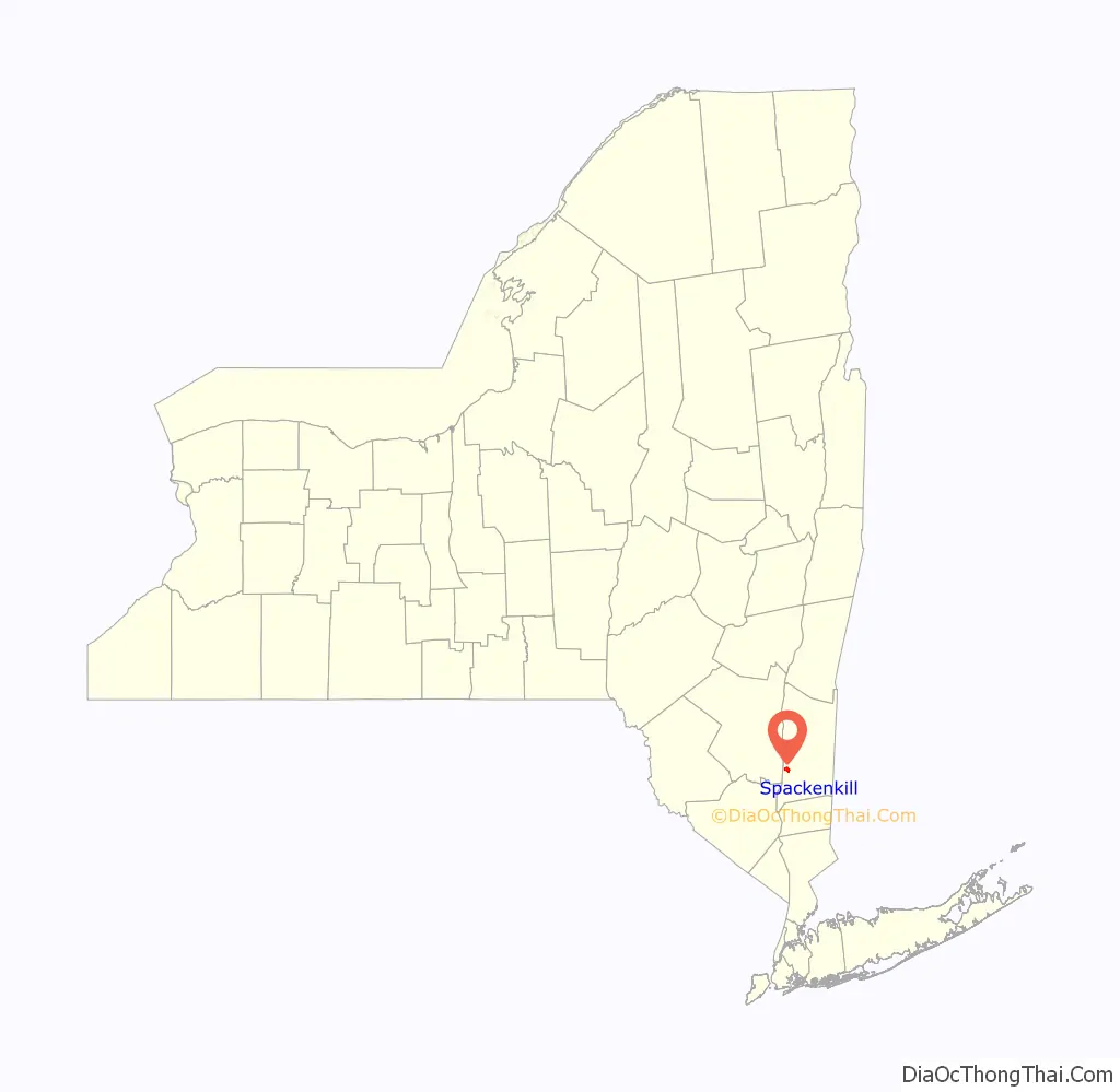
Spackenkill location map. Where is Spackenkill CDP?

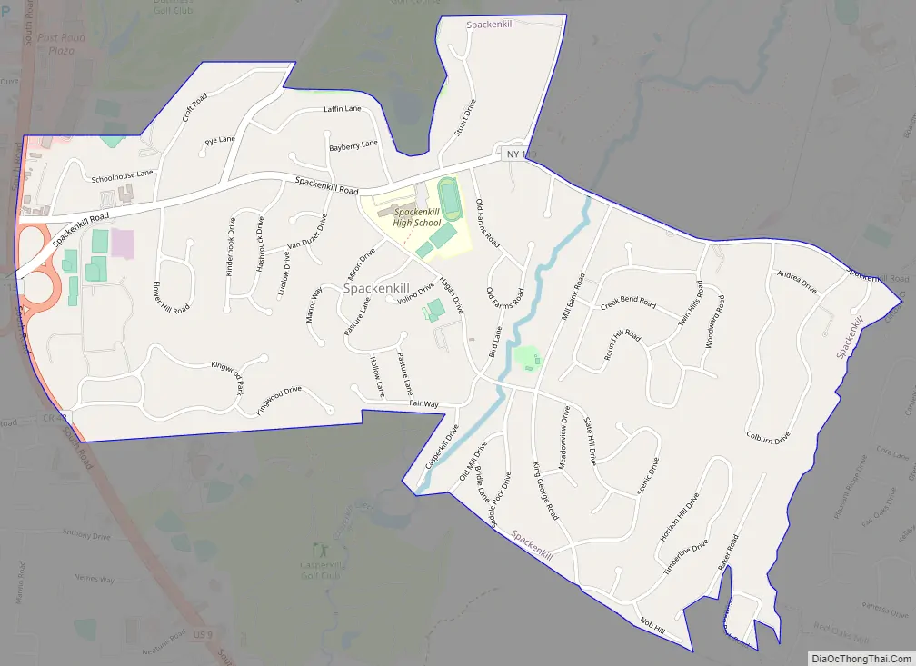
Spackenkill Road Map
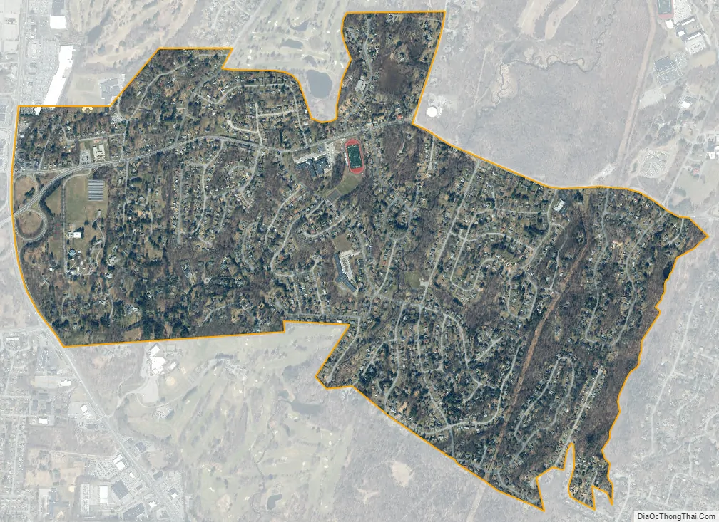
Spackenkill city Satellite Map
Geography
Spackenkill is located in the south-central part of the town of Poughkeepsie at 41°39.1′N 73°54.5′W / 41.6517°N 73.9083°W / 41.6517; -73.9083 (41.6510, -73.9078). Neighboring communities include Crown Heights to the southwest and Red Oaks Mill to the east. The city of Poughkeepsie is 4 miles (6 km) to the north.
According to the United States Census Bureau, the Spackenkill CDP has a total area of 1.8 square miles (4.6 km), all land.
See also
Map of New York State and its subdivision:- Albany
- Allegany
- Bronx
- Broome
- Cattaraugus
- Cayuga
- Chautauqua
- Chemung
- Chenango
- Clinton
- Columbia
- Cortland
- Delaware
- Dutchess
- Erie
- Essex
- Franklin
- Fulton
- Genesee
- Greene
- Hamilton
- Herkimer
- Jefferson
- Kings
- Lake Ontario
- Lewis
- Livingston
- Madison
- Monroe
- Montgomery
- Nassau
- New York
- Niagara
- Oneida
- Onondaga
- Ontario
- Orange
- Orleans
- Oswego
- Otsego
- Putnam
- Queens
- Rensselaer
- Richmond
- Rockland
- Saint Lawrence
- Saratoga
- Schenectady
- Schoharie
- Schuyler
- Seneca
- Steuben
- Suffolk
- Sullivan
- Tioga
- Tompkins
- Ulster
- Warren
- Washington
- Wayne
- Westchester
- Wyoming
- Yates
- Alabama
- Alaska
- Arizona
- Arkansas
- California
- Colorado
- Connecticut
- Delaware
- District of Columbia
- Florida
- Georgia
- Hawaii
- Idaho
- Illinois
- Indiana
- Iowa
- Kansas
- Kentucky
- Louisiana
- Maine
- Maryland
- Massachusetts
- Michigan
- Minnesota
- Mississippi
- Missouri
- Montana
- Nebraska
- Nevada
- New Hampshire
- New Jersey
- New Mexico
- New York
- North Carolina
- North Dakota
- Ohio
- Oklahoma
- Oregon
- Pennsylvania
- Rhode Island
- South Carolina
- South Dakota
- Tennessee
- Texas
- Utah
- Vermont
- Virginia
- Washington
- West Virginia
- Wisconsin
- Wyoming


