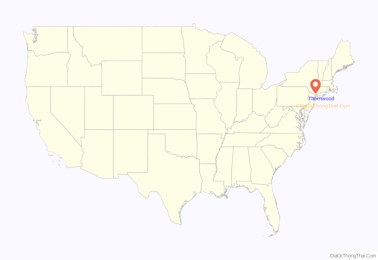
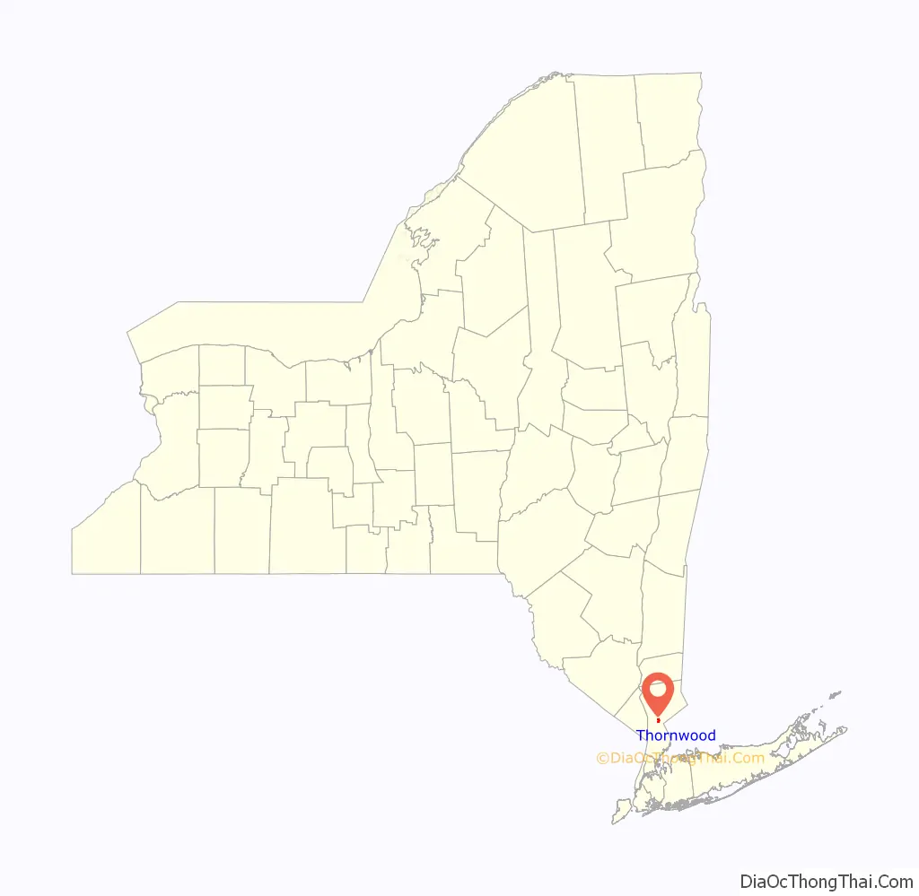
Thornwood is a hamlet (unincorporated community), census-designated place (CDP), and postal designation (with zip code 10594) in the town of Mount Pleasant in Westchester County, New York. The population was 3,759 at the 2010 census.
| Name: | Thornwood CDP |
|---|---|
| LSAD Code: | 57 |
| LSAD Description: | CDP (suffix) |
| State: | New York |
| County: | Westchester County |
| Elevation: | 269 ft (82 m) |
| Total Area: | 1.12 sq mi (2.89 km²) |
| Land Area: | 1.12 sq mi (2.89 km²) |
| Water Area: | 0.00 sq mi (0.00 km²) |
| Total Population: | 3,960 |
| Population Density: | 3,545.21/sq mi (1,368.99/km²) |
| ZIP code: | 10594 |
| Area code: | 914 |
| FIPS code: | 3673715 |
| GNISfeature ID: | 0967439 |
Online Interactive Map
Click on ![]() to view map in "full screen" mode.
to view map in "full screen" mode.
Thornwood location map. Where is Thornwood CDP?
History
In 1891, Lewis Smadback started a very successful development at what is now Thornwood. The village of Sherman Park was incorporated in 1906 and the name was changed to Hillside in 1909. The village was dissolved in 1914, when Thornwood took its current name and became a hamlet within the Town of Mount Pleasant. It is possible that Thornwood is a derivative of “Hawthorne’s Woods,” since Hawthorne is an adjacent hamlet. Another possibility is Thornwood is named after an area in Glasgow, Scotland.
Thornwood once had a large and thriving Westchester marble quarry near its heart, the intersection of Route 141 and Kensico Road (known as Four Corners). Dating back to 1845, the quarry supplied white marble which helped build St. Patrick’s Cathedral (hence the name of Marble Avenue which runs through the hamlet). The quarry pit was filled in during the mid-1980s, and the Town Center shopping mall was constructed over it.
Thornwood once had a station on the Harlem Line of the Metro-North Railroad and was approximately a 48-minute ride to Grand Central Terminal. The station building remains on Commerce Street, but the stop was eliminated when the up-starter Harlem Line (north of North White Plains) was electrified in the mid-1980s. Thornwood was the only stop eliminated as a result of the electrification process. While the station could accommodate diesel trains, the curvature of the tracks as proceeding north to Pleasantville made the construction at Thornwood of an elevated platform, necessary for electric trains, impractical.
The death of baby Kristie Fischer took place in 1991.
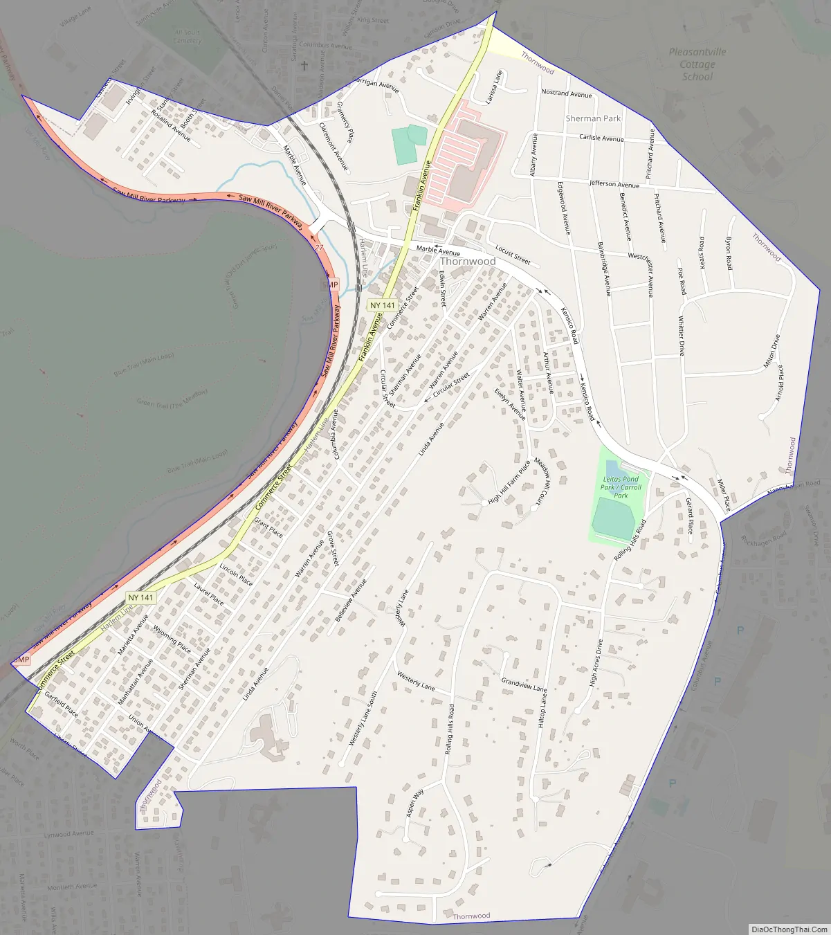
Thornwood Road Map
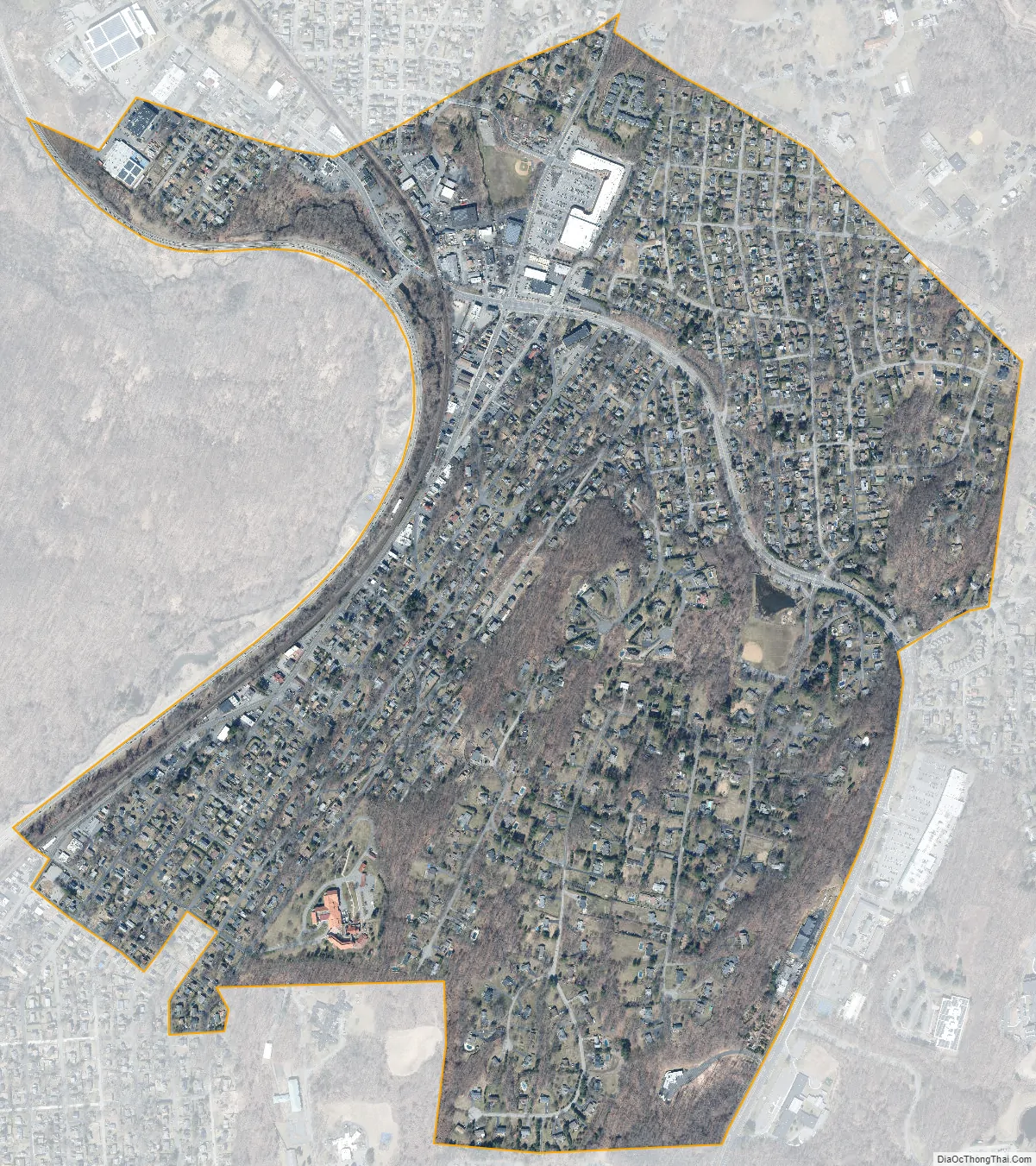
Thornwood city Satellite Map
Geography
Thornwood is located at 41°7′18″N 73°46′37″W / 41.12167°N 73.77694°W / 41.12167; -73.77694 (41.121557, -73.777071). According to the U.S. Census Bureau, the hamlet has a total area of 1.1 square miles (2.9 km), all land.
See also
Map of New York State and its subdivision:- Albany
- Allegany
- Bronx
- Broome
- Cattaraugus
- Cayuga
- Chautauqua
- Chemung
- Chenango
- Clinton
- Columbia
- Cortland
- Delaware
- Dutchess
- Erie
- Essex
- Franklin
- Fulton
- Genesee
- Greene
- Hamilton
- Herkimer
- Jefferson
- Kings
- Lake Ontario
- Lewis
- Livingston
- Madison
- Monroe
- Montgomery
- Nassau
- New York
- Niagara
- Oneida
- Onondaga
- Ontario
- Orange
- Orleans
- Oswego
- Otsego
- Putnam
- Queens
- Rensselaer
- Richmond
- Rockland
- Saint Lawrence
- Saratoga
- Schenectady
- Schoharie
- Schuyler
- Seneca
- Steuben
- Suffolk
- Sullivan
- Tioga
- Tompkins
- Ulster
- Warren
- Washington
- Wayne
- Westchester
- Wyoming
- Yates
- Alabama
- Alaska
- Arizona
- Arkansas
- California
- Colorado
- Connecticut
- Delaware
- District of Columbia
- Florida
- Georgia
- Hawaii
- Idaho
- Illinois
- Indiana
- Iowa
- Kansas
- Kentucky
- Louisiana
- Maine
- Maryland
- Massachusetts
- Michigan
- Minnesota
- Mississippi
- Missouri
- Montana
- Nebraska
- Nevada
- New Hampshire
- New Jersey
- New Mexico
- New York
- North Carolina
- North Dakota
- Ohio
- Oklahoma
- Oregon
- Pennsylvania
- Rhode Island
- South Carolina
- South Dakota
- Tennessee
- Texas
- Utah
- Vermont
- Virginia
- Washington
- West Virginia
- Wisconsin
- Wyoming


