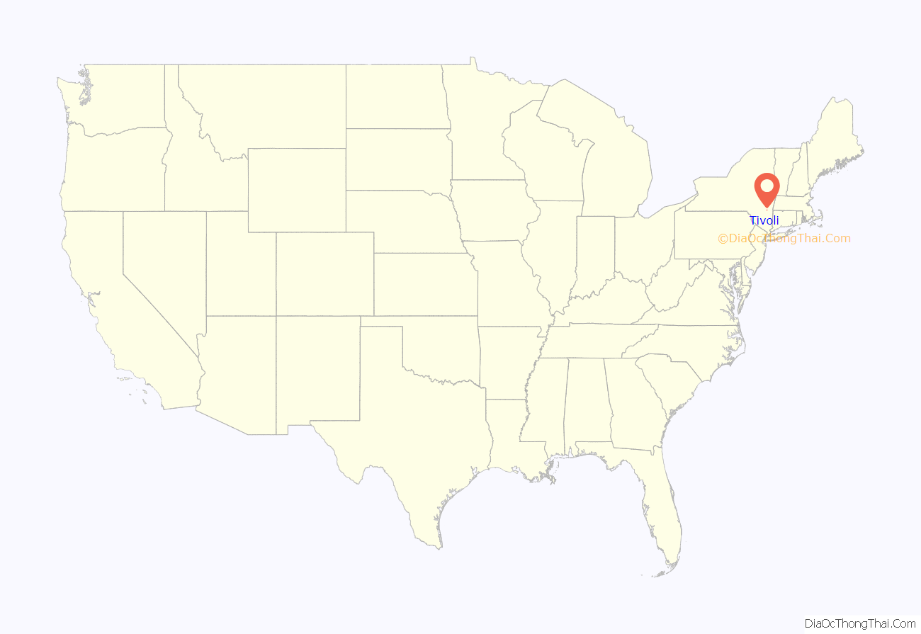
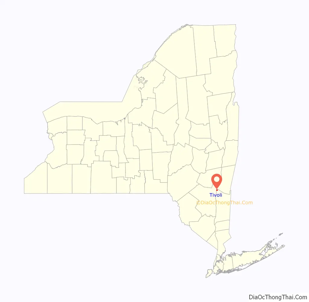
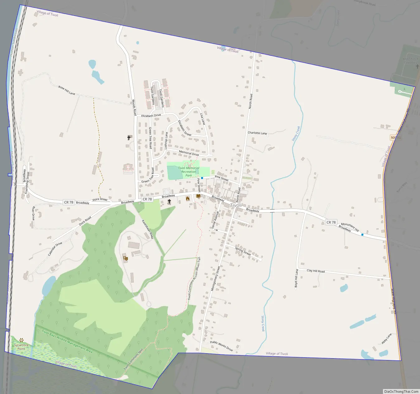
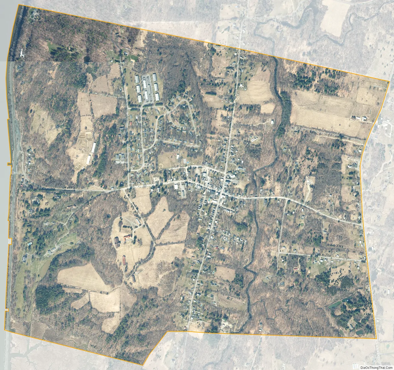
Tivoli is a village in Dutchess County, New York, United States. The population is 1,012, according to the 2020 census. The village, which was incorporated in 1872 from parts of Upper Red Hook Landing and Madalin, is the northernmost settlement in the county, located in the northwestern part of the town of Red Hook. It is part of the Poughkeepsie–Newburgh–Middletown, NY Metropolitan Statistical Area as well as the larger New York–Newark–Bridgeport, NY-NJ–CT–PA Combined Statistical Area. It is entirely within the Hudson River Historic District, a National Historic Landmark. The village is accessible via New York State Route 9G at an intersection with Dutchess County Route 78.
The Kaatsbaan Cultural Center is located within the village boundaries. It was once known as the Kaatsbaan International Dance Center.
| Name: | Tivoli village |
|---|---|
| LSAD Code: | 47 |
| LSAD Description: | village (suffix) |
| State: | New York |
| County: | Dutchess County |
| Incorporated: | 1872 |
| Elevation: | 151 ft (46 m) |
| Total Area: | 1.55 sq mi (4.01 km²) |
| Land Area: | 1.54 sq mi (3.99 km²) |
| Water Area: | 0.01 sq mi (0.01 km²) |
| Total Population: | 1,012 |
| Population Density: | 656.29/sq mi (253.38/km²) |
| ZIP code: | 12583 |
| Area code: | 845 |
| FIPS code: | 3674023 |
| GNISfeature ID: | 0967571 |
| Website: | www.tivoliny.org |
Online Interactive Map
Click on ![]() to view map in "full screen" mode.
to view map in "full screen" mode.
Tivoli location map. Where is Tivoli village?
History
For thousands of years, indigenous peoples had lived in this area. The historic Mohican Native American tribe was living in the area now known as Tivoli at the time Dutch colonists arrived in the 1600s. The Mohican derive from Lenni Lenape people who moved North from the coastal areas and settled in today’s Hudson Valley. They lived along the Hudson River which they named Mahicannituck. They originally called themselves the Muh-he-con-neok (The People of the Waters That Are Never Still). Based on their location, they were often referred to as the River Indians. Their name evolved in spelling over the years, including the name “Mahikan”, until it became today’s Mohican.
A deed to land purchased by Robert Livingston from several Mahican Indians in July 1683, is the strongest evidence that the Roeliff Jansen Kill is considered to mark the downriver boundary of Mahican territory on the East side of the Hudson Valley. This land purchased would form the majority of the manor and lordship of Livingston. Historical accounts state that the settled land of Tivoli was purchased from Native American communities “legitimately” by Colonel David Schuyler on June 2, 1688, although no records of this transaction exist today. There is speculation as to whether or not the Mohican Tribe “fully understood European notions of land ownership.” This transaction would have been a trade of goods in exchange for land. This deal was part of the Schuyler Patent, a June 1688 patent defining some of the towns and villages in Dutchess County and the Poughkeepsie regional area. The patent was obtained for land in the far North-West corner of Dutchess County, lying to the East of Magdalen Island (present-day Cruger Island). The North boundary of the patent abutted the Livingston Purchase of 1683.
The village was formerly known as “Upper Red Hook Landing”. An adjacent community, “Madalin”, was contiguous to Upper Red Hook Landing.
Peter Delabegarre – also known as Pierre de la Bigarre – purchased land along the Hudson River in the 1790s south of Chancellor Robert R. Livingston’s estate Clermont, in order to build a village he called “Tivoli”; the name was taken from the location of the Roman resort. His planned settlement was never built as he conceived it before he went bankrupt, but the name of Tivoli remained attached to the area.
The village of Tivoli was incorporated in 1872, consolidating Madalin and Upper Red Hook Landing. The population at the time was 1,081.
Rose Hill
Rose Hill, located on Rose Hill Lane off Woods Road in Tivoli, New York, is an estate with a villa built in the Tuscan style in 1843 by John Watts de Peyster. The name Rose Hill comes from the summer home in Upper Manhattan of de Peyster’s grandfather, Watts, which in turn was named after the grandfather’s estate near Edinburgh. After his death, it became the Leake and Watts Orphan House. The estate was bought in 1964 by Dorothy Day of the Catholic Worker Movement, which operated it as a farm until 1978. As of 2017, it was the home of painters Brice and Helen Marden, owners of the Hotel Tivoli.
John Cranch’s sister spent a much-enjoyed summer at Rose Hill.
Tivoli Road Map
Tivoli city Satellite Map
Geography
Tivoli is located in the northwest corner of Dutchess County at 42°3′34″N 73°54′38″W / 42.05944°N 73.91056°W / 42.05944; -73.91056 (42.059370, −73.910663). The Tivoli Landing, where Tivoli meets the Hudson River, offers natural advantages that have led members of the Dutchess County Historical Society to assert that there were sporadic American Indian encampments there. The two islands nearby provided a measure of safety.
According to the United States Census Bureau, the village has a total area of 1.64 square miles (4.24 km), of which 1.61 square miles (4.17 km) is land and 0.03 square miles (.07 km), or 1.69%, is water.
See also
Map of New York State and its subdivision:- Albany
- Allegany
- Bronx
- Broome
- Cattaraugus
- Cayuga
- Chautauqua
- Chemung
- Chenango
- Clinton
- Columbia
- Cortland
- Delaware
- Dutchess
- Erie
- Essex
- Franklin
- Fulton
- Genesee
- Greene
- Hamilton
- Herkimer
- Jefferson
- Kings
- Lake Ontario
- Lewis
- Livingston
- Madison
- Monroe
- Montgomery
- Nassau
- New York
- Niagara
- Oneida
- Onondaga
- Ontario
- Orange
- Orleans
- Oswego
- Otsego
- Putnam
- Queens
- Rensselaer
- Richmond
- Rockland
- Saint Lawrence
- Saratoga
- Schenectady
- Schoharie
- Schuyler
- Seneca
- Steuben
- Suffolk
- Sullivan
- Tioga
- Tompkins
- Ulster
- Warren
- Washington
- Wayne
- Westchester
- Wyoming
- Yates
- Alabama
- Alaska
- Arizona
- Arkansas
- California
- Colorado
- Connecticut
- Delaware
- District of Columbia
- Florida
- Georgia
- Hawaii
- Idaho
- Illinois
- Indiana
- Iowa
- Kansas
- Kentucky
- Louisiana
- Maine
- Maryland
- Massachusetts
- Michigan
- Minnesota
- Mississippi
- Missouri
- Montana
- Nebraska
- Nevada
- New Hampshire
- New Jersey
- New Mexico
- New York
- North Carolina
- North Dakota
- Ohio
- Oklahoma
- Oregon
- Pennsylvania
- Rhode Island
- South Carolina
- South Dakota
- Tennessee
- Texas
- Utah
- Vermont
- Virginia
- Washington
- West Virginia
- Wisconsin
- Wyoming


