Wilberforce is a census-designated place (CDP) in Greene County, Ohio, United States. The population was 2,271 at the 2010 census, up from 1,579 at the 2000 census.
| Name: | Wilberforce CDP |
|---|---|
| LSAD Code: | 57 |
| LSAD Description: | CDP (suffix) |
| State: | Ohio |
| County: | Greene County |
| Elevation: | 1,007 ft (307 m) |
| Total Area: | 3.10 sq mi (8.04 km²) |
| Land Area: | 3.08 sq mi (7.98 km²) |
| Water Area: | 0.02 sq mi (0.06 km²) |
| Total Population: | 2,410 |
| Population Density: | 782.21/sq mi (302.03/km²) |
| ZIP code: | 45384 |
| Area code: | 937, 326 |
| FIPS code: | 3985092 |
| GNISfeature ID: | 1061778 |
Online Interactive Map
Click on ![]() to view map in "full screen" mode.
to view map in "full screen" mode.
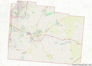
Wilberforce location map. Where is Wilberforce CDP?


History
After Wilberforce College was established in 1856, the community was also named for the English statesman William Wilberforce, who worked for the abolition of slavery and achieved the end of the slave trade in the United Kingdom and its empire. The small community served as an important stop for refugee slaves on the Underground Railroad before the American Civil War, as it had seven stations.
The Ohio Historical Society operates the National Afro-American Museum and Cultural Center, which provides exhibits and learning opportunities for the regional community. The Association of African American Museums, also located in Wilberforce and supported by the private university, works to build professional capacity among smaller museums.
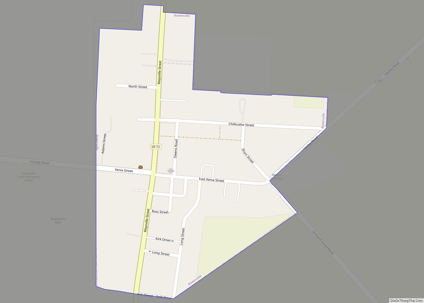
Wilberforce Road Map

Wilberforce city Satellite Map

Geography
Wilberforce is located in central Greene County at 39°42′57″N 83°52′48″W / 39.71583°N 83.88000°W / 39.71583; -83.88000 (39.715739, -83.880022). It is bordered to the southwest by the city of Xenia, the county seat. Wilberforce is part of the Dayton Metropolitan Statistical Area.
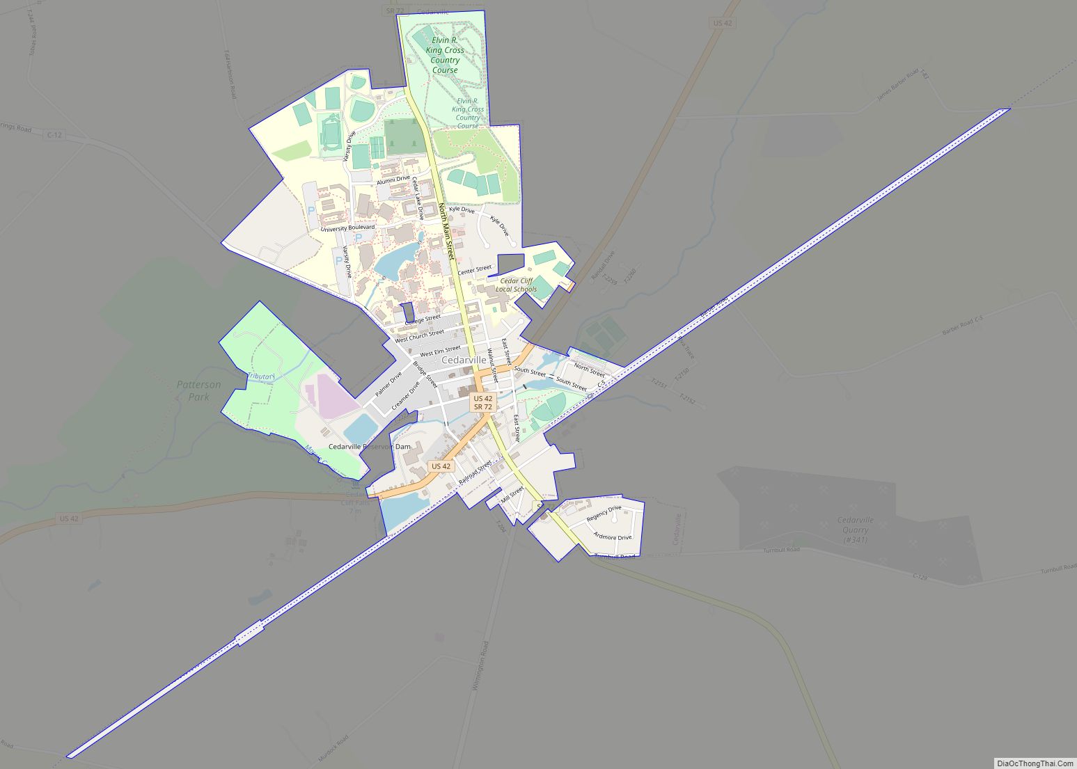
U.S. Route 42 passes through the community, leading southwest 3.5 miles (5.6 km) to the center of Xenia and northeast 4.5 miles (7.2 km) to Cedarville. Downtown Dayton is 19 miles (31 km) to the west of Wilberforce.
According to the United States Census Bureau, the CDP has a total area of 3.1 square miles (8.0 km), of which 0.02 square miles (0.06 km), or 0.78%, is water.
See also
Map of Ohio State and its subdivision:- Adams
- Allen
- Ashland
- Ashtabula
- Athens
- Auglaize
- Belmont
- Brown
- Butler
- Carroll
- Champaign
- Clark
- Clermont
- Clinton
- Columbiana
- Coshocton
- Crawford
- Cuyahoga
- Darke
- Defiance
- Delaware
- Erie
- Fairfield
- Fayette
- Franklin
- Fulton
- Gallia
- Geauga
- Greene
- Guernsey
- Hamilton
- Hancock
- Hardin
- Harrison
- Henry
- Highland
- Hocking
- Holmes
- Huron
- Jackson
- Jefferson
- Knox
- Lake
- Lake Erie
- Lawrence
- Licking
- Logan
- Lorain
- Lucas
- Madison
- Mahoning
- Marion
- Medina
- Meigs
- Mercer
- Miami
- Monroe
- Montgomery
- Morgan
- Morrow
- Muskingum
- Noble
- Ottawa
- Paulding
- Perry
- Pickaway
- Pike
- Portage
- Preble
- Putnam
- Richland
- Ross
- Sandusky
- Scioto
- Seneca
- Shelby
- Stark
- Summit
- Trumbull
- Tuscarawas
- Union
- Van Wert
- Vinton
- Warren
- Washington
- Wayne
- Williams
- Wood
- Wyandot
- Alabama
- Alaska
- Arizona
- Arkansas
- California
- Colorado
- Connecticut
- Delaware
- District of Columbia
- Florida
- Georgia
- Hawaii
- Idaho
- Illinois
- Indiana
- Iowa
- Kansas
- Kentucky
- Louisiana
- Maine
- Maryland
- Massachusetts
- Michigan
- Minnesota
- Mississippi
- Missouri
- Montana
- Nebraska
- Nevada
- New Hampshire
- New Jersey
- New Mexico
- New York
- North Carolina
- North Dakota
- Ohio
- Oklahoma
- Oregon
- Pennsylvania
- Rhode Island
- South Carolina
- South Dakota
- Tennessee
- Texas
- Utah
- Vermont
- Virginia
- Washington
- West Virginia
- Wisconsin
- Wyoming