Hudson is a town in Lincoln County, South Dakota, United States. The population was 311 at the 2020 census. It is the easternmost community in South Dakota.
The town takes its name from Hudson, Iowa, the native home of a large share of the early settlers.
| Name: | Hudson town |
|---|---|
| LSAD Code: | 43 |
| LSAD Description: | town (suffix) |
| State: | South Dakota |
| County: | Lincoln County |
| Elevation: | 1,220 ft (372 m) |
| Total Area: | 0.28 sq mi (0.73 km²) |
| Land Area: | 0.28 sq mi (0.73 km²) |
| Water Area: | 0.00 sq mi (0.00 km²) |
| Total Population: | 311 |
| Population Density: | 1,102.84/sq mi (425.72/km²) |
| ZIP code: | 57034 |
| Area code: | 605 |
| FIPS code: | 4630740 |
| GNISfeature ID: | 1265658 |
Online Interactive Map
Click on ![]() to view map in "full screen" mode.
to view map in "full screen" mode.
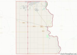
Hudson location map. Where is Hudson town?
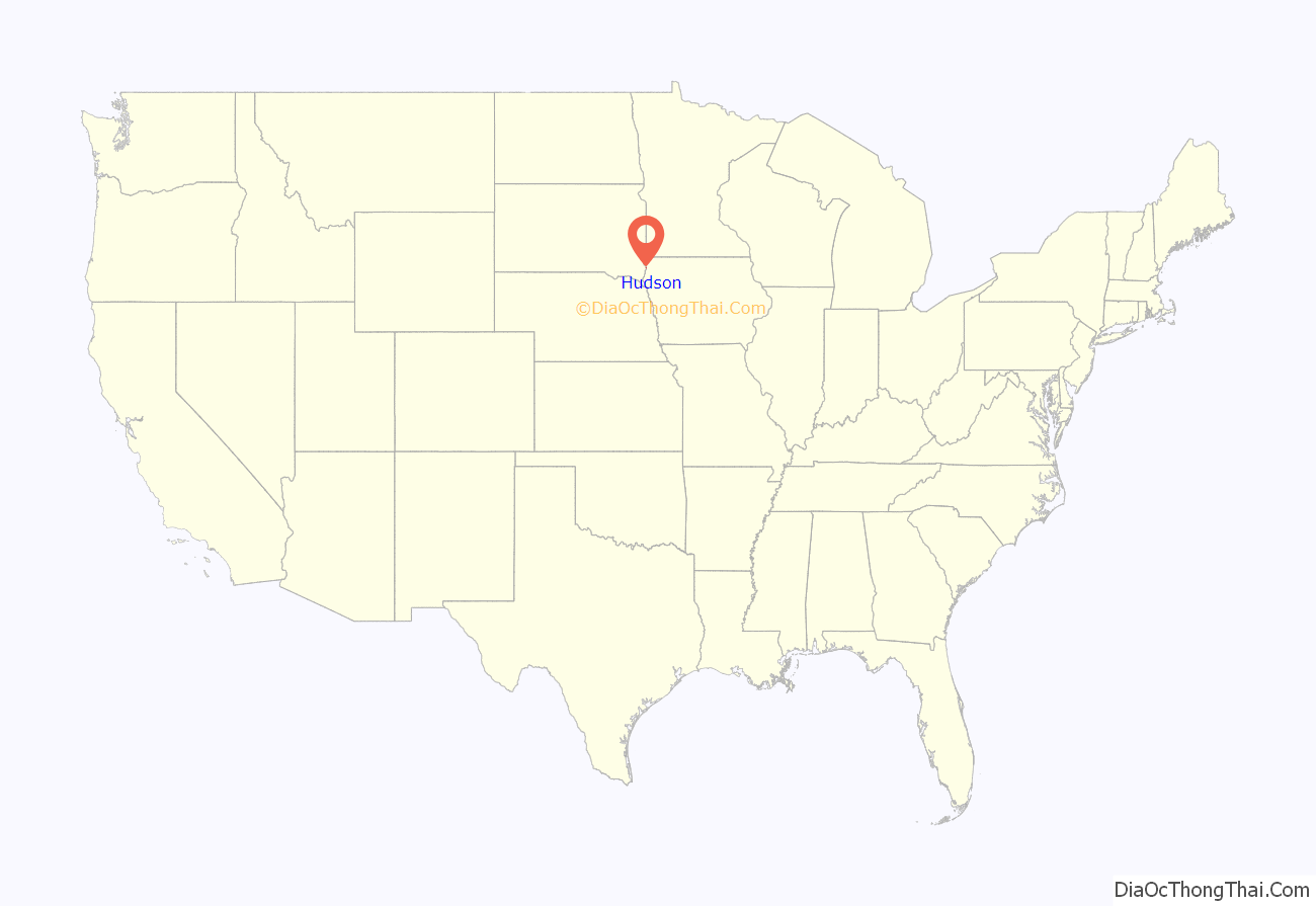
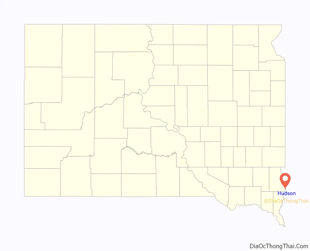
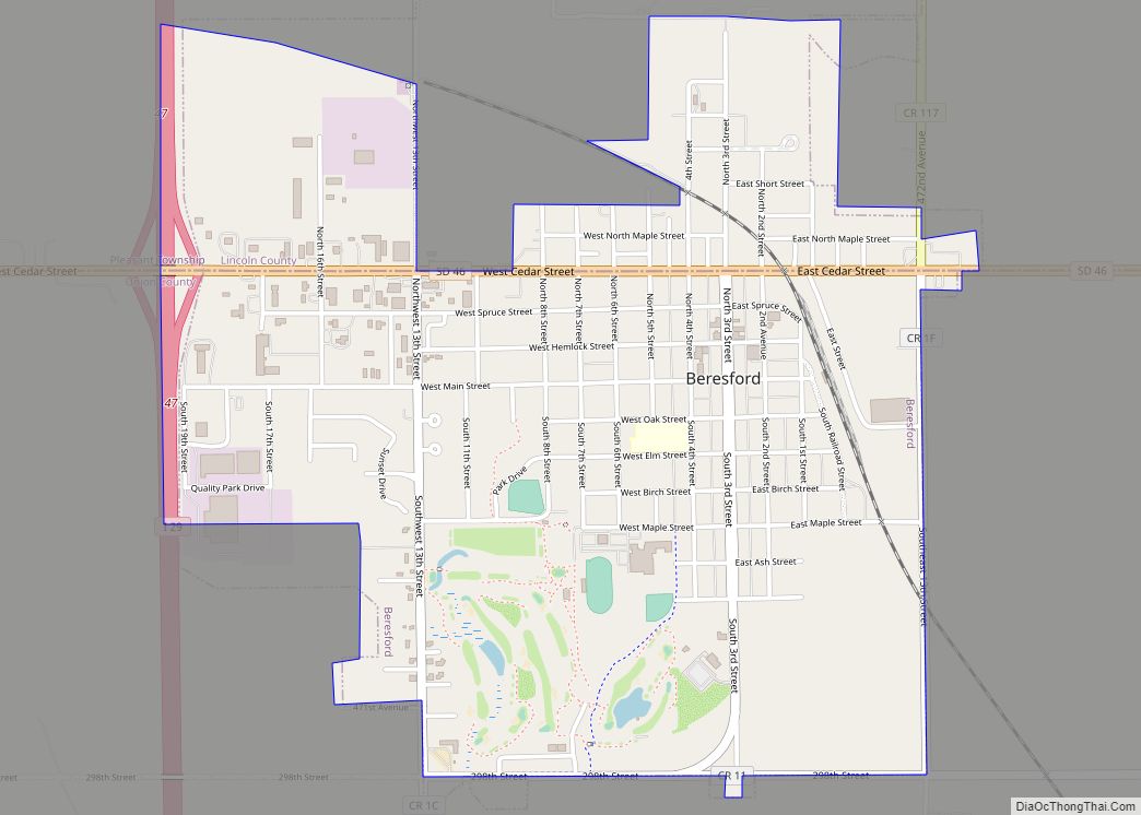
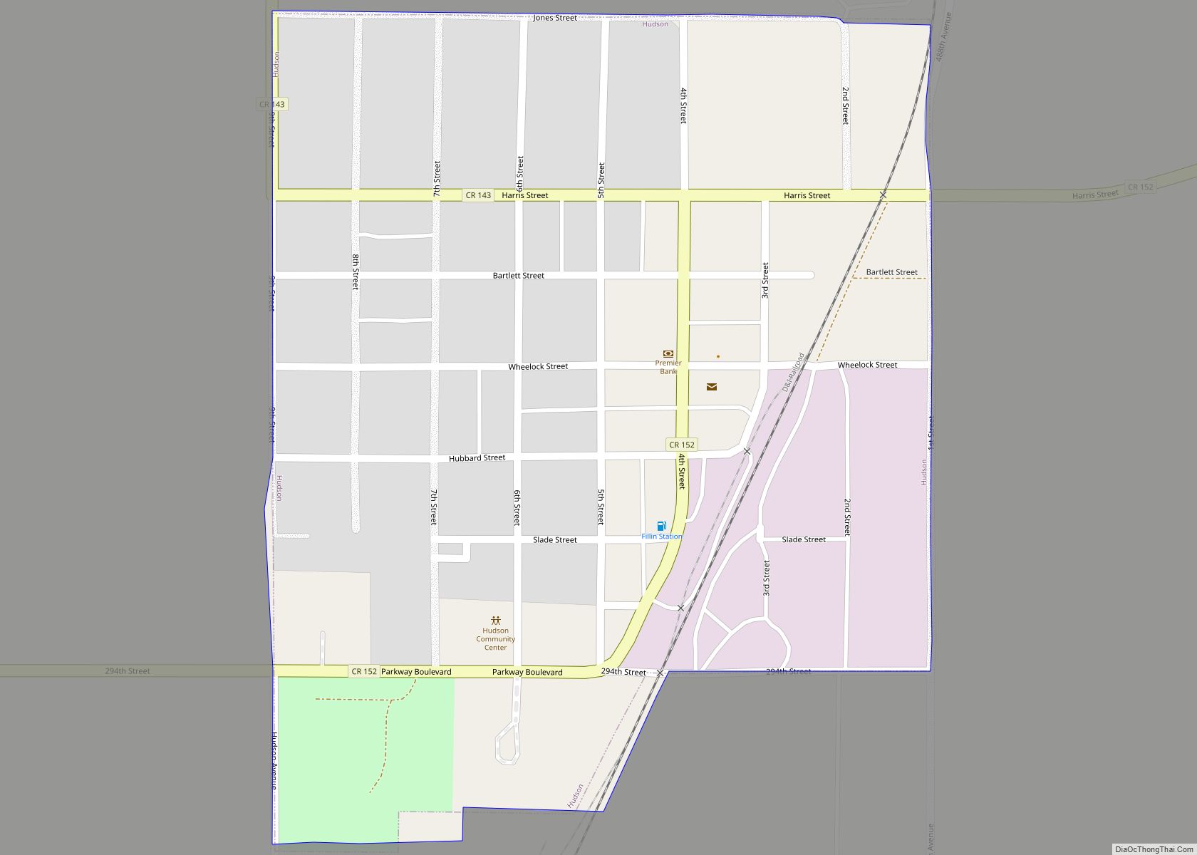
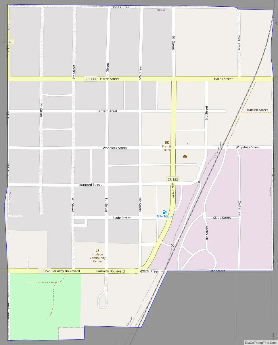
Hudson Road Map
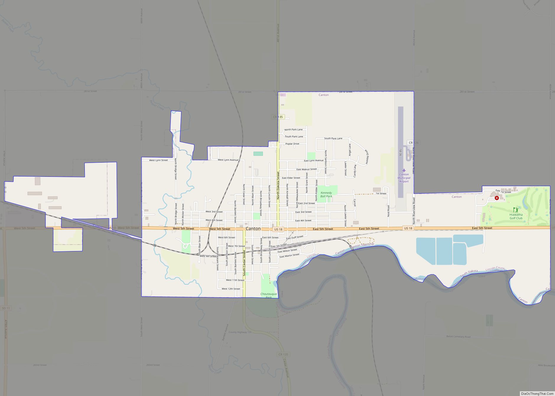
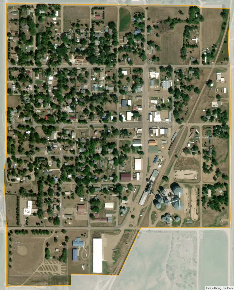
Hudson city Satellite Map
Geography
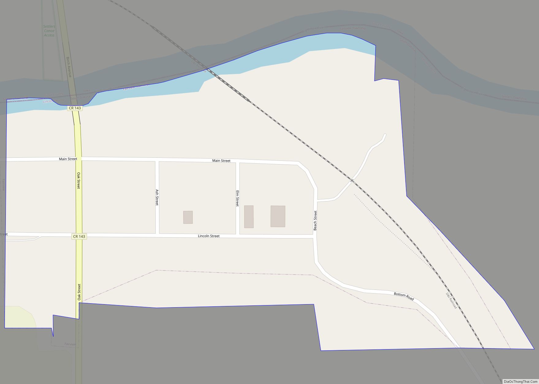
Hudson is located at 43°7′47″N 96°27′17″W / 43.12972°N 96.45472°W / 43.12972; -96.45472 (43.129824, -96.454627), along the Big Sioux River.
According to the United States Census Bureau, the town has a total area of 0.28 square miles (0.73 km), all land.
Hudson has been assigned the ZIP code 57034 and the FIPS place code 30740.
See also
Map of South Dakota State and its subdivision:- Aurora
- Beadle
- Bennett
- Bon Homme
- Brookings
- Brown
- Brule
- Buffalo
- Butte
- Campbell
- Charles Mix
- Clark
- Clay
- Codington
- Corson
- Custer
- Davison
- Day
- Deuel
- Dewey
- Douglas
- Edmunds
- Fall River
- Faulk
- Grant
- Gregory
- Haakon
- Hamlin
- Hand
- Hanson
- Harding
- Hughes
- Hutchinson
- Hyde
- Jackson
- Jerauld
- Jones
- Kingsbury
- Lake
- Lawrence
- Lincoln
- Lyman
- Marshall
- McCook
- McPherson
- Meade
- Mellette
- Miner
- Minnehaha
- Moody
- Pennington
- Perkins
- Potter
- Roberts
- Sanborn
- Shannon
- Spink
- Stanley
- Sully
- Todd
- Tripp
- Turner
- Union
- Walworth
- Yankton
- Ziebach
- Alabama
- Alaska
- Arizona
- Arkansas
- California
- Colorado
- Connecticut
- Delaware
- District of Columbia
- Florida
- Georgia
- Hawaii
- Idaho
- Illinois
- Indiana
- Iowa
- Kansas
- Kentucky
- Louisiana
- Maine
- Maryland
- Massachusetts
- Michigan
- Minnesota
- Mississippi
- Missouri
- Montana
- Nebraska
- Nevada
- New Hampshire
- New Jersey
- New Mexico
- New York
- North Carolina
- North Dakota
- Ohio
- Oklahoma
- Oregon
- Pennsylvania
- Rhode Island
- South Carolina
- South Dakota
- Tennessee
- Texas
- Utah
- Vermont
- Virginia
- Washington
- West Virginia
- Wisconsin
- Wyoming