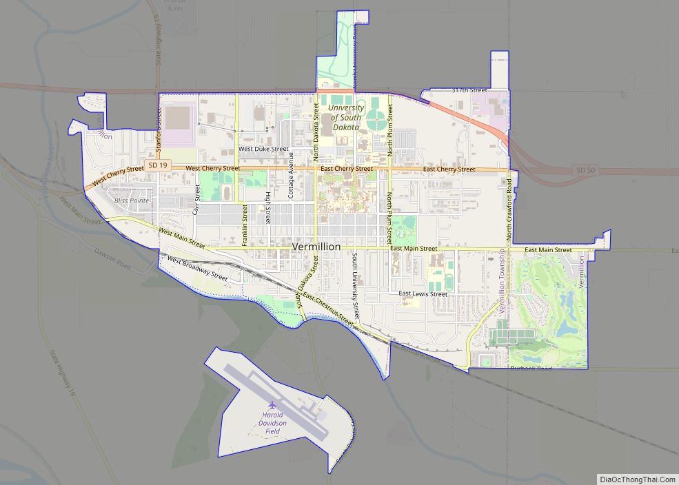
Vermillion (Lakota: Waséoyuze; “The Place Where Vermilion is Obtained”) is a city in the county seat of Clay County. It is in the southeastern corner of South Dakota, United States, and is the state’s 12th-largest city. According to the 2020 Census, the population was 11,695. The city lies atop a bluff near the Missouri River.
The area has been home to Native American tribes for centuries. French fur traders first visited in the late 18th century. Vermillion was founded in 1859 and incorporated in 1873. The name refers to the Lakota name: wa sa wak pa’la (red stream). Home to the University of South Dakota, Vermillion has a mixed academic and rural character: the university is a major academic institution for the state, with its only law and medical schools and its only AACSB-accredited business school. Major farm products include corn, soybeans, and alfalfa.
| Name: | Vermillion city |
|---|---|
| LSAD Code: | 25 |
| LSAD Description: | city (suffix) |
| State: | South Dakota |
| County: | Clay County |
| Incorporated: | 1877 |
| Elevation: | 1,224 ft (373 m) |
| Total Area: | 4.66 sq mi (12.07 km²) |
| Land Area: | 4.66 sq mi (12.07 km²) |
| Water Area: | 0.00 sq mi (0.00 km²) |
| Total Population: | 11,695 |
| Population Density: | 2,509.12/sq mi (968.76/km²) |
| ZIP code: | 57069 |
| Area code: | 605 |
| FIPS code: | 4666700 |
| GNISfeature ID: | 1258745 |
Online Interactive Map
Click on ![]() to view map in "full screen" mode.
to view map in "full screen" mode.
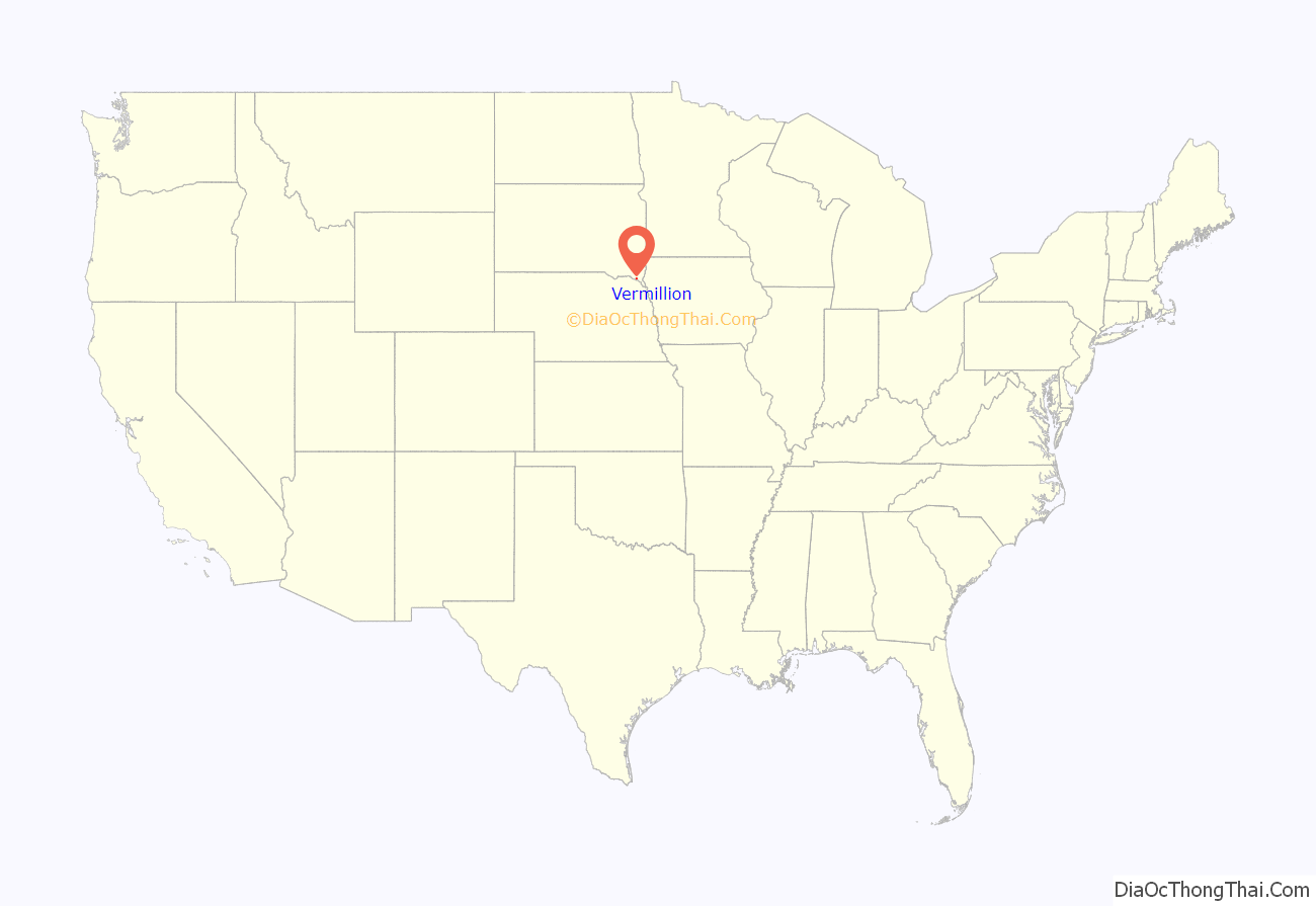
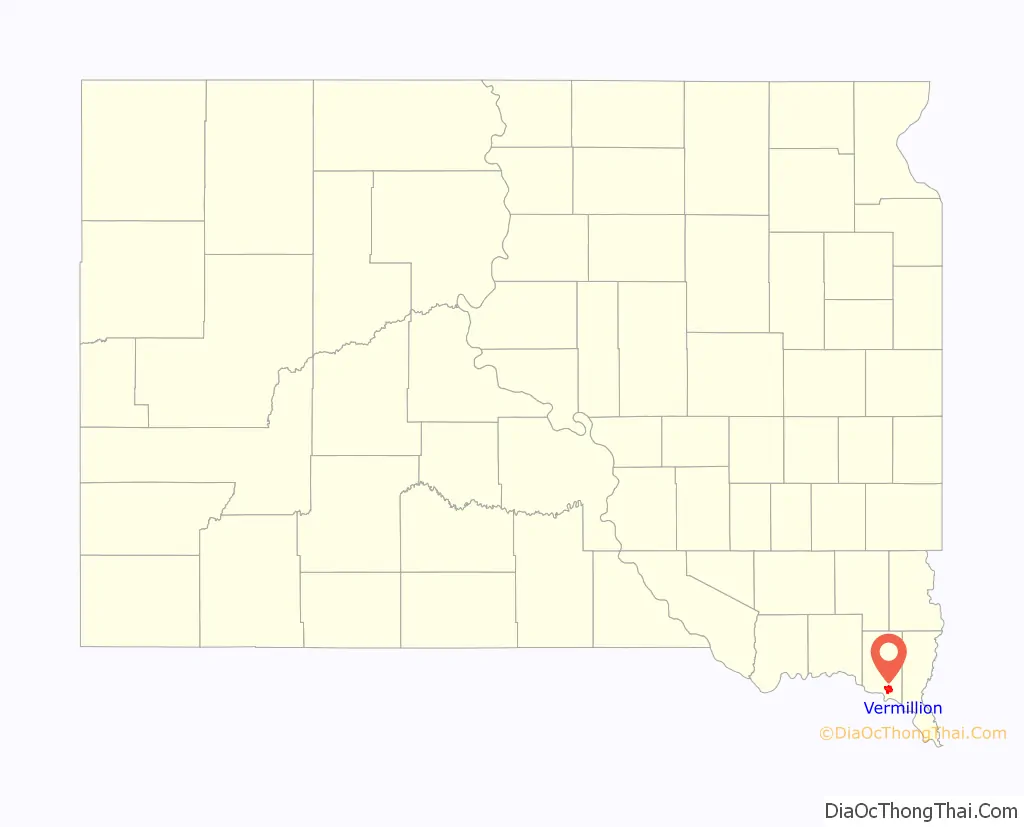
Vermillion location map. Where is Vermillion city?
History
Lewis and Clark camped at the mouth of the Vermillion River near the present-day town on August 24, 1804. The previous day, they had killed their first bison; the next day, they climbed Spirit Mound. In May 1843, John James Audubon visited the Vermillion ravine to view the bird life. The town was considered for the site of South Dakota’s first mental institution (now the Human Services Center) in 1873, but the hospital was eventually awarded to nearby Yankton. The original town was entirely below the bluffs on the banks of the Missouri River, and three-quarters of it washed away in the Great Flood of 1881.
William Jennings Bryan and William Howard Taft—candidates for the U.S. Presidency in the 1908 election—spoke in Vermillion on September 28 and 29, 1908, respectively. Along with Eugene Chafin, they toured South Dakota by train, including stops in Mitchell, Tripp, Yankton, and Elk Point.
John Philip Sousa conducted the Sousa Band on October 26, 1926, at the facility that in 1929 became known as Slagle Auditorium.
On March 24, 1967, in Vermillion, Thomas James White Hawk and William Stands murdered jeweler James Yeado and raped his wife.
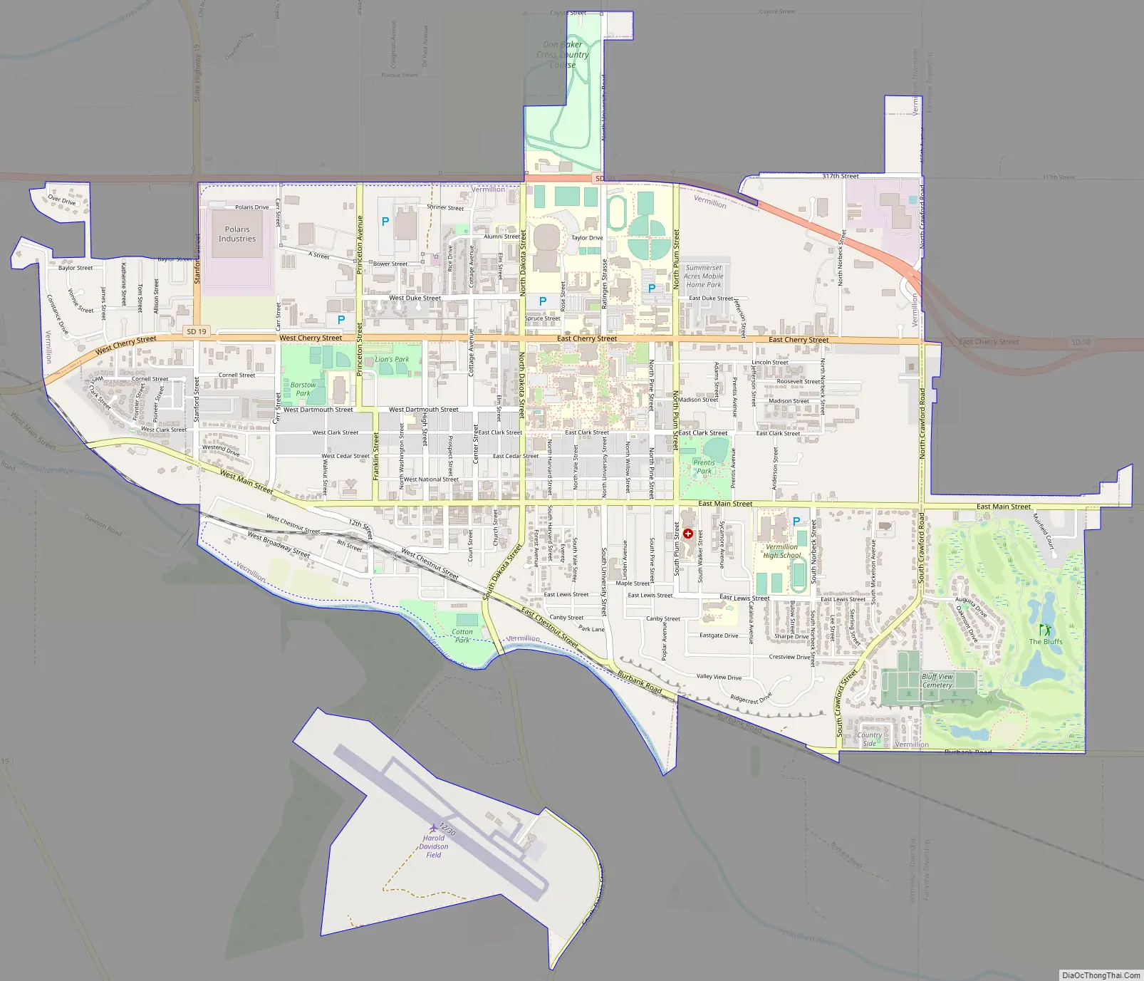
Vermillion Road Map
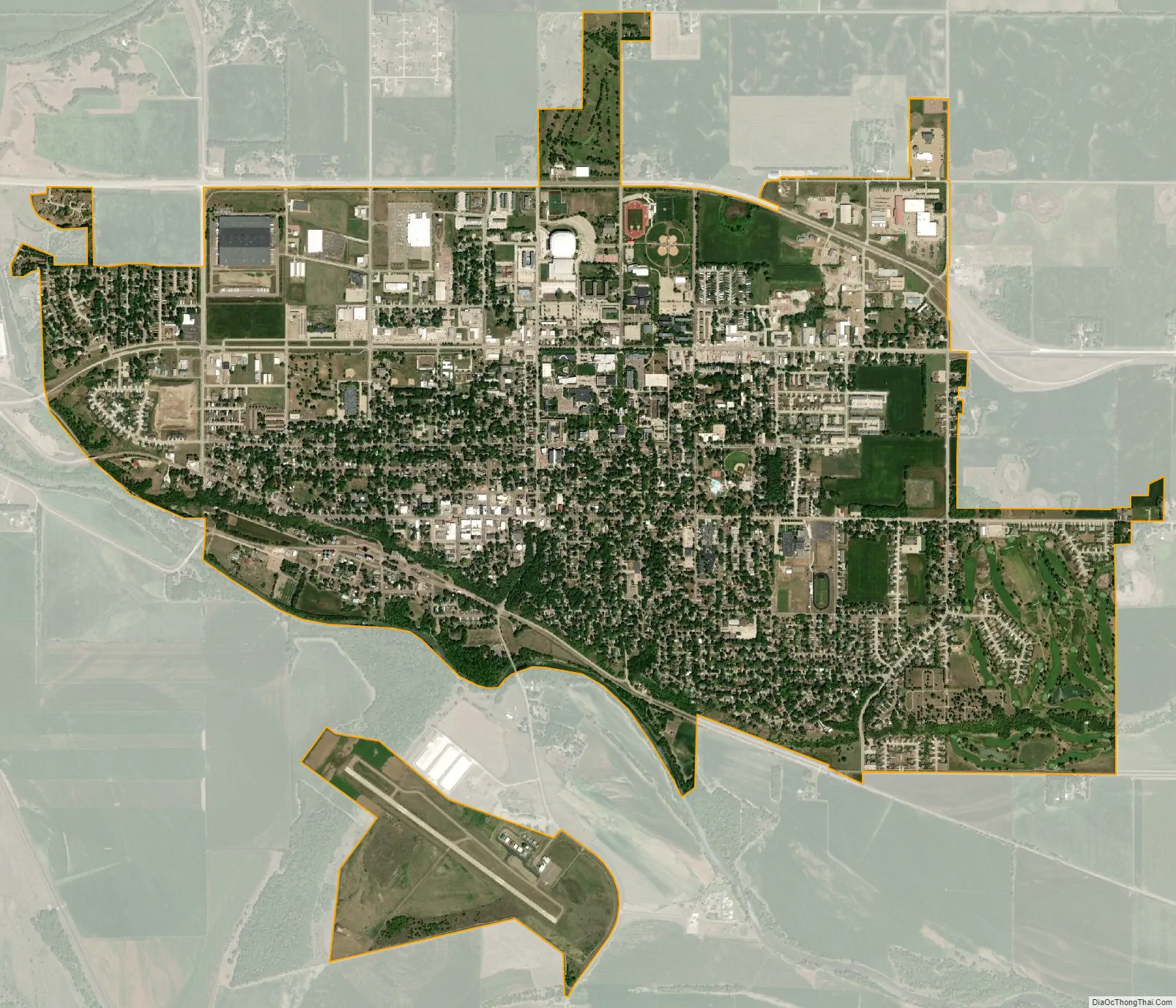
Vermillion city Satellite Map
Geography
According to the United States Census Bureau, the city has an area of 4.03 square miles (10.44 km), all land. The elevation of the city is 1,221 feet (372 m).
Climate
See also
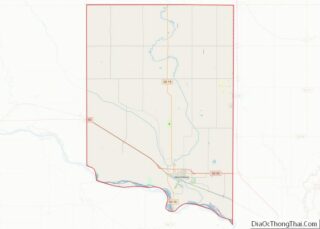
Map of South Dakota State and its subdivision:- Aurora
- Beadle
- Bennett
- Bon Homme
- Brookings
- Brown
- Brule
- Buffalo
- Butte
- Campbell
- Charles Mix
- Clark
- Clay
- Codington
- Corson
- Custer
- Davison
- Day
- Deuel
- Dewey
- Douglas
- Edmunds
- Fall River
- Faulk
- Grant
- Gregory
- Haakon
- Hamlin
- Hand
- Hanson
- Harding
- Hughes
- Hutchinson
- Hyde
- Jackson
- Jerauld
- Jones
- Kingsbury
- Lake
- Lawrence
- Lincoln
- Lyman
- Marshall
- McCook
- McPherson
- Meade
- Mellette
- Miner
- Minnehaha
- Moody
- Pennington
- Perkins
- Potter
- Roberts
- Sanborn
- Shannon
- Spink
- Stanley
- Sully
- Todd
- Tripp
- Turner
- Union
- Walworth
- Yankton
- Ziebach
- Alabama
- Alaska
- Arizona
- Arkansas
- California
- Colorado
- Connecticut
- Delaware
- District of Columbia
- Florida
- Georgia
- Hawaii
- Idaho
- Illinois
- Indiana
- Iowa
- Kansas
- Kentucky
- Louisiana
- Maine
- Maryland
- Massachusetts
- Michigan
- Minnesota
- Mississippi
- Missouri
- Montana
- Nebraska
- Nevada
- New Hampshire
- New Jersey
- New Mexico
- New York
- North Carolina
- North Dakota
- Ohio
- Oklahoma
- Oregon
- Pennsylvania
- Rhode Island
- South Carolina
- South Dakota
- Tennessee
- Texas
- Utah
- Vermont
- Virginia
- Washington
- West Virginia
- Wisconsin
- Wyoming