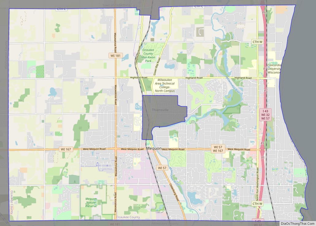
Mequon (/ˈmɛkwɒn/) is the largest city in Ozaukee County, in the U.S. state of Wisconsin, and the third-largest city in Wisconsin by land area. Located on Lake Michigan’s western shore with significant commercial developments along Interstate 43, the community is a suburb in the Milwaukee metropolitan area. Despite being an incorporated city, approximately half of Mequon’s land is undeveloped and agriculture plays a significant role in the local economy. At the time of the 2010 census the population was 23,132.
When the first white settlers arrived in the 1830s, the Mequon area was inhabited by the Menominee, Potawatomi, and Sauk people. In the 1840s, German immigrants settled in the community, building farms and hydropowered mills along the Milwaukee River. Much of the community remained rural, while Thiensville developed as a market town along the local railway, providing services to the farmers. Thiensville incorporated as a village in 1910. Mequon remained rural in the early 20th century but experienced significant population growth during the suburbanization that followed World War II. The community incorporated as a city in 1957 to avoid annexation by the City of Milwaukee. The City of Mequon completely surrounds Thiensville, leading some residents to call Thiensville “Mequon’s donut hole.” The two municipalities have a close relationship, with a shared chamber of commerce, library, and school district.
Lutheranism has played a significant role in Mequon since the community’s early years. Some of the first German settlers were Old Lutherans who founded the Freistadt community—now a neighborhood in western Mequon—in 1839 and went on to form the first Lutheran congregation in Wisconsin. In the 21st century, there are more Lutheran churches in Mequon than churches of any other single denomination. Additionally, Mequon is home to two private Lutheran post-secondary institutions: Concordia University Wisconsin and Wisconsin Lutheran Seminary. In addition to having other Christian denominations, Mequon is also the northernmost of Milwaukee’s suburbs to have a sizable Jewish community.
| Name: | Mequon city |
|---|---|
| LSAD Code: | 25 |
| LSAD Description: | city (suffix) |
| State: | Wisconsin |
| County: | Ozaukee County |
| Incorporated: | 1957; 66 years ago (1957) |
| Elevation: | 669 ft (204 m) |
| Total Area: | 46.96 sq mi (121.63 km²) |
| Land Area: | 46.28 sq mi (119.87 km²) |
| Water Area: | 0.68 sq mi (1.76 km²) |
| Total Population: | 23,132 |
| Population Density: | 526.81/sq mi (203.41/km²) |
| ZIP code: | 53092 and 53097 |
| Area code: | 262 |
| FIPS code: | 5551150 |
| GNISfeature ID: | 1569354 |
| Website: | www.ci.mequon.wi.us |
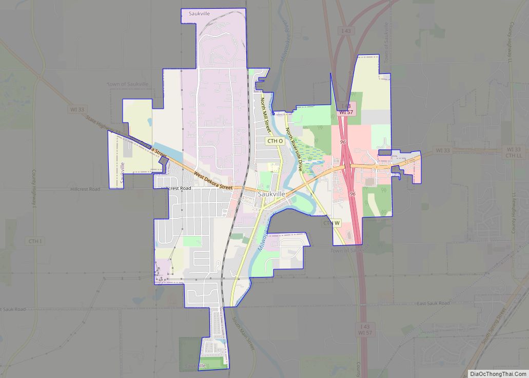
Online Interactive Map
Click on ![]() to view map in "full screen" mode.
to view map in "full screen" mode.
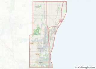
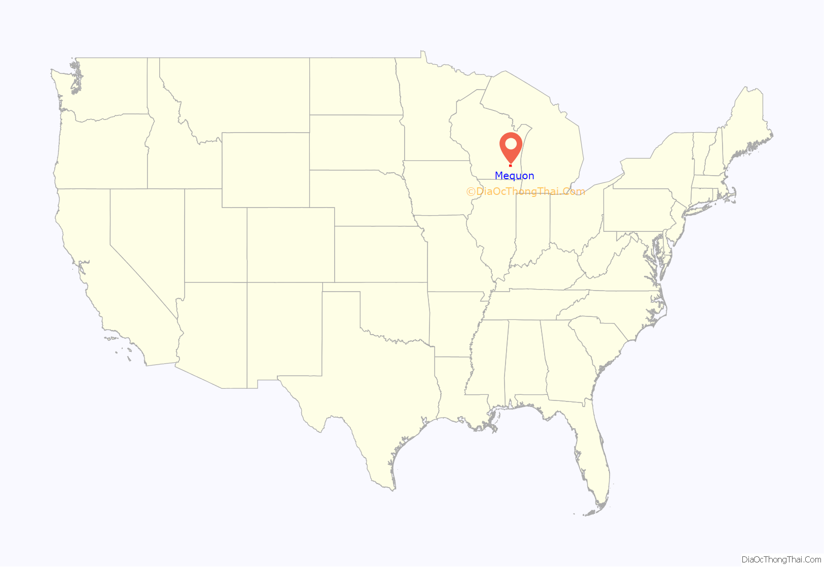
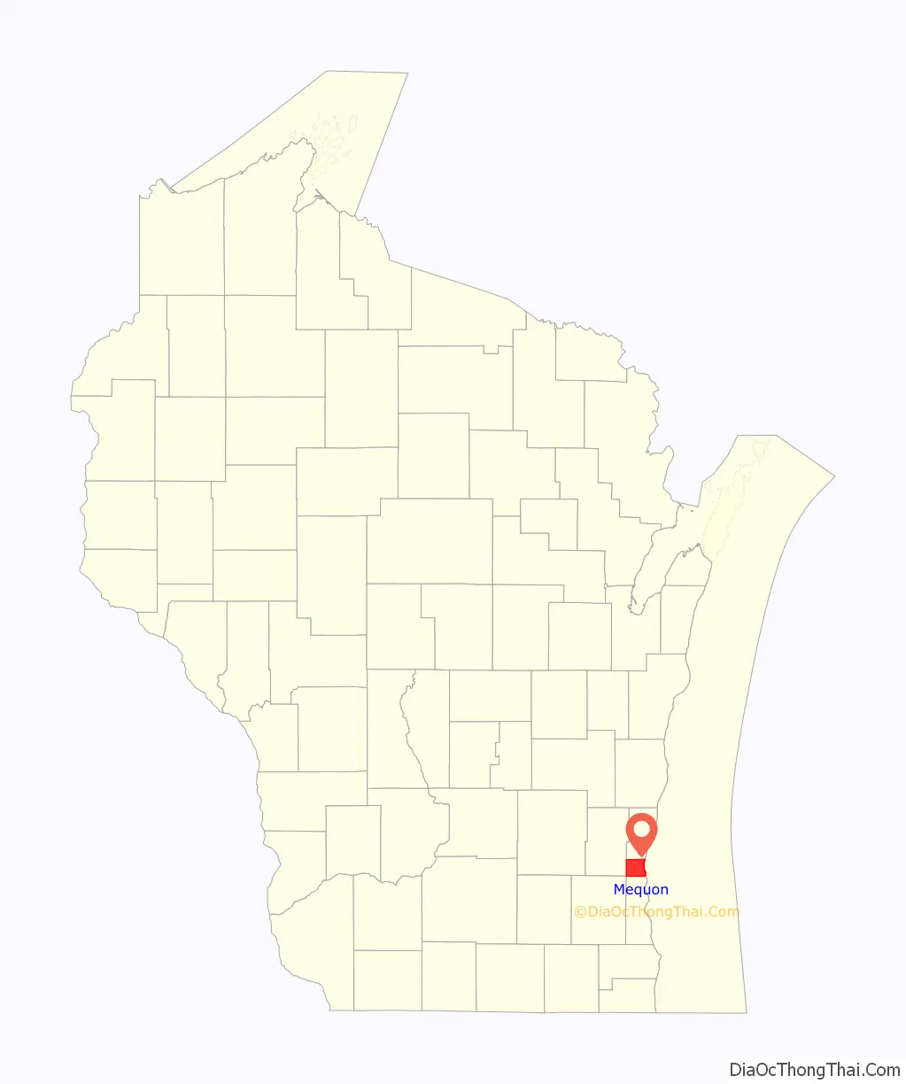
Mequon location map. Where is Mequon city?
History
The area was originally inhabited by Native Americans, including the Menominee, Potawatomi, and Sauk people. In the early 19th century, the Potawatomi had a village in present-day Thiensville located on Pigeon Creek, north of Freistadt Road. In 1832, the Menominee surrendered the land between the Milwaukee River and Lake Michigan to the United States Federal Government through the Treaty of Washington. The Potawatomi surrendered the area of Mequon west of the Milwaukee River in 1833 through the 1833 Treaty of Chicago, which (after being ratified in 1835) required them to leave the area by 1838. While many Native people moved west of the Mississippi River to Kansas, some chose to remain, and were referred to as “strolling Potawatomi” in contemporary documents because many of them were migrants who subsisted by squatting on their ancestral lands, which were now owned by white settlers. Eventually the Potawatomi who evaded forced removal gathered in northern Wisconsin, where they formed the Forest County Potawatomi Community.
European trappers, explorers, and traders used the Milwaukee River through the middle of what is now Mequon as a means of transportation. The first permanent white settlers arrived in the mid-1830s from New York, England, and Ireland. One of the first settlers was John Weston, who settled near present-day Thiensville in 1837 and served as the first postmaster of the Town of Mequon. One of the oldest surviving buildings from this period is the Isham Day House, constructed in 1839 on the west bank of the river. The first Germans arrived in 1839, and in the 1840s Germans became the largest ethnic group in Mequon and Ozaukee County.
Freistadt
In October 1839, a party of twenty German families from Pomerania, Prussia, settled the Freistadt community in the western part of the Town of Mequon. They were Old Lutherans who had resisted the Prussian government’s attempts to take control over the Protestant churches through the Prussian Union of Churches. In German, “Freistadt” means “Free City”.
In 1840, they built a log cabin church, which they named Trinity Lutheran Church. It was the first Lutheran church in Wisconsin. In 1845, what would become the Lutheran Synod of Buffalo was organized in Freistadt. However, the Freistadt church became a part of the Lutheran Church–Missouri Synod in 1848. The wooden church was replaced with a limestone building in 1884.
Thiensville
Joachim Heinrich Thien moved to the area in 1842 from Oldenburg, Prussia, and helped design a plan for the settlement that would become Thiensville. A year later he employed a group of Native American laborers to construct a dam and a canal. He then built a sawmill and a store. Thien hosted the first town meeting for the Town of Mequon in 1846, and in 1857 he established the volunteer fire department and served as its first captain.
Thien was a freethinker, as were many of the early German settlers. The influence of the freethinker societies kept formal churches out of the village until 1919, when St. Cecilia Catholic Church was built.
Thiensville grew in part because of its location on the Chicago, Milwaukee & St. Paul Railway, which was constructed in the early 1870s. In the late 19th and early 20th centuries, Thiensville was one of the most concentrated communities in the Town of Mequon. While most of Mequon was quite rural, Theinsville functioned as a downtown area with stores, mills, and professional services. The village of Theinsville incorporated in 1910.
In 1945, eighty German prisoners of war from Camp Fredonia in Little Kohler, Wisconsin were contracted to work at the Herbert A. Nieman Canning Company in the village to make up for the loss of labor due to local men fighting in World War II. German prisoners from Camp Rockfield in Rockfield, Wisconsin, (located in present-day Germantown) also worked at the Fromm Bros., Nieman & Co. Fox Ranch in northern Mequon.
In the 20th century, Mequon and the village of Thiensville developed a close relationship, with a shared school district, chamber of commerce, and library.
City of Mequon
The Town of Mequon experienced significant population growth during the suburbanization that followed World War II. Between 1950 and 1960, the population increased by roughly 110%, from 4,065 to 8,543. With growth came the risk that municipalities such as Thiensville or Milwaukee would try to annex land from the Town of Mequon, as happened to the Milwaukee County’s Town of Lake in 1954 and Town of Granville in 1956. With a 1957 population of about 7,500, Mequon incorporated as a city under the terms of Wisconsin statute 66.0215, also known as “The Oak Creek Law,” which had been crafted to prevent suburban towns from being annexed by other municipalities.
According to Tougaloo College’s Historical Database of Sundown Towns, Mequon was probably a sundown town until 1954 when Milwaukee Braves right fielder Hank Aaron moved his family to the community. Aaron could not buy his home directly from its builder and instead had to engage a friend to buy it on his behalf.
The city continued to grow with the construction of Interstate 43 in the mid-1960s, making travel to Milwaukee easier. Despite being a city, much of Mequon remains rural, and nearly half of the land in the community is undeveloped.
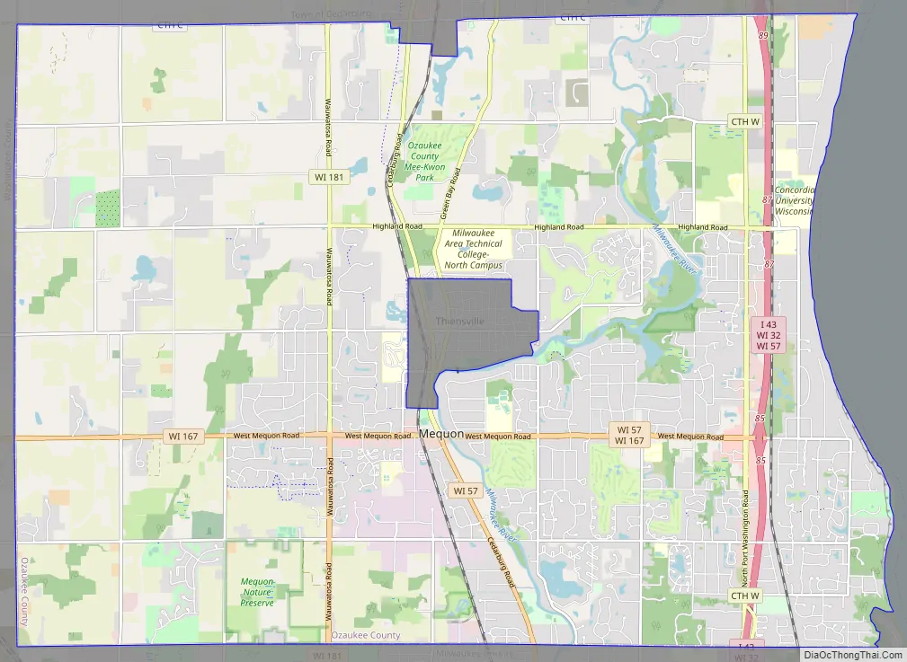
Mequon Road Map
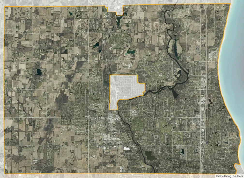
Mequon city Satellite Map
Geography
Mequon is located at 43°13′27″N 87°57′36″W / 43.22417°N 87.96000°W / 43.22417; -87.96000 (43.224243, −87.960094), about 15 miles (24 km) north of Milwaukee and is part of the Milwaukee metropolitan area. According to the United States Census Bureau, the city has a total area of 48.77 square miles (126.31 km), of which, 46.28 square miles (119.86 km) is land and 2.49 square miles (6.45 km) is water. As of 2005, Mequon was the third-largest city in terms of land area in the state of Wisconsin. Though much of the population lives in residential areas, approximately half of the land within the city’s boundaries is undeveloped or farmed.
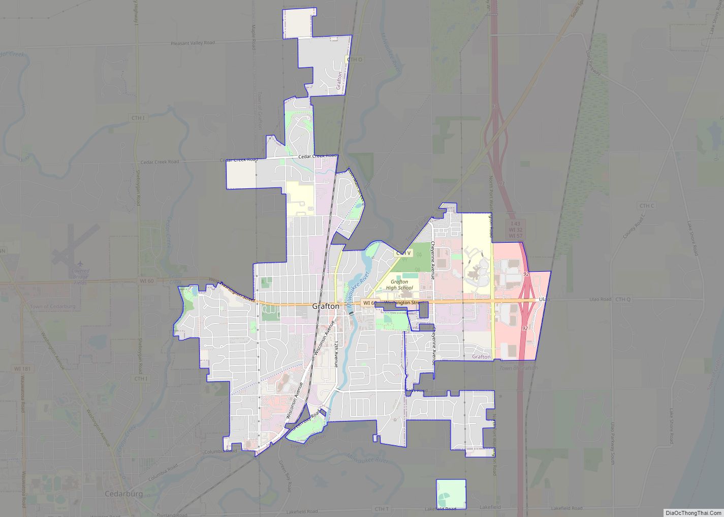
The Village of Thiensville is an enclave in central Mequon. The city is also bordered by the Town of Cedarburg, City of Cedarburg, and Town of Grafton to the north; Lake Michigan to the east; the Village of Bayside, Village of River Hills, Village of Brown Deer, and City of Milwaukee to the south; and the Village of Germantown to the west.
The city is located on the western shore of Lake Michigan, and the coastline is characterized by clay bluffs ranging from 80 to 140 feet (24 to 43 meters) in height with deep ravines where streams flow into the lake. Clay bluffs are a geological formation characteristic of the Lake Michigan shoreline, and are found in few other areas of the world. Much of the coast has mixed gravel and sand beaches.
The city is located in the Southeastern Wisconsin glacial till plains that were created by the Wisconsin glaciation during the most recent ice age. The soil is clayey glacial till with a thin layer of loess on the surface. The city has some limestone deposits, including the Devonian Thiensville formation in north-central Mequon and the Silurian Little Menomonee River Reef District, which contains dolomite marine fossils. The Wisconsin Department of Natural Resources considers the eastern part of the city along the lake to be in the Central Lake Michigan Coastal ecological landscape, while the western part of the city is in the Southern Lake Michigan Coastal ecological landscape.
The Milwaukee River and its tributary Pigeon Creek flow through the eastern part of the city. Little Menomonee Creek and the Little Menomonee River, which are tributaries of the Menomonee River, flow through western Mequon.
Before white settlers arrived in the area, Mequon was an upland forest dominated by American beech and sugar maple trees. There is also a large tamarack swamp along the Little Menomonee River. Much of the original forest was cleared to prepare the land for agriculture.
As land development continues to reduce wild areas, wildlife is forced into closer proximity with human communities like Mequon. Large mammals, including white-tailed deer, coyotes, and red foxes can be seen in the city. Many birds, including chimney swifts, great blue herons, and wild turkeys are found in the city. The city is also home to many rare and notable species, including the state-designated endangered pinedrops and heartleaf plantain; threatened forked aster, snow trillium, and yellow gentian; as well as American gromwell and twinleaf, which are state-designated special concern plant species.
The region struggles with many invasive species, including the emerald ash borer, common carp, reed canary grass, the common reed, purple loosestrife, garlic mustard, Eurasian buckthorns, and honeysuckles.
Climate
Mequon experiences four distinct seasons, with variation in precipitation and temperature being very wide. The warmest month of the year tends to be July, when the high temperature averages 81 °F (27 °C), with low temperatures of approximately 59 °F (15 °C). January is the coldest month in Mequon, with average high temperatures averaging only 27 °F (−3 °C), and lows averaging 11 °F (−12 °C). The highest temperature ever recorded in Mequon was 105 °F (41 °C) on July 24, 1935, and again on July 17, 1995. The coldest temperature ever recorded in the city was −40 °F (−40 °C), on January 17, 1982, also known as Cold Sunday.
See also
Map of Wisconsin State and its subdivision:- Adams
- Ashland
- Barron
- Bayfield
- Brown
- Buffalo
- Burnett
- Calumet
- Chippewa
- Clark
- Columbia
- Crawford
- Dane
- Dodge
- Door
- Douglas
- Dunn
- Eau Claire
- Florence
- Fond du Lac
- Forest
- Grant
- Green
- Green Lake
- Iowa
- Iron
- Jackson
- Jefferson
- Juneau
- Kenosha
- Kewaunee
- La Crosse
- Lafayette
- Lake Michigan
- Lake Superior
- Langlade
- Lincoln
- Manitowoc
- Marathon
- Marinette
- Marquette
- Menominee
- Milwaukee
- Monroe
- Oconto
- Oneida
- Outagamie
- Ozaukee
- Pepin
- Pierce
- Polk
- Portage
- Price
- Racine
- Richland
- Rock
- Rusk
- Saint Croix
- Sauk
- Sawyer
- Shawano
- Sheboygan
- Taylor
- Trempealeau
- Vernon
- Vilas
- Walworth
- Washburn
- Washington
- Waukesha
- Waupaca
- Waushara
- Winnebago
- Wood
- Alabama
- Alaska
- Arizona
- Arkansas
- California
- Colorado
- Connecticut
- Delaware
- District of Columbia
- Florida
- Georgia
- Hawaii
- Idaho
- Illinois
- Indiana
- Iowa
- Kansas
- Kentucky
- Louisiana
- Maine
- Maryland
- Massachusetts
- Michigan
- Minnesota
- Mississippi
- Missouri
- Montana
- Nebraska
- Nevada
- New Hampshire
- New Jersey
- New Mexico
- New York
- North Carolina
- North Dakota
- Ohio
- Oklahoma
- Oregon
- Pennsylvania
- Rhode Island
- South Carolina
- South Dakota
- Tennessee
- Texas
- Utah
- Vermont
- Virginia
- Washington
- West Virginia
- Wisconsin
- Wyoming