Shorewood is a village in Milwaukee County, Wisconsin, United States. The population was 13,859 at the 2020 census.
| Name: | Shorewood village |
|---|---|
| LSAD Code: | 47 |
| LSAD Description: | village (suffix) |
| State: | Wisconsin |
| County: | Milwaukee County |
| Elevation: | 679 ft (207 m) |
| Total Area: | 1.59 sq mi (4.12 km²) |
| Land Area: | 1.59 sq mi (4.12 km²) |
| Water Area: | 0.00 sq mi (0.00 km²) |
| Total Population: | 13,859 |
| Population Density: | 8,716/sq mi (3,350/km²) |
| Area code: | 414 |
| FIPS code: | 5573725 |
| GNISfeature ID: | 1574071 |
| Website: | villageofshorewood.org |
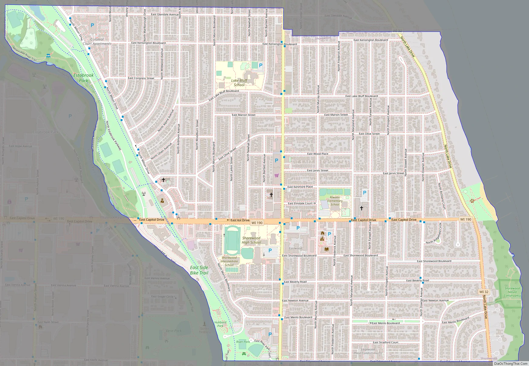
Online Interactive Map
Click on ![]() to view map in "full screen" mode.
to view map in "full screen" mode.
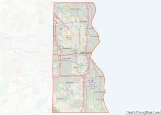
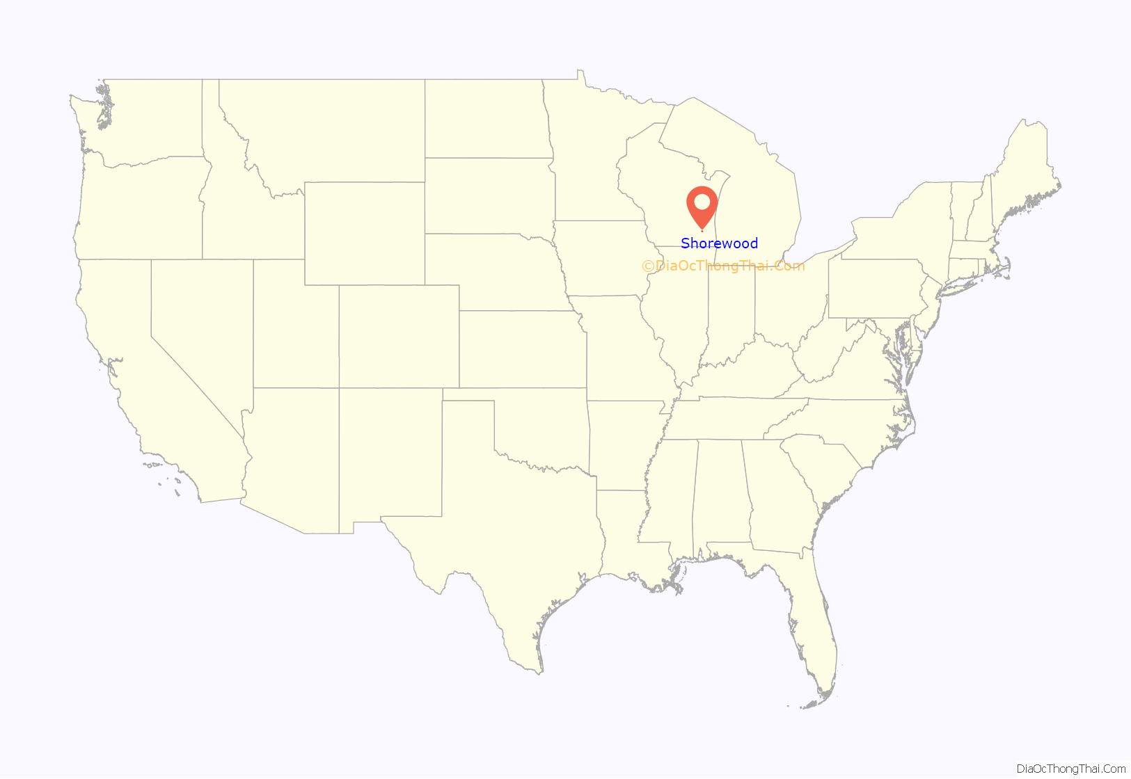
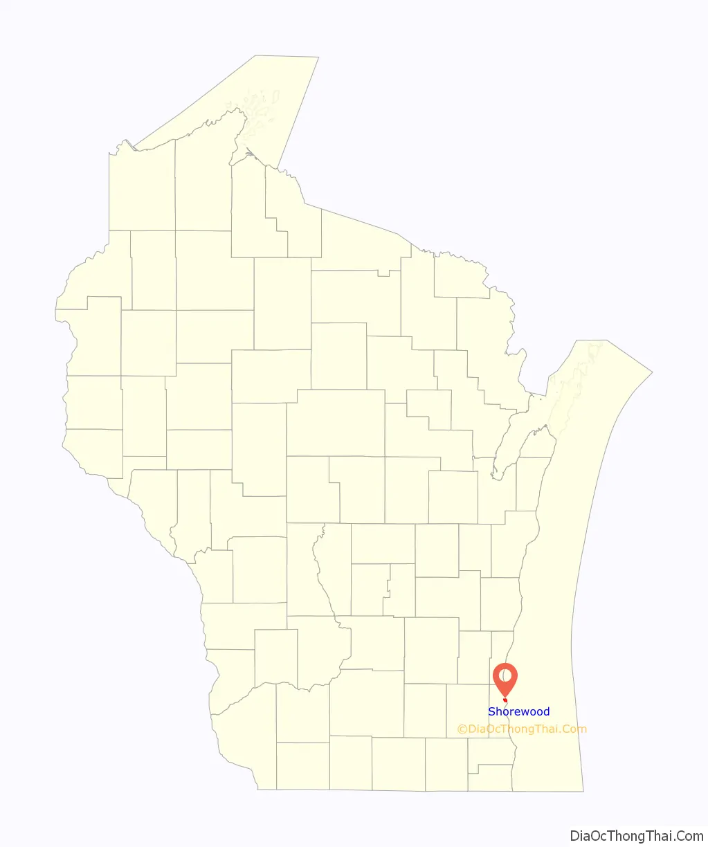
Shorewood location map. Where is Shorewood village?
History
In the early 19th century when the first white settlers arrived, the Shorewood area was controlled by Native Americans, including the Menominee, Potawatomi, and Sauk people. The United States Federal Government acquired the land from the Menominee people in 1832 through the Treaty of Washington.
The land was organized as part of the Town of Milwaukee in 1835, and when settlers arrived in the mid-1830s, they found the area to be heavily forested. They built two sawmills on the east bank of the Milwaukee River, and the unincorporated community around the sawmills was known as Mechanicsville. However, the mills’ success was short-lived; both closed during the Panic of 1837. Thomas Bare, the area’s first permanent white settler, arrived in 1841 and purchased ninety acres of farmland east of the Milwaukee River. Around 1850, another unincorporated community known as Humboldt was settled in the area. Humboldt’s industrial base included a paper mill and a grist mill.
Beginning in the 1870s, the area’s economy began to diversify. In 1873, the Northwestern Union Railway laid tracks through present-day Shorewood along the eastern bank of the Milwaukee River. The railroad was a boon for local businesses, including the Milwaukee Cement Company, which began quarrying limestone on the bluffs above the river in 1876. The community that grew around the company was known as Cementville and prospered until quarrying operations ceased in 1909.
In 1872, a resort called Lueddemann’s-on-the-River opened in the southwestern part of present-day Shorewood. Accessible by riverboat and later by train, the resort was the first of several beer gardens and amusement parks that operated in the area between the 1872 and 1916. Coney Island, an amusement park that opened in 1900, proved to be particularly controversial and played a significant role in Shorewood’s incorporation as a village. The park included loud music, electric lights, and a roller coaster. Some town residents were opposed to the noise, light pollution, and raucous visitors coming from the City of Milwaukee on the newly constructed Milwaukee Electric Railway streetcar lines. Some blamed the Town of Milwaukee, which collected licensing fees from the park and allowed it to operate. Additionally, the roads in the community were of poor quality compared with those in the neighboring city of Milwaukee, and residents were unhappy that tax revenue from the increasingly suburban Shorewood area—including the taxes from Coney Island—were being redistributed across the town rather than being used to increase their standard of living. In response, residents voted to incorporate as the Village of East Milwaukee. At the time of incorporation in August 1900, the village had a population of 300.
In the early 1900s, the village developed as a streetcar suburb of Milwaukee, with public transportation allowing residents to easily commute to the city. The village’s center emerged along the streetcar lines on Oakland Avenue and Atwater Road (now known as Capitol Drive). Additionally, affluent Milwaukeeans began building mansions in the eastern part of the village along Lake Drive and the bluff overlooking Lake Michigan. The population grew to 1,255 by 1913, and in the 1910s municipal improvements included paved roads and sidewalks, gas mains, and street signs. The Village of East Milwaukee changed its name to the Village of Shorewood in 1917.
Shorewood saw significant growth in the 1920s, with the population quadrupling from 2,650 residents in 1920 to 13,479 in 1930. During the decade, as many as 200 new homes were constructed per year in the village, including work by Alexander C. Eschweiler as well as Flagg-system homes constructed by Arnold F. Meyer & Co. As the village population swelled, local municipal institutions became more organized. The village’s health department organized in 1918; the police department, in 1920; and the fire department, in 1929. In 1928, the village’s elected board of trustees hired a full-time village manager to head the village’s day-to-day operations, and Shorewood has had a council–manager government ever since. Shorewood’s school district also grew in the 1920s and was influenced by the ideas of philosopher John Dewey.
The village’s historical population reached its zenith after World War II, with over 16,000 residents. The community underwent urban renewal projects beginning in the 1960s, but the population has slowly declined to approximately 13,000 as of 2010.
Shorewood Road Map
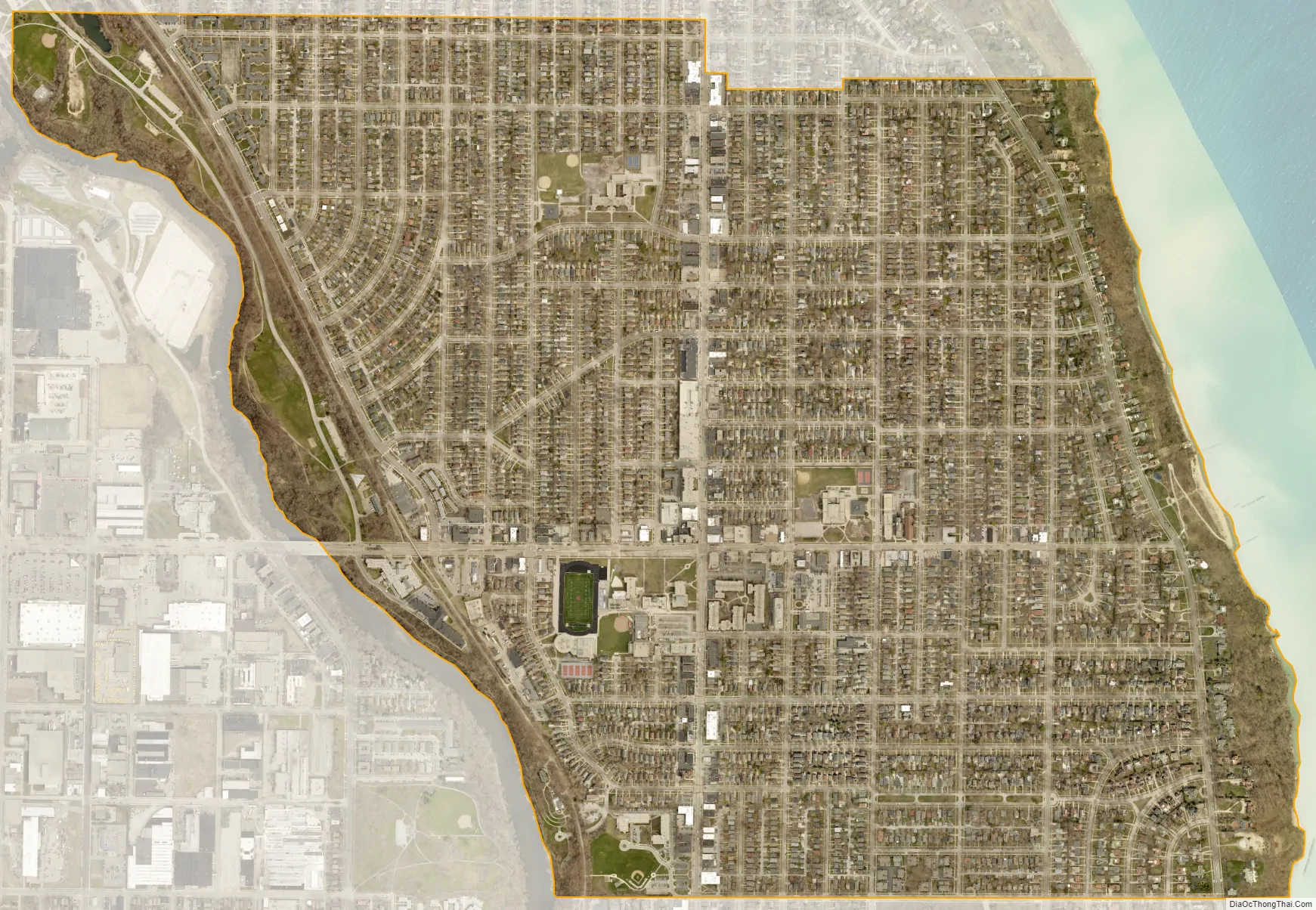
Shorewood city Satellite Map
Geography
Shorewood is located at 43°05′31″N 87°53′11″W / 43.092061°N 87.886333°W / 43.092061; -87.886333 (43.092061, −87.886333).
Nestled between the Milwaukee River and Lake Michigan, Shorewood is bordered by the City of Milwaukee to the south and west and Whitefish Bay to the north. According to the United States Census Bureau, the village has a total area of 1.59 square miles (4.12 km), all of it land.
Shorewood’s border to the west stops at the Milwaukee River’s edge according to the Village Charter, unlike most river municipal boundaries that are set at the middle of the river.
See also
Map of Wisconsin State and its subdivision:- Adams
- Ashland
- Barron
- Bayfield
- Brown
- Buffalo
- Burnett
- Calumet
- Chippewa
- Clark
- Columbia
- Crawford
- Dane
- Dodge
- Door
- Douglas
- Dunn
- Eau Claire
- Florence
- Fond du Lac
- Forest
- Grant
- Green
- Green Lake
- Iowa
- Iron
- Jackson
- Jefferson
- Juneau
- Kenosha
- Kewaunee
- La Crosse
- Lafayette
- Lake Michigan
- Lake Superior
- Langlade
- Lincoln
- Manitowoc
- Marathon
- Marinette
- Marquette
- Menominee
- Milwaukee
- Monroe
- Oconto
- Oneida
- Outagamie
- Ozaukee
- Pepin
- Pierce
- Polk
- Portage
- Price
- Racine
- Richland
- Rock
- Rusk
- Saint Croix
- Sauk
- Sawyer
- Shawano
- Sheboygan
- Taylor
- Trempealeau
- Vernon
- Vilas
- Walworth
- Washburn
- Washington
- Waukesha
- Waupaca
- Waushara
- Winnebago
- Wood
- Alabama
- Alaska
- Arizona
- Arkansas
- California
- Colorado
- Connecticut
- Delaware
- District of Columbia
- Florida
- Georgia
- Hawaii
- Idaho
- Illinois
- Indiana
- Iowa
- Kansas
- Kentucky
- Louisiana
- Maine
- Maryland
- Massachusetts
- Michigan
- Minnesota
- Mississippi
- Missouri
- Montana
- Nebraska
- Nevada
- New Hampshire
- New Jersey
- New Mexico
- New York
- North Carolina
- North Dakota
- Ohio
- Oklahoma
- Oregon
- Pennsylvania
- Rhode Island
- South Carolina
- South Dakota
- Tennessee
- Texas
- Utah
- Vermont
- Virginia
- Washington
- West Virginia
- Wisconsin
- Wyoming