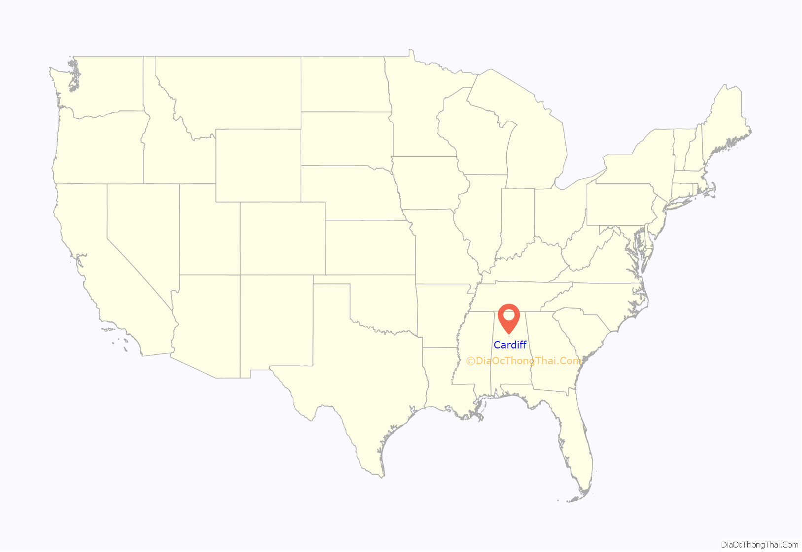
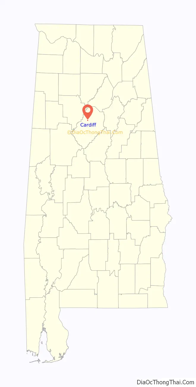
Cardiff is a town in Jefferson County, Alabama, United States west of Gardendale. At the 2010 census the population was 55, placing it as the least-populated incorporated area in Jefferson County. It is named after the capital of Wales. It is one of four Jefferson County cities named after cities in Great Britain, the others being Birmingham, Leeds and Brighton.
| Name: | Cardiff town |
|---|---|
| LSAD Code: | 43 |
| LSAD Description: | town (suffix) |
| State: | Alabama |
| County: | Jefferson County |
| Elevation: | 358 ft (109 m) |
| Total Area: | 0.21 sq mi (0.54 km²) |
| Land Area: | 0.21 sq mi (0.54 km²) |
| Water Area: | 0.00 sq mi (0.00 km²) |
| Total Population: | 52 |
| Population Density: | 248.80/sq mi (96.10/km²) |
| ZIP code: | 35041 |
| Area code: | 205 & 659 |
| FIPS code: | 0112040 |
| GNISfeature ID: | 0115614 |
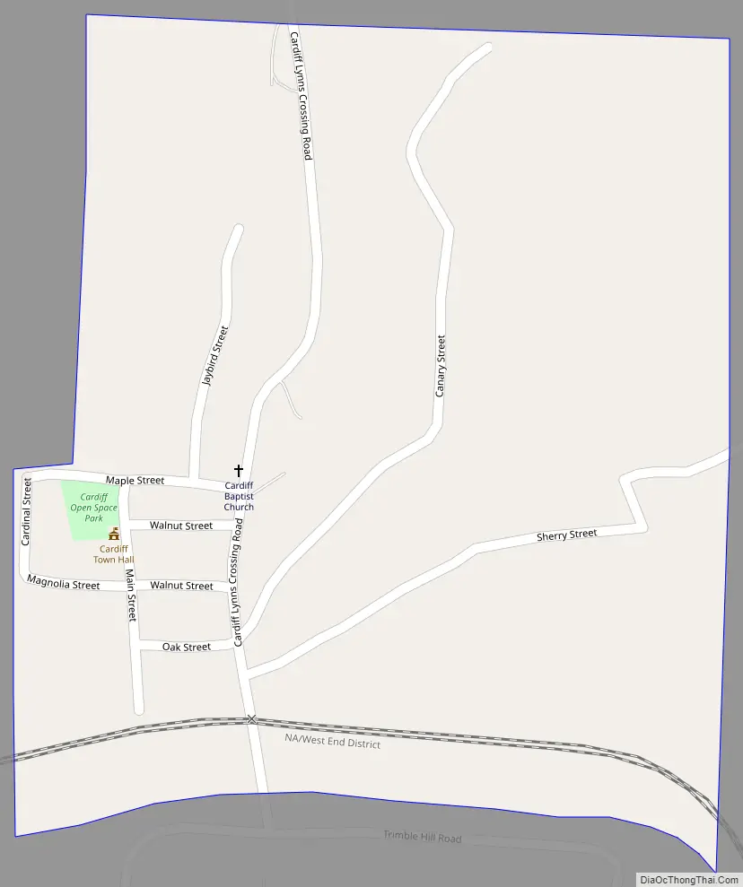
Online Interactive Map
Click on ![]() to view map in "full screen" mode.
to view map in "full screen" mode.
Cardiff location map. Where is Cardiff town?
History
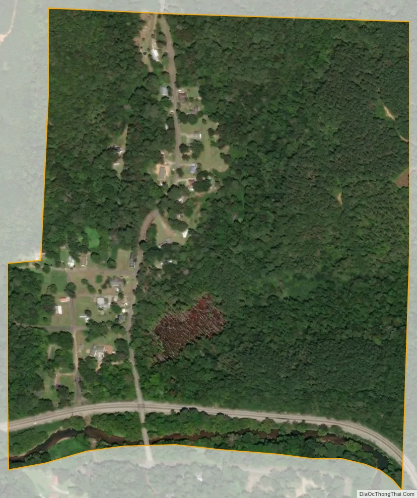
Coal mining was the historical basis of the economy. The town, for years the smallest incorporated town in the State of Alabama, declined along with the decline of underground coal mining and the rise of strip mining. The epochal flood of May 2003 destroyed a number of buildings in that part of Cardiff close to Five Mile Creek. The town is now but a dent in the land; scarce of life with a scant 20–30 people and covered with kudzu. Cardiff is becoming a ghost town.
Cardiff Road Map
Cardiff city Satellite Map
Geography
Cardiff is located at 33°38′43″N 86°55′59″W / 33.64528°N 86.93306°W / 33.64528; -86.93306 (33.645384, −86.932965). on Five Mile Creek, a tributary of the Locust Fork of the Black Warrior River. It is immediately downstream of Brookside. The region is part of the Cumberland Plateau, with shallow but deeply incised stream valleys dissecting sedimentary rock, including significant seams of bituminous coal.
According to the U.S. Census Bureau, the town has a total area of 0.2 square miles (0.52 km), all land.
See also
Map of Alabama State and its subdivision:- Autauga
- Baldwin
- Barbour
- Bibb
- Blount
- Bullock
- Butler
- Calhoun
- Chambers
- Cherokee
- Chilton
- Choctaw
- Clarke
- Clay
- Cleburne
- Coffee
- Colbert
- Conecuh
- Coosa
- Covington
- Crenshaw
- Cullman
- Dale
- Dallas
- De Kalb
- Elmore
- Escambia
- Etowah
- Fayette
- Franklin
- Geneva
- Greene
- Hale
- Henry
- Houston
- Jackson
- Jefferson
- Lamar
- Lauderdale
- Lawrence
- Lee
- Limestone
- Lowndes
- Macon
- Madison
- Marengo
- Marion
- Marshall
- Mobile
- Monroe
- Montgomery
- Morgan
- Perry
- Pickens
- Pike
- Randolph
- Russell
- Saint Clair
- Shelby
- Sumter
- Talladega
- Tallapoosa
- Tuscaloosa
- Walker
- Washington
- Wilcox
- Winston
- Alabama
- Alaska
- Arizona
- Arkansas
- California
- Colorado
- Connecticut
- Delaware
- District of Columbia
- Florida
- Georgia
- Hawaii
- Idaho
- Illinois
- Indiana
- Iowa
- Kansas
- Kentucky
- Louisiana
- Maine
- Maryland
- Massachusetts
- Michigan
- Minnesota
- Mississippi
- Missouri
- Montana
- Nebraska
- Nevada
- New Hampshire
- New Jersey
- New Mexico
- New York
- North Carolina
- North Dakota
- Ohio
- Oklahoma
- Oregon
- Pennsylvania
- Rhode Island
- South Carolina
- South Dakota
- Tennessee
- Texas
- Utah
- Vermont
- Virginia
- Washington
- West Virginia
- Wisconsin
- Wyoming


