Helena (/həˈlinə/) is a city in Jefferson and Shelby counties in the state of Alabama. Helena is considered a suburb of Birmingham and part of the Birmingham-Hoover Metropolitan Area. As of 2022 the United States Census Bureau estimates the population to be 21,560.
Helena is highly regarded as a place to live and raise children; Business Week ranked the city as the 13th “Best Place to Raise Your Kids” in 2007. It has the eighth-lowest crime rate per population in the U.S., and the city was ranked in Money magazine’s 2007 list of “Best Places to Live: Top 100” in the U.S., placing at number 91. The Alabama League of Municipalities awarded Helena the 2008 Municipal Achievement Award (population 10,001 to 20,000).
Helena initially incorporated in 1877, but reincorporated in 1917 after errors were discovered in the initial incorporation papers. Its population was not recorded separately in the U.S. Census until 1920, reflecting the later date of incorporation.
| Name: | Helena city |
|---|---|
| LSAD Code: | 25 |
| LSAD Description: | city (suffix) |
| State: | Alabama |
| County: | Jefferson County, Shelby County |
| Elevation: | 453 ft (138 m) |
| Total Area: | 22.38 sq mi (57.95 km²) |
| Land Area: | 22.06 sq mi (57.13 km²) |
| Water Area: | 0.32 sq mi (0.82 km²) |
| Total Population: | 21,560 |
| Population Density: | 948.2/sq mi (366.09/km²) |
| ZIP code: | 35080 |
| Area code: | 205 |
| FIPS code: | 0134024 |
| GNISfeature ID: | 2404677 |
| Website: | http://www.cityofhelena.org/ |
Online Interactive Map
Click on ![]() to view map in "full screen" mode.
to view map in "full screen" mode.
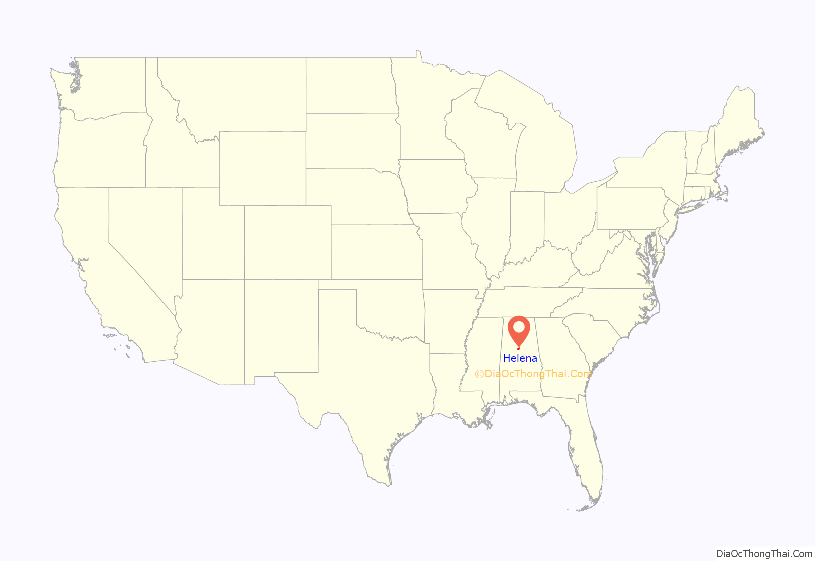
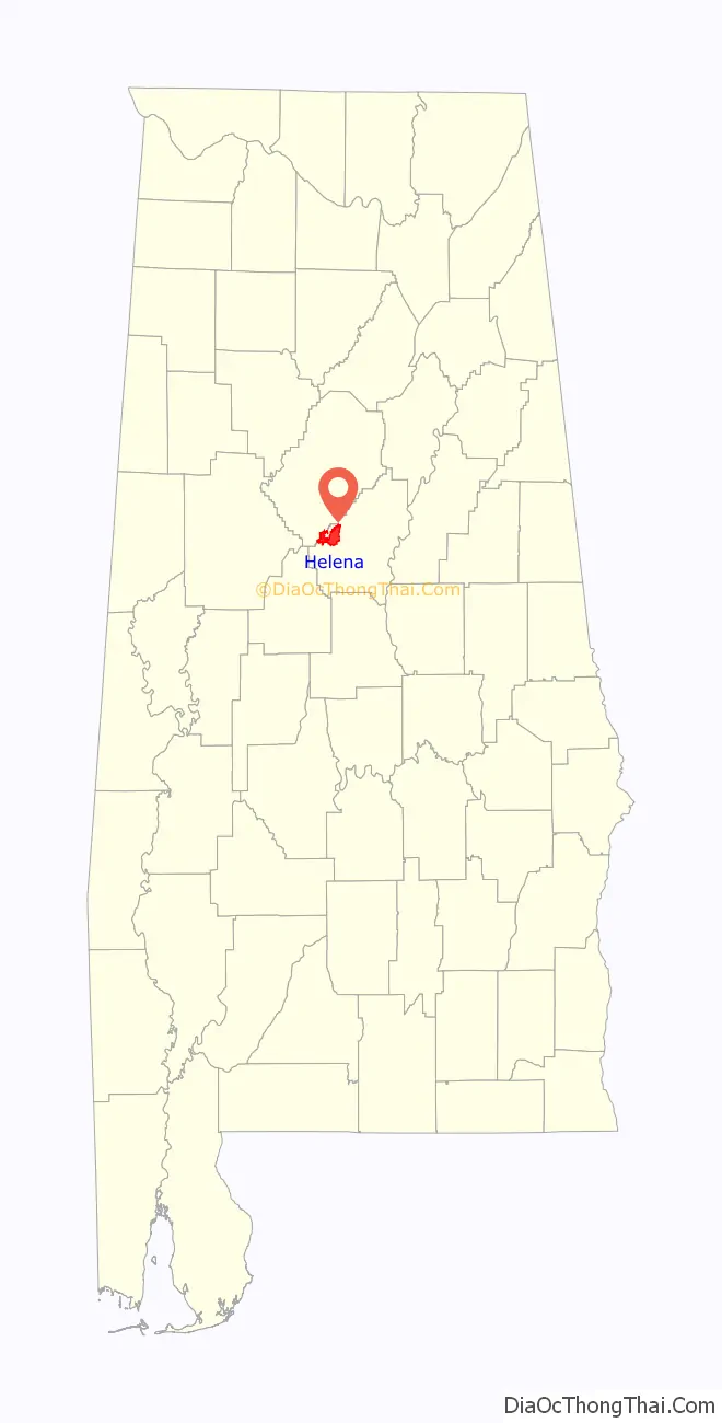
Helena location map. Where is Helena city?
History
Early settlers
The area was long the territory of the historic Muscogee people, known by English colonists as the Creek Indians. While Scots-Irish and English traders had interaction with them, and there was some armed conflict in the early 19th century, most European-American settlers did not come to this area until 1849. This was after the United States had conducted Indian Removal of the Creek and other Southeastern tribes in the 1830s, to lands west of the Mississippi River.
The first European-American settlers to Helena, which they initially named Cove, were veterans of the final campaigns of the War of 1812. Members of Andrew Jackson’s army were attracted to the quiet, peaceful valleys and streams after the Battle of Horseshoe Bend. By 1856, the Cove post office opened. Shortly thereafter, the settlers changed the name of the town to Hillsboro.
Civil War
The onset of the American Civil War brought the need for the South to increase its manufacturing production and develop new industries, in service of the Confederate States of America. Coal and iron ore mines were dug throughout this area and the construction of the Louisville & Nashville Railroad provided new transportation connections. Helena became an important industrial center for the wartime efforts. Around 1864 a rolling mill was built on Buck Creek, near the rail lines to process the iron from Selma.
Peter Boyle, an engineer for the railroad working on a new line, met and courted Helen Lee. He would name the rail station that supported the rolling mill after her. Eventually the town was named Helena after the train station.
As the final battles of the Civil War were being fought, Union forces amassed a force for a cavalry raid to attack the South’s war fighting capability, as Sherman’s march had done the previous year. Led by James Harrison Wilson, this force passed through the town of Helena on March 30, 1865, where they destroyed much of the newly developed industry and residential buildings.
Reconstruction
Within a few years of the end of the Civil War and the beginning of the reconstruction era, industrialists were again developing the area coal and iron ore resources. The railroads were rebuilt and coke ovens were established by the Eureka Company in 1870. The rolling mill was rebuilt in 1873, with support spurred by Rufus Cobb, later elected as a two-term governor. Much of what was Hillsboro had been absorbed by the expanding Helena area. The town was surveyed by Joseph Squire in 1873 and incorporated in 1877.
By 1880, Helena contained
A rail yard was added by the Louisville & Nashville Railroad Company.
Depression era
The town was reincorporated in 1917 after the initial incorporation paperwork was found to contain errors. Charles Hind was elected mayor the same year. Much of the industry began to decline as the economy contracted in the years after World War I. The rolling mill was closed in 1923 and many mine closures followed. As the Great Depression set in during the 1930s, the town fell on hard times. Many residents left to find work elsewhere.
Around 3 AM on May 5, 1933, residents were awoken to a massive tornado that ripped through the heart of Helena. A total of twelve persons were killed; 75 people were reported as injured. Many of the original houses were completely destroyed and railroad cars were overturned. The property damage was estimated to be in the range of $100,000 to $150,000 (not adjusted).
Modern expansion
Helena remained a small town in the largely rural county until suburban growth from Birmingham reached the city in the late 20th century. Numerous residential and commercial developments have taken place, spurring improvements to city facilities and services. By the early 21st century, Helena had large population gains, with related growing pains in trying to provide services, as a result of its convenient location and high quality of life.
Another tornado struck the town on March 25, 2021, causing EF1 damage to several homes and downing trees throughout several neighborhoods. The tornado eventually reached low-end EF3 strength northeast of town.
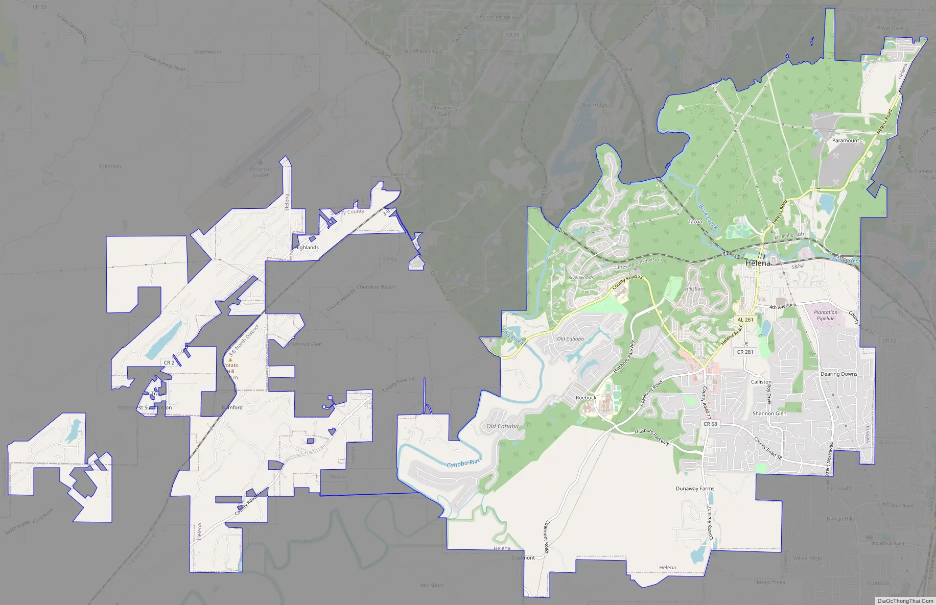
Helena Road Map
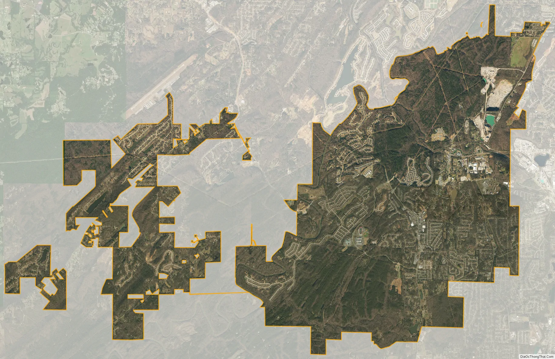
Helena city Satellite Map
Geography
Helena is located at 33°16′47″N 86°51′22″W / 33.27972°N 86.85611°W / 33.27972; -86.85611 (33.279715, -86.856060).
According to the U.S. Census Bureau, the city has a total area of 17.1 square miles (44 km), of which 17.1 square miles (44 km) is land and 0.04 square miles (0.10 km) (0.12%) is covered by water. The Cahaba River and its tributary Buck Creek run through Helena. Buck Creek is dammed upstream of Alabama State Route 261 in the Old Town area to form Lake Davidson. It was used both for recreation and to generate water wheel power at the turn of the 20th century. Fishing, wading, and canoeing are popular uses of both waterways.
Helena sits at the foothills of the very southern extent of the Appalachian Mountains as they descend into the Gulf of Mexico coastal plain. The area is largely rolling hills with numerous small streams, and undeveloped areas are primarily mixed woodlands.
Downtown Birmingham is 20 mi (32 km) north via Alabama Route 261 to US-31 or I-65.
Climate
The climate of Helena is typical of the Deep South, with long, hot, humid summers and short, relatively mild winters. Summer high temperatures are commonly in the upper 90s and low 100s F; winter lows are usually in the 20s F. Measurable snowfall is rare, occurring only a few times a decade. Thunderstorms are frequent occurrences during the summer. The Helena area experiences two severe weather peaks, early spring (March–April) and late fall (November), with tornadoes being frequent hazards during both peaks. Hurricanes coming ashore on the northern Gulf coast occasionally reach Helena with tropical storm-force winds.
See also
Map of Alabama State and its subdivision:- Autauga
- Baldwin
- Barbour
- Bibb
- Blount
- Bullock
- Butler
- Calhoun
- Chambers
- Cherokee
- Chilton
- Choctaw
- Clarke
- Clay
- Cleburne
- Coffee
- Colbert
- Conecuh
- Coosa
- Covington
- Crenshaw
- Cullman
- Dale
- Dallas
- De Kalb
- Elmore
- Escambia
- Etowah
- Fayette
- Franklin
- Geneva
- Greene
- Hale
- Henry
- Houston
- Jackson
- Jefferson
- Lamar
- Lauderdale
- Lawrence
- Lee
- Limestone
- Lowndes
- Macon
- Madison
- Marengo
- Marion
- Marshall
- Mobile
- Monroe
- Montgomery
- Morgan
- Perry
- Pickens
- Pike
- Randolph
- Russell
- Saint Clair
- Shelby
- Sumter
- Talladega
- Tallapoosa
- Tuscaloosa
- Walker
- Washington
- Wilcox
- Winston
- Alabama
- Alaska
- Arizona
- Arkansas
- California
- Colorado
- Connecticut
- Delaware
- District of Columbia
- Florida
- Georgia
- Hawaii
- Idaho
- Illinois
- Indiana
- Iowa
- Kansas
- Kentucky
- Louisiana
- Maine
- Maryland
- Massachusetts
- Michigan
- Minnesota
- Mississippi
- Missouri
- Montana
- Nebraska
- Nevada
- New Hampshire
- New Jersey
- New Mexico
- New York
- North Carolina
- North Dakota
- Ohio
- Oklahoma
- Oregon
- Pennsylvania
- Rhode Island
- South Carolina
- South Dakota
- Tennessee
- Texas
- Utah
- Vermont
- Virginia
- Washington
- West Virginia
- Wisconsin
- Wyoming


