Clanton is a city in Chilton County, Alabama, United States. It is part of the Birmingham–Hoover–Cullman Combined Statistical Area. At the 2020 census, the population was 8,768. The city is the county seat of Chilton County. Clanton is near the site of the geographic center of the U.S. state of Alabama.
| Name: | Clanton city |
|---|---|
| LSAD Code: | 25 |
| LSAD Description: | city (suffix) |
| State: | Alabama |
| County: | Chilton County |
| Founded: | 1866 |
| Incorporated: | April 23, 1873 |
| Elevation: | 600 ft (183 m) |
| Total Area: | 23.24 sq mi (60.18 km²) |
| Land Area: | 23.10 sq mi (59.83 km²) |
| Water Area: | 0.14 sq mi (0.36 km²) |
| Total Population: | 8,768 |
| Population Density: | 380/sq mi (150/km²) |
| ZIP code: | 35045-35046 |
| Area code: | 205, 659 |
| FIPS code: | 0115136 |
| GNISfeature ID: | 0157918 |
| Website: | www.clanton.al.us |
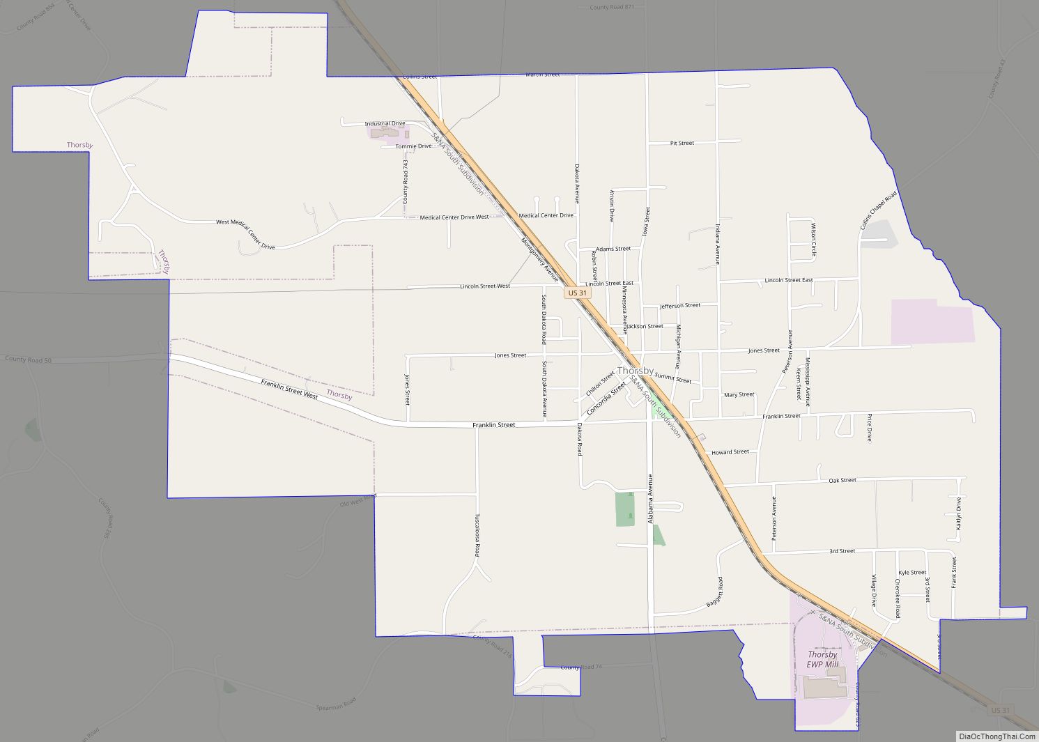
Online Interactive Map
Click on ![]() to view map in "full screen" mode.
to view map in "full screen" mode.
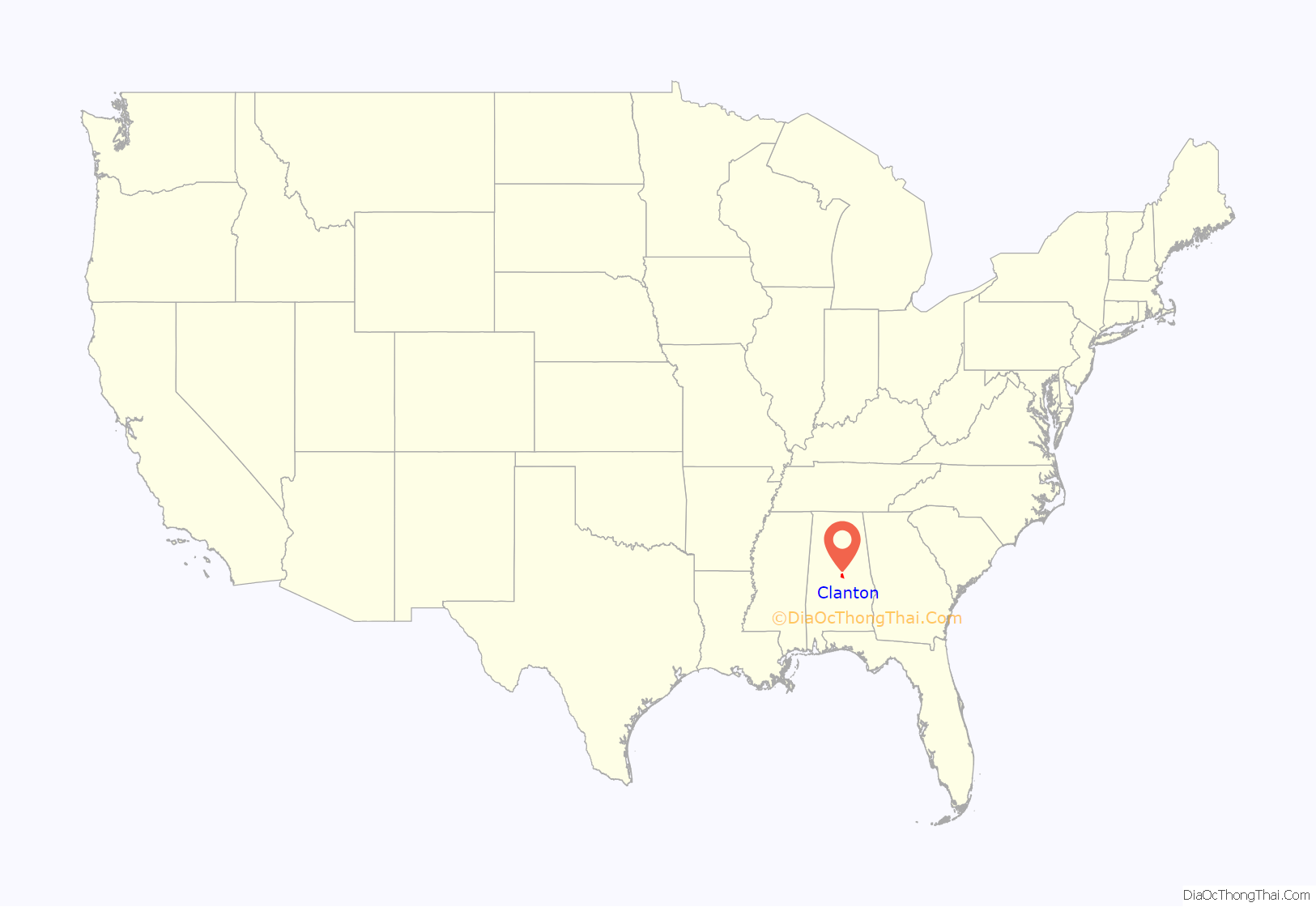
Clanton location map. Where is Clanton city?
History
The area that would become Clanton was known as “Goose Pond” and nearby “Ranch” when Baker County (later renamed Chilton County) was founded on December 30, 1868. Soon thereafter (May 1871) the town of Clanton took its name from the South and North Alabama Railroad station of that name. A couple of actions solidified the name of the town. First, during the Alabama Legislative actions to allow the vote to set the permanent location of the courthouse (January – March 1871), their amendments changed the nominated name from “Baker’s” to “Clanton.” Finalizing the name change was an official application in May 1871 by the Postmaster to the Federal Postal System to re-designate the local Post Office as “Clanton” and terminate the former designation (Goose Pond). The railroad had named “Clanton Station” in honor of James H. Clanton, an attorney, Chairman of the Alabama Democratic Executive committee, and a former Brigadier General in the Confederate States Army. It was incorporated on April 23, 1873. Alfred Baker was also elected first mayor of the town.
Nearby Mitchell Dam became Alabama Power’s first two dams in the state, bringing economic improvements to the area. Immigrants played a part in starting the county’s peach industry more than a century ago. Today, the peach industry is the number one industry in Chilton County, not only bringing fame to the county, but also millions of dollars to the local economy. The city of Clanton constructed a water tower in the form of a peach in 1993, becoming a landmark for travelers along Interstate 65.
Early civil rights activist Ida B. Wells reproduced a photographic postcard depicting an 1891 lynching in Clanton to educate the white public of the atrocities committed against blacks.
During World War II, a small German prisoner of war camp was located in Clanton in the former Civilian Conservation Corps (CCC) camp west of town.
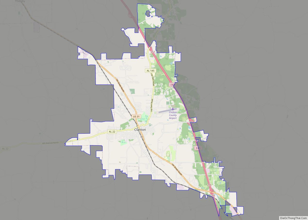
Clanton Road Map
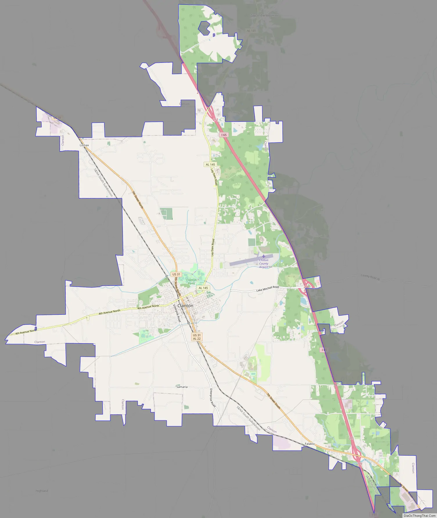
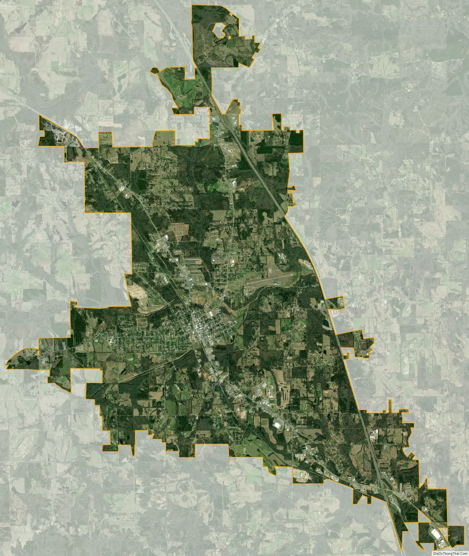
Clanton city Satellite Map
Geography
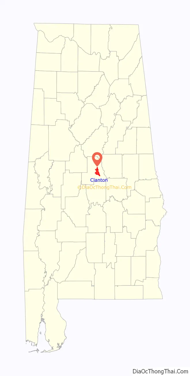
Clanton is located southeast of the center of Chilton County at 32°50’23.316″ North, 86°37’41.477″ West (32.839810, -86.628188).
The city is located in the central part of the state along Interstate 65, which runs north to south to the east of the city, with access from exits 205, 208, and 212. Via I-65, Birmingham is 53 mi (85 km) north, and Montgomery is 40 mi (64 km) southeast. Other highways that run through the city include U.S. Route 31, which runs north to south through the center of the city, leading north 22 mi (35 km) to Calera and south 31 mi (50 km) to Prattville, and Alabama State Route 22, which leads east 29 mi (47 km) to Rockford and west 15 mi (24 km) to Maplesville.
According to the U.S. Census Bureau, the city has a total area of 22.1 square miles (57.2 km), of which 21.9 square miles (56.8 km) is land and 0.15 square miles (0.4 km), or 0.62%, is water.
Climate
The climate in this area is characterized by hot, humid summers and generally mild to cool winters. According to the Köppen Climate Classification system, Clanton has a humid subtropical climate, abbreviated Cfa on climate maps.
See also
Map of Alabama State and its subdivision:- Autauga
- Baldwin
- Barbour
- Bibb
- Blount
- Bullock
- Butler
- Calhoun
- Chambers
- Cherokee
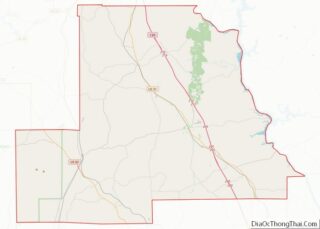
- Chilton
- Choctaw
- Clarke
- Clay
- Cleburne
- Coffee
- Colbert
- Conecuh
- Coosa
- Covington
- Crenshaw
- Cullman
- Dale
- Dallas
- De Kalb
- Elmore
- Escambia
- Etowah
- Fayette
- Franklin
- Geneva
- Greene
- Hale
- Henry
- Houston
- Jackson
- Jefferson
- Lamar
- Lauderdale
- Lawrence
- Lee
- Limestone
- Lowndes
- Macon
- Madison
- Marengo
- Marion
- Marshall
- Mobile
- Monroe
- Montgomery
- Morgan
- Perry
- Pickens
- Pike
- Randolph
- Russell
- Saint Clair
- Shelby
- Sumter
- Talladega
- Tallapoosa
- Tuscaloosa
- Walker
- Washington
- Wilcox
- Winston
- Alabama
- Alaska
- Arizona
- Arkansas
- California
- Colorado
- Connecticut
- Delaware
- District of Columbia
- Florida
- Georgia
- Hawaii
- Idaho
- Illinois
- Indiana
- Iowa
- Kansas
- Kentucky
- Louisiana
- Maine
- Maryland
- Massachusetts
- Michigan
- Minnesota
- Mississippi
- Missouri
- Montana
- Nebraska
- Nevada
- New Hampshire
- New Jersey
- New Mexico
- New York
- North Carolina
- North Dakota
- Ohio
- Oklahoma
- Oregon
- Pennsylvania
- Rhode Island
- South Carolina
- South Dakota
- Tennessee
- Texas
- Utah
- Vermont
- Virginia
- Washington
- West Virginia
- Wisconsin
- Wyoming