Meadowbrook is an unincorporated community and census-designated place (CDP) in Shelby County, Alabama, United States. At the 2020 census, the population was 9,688. It is part of the Birmingham metropolitan area.
| Name: | Meadowbrook CDP |
|---|---|
| LSAD Code: | 57 |
| LSAD Description: | CDP (suffix) |
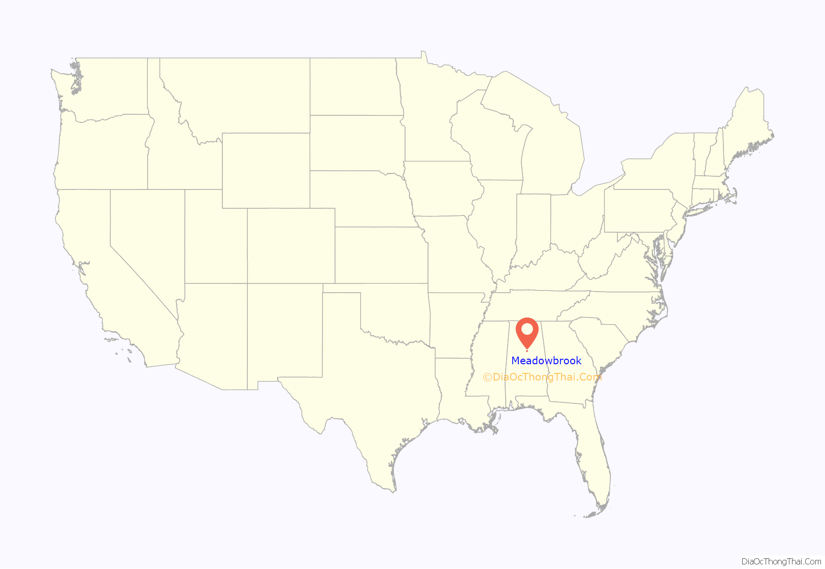
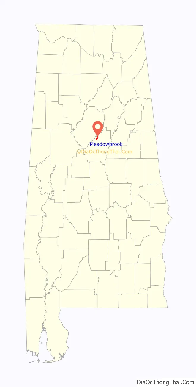
| State: | Alabama |
| County: | Shelby County |
| Elevation: | 627 ft (191 m) |
| Total Area: | 4.37 sq mi (11.32 km²) |
| Land Area: | 4.36 sq mi (11.29 km²) |
| Water Area: | 0.01 sq mi (0.03 km²) |
| Total Population: | 9,688 |
| Population Density: | 2,222.53/sq mi (858.17/km²) |
| ZIP code: | 35242 |
| Area code: | 205 and 659 |
| FIPS code: | 0147740 |
| GNISfeature ID: | 1866929 |
Online Interactive Map
Click on ![]() to view map in "full screen" mode.
to view map in "full screen" mode.
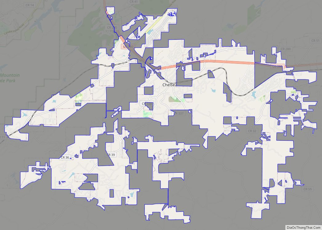
Meadowbrook location map. Where is Meadowbrook CDP?
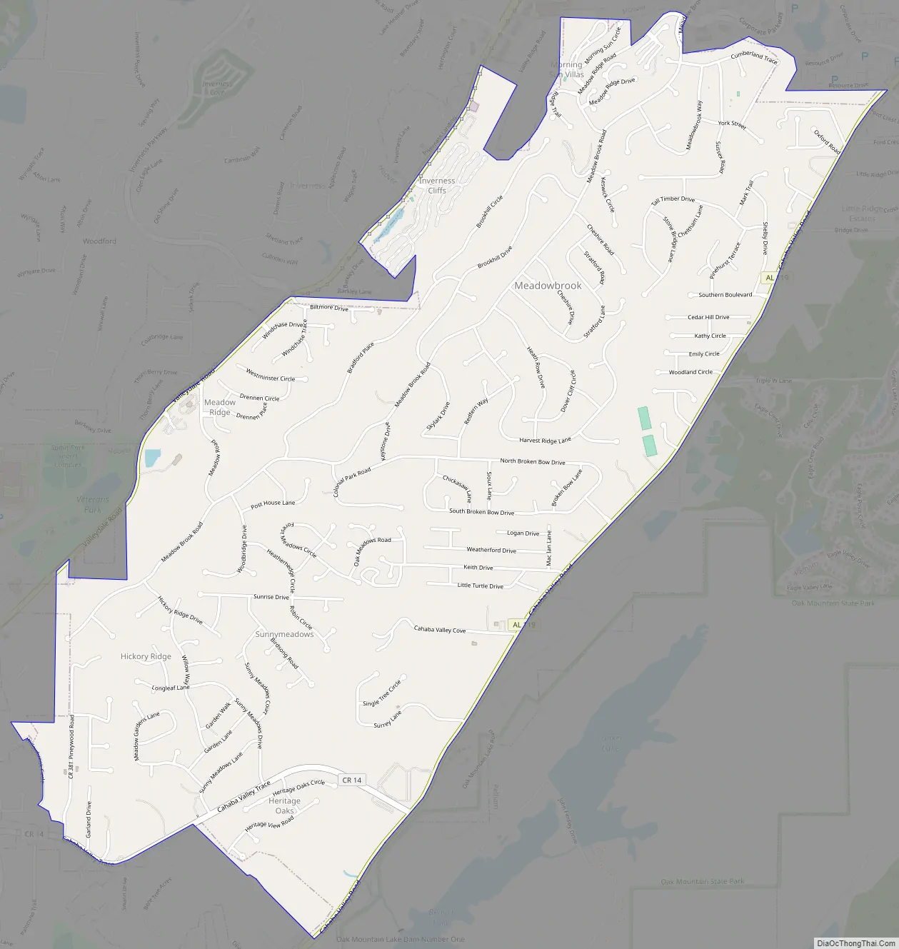
Meadowbrook Road Map
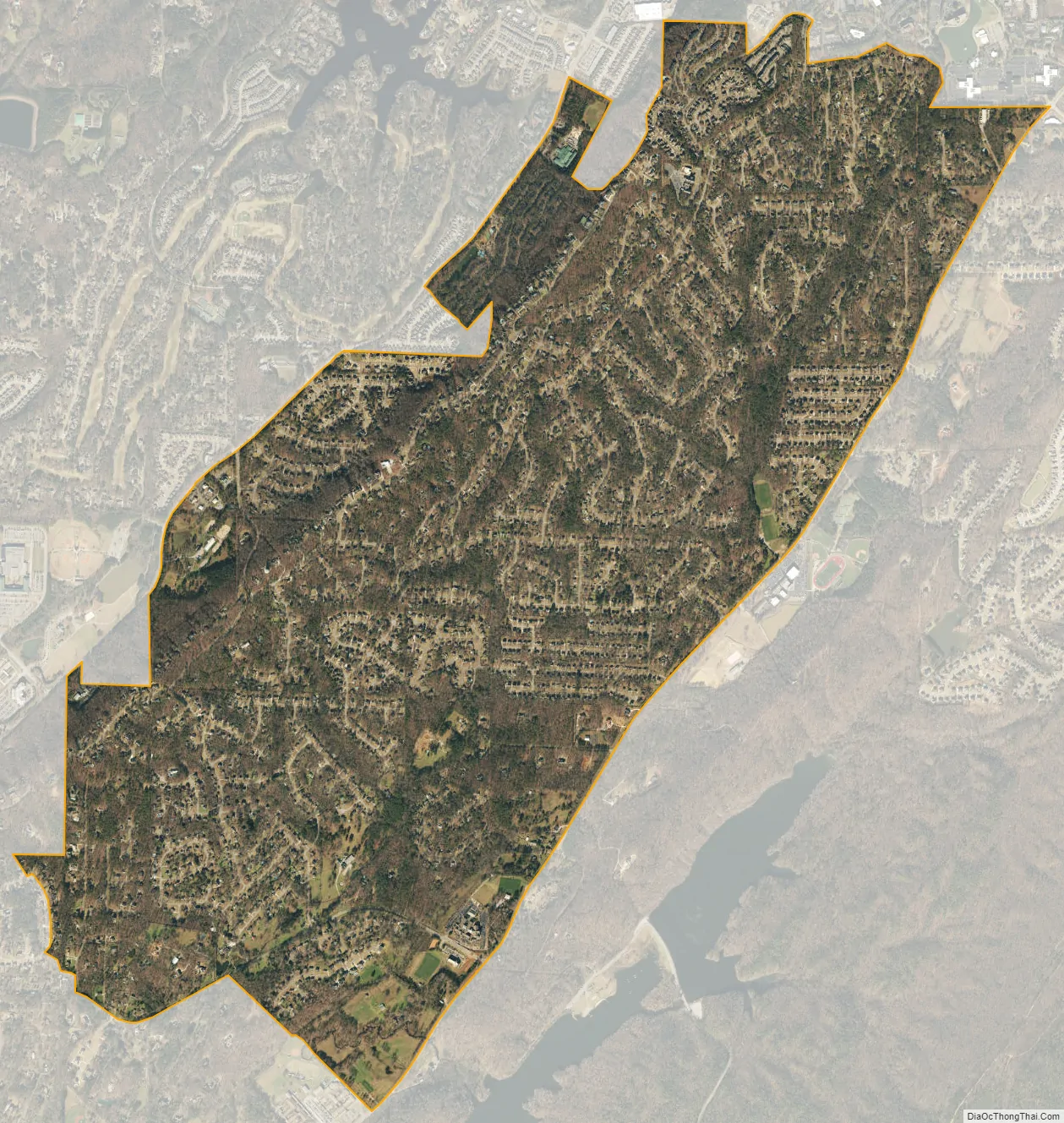
Meadowbrook city Satellite Map
Geography
Meadowbrook is located at 33°24′14″N 86°41′27″W / 33.40389°N 86.69083°W / 33.40389; -86.69083 (33.403788, -86.690758).
The community is located within the southeastern suburbs of Birmingham, generally bounded by U.S. Route 280 to the north, Alabama State Route 119 to the east, Valleydale Rd to the west, and Meadow Brook Rd to the south. Downtown Birmingham is 13 mi (21 km) to the northwest via US 280.
According to the U.S. Census Bureau, the community has a total area of 4.2 square miles (11 km), all land.
See also
Map of Alabama State and its subdivision:- Autauga
- Baldwin
- Barbour
- Bibb
- Blount
- Bullock
- Butler
- Calhoun
- Chambers
- Cherokee
- Chilton
- Choctaw
- Clarke
- Clay
- Cleburne
- Coffee
- Colbert
- Conecuh
- Coosa
- Covington
- Crenshaw
- Cullman
- Dale
- Dallas
- De Kalb
- Elmore
- Escambia
- Etowah
- Fayette
- Franklin
- Geneva
- Greene
- Hale
- Henry
- Houston
- Jackson
- Jefferson
- Lamar
- Lauderdale
- Lawrence
- Lee
- Limestone
- Lowndes
- Macon
- Madison
- Marengo
- Marion
- Marshall
- Mobile
- Monroe
- Montgomery
- Morgan
- Perry
- Pickens
- Pike
- Randolph
- Russell
- Saint Clair
- Shelby
- Sumter
- Talladega
- Tallapoosa
- Tuscaloosa
- Walker
- Washington
- Wilcox
- Winston
- Alabama
- Alaska
- Arizona
- Arkansas
- California
- Colorado
- Connecticut
- Delaware
- District of Columbia
- Florida
- Georgia
- Hawaii
- Idaho
- Illinois
- Indiana
- Iowa
- Kansas
- Kentucky
- Louisiana
- Maine
- Maryland
- Massachusetts
- Michigan
- Minnesota
- Mississippi
- Missouri
- Montana
- Nebraska
- Nevada
- New Hampshire
- New Jersey
- New Mexico
- New York
- North Carolina
- North Dakota
- Ohio
- Oklahoma
- Oregon
- Pennsylvania
- Rhode Island
- South Carolina
- South Dakota
- Tennessee
- Texas
- Utah
- Vermont
- Virginia
- Washington
- West Virginia
- Wisconsin
- Wyoming