Columbiana is a city and the county seat of Shelby County, Alabama, United States. At the 2020 census, the population was 4,462.
| Name: | Columbiana city |
|---|---|
| LSAD Code: | 25 |
| LSAD Description: | city (suffix) |
| State: | Alabama |
| County: | Shelby County |
| Elevation: | 574 ft (175 m) |
| Total Area: | 17.40 sq mi (45.07 km²) |
| Land Area: | 17.30 sq mi (44.81 km²) |
| Water Area: | 0.10 sq mi (0.26 km²) |
| Total Population: | 4,462 |
| Population Density: | 257.89/sq mi (99.57/km²) |
| ZIP code: | 35051 |
| Area code: | 205, 659 |
| FIPS code: | 0116768 |
| GNISfeature ID: | 2404109 |
| Website: | cityofcolumbiana.com |
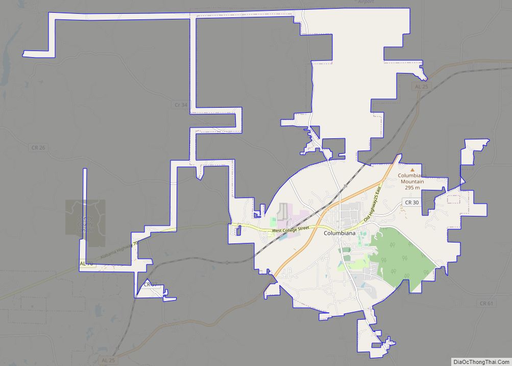
Online Interactive Map
Click on ![]() to view map in "full screen" mode.
to view map in "full screen" mode.
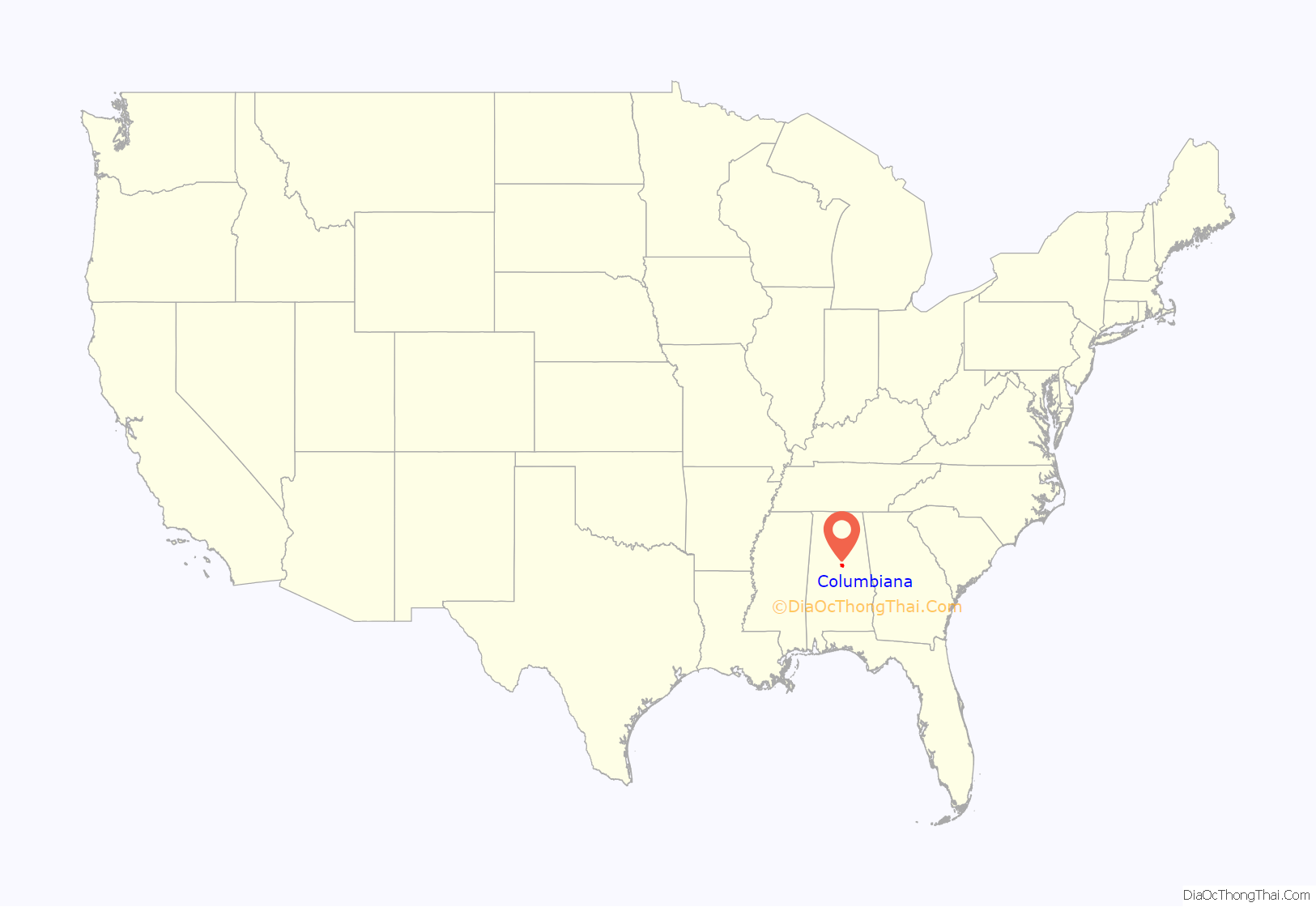
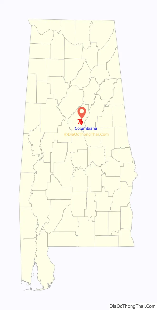
Columbiana location map. Where is Columbiana city?
History
Columbiana, originally called Columbia, was selected as the county seat of Shelby County in 1826 over rivals Calera and Montevallo. After the selection as the county seat, Columbiana celebrated by drilling holes in a large pine tree and packing it with gunpowder. The tree was blown up and the sound could be heard for miles. Later in 1826, the courthouse was moved to an old school building in Columbiana.
An act of the Alabama Legislature officially changed the name of Shelby County’s county seat to Columbiana on January 13, 1832. Columbiana was incorporated on December 5, 1837, with corporate limits one-quarter of a mile in each direction from the public square.
In 1854, the decision was made to build a larger courthouse at the south end of “Silk Stocking Road”, now Main Street. From 1854 to 1908 several additions and changes were made to the courthouse. During the American Civil War, Columbiana was connected to the nearby town of Shelby by the Shelby Iron Company Railroad, which connected the Shelby Iron Works to the Alabama and Tennessee River Railroad. The Iron Works supplied iron to the C.B. Churchill and Company foundry, which moved to Columbiana in 1862 after the fall of Corinth, Mississippi. The Churchill foundry made eight and ten pound shot, eight and ten pound shells, and shells for Blakely rifles. The C.B. Churchill and Company foundry, Shelby Iron Works and the railroad were destroyed by Union forces on March 31, 1865, as part of Wilson’s Raid.
Moving the courthouse to Columbiana was not necessarily popular in 1826 and there have been numerous attempts to relocate the county seat over the years. In 1901, the Alabama Constitutional Convention addressed the issue by including Section 41 in the new state constitution. Section 41 prohibited a move of the Shelby County seat from Columbiana unless a vote of the people was held, the only county in Alabama with such a designation.
To further solidify Columbiana’s claim to the county seat, in 1905 construction began two blocks north of the existing courthouse on a new marble courthouse at a cost of $300,000. The new courthouse was completed in 1908 and has been renovated and enlarged on a number of occasions. The new courthouse has served Shelby County for over 100 years.
The “Old Courthouse” is now home to the Shelby County Museum and Archives.
Today, Columbiana is home to the Shelby County Board of Education, the Shelby County Sheriff’s Office, the Shelby County Jail, and Harrison Regional Library, which is the main office for the Shelby County Library System. Columbiana holds the annual Liberty Day celebration on the last weekend in June, which was first held in 1986 to honor the 100th anniversary of the Statue of Liberty. The current mayor is David Mitchell.
The population of Columbiana was 4,546 as of 2021.
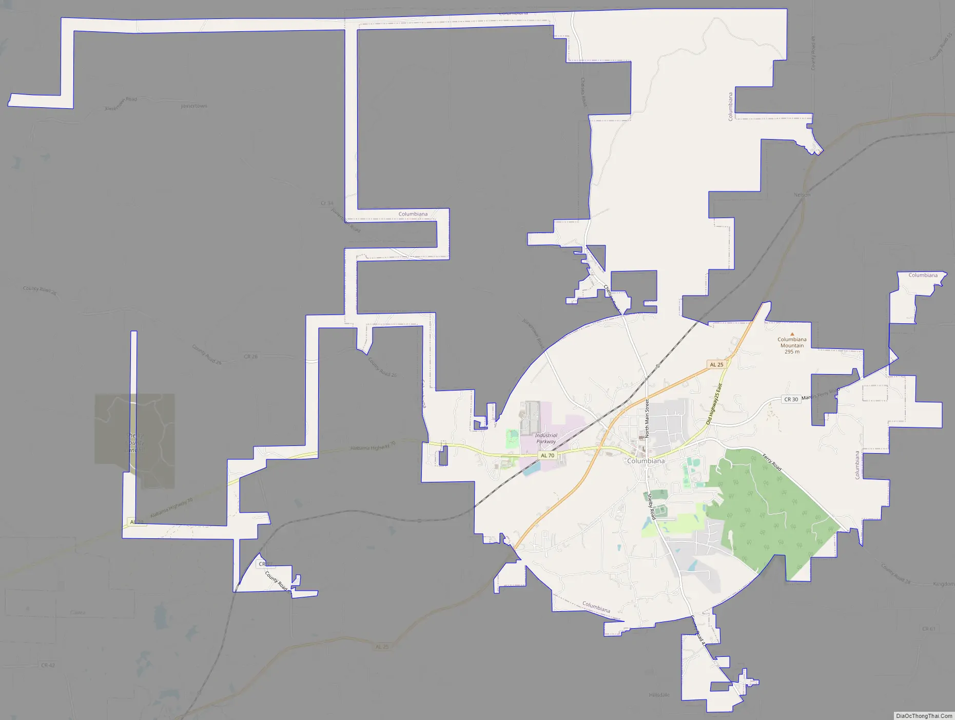
Columbiana Road Map
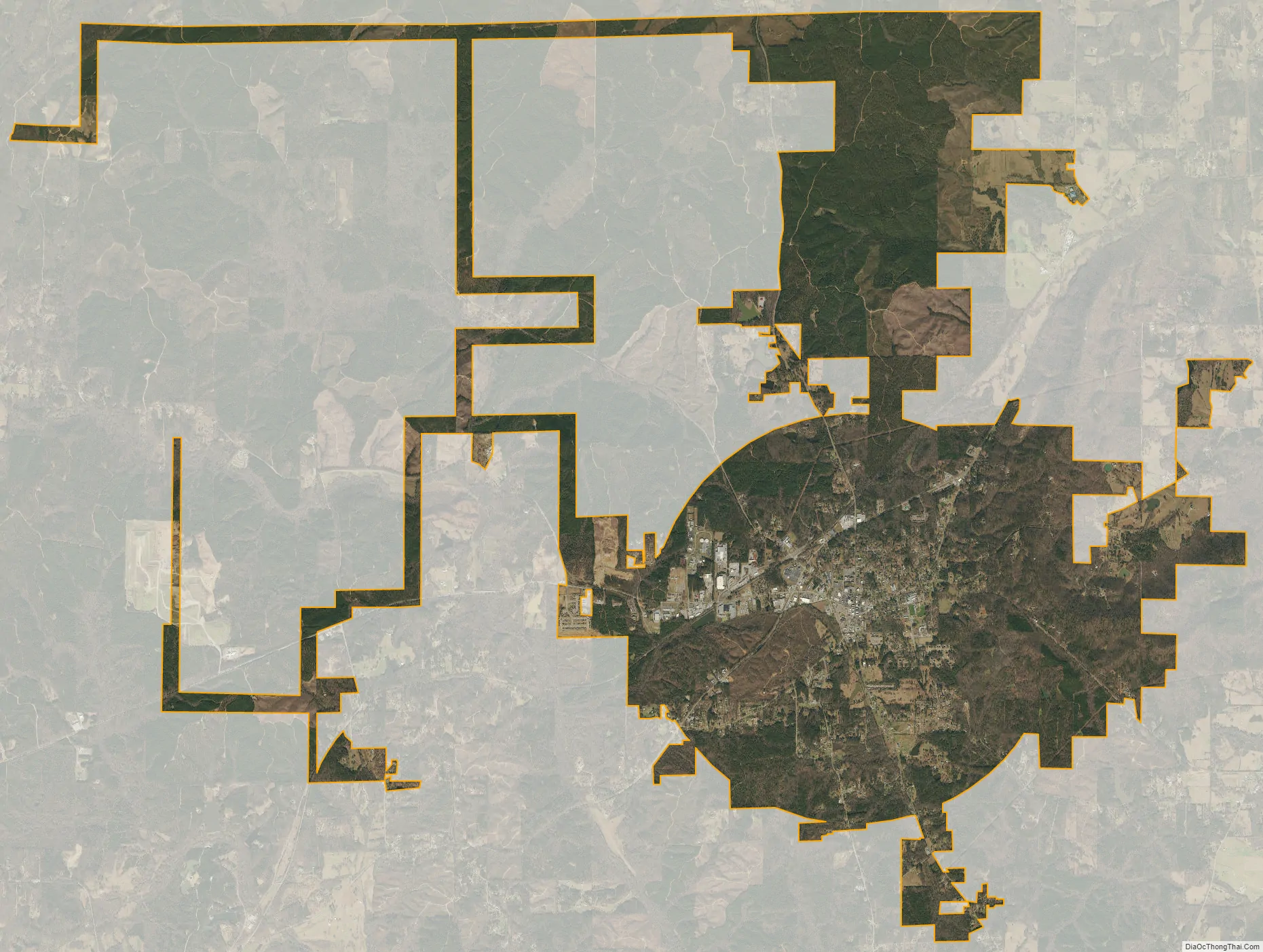
Columbiana city Satellite Map
Geography
The city is located in the southeastern part of the county along Alabama State Route 25, which runs northeast to southwest to the west of the downtown area, leading northeast 9 miles (14 km) to Wilsonville and southwest 11 miles (18 km) to Calera.
See also
Map of Alabama State and its subdivision:- Autauga
- Baldwin
- Barbour
- Bibb
- Blount
- Bullock
- Butler
- Calhoun
- Chambers
- Cherokee
- Chilton
- Choctaw
- Clarke
- Clay
- Cleburne
- Coffee
- Colbert
- Conecuh
- Coosa
- Covington
- Crenshaw
- Cullman
- Dale
- Dallas
- De Kalb
- Elmore
- Escambia
- Etowah
- Fayette
- Franklin
- Geneva
- Greene
- Hale
- Henry
- Houston
- Jackson
- Jefferson
- Lamar
- Lauderdale
- Lawrence
- Lee
- Limestone
- Lowndes
- Macon
- Madison
- Marengo
- Marion
- Marshall
- Mobile
- Monroe
- Montgomery
- Morgan
- Perry
- Pickens
- Pike
- Randolph
- Russell
- Saint Clair
- Shelby
- Sumter
- Talladega
- Tallapoosa
- Tuscaloosa
- Walker
- Washington
- Wilcox
- Winston
- Alabama
- Alaska
- Arizona
- Arkansas
- California
- Colorado
- Connecticut
- Delaware
- District of Columbia
- Florida
- Georgia
- Hawaii
- Idaho
- Illinois
- Indiana
- Iowa
- Kansas
- Kentucky
- Louisiana
- Maine
- Maryland
- Massachusetts
- Michigan
- Minnesota
- Mississippi
- Missouri
- Montana
- Nebraska
- Nevada
- New Hampshire
- New Jersey
- New Mexico
- New York
- North Carolina
- North Dakota
- Ohio
- Oklahoma
- Oregon
- Pennsylvania
- Rhode Island
- South Carolina
- South Dakota
- Tennessee
- Texas
- Utah
- Vermont
- Virginia
- Washington
- West Virginia
- Wisconsin
- Wyoming