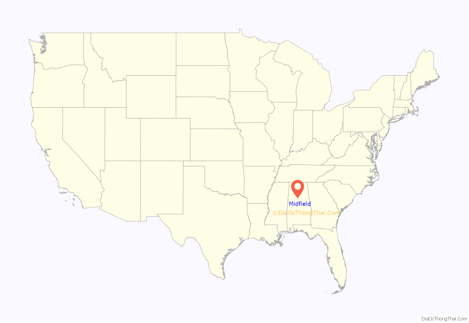
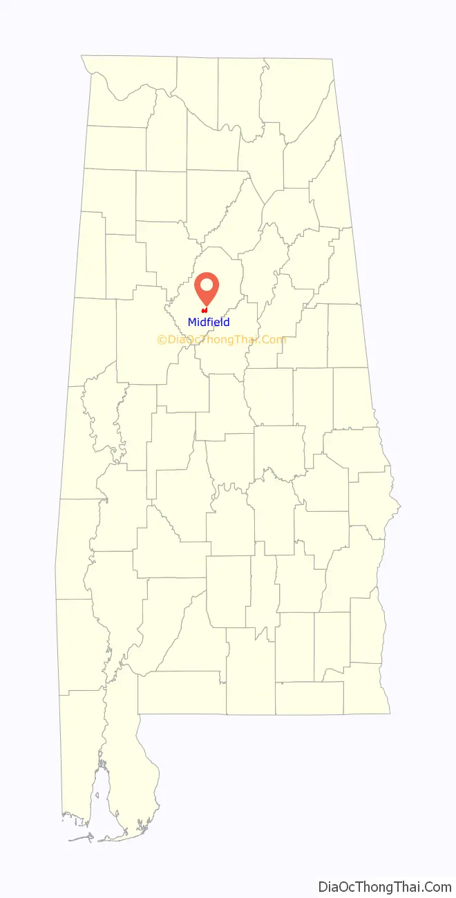
Midfield is a town in Jefferson County, Alabama, United States, located two miles south of the Birmingham suburb of Fairfield. It incorporated in 1953. As of the 2010 census, it had a population of 5,365.
| Name: | Midfield city |
|---|---|
| LSAD Code: | 25 |
| LSAD Description: | city (suffix) |
| State: | Alabama |
| County: | Jefferson County |
| Elevation: | 525 ft (160 m) |
| Total Area: | 2.66 sq mi (6.88 km²) |
| Land Area: | 2.66 sq mi (6.88 km²) |
| Water Area: | 0.00 sq mi (0.00 km²) |
| Total Population: | 5,211 |
| Population Density: | 1,960.50/sq mi (757.06/km²) |
| ZIP code: | 35228 |
| Area code: | 205 & 659 |
| FIPS code: | 0148376 |
| GNISfeature ID: | 2404254 |
| Website: | www.cityofmidfield.com |
Online Interactive Map
Click on ![]() to view map in "full screen" mode.
to view map in "full screen" mode.
Midfield location map. Where is Midfield city?
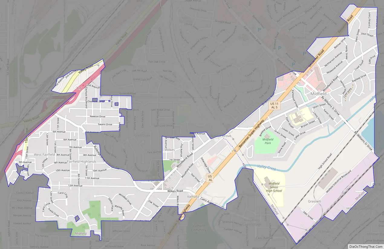
Midfield Road Map
Midfield city Satellite Map
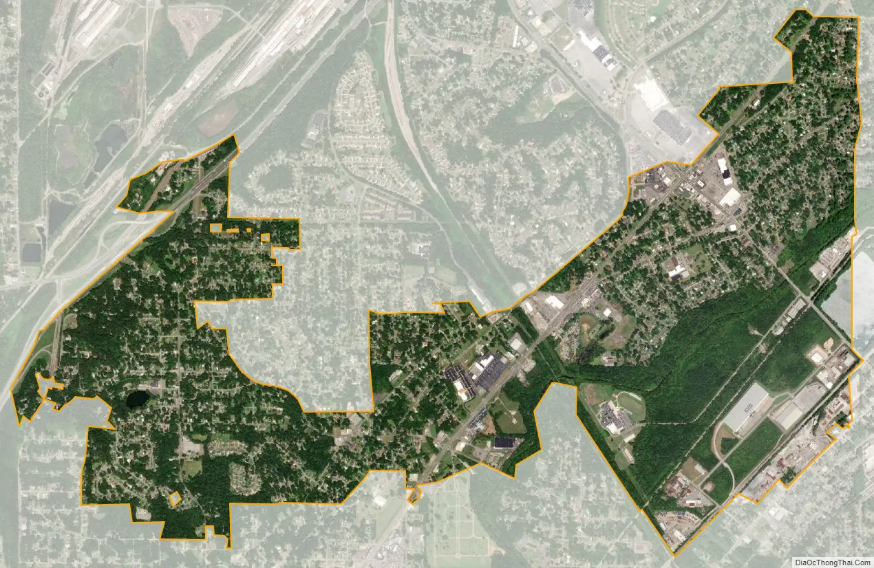
Geography
Midfield is located at 33°27′21″N 86°55′37″W / 33.45583°N 86.92694°W / 33.45583; -86.92694 (33.455874, -86.927044).
According to the U.S. Census Bureau, this town has a total area of about 2.6 square miles (6.7 km), all land.
See also
Map of Alabama State and its subdivision:- Autauga
- Baldwin
- Barbour
- Bibb
- Blount
- Bullock
- Butler
- Calhoun
- Chambers
- Cherokee
- Chilton
- Choctaw
- Clarke
- Clay
- Cleburne
- Coffee
- Colbert
- Conecuh
- Coosa
- Covington
- Crenshaw
- Cullman
- Dale
- Dallas
- De Kalb
- Elmore
- Escambia
- Etowah
- Fayette
- Franklin
- Geneva
- Greene
- Hale
- Henry
- Houston
- Jackson
- Jefferson
- Lamar
- Lauderdale
- Lawrence
- Lee
- Limestone
- Lowndes
- Macon
- Madison
- Marengo
- Marion
- Marshall
- Mobile
- Monroe
- Montgomery
- Morgan
- Perry
- Pickens
- Pike
- Randolph
- Russell
- Saint Clair
- Shelby
- Sumter
- Talladega
- Tallapoosa
- Tuscaloosa
- Walker
- Washington
- Wilcox
- Winston
- Alabama
- Alaska
- Arizona
- Arkansas
- California
- Colorado
- Connecticut
- Delaware
- District of Columbia
- Florida
- Georgia
- Hawaii
- Idaho
- Illinois
- Indiana
- Iowa
- Kansas
- Kentucky
- Louisiana
- Maine
- Maryland
- Massachusetts
- Michigan
- Minnesota
- Mississippi
- Missouri
- Montana
- Nebraska
- Nevada
- New Hampshire
- New Jersey
- New Mexico
- New York
- North Carolina
- North Dakota
- Ohio
- Oklahoma
- Oregon
- Pennsylvania
- Rhode Island
- South Carolina
- South Dakota
- Tennessee
- Texas
- Utah
- Vermont
- Virginia
- Washington
- West Virginia
- Wisconsin
- Wyoming


