Mountain Brook is a city in southeastern Jefferson County, Alabama, United States, and a suburb of Birmingham. Its population at the 2020 census was 22,461.
| Name: | Mountain Brook city |
|---|---|
| LSAD Code: | 25 |
| LSAD Description: | city (suffix) |
| State: | Alabama |
| County: | Jefferson County |
| Incorporated: | March 24, 1942 |
| Elevation: | 955 ft (291 m) |
| Total Area: | 12.84 sq mi (33.25 km²) |
| Land Area: | 12.82 sq mi (33.20 km²) |
| Water Area: | 0.02 sq mi (0.05 km²) |
| Total Population: | 22,461 |
| Population Density: | 1,752.03/sq mi (676.47/km²) |
| ZIP code: | 35213, 35223, 35243 |
| Area code: | 205 & 659 |
| FIPS code: | 0151696 |
| GNISfeature ID: | 2404329 |
| Website: | http://www.mtnbrook.org/ |
Online Interactive Map
Click on ![]() to view map in "full screen" mode.
to view map in "full screen" mode.
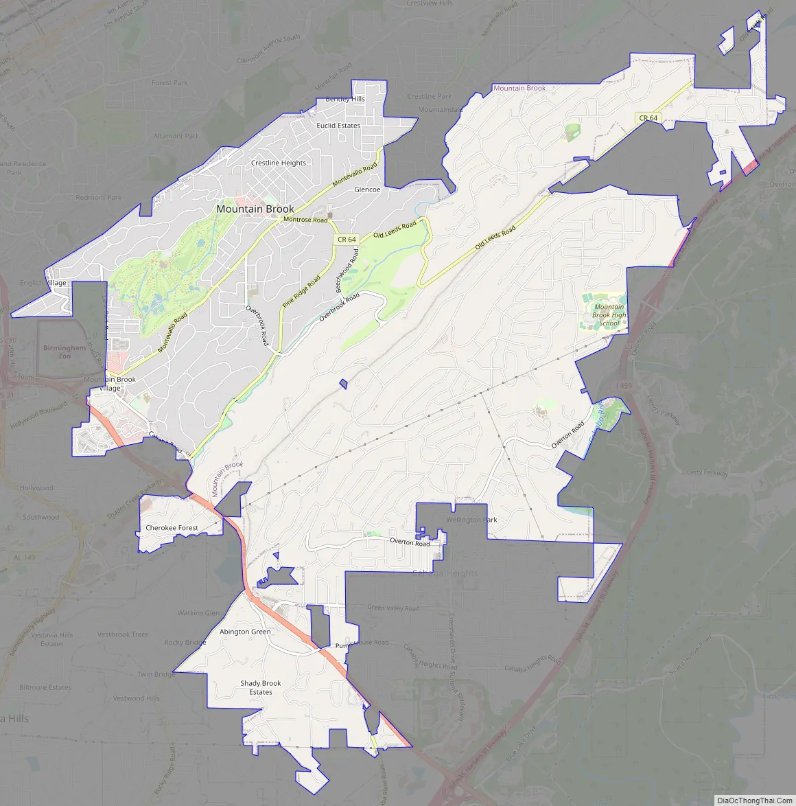
Mountain Brook location map. Where is Mountain Brook city?
History
The city was originally developed in 1929 by real-estate businessman Robert Jemison, Jr., as a whites-only suburb of Birmingham along the ridges known as Red Mountain and Shades Mountain. It was incorporated on May 24, 1942. The plans, by Boston-based landscape architect Warren H. Manning, called for estate-sized lots along winding scenic roads and denser commercial development centering on three picturesque “villages”: English Village, Mountain Brook Village and Crestline Village. Most of Mountain Brook’s development preserved the existing trees: 92.03% is under tree cover, one of the highest ratios in the nation. Residential sections such as Cherokee Bend, Brookwood Forest, Overton, and Crestline have houses in a forest setting, with a recreational network of bridle paths. This has protected the area from urban encroachment.
Mountain Brook is the location of the first office park in the U.S., built in 1955. It featured the then novel concepts of ample free parking and low-profile office buildings surrounded by waterspouts and landscaped grounds.
A new city hall, including a fire and police station, was completed in 2013.
Mountain Brook Road Map
Mountain Brook city Satellite Map
Geography
According to the U.S. Census Bureau, it has a total area of 12.82 square miles (33.2 km), all land.
See also
Map of Alabama State and its subdivision:- Autauga
- Baldwin
- Barbour
- Bibb
- Blount
- Bullock
- Butler
- Calhoun
- Chambers
- Cherokee
- Chilton
- Choctaw
- Clarke
- Clay
- Cleburne
- Coffee
- Colbert
- Conecuh
- Coosa
- Covington
- Crenshaw
- Cullman
- Dale
- Dallas
- De Kalb
- Elmore
- Escambia
- Etowah
- Fayette
- Franklin
- Geneva
- Greene
- Hale
- Henry
- Houston
- Jackson
- Jefferson
- Lamar
- Lauderdale
- Lawrence
- Lee
- Limestone
- Lowndes
- Macon
- Madison
- Marengo
- Marion
- Marshall
- Mobile
- Monroe
- Montgomery
- Morgan
- Perry
- Pickens
- Pike
- Randolph
- Russell
- Saint Clair
- Shelby
- Sumter
- Talladega
- Tallapoosa
- Tuscaloosa
- Walker
- Washington
- Wilcox
- Winston
- Alabama
- Alaska
- Arizona
- Arkansas
- California
- Colorado
- Connecticut
- Delaware
- District of Columbia
- Florida
- Georgia
- Hawaii
- Idaho
- Illinois
- Indiana
- Iowa
- Kansas
- Kentucky
- Louisiana
- Maine
- Maryland
- Massachusetts
- Michigan
- Minnesota
- Mississippi
- Missouri
- Montana
- Nebraska
- Nevada
- New Hampshire
- New Jersey
- New Mexico
- New York
- North Carolina
- North Dakota
- Ohio
- Oklahoma
- Oregon
- Pennsylvania
- Rhode Island
- South Carolina
- South Dakota
- Tennessee
- Texas
- Utah
- Vermont
- Virginia
- Washington
- West Virginia
- Wisconsin
- Wyoming


