Thorsby is a town in Chilton County, Alabama, United States. As of the 2010 census, the population of the town was 1,980. The town mayor is Robert Hight.
| Name: | Thorsby town |
|---|---|
| LSAD Code: | 43 |
| LSAD Description: | town (suffix) |
| State: | Alabama |
| County: | Chilton County |
| Elevation: | 696 ft (212 m) |
| Total Area: | 5.84 sq mi (15.12 km²) |
| Land Area: | 5.83 sq mi (15.10 km²) |
| Water Area: | 0.01 sq mi (0.03 km²) |
| Total Population: | 2,064 |
| Population Density: | 354.09/sq mi (136.72/km²) |
| ZIP code: | 35171 |
| Area code: | 205, 659 |
| FIPS code: | 0176080 |
| GNISfeature ID: | 0153689 |
| Website: | www.townofthorsby.com |
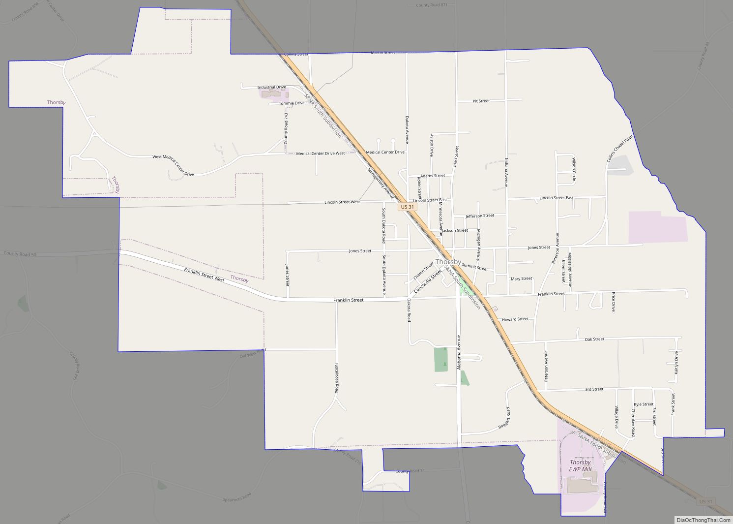
Online Interactive Map
Click on ![]() to view map in "full screen" mode.
to view map in "full screen" mode.
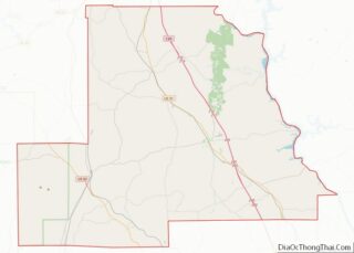
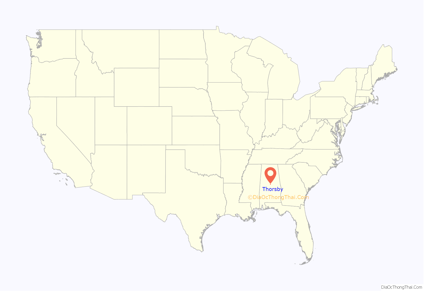
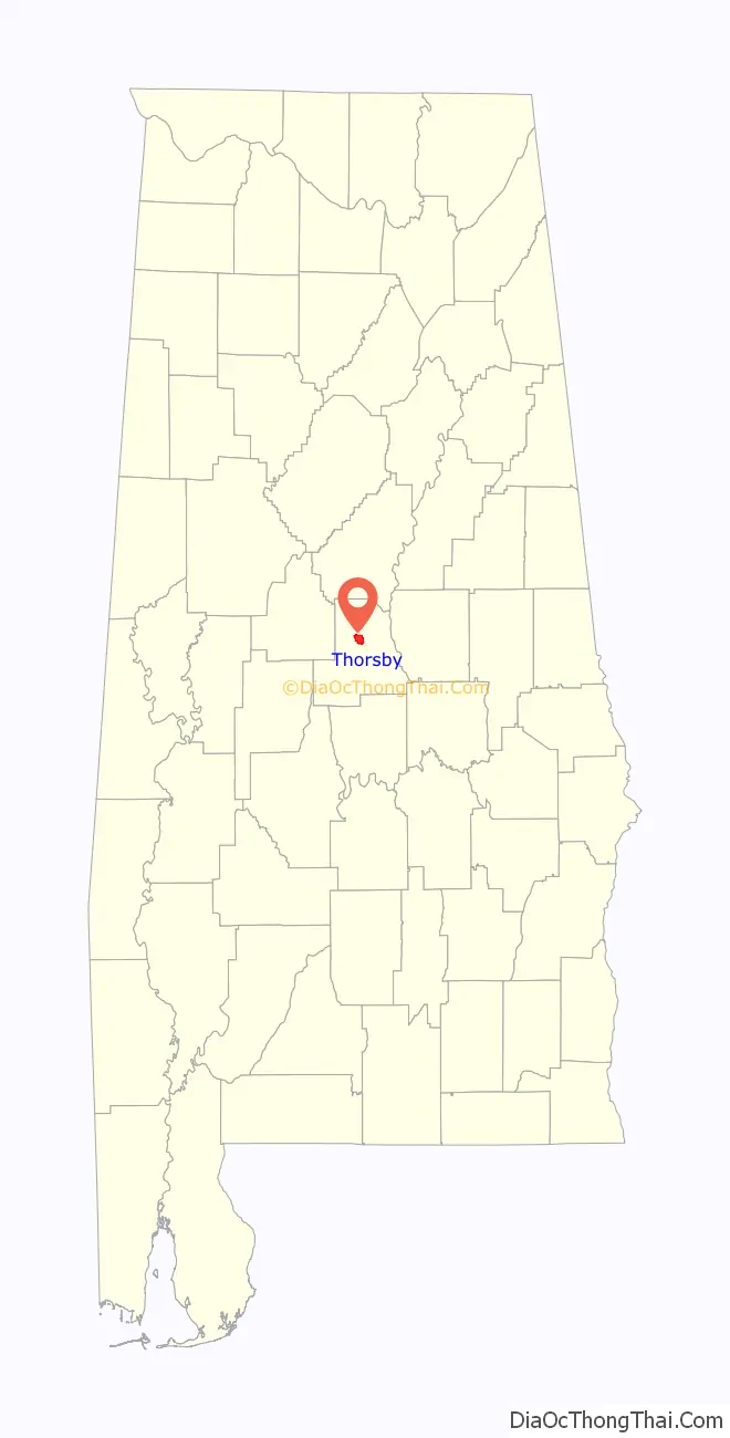
Thorsby location map. Where is Thorsby town?
History
Thorsby is a small Central Alabama town located in Chilton County. Thorsby was first settled in 1815 and incorporated in 1901 by Scandinavian immigrants who had originally settled in the midwestern United States, but who were seeking a milder climate and fertile soil for growing food. One of those earliest settlers was Theodore T. Thorson, for whom the town was eventually named (the suffix “by” meaning “settlement” in Scandinavian languages). The town grew quickly, with two hotels, a sawmill and lumber company, and two wineries being built within the first couple of years. The town of Thorsby was declared a promised land for northerners looking to relocate to a warmer climate, suitable for farming and better health. The fertile soil of the South produced grapes in large numbers, along with other fruits such as strawberries, and the peaches for which Chilton County is famous. The founders formed the Concordia Land and Improvement Association and began advertising in New England newspapers about the “utopia” they had discovered in the Southeastern United States. Many traveled by railroad to purchase a tract of land and start a better life. Thorsby became affectionately known as the little “Swede town” by locals.
Thorsby is located almost exactly between the downtown areas of Birmingham and Montgomery, with either destination being approximately 45 miles (72 km) from the center of town.
Each autumn, the town of Thorsby celebrates its heritage with the Annual Swedish Festival that includes an arts and crafts fair, a pageant, music, car and motorcycle shows and food native to the American South. The town maintains a museum in the old Norwegian Lutheran Church, now called “Helen Jenkins Chapel”. A Scandinavian Cemetery is available for visits any time. The town operates its own police and fire departments, as well as departments of building inspection, law, parks and recreation, and the Thorsby Water Works. The Chilton County School System operates the K-12 Thorsby School in the town.
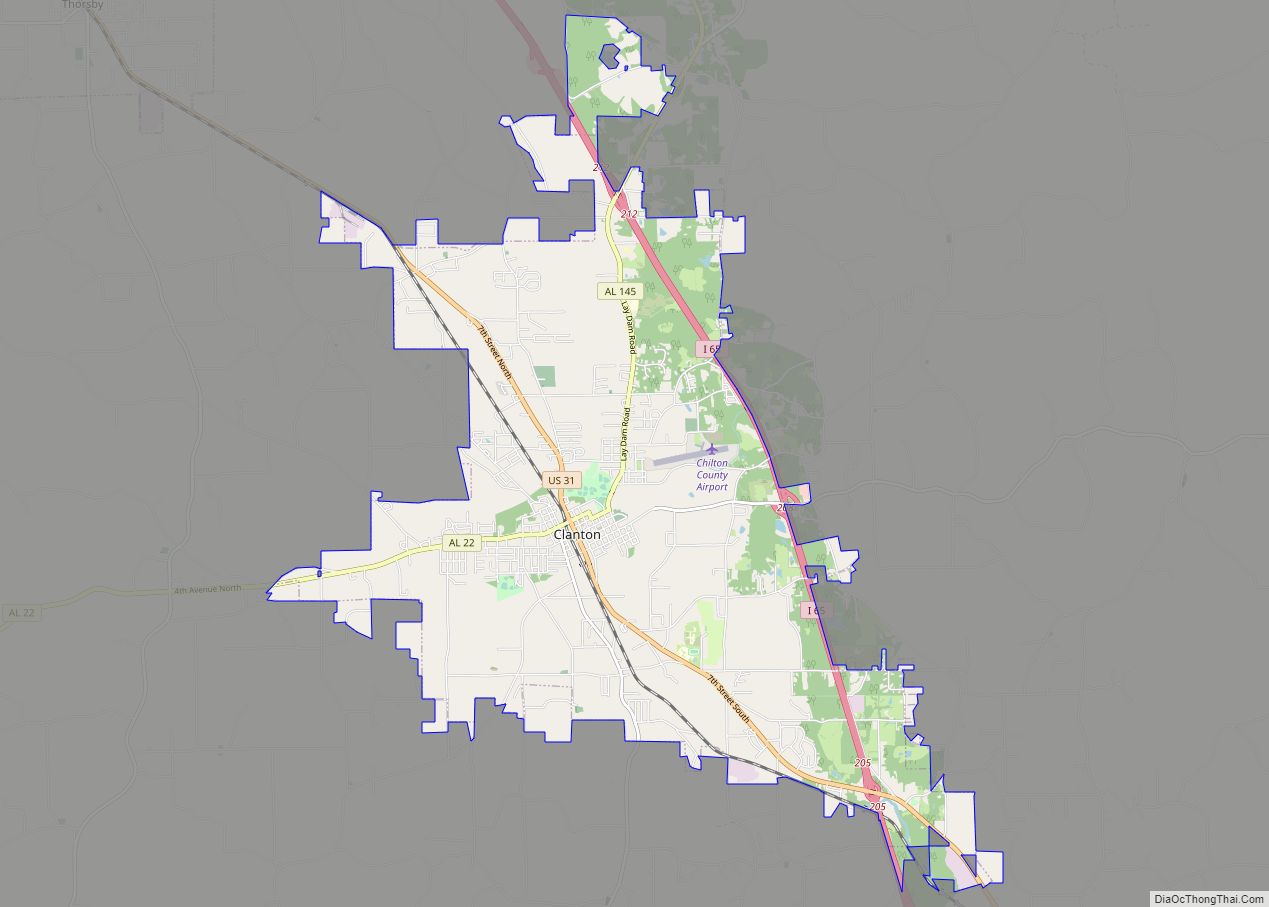
Thorsby Road Map
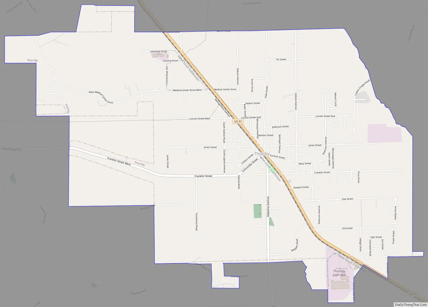
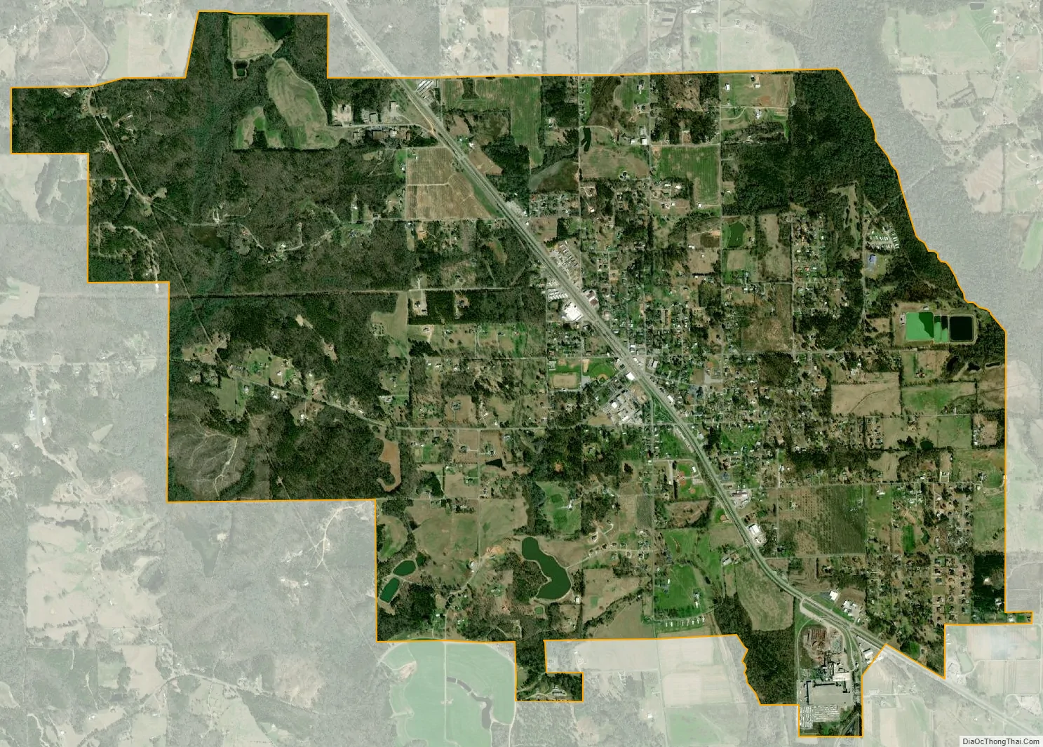
Thorsby city Satellite Map
Geography
Thorsby is located north of the center of Chilton County at 32°55’1.171″ North, 86°42’57.442″ West (32.916992, -86.715956).
According to the U.S. Census Bureau, the town has a total area of 5.1 square miles (13.3 km), of which 0.012 square miles (0.03 km), or 0.19%, is water.
See also
Map of Alabama State and its subdivision:- Autauga
- Baldwin
- Barbour
- Bibb
- Blount
- Bullock
- Butler
- Calhoun
- Chambers
- Cherokee
- Chilton
- Choctaw
- Clarke
- Clay
- Cleburne
- Coffee
- Colbert
- Conecuh
- Coosa
- Covington
- Crenshaw
- Cullman
- Dale
- Dallas
- De Kalb
- Elmore
- Escambia
- Etowah
- Fayette
- Franklin
- Geneva
- Greene
- Hale
- Henry
- Houston
- Jackson
- Jefferson
- Lamar
- Lauderdale
- Lawrence
- Lee
- Limestone
- Lowndes
- Macon
- Madison
- Marengo
- Marion
- Marshall
- Mobile
- Monroe
- Montgomery
- Morgan
- Perry
- Pickens
- Pike
- Randolph
- Russell
- Saint Clair
- Shelby
- Sumter
- Talladega
- Tallapoosa
- Tuscaloosa
- Walker
- Washington
- Wilcox
- Winston
- Alabama
- Alaska
- Arizona
- Arkansas
- California
- Colorado
- Connecticut
- Delaware
- District of Columbia
- Florida
- Georgia
- Hawaii
- Idaho
- Illinois
- Indiana
- Iowa
- Kansas
- Kentucky
- Louisiana
- Maine
- Maryland
- Massachusetts
- Michigan
- Minnesota
- Mississippi
- Missouri
- Montana
- Nebraska
- Nevada
- New Hampshire
- New Jersey
- New Mexico
- New York
- North Carolina
- North Dakota
- Ohio
- Oklahoma
- Oregon
- Pennsylvania
- Rhode Island
- South Carolina
- South Dakota
- Tennessee
- Texas
- Utah
- Vermont
- Virginia
- Washington
- West Virginia
- Wisconsin
- Wyoming