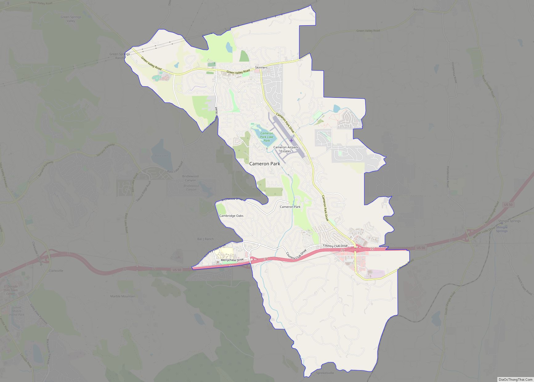
Cameron Park is a census-designated place (CDP) in El Dorado County, California, United States and is part of the Greater Sacramento Area. The population was 19,171 in the 2020 census, up from 18,228 in 2010. Cameron Park is a community located in the Northern California Gold Country of the Sierra Nevada foothills, approximately 30 miles (50 km) east of Sacramento and 70 miles (110 km) west of South Lake Tahoe.
| Name: | Cameron Park CDP |
|---|---|
| LSAD Code: | 57 |
| LSAD Description: | CDP (suffix) |
| State: | California |
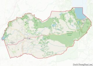
| County: | El Dorado County |
| Elevation: | 1,198 ft (365 m) |
| Total Area: | 11.30 sq mi (29.26 km²) |
| Land Area: | 11.23 sq mi (29.08 km²) |
| Water Area: | 0.07 sq mi (0.19 km²) 0.62% |
| Total Population: | 19,171 |
| Population Density: | 1,681.75/sq mi (649.31/km²) |
| ZIP code: | 95682 |
| Area code: | 530 |
| FIPS code: | 0610256 |
| GNISfeature ID: | 1733968 |
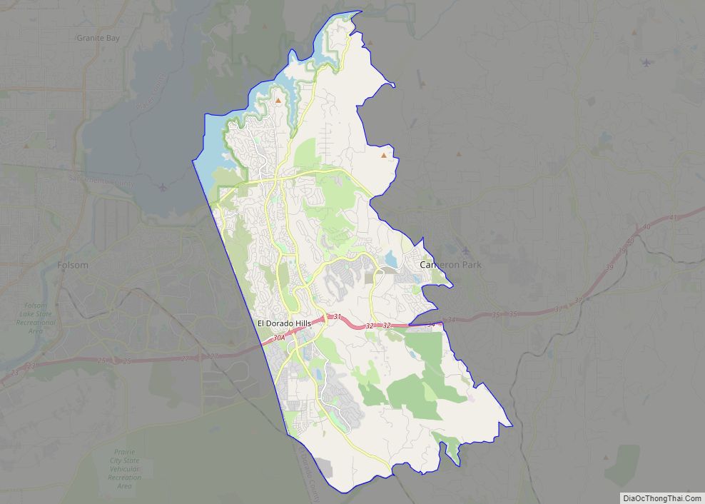
Online Interactive Map
Click on ![]() to view map in "full screen" mode.
to view map in "full screen" mode.
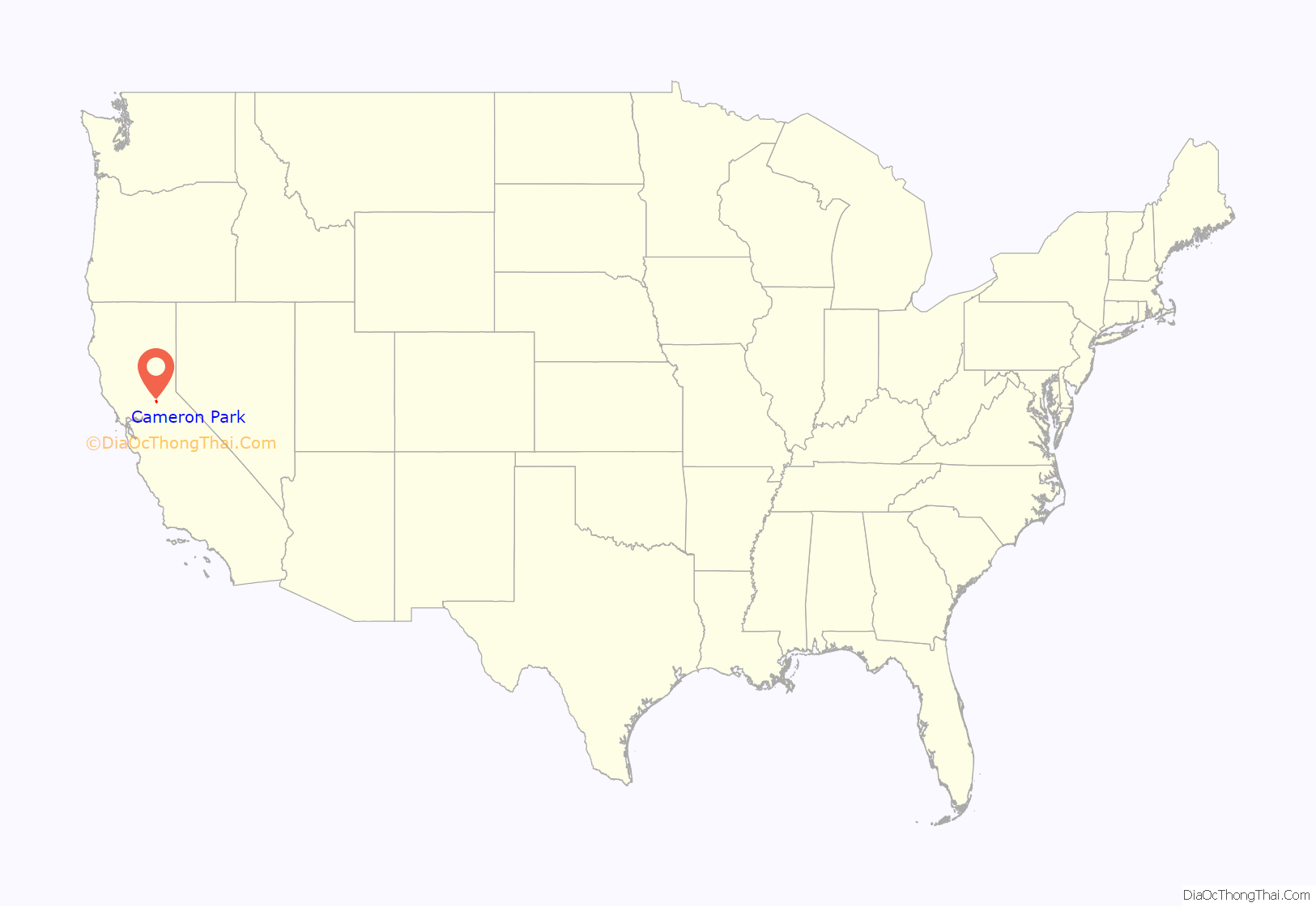
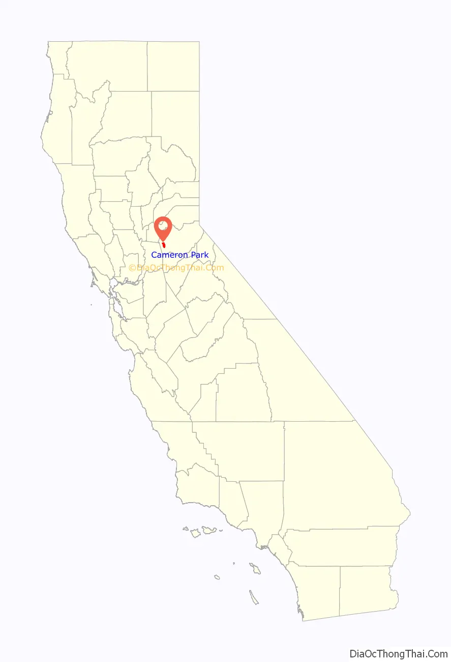
Cameron Park location map. Where is Cameron Park CDP?
History
The original Native American inhabitants of the area surrounding Cameron Park were Nisenan, or Southern Maidu Indians. Grinding rocks and burial mounds serve as glimpses of the past and are still visible in various locations in and near Cameron Park.
Modern development accelerated in the area when Larry Cameron purchased 5,000 acres (2,000 ha) of foothill land in the 1950s for development purposes, first for ranching, then involving housing, a golf course, parks, a lake and a small airport. In the years since then, the land has slowly been sub-divided into lots of varying sizes, including ranch-sized properties and medium and high density residential neighborhoods. Today, Cameron Park contains a mix of ranches, single family homes, condominiums, apartments and businesses. As of the 2020 Census, the Cameron Park CDP had 7,748 housing units.
Cameron Park Road Map
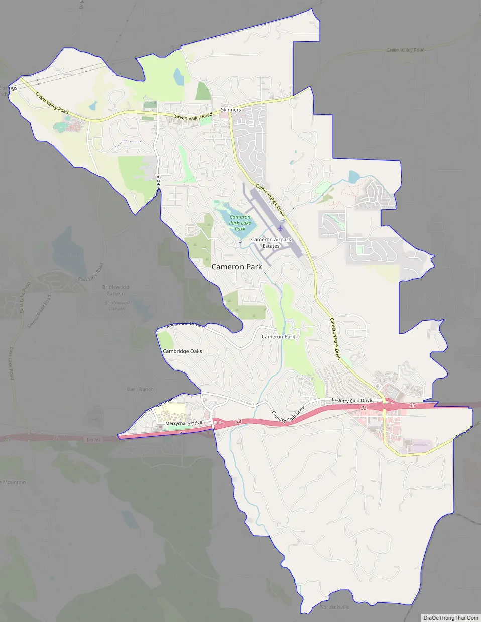
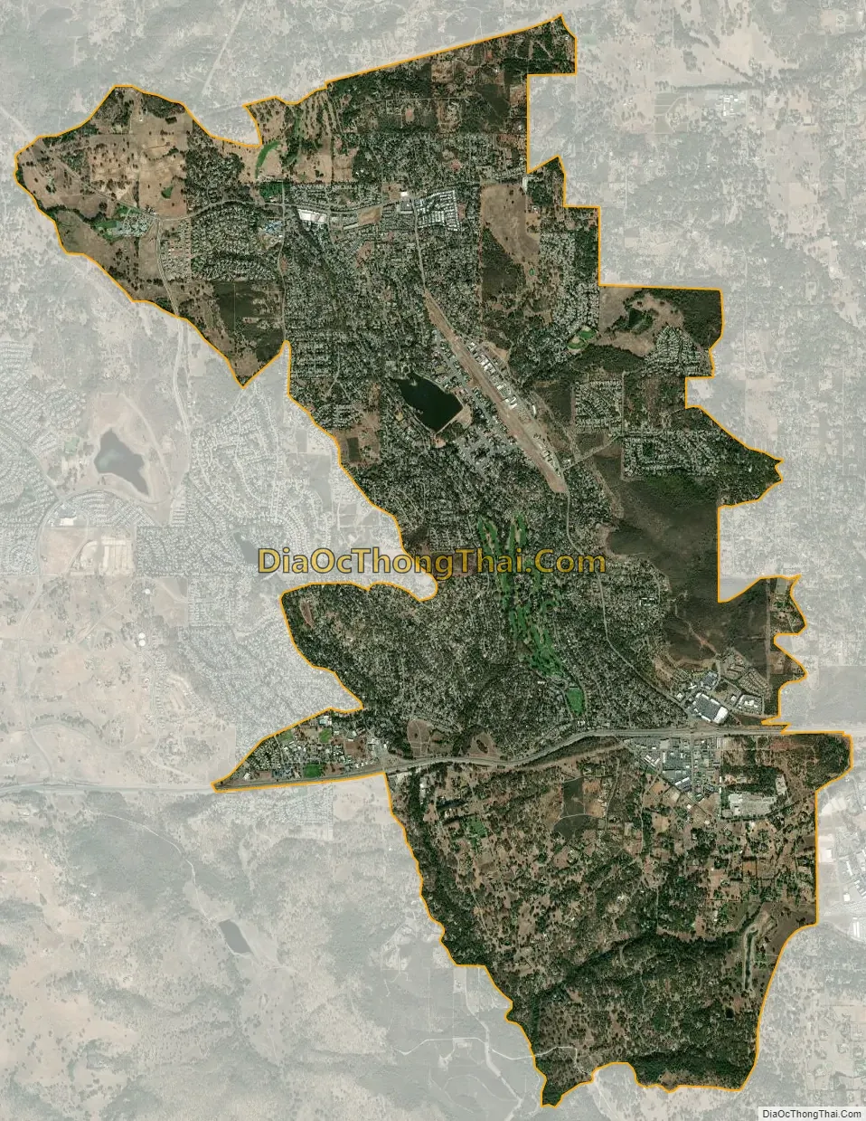
Cameron Park city Satellite Map
Geography
According to the United States Census Bureau, the CDP has a total area of 11.2 square miles (29 km), of which 11.1 square miles (29 km) is land and 0.1 square miles (0.26 km) (0.62%) is water (Cameron Park Lake).
Cameron Park is situated in an interior chaparral zone or brush zone just east of the Central Valley. It is the closest population center to the Pine Hill Ecological Reserve. Native vegetation includes an abundance of redbud and manzanita bushes, and brush in general. Where treed the native trees are primarily gray pines, and oak trees with some small groves of ponderosa pines starting in the higher elevation zones. The elevation of Cameron Park varies between approximately 1,200 and 1,450 feet (370 and 440 m) above sea level, and is not considered in the snow zone of the Sierra Nevada mountains to the east, which are typically between 3,000 and 5,000 feet of elevation and above.
Summers are generally hot and dry, with average daytime temperatures in the 90 to 100 °F (32 to 38 °C) range, but sometimes reaching 110 °F (43 °C), or more. It can be very dry, with little effect of mountain thunderstorms or monsoonal flows that affect the south and interiors. Nights, however, tend to cool off more so than in the Sacramento Valley below, and temperatures in general range a few degrees below the eastern portion of the Central Valley because of the elevation difference. Autumns tend to be an “extended dry, hot summer” throughout California and Cameron Park is no exception. Winters are generally cool and rainy, with highs averaging 40 to 60 °F (4 to 16 °C) and nights occasionally dropping below freezing. Cameron Park typically receives exceptional snow events, about once every few years.
The soil in Cameron Park is reddish and clay-like and usually must be amended in order for many non-native ornamental plants to survive. The soil is derived from Gabbro type of volcanic bedrock and despite its clay-like composition it is good soil and rich in nutrients. Cameron Park is in Sunset Climate Zone 9 and USDA Plant Hardiness Zone 9A.
See also
Map of California State and its subdivision:- Alameda
- Alpine
- Amador
- Butte
- Calaveras
- Colusa
- Contra Costa
- Del Norte
- El Dorado
- Fresno
- Glenn
- Humboldt
- Imperial
- Inyo
- Kern
- Kings
- Lake
- Lassen
- Los Angeles
- Madera
- Marin
- Mariposa
- Mendocino
- Merced
- Modoc
- Mono
- Monterey
- Napa
- Nevada
- Orange
- Placer
- Plumas
- Riverside
- Sacramento
- San Benito
- San Bernardino
- San Diego
- San Francisco
- San Joaquin
- San Luis Obispo
- San Mateo
- Santa Barbara
- Santa Clara
- Santa Cruz
- Shasta
- Sierra
- Siskiyou
- Solano
- Sonoma
- Stanislaus
- Sutter
- Tehama
- Trinity
- Tulare
- Tuolumne
- Ventura
- Yolo
- Yuba
- Alabama
- Alaska
- Arizona
- Arkansas
- California
- Colorado
- Connecticut
- Delaware
- District of Columbia
- Florida
- Georgia
- Hawaii
- Idaho
- Illinois
- Indiana
- Iowa
- Kansas
- Kentucky
- Louisiana
- Maine
- Maryland
- Massachusetts
- Michigan
- Minnesota
- Mississippi
- Missouri
- Montana
- Nebraska
- Nevada
- New Hampshire
- New Jersey
- New Mexico
- New York
- North Carolina
- North Dakota
- Ohio
- Oklahoma
- Oregon
- Pennsylvania
- Rhode Island
- South Carolina
- South Dakota
- Tennessee
- Texas
- Utah
- Vermont
- Virginia
- Washington
- West Virginia
- Wisconsin
- Wyoming