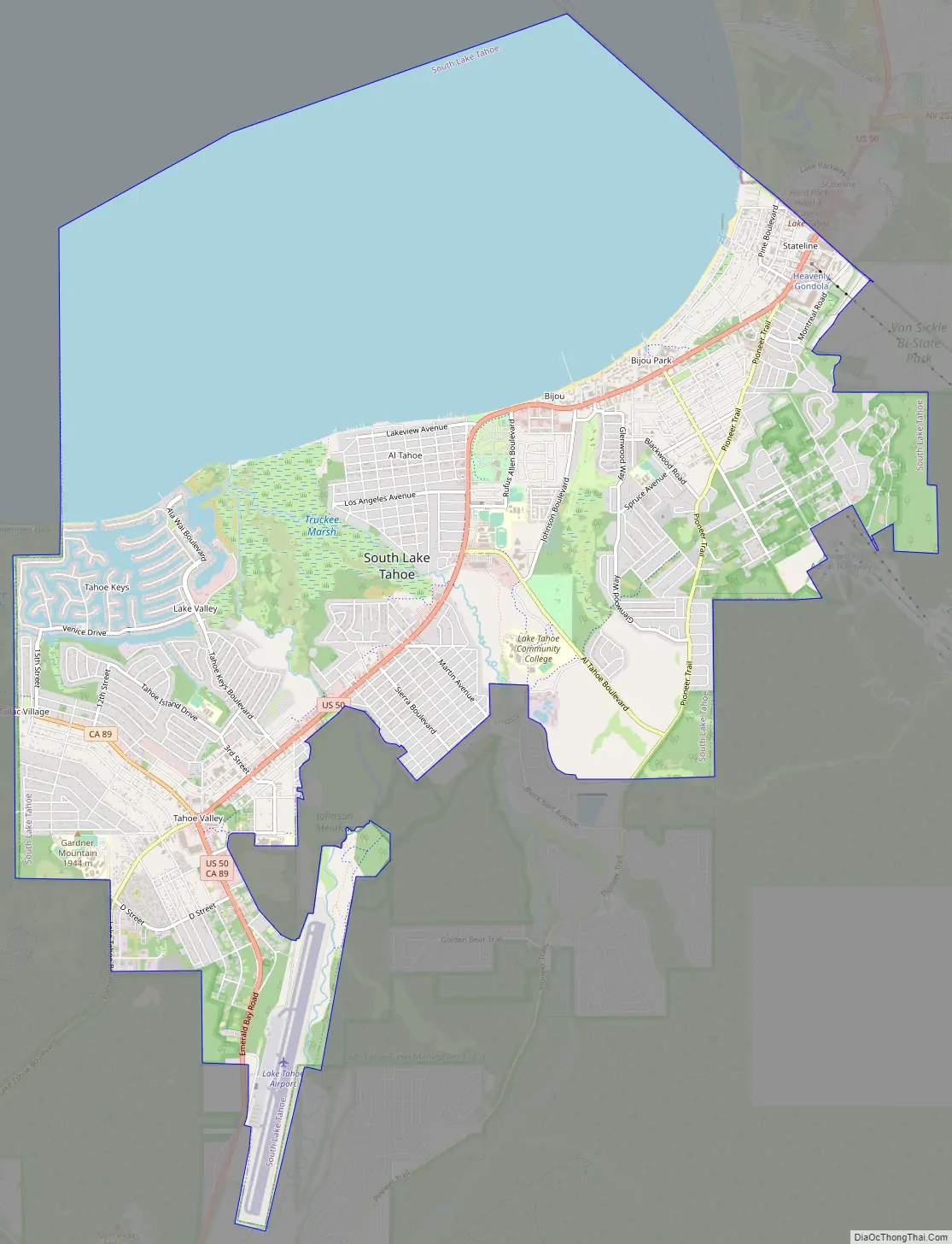
South Lake Tahoe is the most populous city in El Dorado County, California, United States, in the Sierra Nevada mountains. The city’s population was 21,330 at the 2020 census, down from 21,403 at the 2010 census. The city, along the southern edge of Lake Tahoe, extends about 5 miles (8 km) west-southwest along U.S. Route 50, also known as Lake Tahoe Boulevard. The east end of the city, on the California–Nevada state line right next to the town of Stateline, Nevada, is mainly geared towards tourism, with T-shirt shops, restaurants, hotels, and Heavenly Mountain Resort with the Nevada casinos just across the state line in Stateline. The western end of town is mainly residential, and clusters around “The Y”, the X-shaped intersection of US 50, State Route 89, and the continuation of Lake Tahoe Boulevard after it loses its federal highway designation.
| Name: | South Lake Tahoe city |
|---|---|
| LSAD Code: | 25 |
| LSAD Description: | city (suffix) |
| State: | California |
| County: | El Dorado County |
| Incorporated: | November 30, 1965 |
| Elevation: | 6,237 ft (1,901 m) |
| Total Area: | 16.60 sq mi (42.98 km²) |
| Land Area: | 10.15 sq mi (26.30 km²) |
| Water Area: | 6.44 sq mi (16.68 km²) 38.80% |
| Total Population: | 21,330 |
| Population Density: | 1,300/sq mi (500/km²) |
| ZIP code: | 96150 |
| Area code: | 530 |
| FIPS code: | 0673108 |
| Website: | www.cityofslt.us |
Online Interactive Map
Click on ![]() to view map in "full screen" mode.
to view map in "full screen" mode.
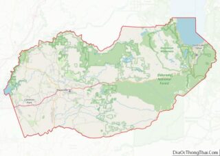
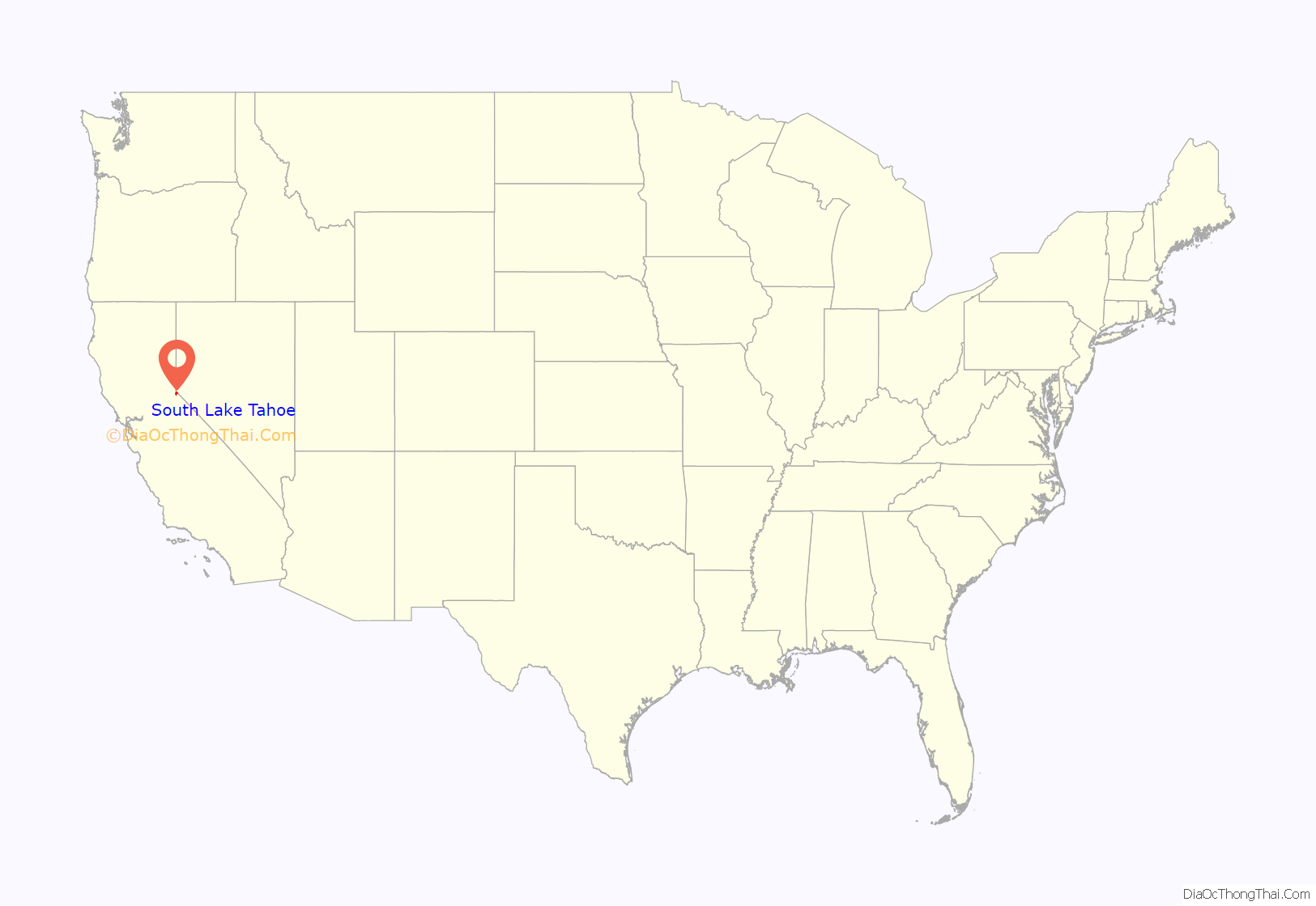
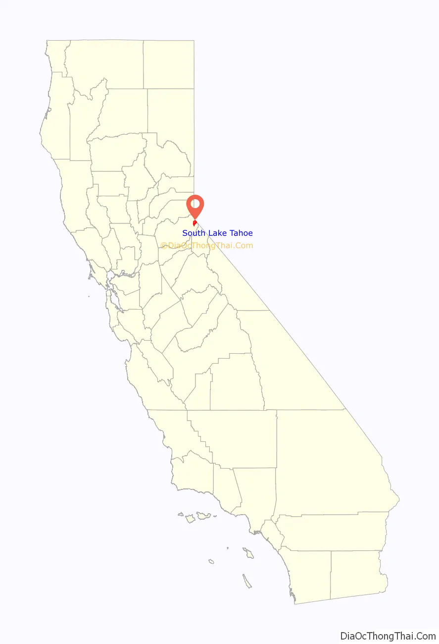
South Lake Tahoe location map. Where is South Lake Tahoe city?
History
The city incorporated in 1965 by combining the previously unincorporated communities of Al Tahoe, Bijou, Bijou Park, Stateline, Tahoe Valley, and Tallac Village. A post office was established in 1967.
Gambling arrived at the Lake in 1944, when Harvey’s Wagon Wheel Saloon and Gambling Hall opened in Nevada as one of the area’s first gaming establishments. Competition soon sprang up and so did the need for more permanent accommodations. By the 1950s, roads began to be plowed year-round, enabling access to permanent residences. When the 1960 Winter Olympics came to what is now Olympic Valley, Lake Tahoe was put firmly on the map as the skiing center of the western United States.
In 2012, the Lakeview Commons Park was renamed. As reported in the local media, “The Washoe Tribe has presented the name Tahnu Leweh (Pronounced Tah-New Lay-Way) which, in native language, means ‘all the people’s place.’ It is a name the Tribe would like to gift to El Dorado County and South Lake Tahoe as a symbol of peace, prosperity and goodness.”
In August 2021, the entire city was forced to evacuate due to the Caldor Fire.
South Lake Tahoe Road Map
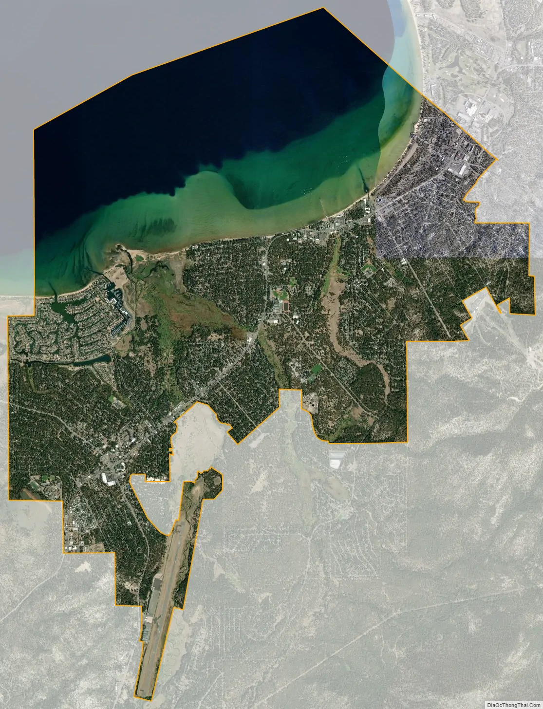
South Lake Tahoe city Satellite Map
Geography
According to the United States Census Bureau, the city has a total area of 16.6 square miles (43 km), of which 10.2 square miles (26 km) is land and 6.4 square miles (17 km), or 38.80%, is water. Its elevation is about 6,237 feet (1,901 m) above sea level.
See also
Map of California State and its subdivision:- Alameda
- Alpine
- Amador
- Butte
- Calaveras
- Colusa
- Contra Costa
- Del Norte
- El Dorado
- Fresno
- Glenn
- Humboldt
- Imperial
- Inyo
- Kern
- Kings
- Lake
- Lassen
- Los Angeles
- Madera
- Marin
- Mariposa
- Mendocino
- Merced
- Modoc
- Mono
- Monterey
- Napa
- Nevada
- Orange
- Placer
- Plumas
- Riverside
- Sacramento
- San Benito
- San Bernardino
- San Diego
- San Francisco
- San Joaquin
- San Luis Obispo
- San Mateo
- Santa Barbara
- Santa Clara
- Santa Cruz
- Shasta
- Sierra
- Siskiyou
- Solano
- Sonoma
- Stanislaus
- Sutter
- Tehama
- Trinity
- Tulare
- Tuolumne
- Ventura
- Yolo
- Yuba
- Alabama
- Alaska
- Arizona
- Arkansas
- California
- Colorado
- Connecticut
- Delaware
- District of Columbia
- Florida
- Georgia
- Hawaii
- Idaho
- Illinois
- Indiana
- Iowa
- Kansas
- Kentucky
- Louisiana
- Maine
- Maryland
- Massachusetts
- Michigan
- Minnesota
- Mississippi
- Missouri
- Montana
- Nebraska
- Nevada
- New Hampshire
- New Jersey
- New Mexico
- New York
- North Carolina
- North Dakota
- Ohio
- Oklahoma
- Oregon
- Pennsylvania
- Rhode Island
- South Carolina
- South Dakota
- Tennessee
- Texas
- Utah
- Vermont
- Virginia
- Washington
- West Virginia
- Wisconsin
- Wyoming