Hemet is a city in the San Jacinto Valley in Riverside County, California. It covers a total area of 27.8 square miles (72 km), about half of the valley, which it shares with the neighboring city of San Jacinto. The population was 89,833 at the 2020 census.
The founding of Hemet, initially called South San Jacinto, predates the formation of Riverside County. This area was then still part of San Diego County. The formation of Lake Hemet helped the city to grow and stimulated agriculture in the area.
The city is known for being the home of The Ramona Pageant, California’s official outdoor play set in the Spanish colonial era. Started in 1923, the play is one of the longest-running outdoor plays in the United States.
Hemet has been named a Tree City USA for 20 years by the Arbor Day Foundation for its dedication to the local forest. The city is home to the Hemet Valley Medical Center, a 320-bed general hospital.
| Name: | Hemet city |
|---|---|
| LSAD Code: | 25 |
| LSAD Description: | city (suffix) |
| State: | California |
| County: | Riverside County |
| Elevation: | 1,594 ft (486 m) |
| Total Area: | 29.28 sq mi (75.84 km²) |
| Land Area: | 29.28 sq mi (75.84 km²) |
| Water Area: | 0.00 sq mi (0.00 km²) 0% |
| Total Population: | 89,833 |
| Population Density: | 3,068.07/sq mi (1,184.51/km²) |
| Area code: | 951 |
| FIPS code: | 0633182 |
| Website: | www.hemetca.gov |
Online Interactive Map
Click on ![]() to view map in "full screen" mode.
to view map in "full screen" mode.
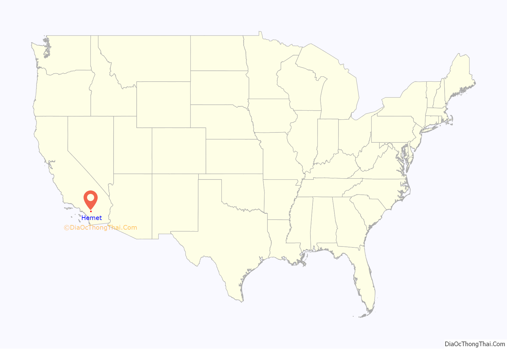
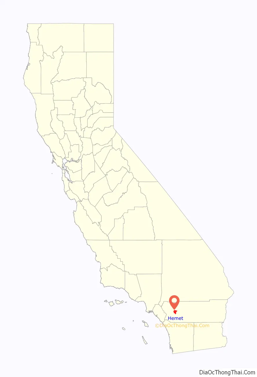
Hemet location map. Where is Hemet city?
History
This had long been the territory of the indigenous Soboba people and Cahuilla tribe prior to Spanish colonization. During the early 19th century, Mission San Luis Rey used the land for cattle ranching. They named the area with the settler name Rancho San Jacinto.
Etymology
Hemet was named by the land development company that founded the town, The Lake Hemet Land Company. The company drew its name from Hemet Valley, now called Garner Valley, located in the San Jacinto Mountains. Initially the company referred to the area as South San Jacinto, but changed the name to Hemet when the land company filed a plat map on November 11, 1893.
Mexican period
Following Mexico gaining independence from Spain, in 1842, settler José Antonio Estudillo received the Rancho San Jacinto Viejo Mexican land grant.
In 1848 the United States annexed the California territory after defeating Mexico in the Mexican–American War. In 1887, during the first major Southern California land boom, Anglo-Americans W.F. Whittier and E.L. Mayberry founded the Lake Hemet Water Company, and the Lake Hemet Land Company, for speculative development. They had plans to dam the San Jacinto River to provide irrigation water to the valley. They named the town Hemet in November 1893.
In 1895, they completed Hemet Dam as a private project on the San Jacinto River, creating Lake Hemet and providing a reliable water supply to the San Jacinto Valley. This water system, for irrigation in an arid region, was integral to the valley’s development as an agricultural area.
By 1894, settlers had established a newspaper, the Hemet News, and “several general stores”, the largest being Heffelfinger & Co, which occupied an entire block. Other businesses included “a drug store, an excellent barber shop, two blacksmith shops, harness shop, shoe repairing houses, two real estate offices and two lumber yards.” “The most pretentious building” was the two-story Hotel Mayberry, “supplied with all the modern conveniences usually found in first-class hostelries, including stationary water, baths, etc., and a complete electric light system, the power for which is furnished by the company’s private plant.” Also noted was the Hemet flour mill, owned by John McCool and built at a cost of $20,000. It was the only such mill in this area, and was housed in a brick building. It could produce 50 barrels of flour per day.
Incorporation
Hemet was incorporated in January 1910. Of 177 residents, 130 voted to incorporate, with 33 against. Those who voted against incorporation were landowners who feared increased taxation. The incorporation helped to serve the growing city, which was outgrowing its current infrastructure.
With a railroad spur running from Riverside, the city became a trading center for San Jacinto Valley agriculture; commodity crops included citrus, apricots, peaches, olives, and walnuts. The Agricultural District Farmer’s Fair of Riverside County began here in 1936 as the Hemet Turkey Show. It was relocated to Perris.
During World War II, the city hosted the Ryan School of Aeronautics, which trained about 6,000 fliers for the Army Air Force between 1940 and 1944. The site of the flight school was redeveloped as Hemet-Ryan Airport. In 1950, Hemet was home to 10,000 people, joining Corona and Riverside as the three largest cities in Riverside County.
Hemet was racially discriminatory. Numerous African Americans migrated to California during and after World War II in the Great Migration from such Deep South states as Mississippi, Louisiana, and Texas. Hemet was a sundown town, prohibiting African Americans from living there or even staying overnight.
In the 1960s, large-scale residential development began, mostly in the form of mobile home parks and retirement communities. Hemet was known as a working-class retirement area. In the 1980s, former ranchland was developed in subdivisions of single-family homes. “Big-box” retail followed the increase in population. After a roughly decade-long lull in development following the major economic downturn of the early 1990s, housing starts in the city skyrocketed in the early 21st century. The area’s affordability, its proximity to employment centers such as Corona, Riverside and San Bernardino, and its relatively rural character made it an attractive location for working-class families priced out of other areas of Southern California.
Timeline
From the Hemet Library Heritage Room History Collection:
- 1850: California becomes state
- 1858: Hemet established as a farm settlement
- 1887: Lake Hemet Water Company & Hemet Land Company formed
- 1888: Rail service from Perris to the San Jacinto Valley
- 1892: US Post office established
- 1893: Riverside County formed from parts of San Diego & San Bernardino counties
- 1893: First elementary school built on North Alessandro Street
- 1894: First high school built at Buena Vista and Acacia
- 1895: Lake Hemet Dam completed
- 1899: Earthquake (estimated magnitude ~6.5) destroyed most brick buildings in downtown
- 1910: City of Hemet incorporated
- 1914: Santa Fe depot opened at present site
- 1918: The 6.7 Mw San Jacinto earthquake caused significant structural damage and ground failure.
- 1921: Opening of the Hemet Theater
- 1923: First performance of the Ramona Pageant
- 1940: Ryan School of Aeronautics opened
- 1943: Hemet Community Hospital opened
- 1950: Eastern Municipal Water District created
- 1959: Hemet Police Department built
- 1966: Hemet Unified School District formed from several existing districts
- 1970: More than 10,000 residents for the first time
- 1971: Paradise Valley Ranch served as an infirmary for contained outbreak of Mad Cow Disease.
- 1972: New Hemet high school opened
- 1974: Kushimoto, Japan became first sister city.
- 1980: Hemet Valley Mall opened on W Florida Ave between N Kirby St & N Gilmore St
- 1983: Ebeltoft, Denmark became second sister city.
- 1987: Depot abandoned by Santa Fe railroad—offered to sell to City of Hemet
- 1987: Bácum, Mexico became third sister city
- 1988: Save Our Station (S.O.S.) purchased Santa Fe Depot for renovation and preservation
- 1989: Marumori, Japan became fourth sister city.
- 1991: Domenigoni and Diamond Valleys named sites for M.W.D. reservoir
- 1995: Metropolitan Water District started 800,000 ac·ft reservoir
- 1996: Domenigoni Parkway opened
- 1998: Hemet Museum opened in Santa Fe depot
- 1999: M.W.D. Diamond Valley Lake completed
- 2000: Diamond Valley Lake dedicated
- 2003: Public library moved to East Latham Avenue
- 2010: Centennial as an incorporated city
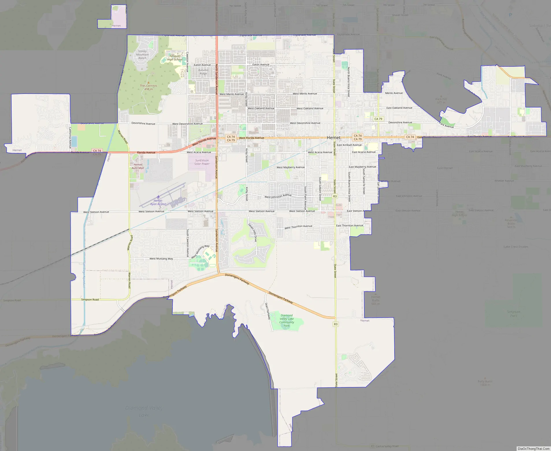
Hemet Road Map
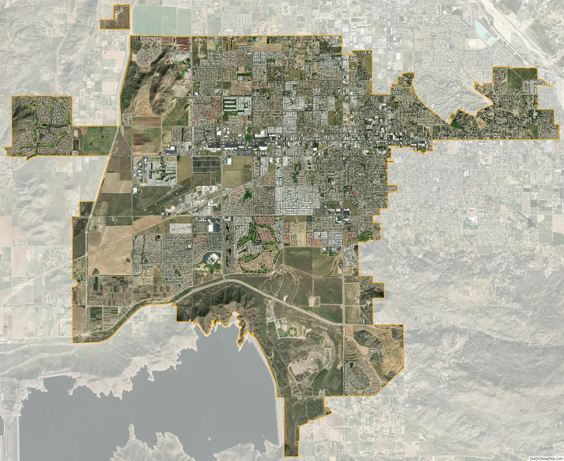
Hemet city Satellite Map
Geography
Hemet is in the San Jacinto Valley of western Riverside County, south of San Jacinto. The valley, surrounded by the Santa Rosa Hills and San Jacinto Mountains, is mostly dry land, except for Diamond Valley Lake to the south. Hemet is located at 33°44′31″N 116°58′59″W / 33.74194°N 116.98306°W / 33.74194; -116.98306 (33.742001, −116.983068). According to the United States Census Bureau, the city has a total area of 27.847 square miles (72 km) as of the 2010 census, all land.
Hemet is 80 miles (130 km) southeast of Downtown Los Angeles.
Climate
Hemet has a semi-arid climate (Köppen climate classification: BSh) with mild winters and very hot, very dry summers.
See also
Map of California State and its subdivision:- Alameda
- Alpine
- Amador
- Butte
- Calaveras
- Colusa
- Contra Costa
- Del Norte
- El Dorado
- Fresno
- Glenn
- Humboldt
- Imperial
- Inyo
- Kern
- Kings
- Lake
- Lassen
- Los Angeles
- Madera
- Marin
- Mariposa
- Mendocino
- Merced
- Modoc
- Mono
- Monterey
- Napa
- Nevada
- Orange
- Placer
- Plumas
- Riverside
- Sacramento
- San Benito
- San Bernardino
- San Diego
- San Francisco
- San Joaquin
- San Luis Obispo
- San Mateo
- Santa Barbara
- Santa Clara
- Santa Cruz
- Shasta
- Sierra
- Siskiyou
- Solano
- Sonoma
- Stanislaus
- Sutter
- Tehama
- Trinity
- Tulare
- Tuolumne
- Ventura
- Yolo
- Yuba
- Alabama
- Alaska
- Arizona
- Arkansas
- California
- Colorado
- Connecticut
- Delaware
- District of Columbia
- Florida
- Georgia
- Hawaii
- Idaho
- Illinois
- Indiana
- Iowa
- Kansas
- Kentucky
- Louisiana
- Maine
- Maryland
- Massachusetts
- Michigan
- Minnesota
- Mississippi
- Missouri
- Montana
- Nebraska
- Nevada
- New Hampshire
- New Jersey
- New Mexico
- New York
- North Carolina
- North Dakota
- Ohio
- Oklahoma
- Oregon
- Pennsylvania
- Rhode Island
- South Carolina
- South Dakota
- Tennessee
- Texas
- Utah
- Vermont
- Virginia
- Washington
- West Virginia
- Wisconsin
- Wyoming


