Laguna Niguel (/ləˈɡuːnə nɪˈɡɛl/) is a city in Orange County, California, United States. The name Laguna Niguel is derived from the words “Laguna” (Spanish for “lagoon”) and “Niguili” (the name of a Native American village once located near Aliso Creek). As of the 2020 census, the population was 64,355. Laguna Niguel is located in the San Joaquin Hills in the southeastern corner of Orange County, close to the Pacific Ocean, and borders the cities of Aliso Viejo, Dana Point, Laguna Beach, Laguna Hills, Mission Viejo, and San Juan Capistrano.
Laguna Niguel has its origins in the Rancho Niguel Mexican land grant, which was acquired in 1959 by the Laguna Niguel Corporation to develop one of California’s first master-planned communities. As a predominantly residential city, Laguna Niguel serves as a bedroom community for the job centers of northern and central Orange County. Laguna Niguel has a median household income 31 percent above the Orange County average and nearly double the U.S. average. It is known for its mild coastal climate, low crime rate, and its numerous parks and public trails.
| Name: | Laguna Niguel city |
|---|---|
| LSAD Code: | 25 |
| LSAD Description: | city (suffix) |
| State: | California |
| County: | Orange County |
| Incorporated: | December 1, 1989 |
| Elevation: | 400 ft (122 m) |
| Total Area: | 14.79 sq mi (38.30 km²) |
| Land Area: | 14.74 sq mi (38.17 km²) |
| Water Area: | 0.05 sq mi (0.13 km²) 0.35% |
| Total Population: | 64,355 |
| Population Density: | 4,400/sq mi (1,700/km²) |
| ZIP code: | 92607, 92677 |
| Area code: | 949 |
| FIPS code: | 0639248 |
| Website: | cityoflagunaniguel.org |
Online Interactive Map
Click on ![]() to view map in "full screen" mode.
to view map in "full screen" mode.
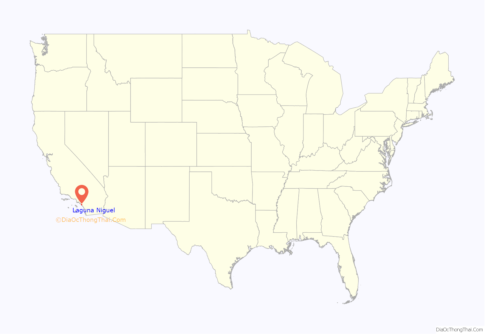
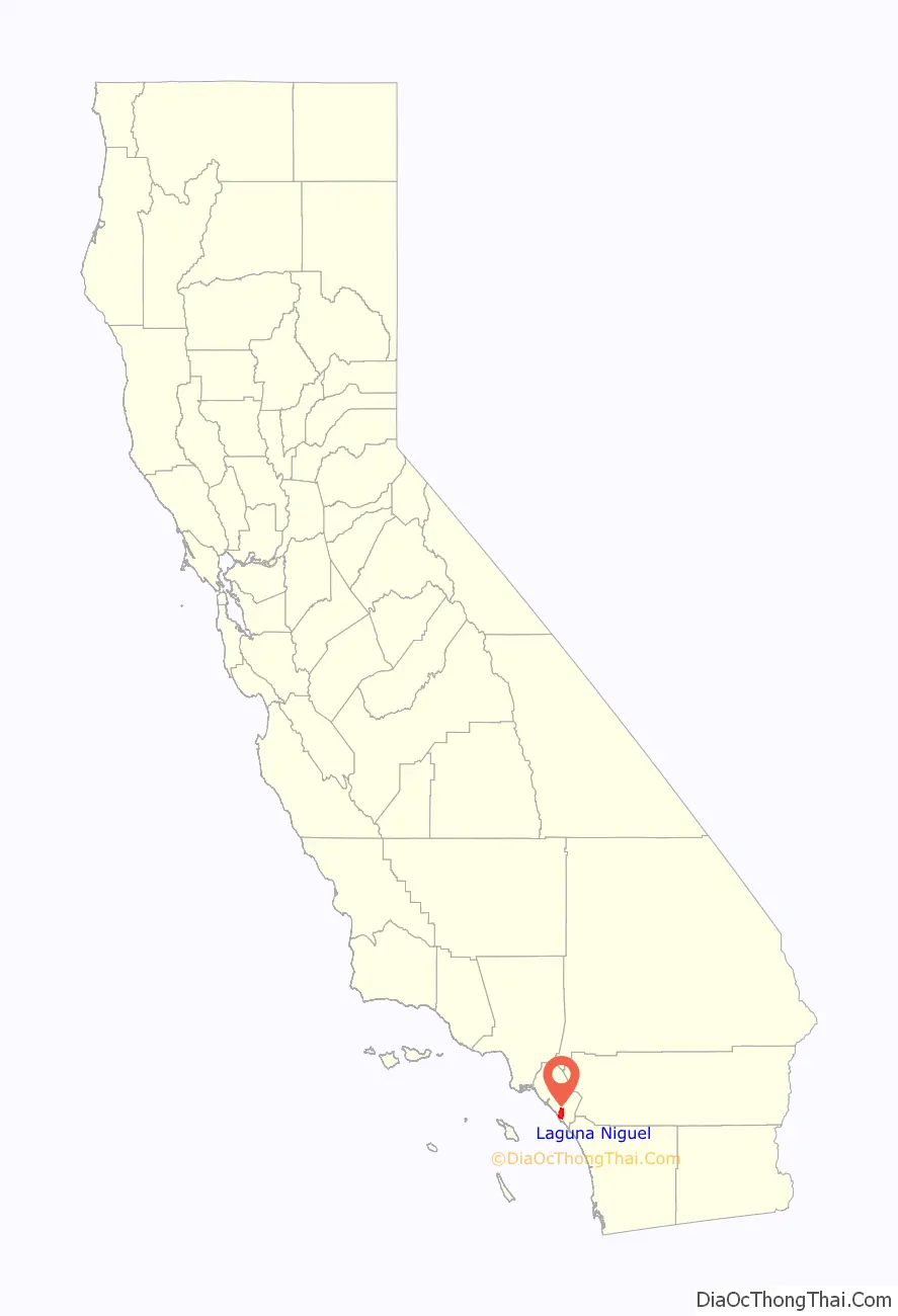
Laguna Niguel location map. Where is Laguna Niguel city?
History
Early inhabitants and settlers
The first recorded inhabitants of the Laguna Niguel area were the Acjachemem Native Americans, who may have had a village called “Niguili” near the confluence of Aliso Creek and Sulphur Creek. Aliso Creek marked the boundary between the Acjachemem and Tongva people. In the 1700s, during the Spanish colonization of the Americas, Spanish missionaries established the nearby Mission San Juan Capistrano to convert the Acjachemem (called the Juañeno by the Spanish) to Christianity. The Mission lands, which included the present-day boundaries of Laguna Niguel, were divided into private land grants in 1821 upon Mexico‘s independence from Spain.
In 1842, the 13,316-acre (5,389 ha) Rancho Niguel was granted to Juan Avila; he retained ownership of the land through the Mexican–American War (when California became part of the United States) until 1865, when a severe drought forced him into bankruptcy. In 1895 Lewis Moulton and Jean Pierre Daguerre bought the Rancho Niguel and other portions of the surrounding area from farmers who were struggling due to persistent drought conditions. The Moulton Company was established to oversee 19,000 acres (7,700 ha) of local land which was used, mainly for orchards and sheep ranching, well into the mid-20th century. In 1951 the land was divided between the Moulton and Daguerre families, the latter inheriting 8,056 acres (3,260 ha) in the future location of Laguna Niguel. In 1954 the Daguerres sold 7,200 acres (2,900 ha) to the Shumaker Group and 856 acres (346 ha) of oceanfront to George Capron, a former Major League Baseball player who established the Capron Ranch.
Laguna Niguel Corporation
The completion of Interstate 5 in 1959 enabled easy access to job centers in Los Angeles County, creating a boom in the Orange County housing market. In 1959, Cabot, Cabot & Forbes and Paine Webber partnered to form the Laguna Niguel Corporation, which purchased the Daguerre land to develop one of California’s first master planned communities. The initial 7,100-acre (2,900 ha) town plan was created by Viennese architect Victor Gruen and expanded beginning in 1971 by AVCO Community Developers after they acquired the Laguna Niguel Corporation. The name of the city was created from “Laguna”, a reference to the tidal lagoon that once formed at the mouth of Aliso Creek, and the name of the Acjachemem village Niguili that once occupied the area. As the city would be developed in stages, ranchers and farmers signed annual leases with the Laguna Niguel Corporation to use the land until the planned communities were built.
In contrast to a traditional bedroom community, Laguna Niguel was designed so that “families should have most of their economic needs and their social and cultural interests met by facilities within the community”. The plan was also notable for its emphasis on parks and open space – comprising nearly a third of the land to be developed. The Laguna Niguel Corporation went public in April 1959 and raised an initial $8.2 million from investors. In 1962 the first tracts of Monarch Bay and Niguel Terrace were completed, consisting of 565 homes. In 1960, the Moulton Niguel Water District (which today serves all of Laguna Niguel) was established by a conglomerate of ranchers, to import water from the Colorado River Aqueduct as the area lacked a sufficient natural water supply. In 1964, Crown Valley Parkway was completed from I-5 to the Pacific Coast Highway, facilitating transport through the growing city. By 1965 the population of Laguna Niguel reached 1,000.
The Laguna Niguel Homeowner’s Association was formed in 1966 as an advisory to the Orange County Board of Supervisors (which governed the unincorporated community). In 1973 Laguna Niguel Regional Park opened to the public. The Chet Holifield Federal Building (a local landmark popularly known as the “Ziggurat”), designed by William L. Pereira, was constructed for Rockwell International in 1971 and was meant to bring 7,000 jobs to the area. It was traded to the US General Services Administration in exchange for industrial facilities elsewhere.
Incorporation and conflict with Dana Point
In 1965 the Laguna Niguel Corporation had purchased George Capron’s oceanfront property and began to develop the Niguel Shores neighborhood, known in its early days as the “Coastal Strip” and today as Monarch Beach. By the 1970s, unincorporated Dana Point began expressing interest in including the Niguel Shores in a new city. In 1977 Dana Point briefly proposed incorporation with Laguna Niguel as a single city. Both cities submitted incorporation requests in December 1986, when a controversy immediately erupted over the coastal Monarch Beach community. Although Monarch Beach had been developed by the Laguna Niguel Corporation, its residents voted 61 percent in favor of joining with Dana Point. Laguna Niguel filed a lawsuit, which was ultimately turned down by a judge. Laguna Niguel was formally incorporated on December 1, 1989, without the coastal strip, as Orange County’s 29th city.
Incorporated city
The population increased quickly during the last few decades of the 20th century, from 12,237 in 1980 to 61,891 in 2000. Growth since 2000 has been slower, with an estimate of 65,806 in 2015, due to the fact that the city has been fully built out. In 1992, Alicia Parkway was completed to I-5, providing a shorter route for northbound commuters; in 1996 the 73 San Joaquin Hills toll road opened, linking Laguna Niguel to the Interstate 405 in Costa Mesa. The Laguna Niguel City Hall, which had been planned as early as 1989, finally opened on October 15, 2011.
In 1994 local residents first noticed damage to retaining walls and roads near an artificial slope on Via Estoril in the Niguel Summit community, and geologists warned that the area could be subject to a landslide. After heavy rains caused by the 1997–98 Super El Niño, the hill collapsed on March 19, 1998, destroying four homes at the top and five condominium units at the bottom. There were no deaths as the area had been evacuated only a few hours prior to the collapse. An investigation revealed that the company responsible for development, J.M. Peters Inc., had improperly packed and graded the 275,000 tons of fill supporting the Niguel Summit homes. In addition, the project had been plagued by instability throughout its construction, and halted repeatedly “after complaints of mudslides, slope washouts, erosion and dust.” The Los Angeles Times reported that “according to county records, the developers were warned that building on “ancient landslides” could be unsafe, but they were able to continue construction after producing their own geological report that persuaded county officials to let the project go forward.” However the most recent disaster to the Niguel Summit Subdivision has been the coastal fire in 2022 which flattened 20 homes and damaged many more. This fire started after problems and circuit activity was reported on a Southern California Edison short distance electricity tower in Laguna Beach.
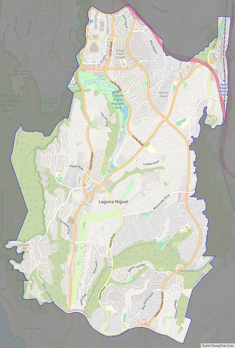
Laguna Niguel Road Map
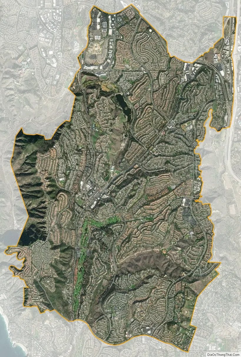
Laguna Niguel city Satellite Map
Geography
According to the United States Census Bureau, the city has a total area of 14.9 square miles (39 km). 14.8 square miles (38 km) of it is land and 0.05 square miles (0.13 km) of it (0.35%) is water.
Laguna Niguel consists of mostly hilly terrain, being located within the San Joaquin Hills. The average elevation is 400 feet (120 m); elevations range from near sea level to 936 feet (285 m) at the summit of Niguel Hill, in the southwest corner of the city. Neighboring cities are Aliso Viejo and Laguna Hills to the north, Mission Viejo and San Juan Capistrano to the east, and Laguna Beach and Dana Point to the south. On the west, it borders the significant unincorporated acreage of Aliso and Wood Canyons Wilderness Park.
The main watercourses in Laguna Niguel are Salt Creek, which flows through the southern part of the city, and Sulphur Creek, which drains much of the northern half. Sulphur Creek is a tributary of Aliso Creek, which flows through the wide and deep Aliso Canyon before reaching the Pacific Ocean. Laguna Niguel Lake, formed by damming Sulphur Creek, is the largest body of water in the city. Although Laguna Niguel is located very close to the Pacific, it does not border it, the result of a controversy over the coastline with Dana Point in 1989 (see #History).
Climate
Like much of coastal Southern California, Laguna Niguel has pleasant weather year-round. On average, August is the hottest month and December the coolest. The highest recorded temperature was 108 °F (42 °C), which occurred in 1963, and the lowest temperature was 21 °F (−6 °C), which was recorded in 1949. Precipitation is sparse in Laguna Niguel, as only five months out of the year receive rainfall greater than one inch, with an annual average of 14.2 inches (360 mm). The highest monthly rainfall on average occurs in February and is 3.4 inches (86 mm).
Neighborhoods
Neighborhoods include Bear Brand Ranch, San Marin, El Niguel Heights and Golf Course, Ocean Ranch, Laguna Crest, Laguna Sur. Coronado Pointe, South Peak, Crest de Ville, Niguel Coast, Palmilla, Beacon Hill, Monarch Point, and the Highlands, which offer city, canyon, and ocean views. Other neighborhoods include Rancho Niguel, Marina Hills, Concord Hill, Niguel West, Niguel Summit, Kite Hill, Rolling Hills, and San Joaquin Hills.
See also
Map of California State and its subdivision:- Alameda
- Alpine
- Amador
- Butte
- Calaveras
- Colusa
- Contra Costa
- Del Norte
- El Dorado
- Fresno
- Glenn
- Humboldt
- Imperial
- Inyo
- Kern
- Kings
- Lake
- Lassen
- Los Angeles
- Madera
- Marin
- Mariposa
- Mendocino
- Merced
- Modoc
- Mono
- Monterey
- Napa
- Nevada
- Orange
- Placer
- Plumas
- Riverside
- Sacramento
- San Benito
- San Bernardino
- San Diego
- San Francisco
- San Joaquin
- San Luis Obispo
- San Mateo
- Santa Barbara
- Santa Clara
- Santa Cruz
- Shasta
- Sierra
- Siskiyou
- Solano
- Sonoma
- Stanislaus
- Sutter
- Tehama
- Trinity
- Tulare
- Tuolumne
- Ventura
- Yolo
- Yuba
- Alabama
- Alaska
- Arizona
- Arkansas
- California
- Colorado
- Connecticut
- Delaware
- District of Columbia
- Florida
- Georgia
- Hawaii
- Idaho
- Illinois
- Indiana
- Iowa
- Kansas
- Kentucky
- Louisiana
- Maine
- Maryland
- Massachusetts
- Michigan
- Minnesota
- Mississippi
- Missouri
- Montana
- Nebraska
- Nevada
- New Hampshire
- New Jersey
- New Mexico
- New York
- North Carolina
- North Dakota
- Ohio
- Oklahoma
- Oregon
- Pennsylvania
- Rhode Island
- South Carolina
- South Dakota
- Tennessee
- Texas
- Utah
- Vermont
- Virginia
- Washington
- West Virginia
- Wisconsin
- Wyoming


