Mount Hermon is an unincorporated community and census-designated place (CDP) in Santa Cruz County, California.
| Name: | Mount Hermon CDP |
|---|---|
| LSAD Code: | 57 |
| LSAD Description: | CDP (suffix) |
| State: | California |
| County: | Santa Cruz County |
| Elevation: | 584 ft (178 m) |
| Total Area: | 0.889 sq mi (2.303 km²) |
| Land Area: | 0.889 sq mi (2.303 km²) |
| Water Area: | 0 sq mi (0 km²) 0% |
| Total Population: | 1,110 |
| Population Density: | 1,200/sq mi (480/km²) |
| ZIP code: | 95041 |
| Area code: | 831 |
| FIPS code: | 0649796 |
Online Interactive Map
Click on ![]() to view map in "full screen" mode.
to view map in "full screen" mode.
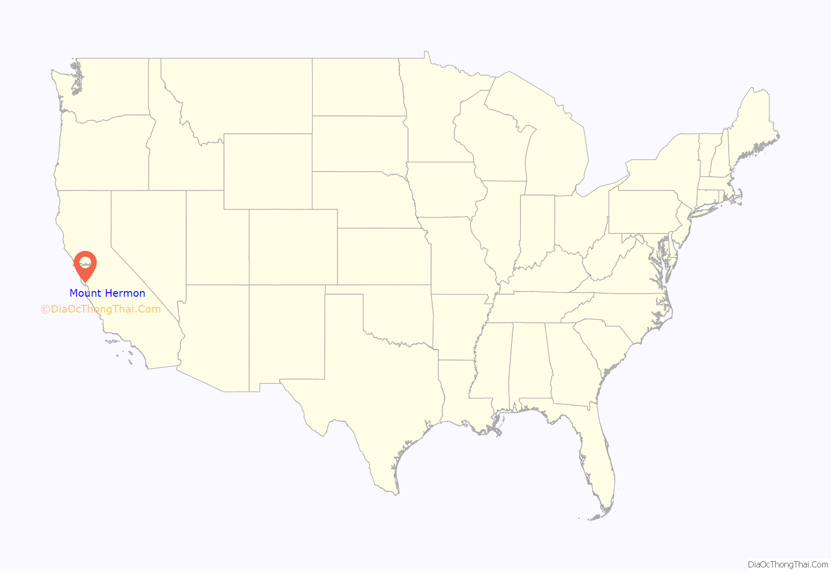
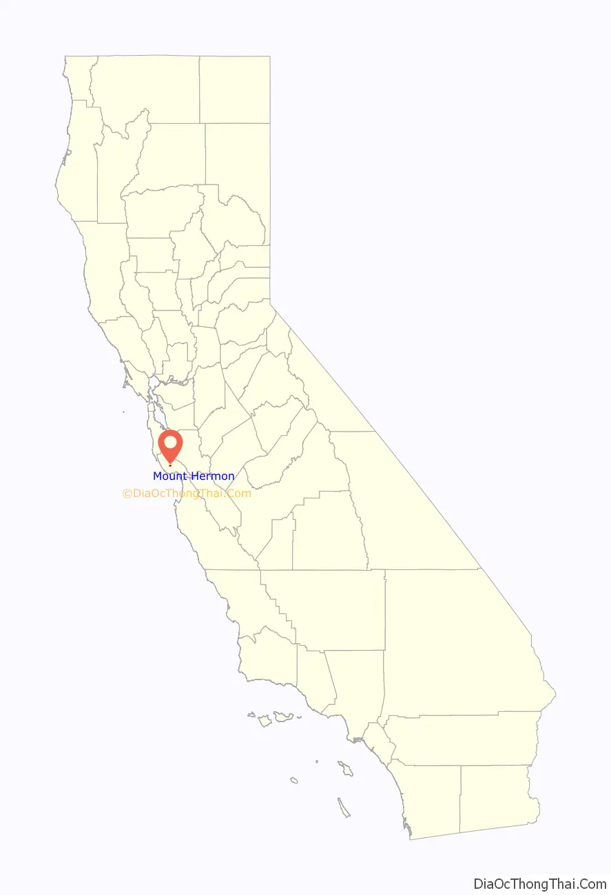
Mount Hermon location map. Where is Mount Hermon CDP?
History
In 1841, California’s first water-powered sawmill was built at the junction of Bean Creek and Zayante Creek by Peter Lassen, Isaac Graham, J. Majors, and F. Hoeger.
Mount Hermon, known as “Tuxedo Junction” prior to 1906, was a stop on the South Coast Pacific Railroad from Alameda to Santa Cruz. Hotel Tuxedo was on the property; the hotel was purchased and renamed the Zayante Inn on April 14, 1906, by a group which later became the Mount Hermon Association, Inc. Five ladies of the group were entrusted with the selection of a new name for the area, and they chose that of the peak in the Holy Land. The land was to be used as a Christian retreat center, whose dedication day, known as “The Great Day”, was July 22, 1906; the event was held at the Zayante Inn with 1400 people in attendance. Speaking at the dedication was Dr. Reuben A. Torrey, President of the Moody Bible Institute in Chicago, Illinois.
The Zayante Inn and surrounding cottages were destroyed by fire on April 18, 1921. At the site, the Mount Hermon Christian Conference Center, with three separate facilities, operates on much of the original property. There are also several hundred privately owned homes, the Mount Hermon post office, and a bookstore.
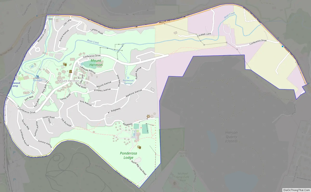
Mount Hermon Road Map
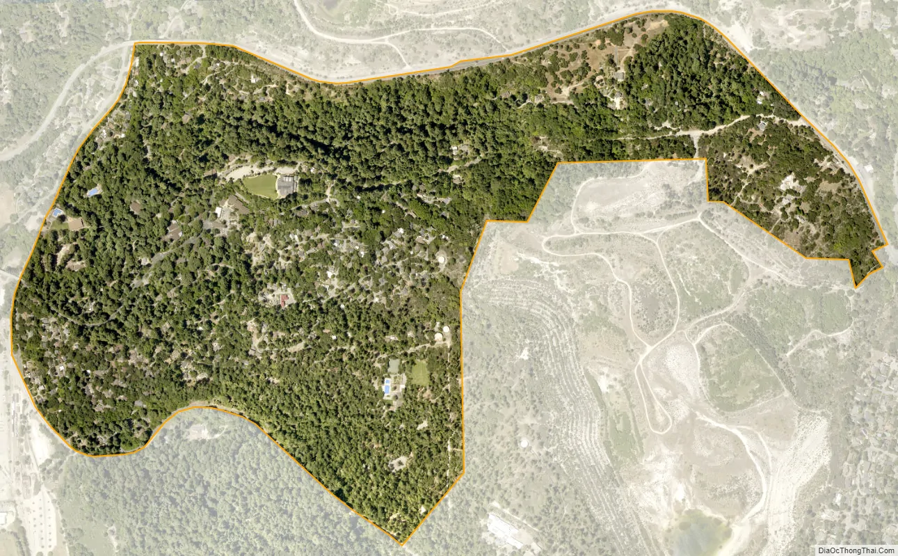
Mount Hermon city Satellite Map
Geography
According to the United States Census Bureau, the CDP covers an area of 0.9 square miles (2.3 km), all of it land.
See also
Map of California State and its subdivision:- Alameda
- Alpine
- Amador
- Butte
- Calaveras
- Colusa
- Contra Costa
- Del Norte
- El Dorado
- Fresno
- Glenn
- Humboldt
- Imperial
- Inyo
- Kern
- Kings
- Lake
- Lassen
- Los Angeles
- Madera
- Marin
- Mariposa
- Mendocino
- Merced
- Modoc
- Mono
- Monterey
- Napa
- Nevada
- Orange
- Placer
- Plumas
- Riverside
- Sacramento
- San Benito
- San Bernardino
- San Diego
- San Francisco
- San Joaquin
- San Luis Obispo
- San Mateo
- Santa Barbara
- Santa Clara
- Santa Cruz
- Shasta
- Sierra
- Siskiyou
- Solano
- Sonoma
- Stanislaus
- Sutter
- Tehama
- Trinity
- Tulare
- Tuolumne
- Ventura
- Yolo
- Yuba
- Alabama
- Alaska
- Arizona
- Arkansas
- California
- Colorado
- Connecticut
- Delaware
- District of Columbia
- Florida
- Georgia
- Hawaii
- Idaho
- Illinois
- Indiana
- Iowa
- Kansas
- Kentucky
- Louisiana
- Maine
- Maryland
- Massachusetts
- Michigan
- Minnesota
- Mississippi
- Missouri
- Montana
- Nebraska
- Nevada
- New Hampshire
- New Jersey
- New Mexico
- New York
- North Carolina
- North Dakota
- Ohio
- Oklahoma
- Oregon
- Pennsylvania
- Rhode Island
- South Carolina
- South Dakota
- Tennessee
- Texas
- Utah
- Vermont
- Virginia
- Washington
- West Virginia
- Wisconsin
- Wyoming


