Norwalk is a city in Los Angeles County, California, United States. The population was 105,549 at the 2010 census and an estimated 103,949 in 2019. It is the 58th most densely-populated city in California.
Founded in the late 19th century, Norwalk was incorporated as a city in 1957. It is located 17 miles (27 km) southeast of downtown Los Angeles and is part of the Greater Los Angeles area.
Norwalk is a member of the Gateway Cities Council of Governments. Norwalk’s sister cities are Morelia in the Mexican state of Michoacán, and Hermosillo, in the Mexican state of Sonora.
| Name: | Norwalk city |
|---|---|
| LSAD Code: | 25 |
| LSAD Description: | city (suffix) |
| State: | California |
| County: | Los Angeles County |
| Incorporated: | August 26, 1957 |
| Elevation: | 92 ft (28 m) |
| Total Area: | 9.75 sq mi (25.24 km²) |
| Land Area: | 9.71 sq mi (25.14 km²) |
| Water Area: | 0.04 sq mi (0.10 km²) 0.40% |
| Total Population: | 105,549 |
| Population Density: | 10,708.66/sq mi (4,134.55/km²) |
| ZIP code: | 90650–90652, 90659 |
| Area code: | 562 |
| FIPS code: | 0652526 |
| Website: | www.norwalk.org |
Online Interactive Map
Click on ![]() to view map in "full screen" mode.
to view map in "full screen" mode.
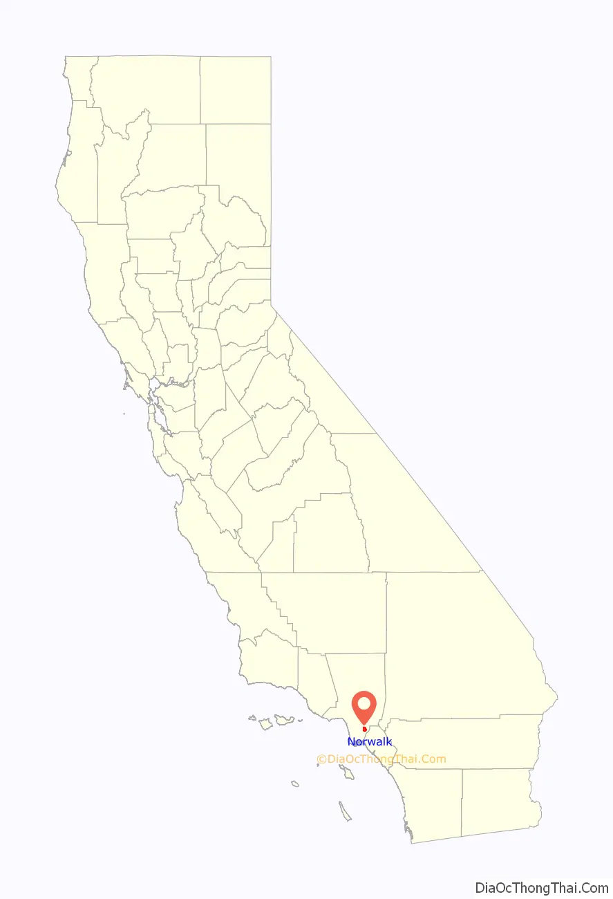
Norwalk location map. Where is Norwalk city?

History
The area known as “Norwalk” was first home to the Shoshonean Native American tribe. They survived primarily on honey, an array of berries, acorns, sage, squirrels, rabbits and birds. Their huts were part of the Sejat Indian village.
In the late 1760s, settlers and missions flourished under Spanish rule with the famous El Camino Real trail traversing the area. Manuel Nieto, a Spanish soldier, received a Spanish land grant (Rancho Los Nietos) in 1784 that included Norwalk.
After the Mexican–American War in 1848, the Rancho and mining days ended. Portions of the land were subdivided and made available for sale when California was admitted into the union of the United States. Word of this land development reached the Sproul Brothers in Oregon. They recalled the fertile land and huge sycamore trees they saw during an earlier visit to the Southern California area. In 1869, Atwood Sproul, on behalf of his brother, Gilbert, purchased 463 acres (1.87 km) of land at $11 an acre ($2,700/km) in an area known as Corazón de los Valles, or “Heart of the Valleys”.
By 1873, railroads were being built in the area and the Sprouls deeded 23 acres (93,000 m), stipulating a “passenger stop” clause in the deed. Three days after the Anaheim Branch Railroad crossed the “North-walk” for the first time, Gilbert Sproul surveyed a town site. In 1874, the name was recorded officially as Norwalk. While a majority of the Norwalk countryside remained undeveloped during the 1880s, the Norwalk Station allowed potential residents the opportunity to visit the “country” from across the nation.
The families referred to as the “first families” of Norwalk (including the Sprouls, the Dewitts, the Settles, and the Orrs) settled in the area in the years before 1900. D.D. Johnston pioneered the first school system in Norwalk in 1880. Johnston was also responsible for the first real industry in town, a cheese factory, by furnishing Tom Lumbard with the money in 1882. Norwalk’s prosperity was evident in the 1890s with the construction of a number of fine homes that were located in the middle of orchards, farms and dairies. Headstones for these families can be found at Little Lake Cemetery, which was founded in 1843 on the border between Norwalk and Santa Fe Springs at Lakeland Road.
At the turn of the 19th century, Norwalk had become established as a dairy center. Of the 50 local families reported in the 1900 census, most were associated with farming or with the dairy industry. Norwalk was also the home of some of the largest sugar beet farms in all of Southern California during this era. Many of the dairy farmers who settled in Norwalk during the early part of the 20th century were Dutch.
After the 1950s, the Hispanic population in Norwalk grew significantly as the area became increasingly residential.
Airplane disaster
In February 1958, two military aircraft, a Douglas C-118A military transport and a U.S. Navy P2V-5F Neptune patrol bomber, collided over Norwalk at night. Forty-seven servicemen were killed, as was a civilian 23-year-old woman on the ground who was hit by falling debris. A plaque commemorating the disaster and erected by the American Legion in 1961 marks the spot of the accident, today a mini-mall at the corner of Firestone Boulevard and Pioneer Boulevard.
The Hargitt House
Built in 1891 by the D.D. Johnston family, the Hargitt House was built in the architectural style of Victorian Eastlake. The Hargitt House Museum, located at 12426 Mapledale, was donated to the people of Norwalk by Charles (“Chun”) and Ida Hargitt.
The Sproul House
The Sproul House is a Stick Style-influenced, Victorian farm house built in 1870 by the founder of Norwalk, Gilbert Sproul. He and his family lived there while he founded Norwalk. His descendants lived in the house continually until 1962 when it was donated to the city. Today it houses the Gilbert Sproul Museum which covers Norwalk history through artifacts, photos, documents and other interpretive elements.
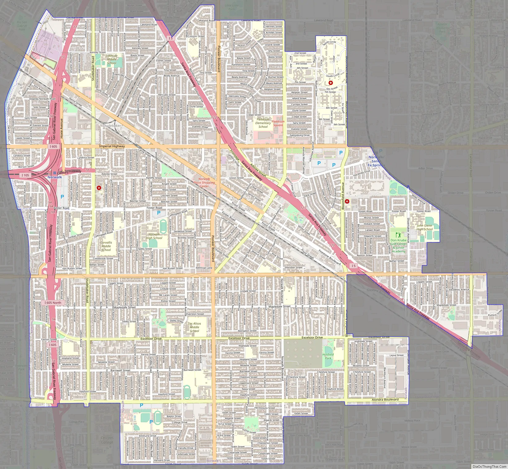
Norwalk Road Map
Norwalk city Satellite Map

Geography
Norwalk is located at 33°54′25″N 118°5′0″W / 33.90694°N 118.08333°W / 33.90694; -118.08333 (33.906914, -118.083398).
According to the United States Census Bureau, the city has a total area of 25.243 km (10 sq mi). 9.707 square miles (25.14 km) of it is land and 0.039 square miles (0.10 km) of it (0.40%) is water.
Norwalk is bordered by Downey to the northwest, Bellflower to the southwest, Cerritos and Artesia to the south, and Santa Fe Springs and Whittier to the north and east.
See also
Map of California State and its subdivision:- Alameda
- Alpine
- Amador
- Butte
- Calaveras
- Colusa
- Contra Costa
- Del Norte
- El Dorado
- Fresno
- Glenn
- Humboldt
- Imperial
- Inyo
- Kern
- Kings
- Lake
- Lassen
- Los Angeles
- Madera
- Marin
- Mariposa
- Mendocino
- Merced
- Modoc
- Mono
- Monterey
- Napa
- Nevada
- Orange
- Placer
- Plumas
- Riverside
- Sacramento
- San Benito
- San Bernardino
- San Diego
- San Francisco
- San Joaquin
- San Luis Obispo
- San Mateo
- Santa Barbara
- Santa Clara
- Santa Cruz
- Shasta
- Sierra
- Siskiyou
- Solano
- Sonoma
- Stanislaus
- Sutter
- Tehama
- Trinity
- Tulare
- Tuolumne
- Ventura
- Yolo
- Yuba
- Alabama
- Alaska
- Arizona
- Arkansas
- California
- Colorado
- Connecticut
- Delaware
- District of Columbia
- Florida
- Georgia
- Hawaii
- Idaho
- Illinois
- Indiana
- Iowa
- Kansas
- Kentucky
- Louisiana
- Maine
- Maryland
- Massachusetts
- Michigan
- Minnesota
- Mississippi
- Missouri
- Montana
- Nebraska
- Nevada
- New Hampshire
- New Jersey
- New Mexico
- New York
- North Carolina
- North Dakota
- Ohio
- Oklahoma
- Oregon
- Pennsylvania
- Rhode Island
- South Carolina
- South Dakota
- Tennessee
- Texas
- Utah
- Vermont
- Virginia
- Washington
- West Virginia
- Wisconsin
- Wyoming


