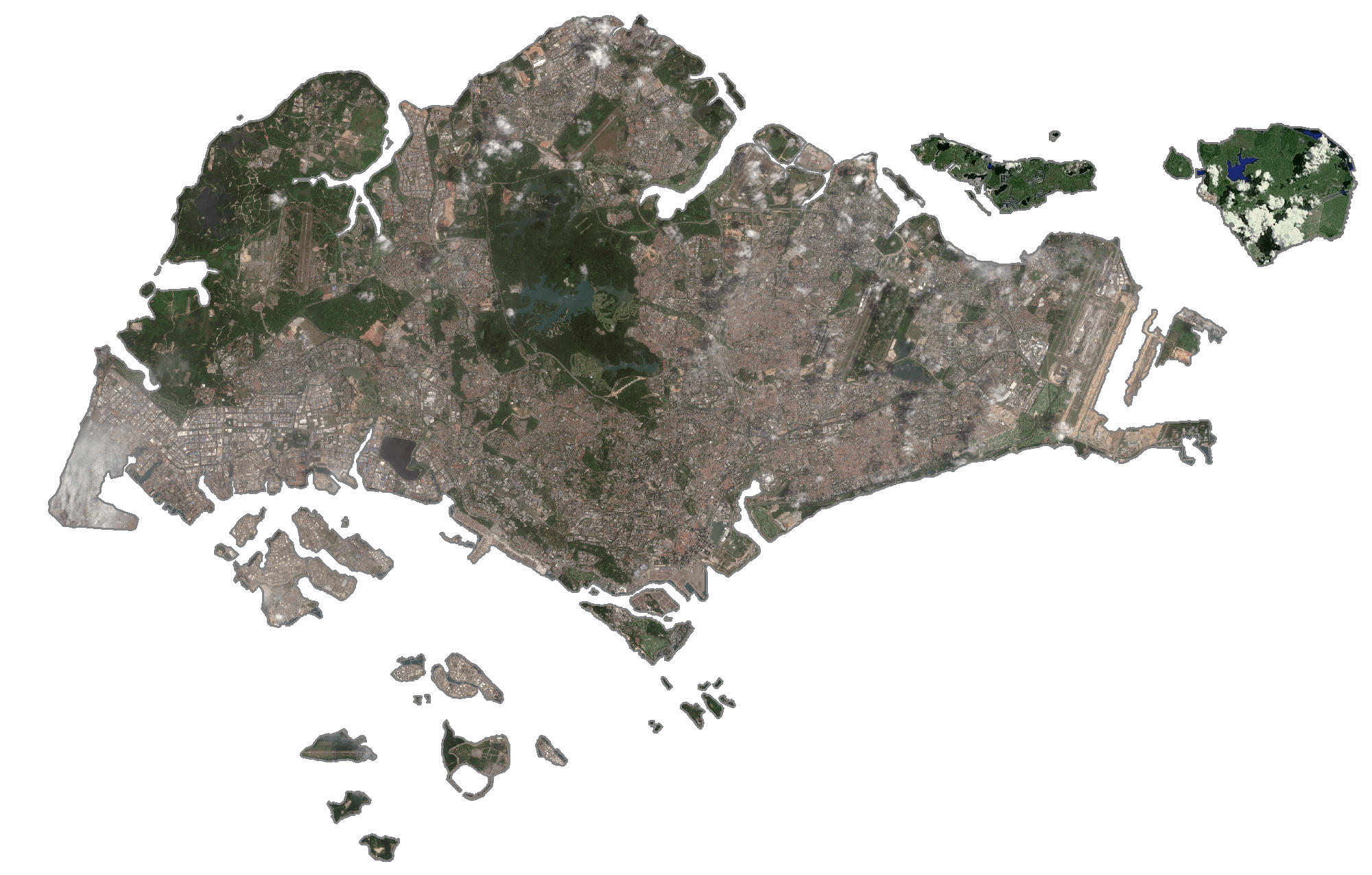
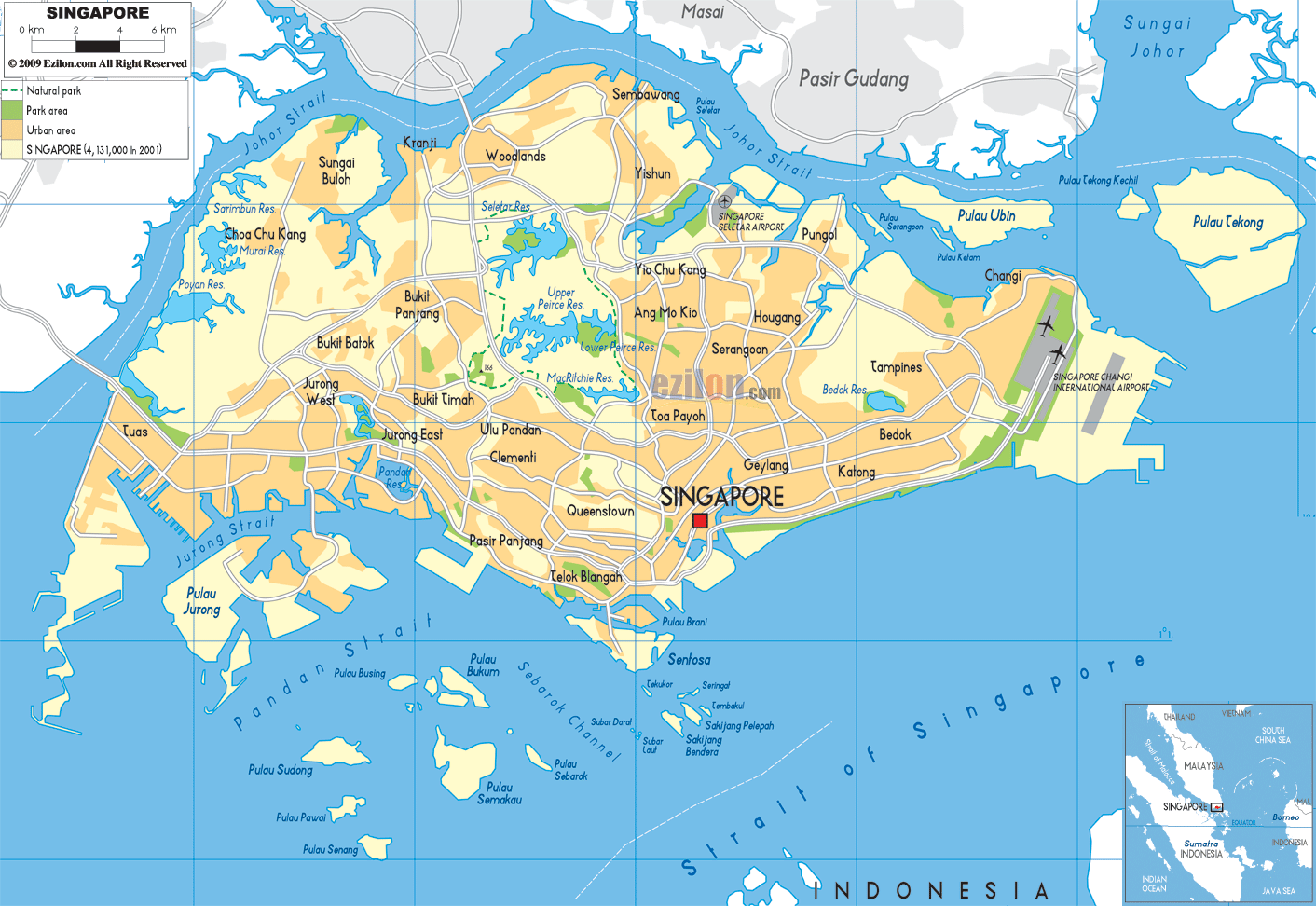
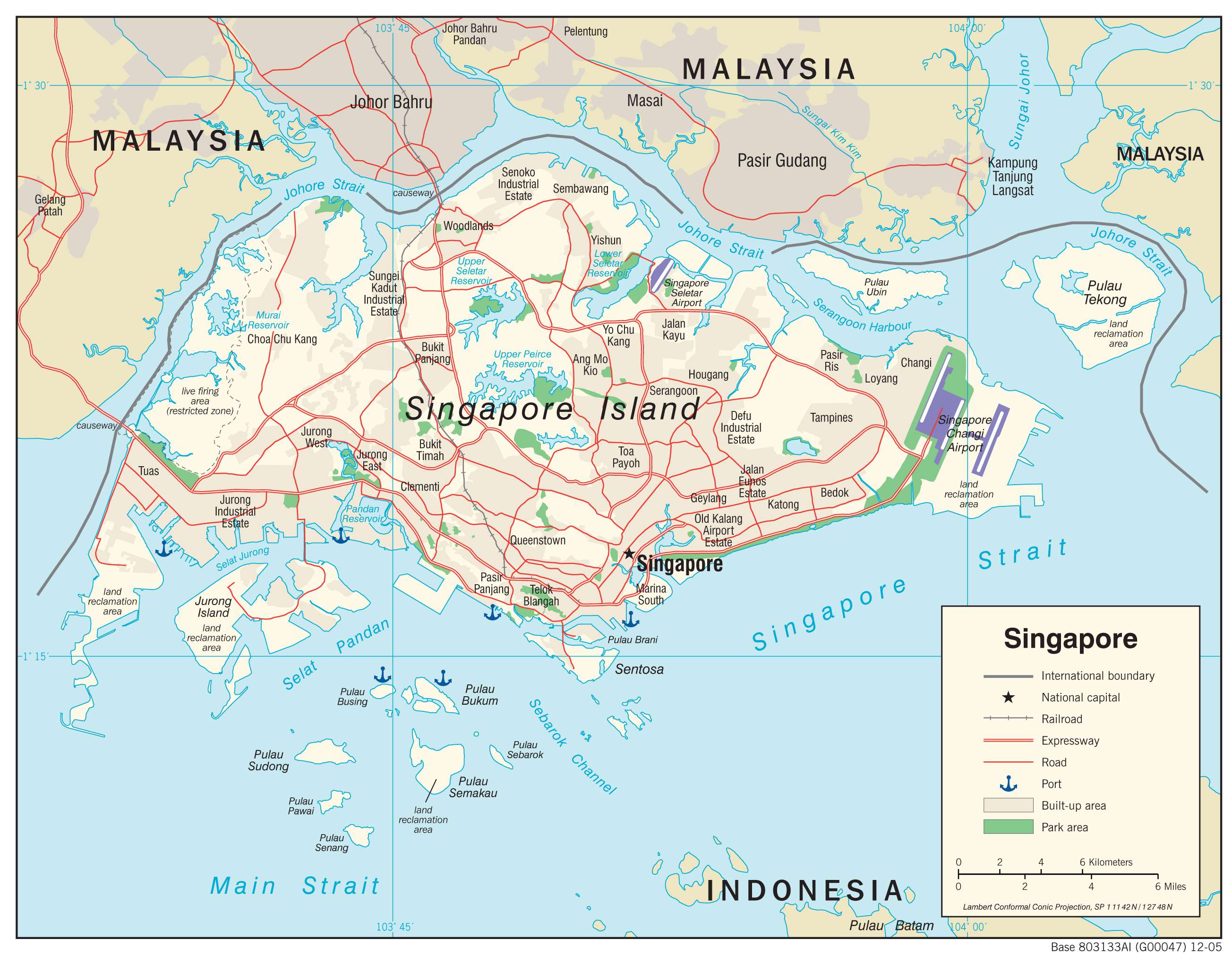
With an area of only 725.7 sq. km, Singapore is one of the world’s smallest countries. This island nation comprises of one main island and over 60 smaller ones. Some of these islands like Sentosa, Jurong, Tekong, Senang have been marked on the map above.
The middle of the main island contains several rounded hills; west and southwest the land is a series of low ridges, while east and southeast, the land is generally flat.
The highest point of Singapore is Bukit Timah at only 545 ft. (166 m), while the lowest point is the Strait of Singapore (0 m).
Singapore is drained by a large number of narrow and short streams, some of which flow into the sea through mangrove swamps, or estuaries.Water reservoirs cover parts of the central area, as there are no significant lakes or rivers.
| Flag: |  |
|---|---|
| Legal Name: | Republic of Singapore |
| Capital Value: | Singapore |
| Largest City: |
Singapore (5,935,053) |
| Official languages: |
|
| Demonym(s): | Singaporean |
| Government: | Unitary dominant-party parliamentary republic |
| Legislature: | Parliament |
| Total Area: | 719 km² |
| Land Area: | 709 km² |
| Water Area: | 10 km² |
| Population: | 5,703,569 |
| Density: | 7,804/km (20,212.3/sq mi) (3rd) |
| GDP: | $372.06 Billion |
| GDP Per Capita: | $65,233.28 |
| Currency Value: | Singapore dollars (SGD) |
| Driving side: | left |
| Calling code: | +65 |
| Internet TLD: | .sg |
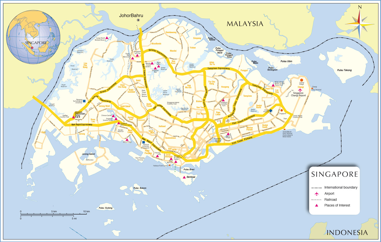
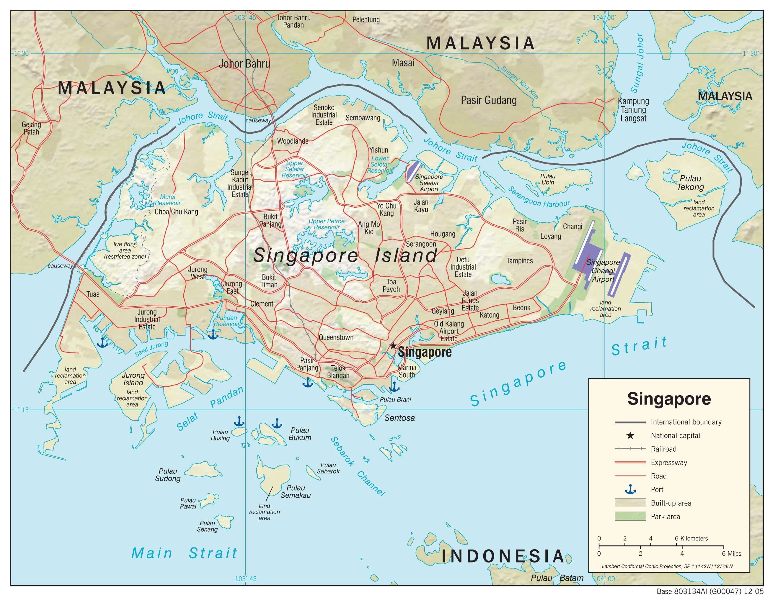
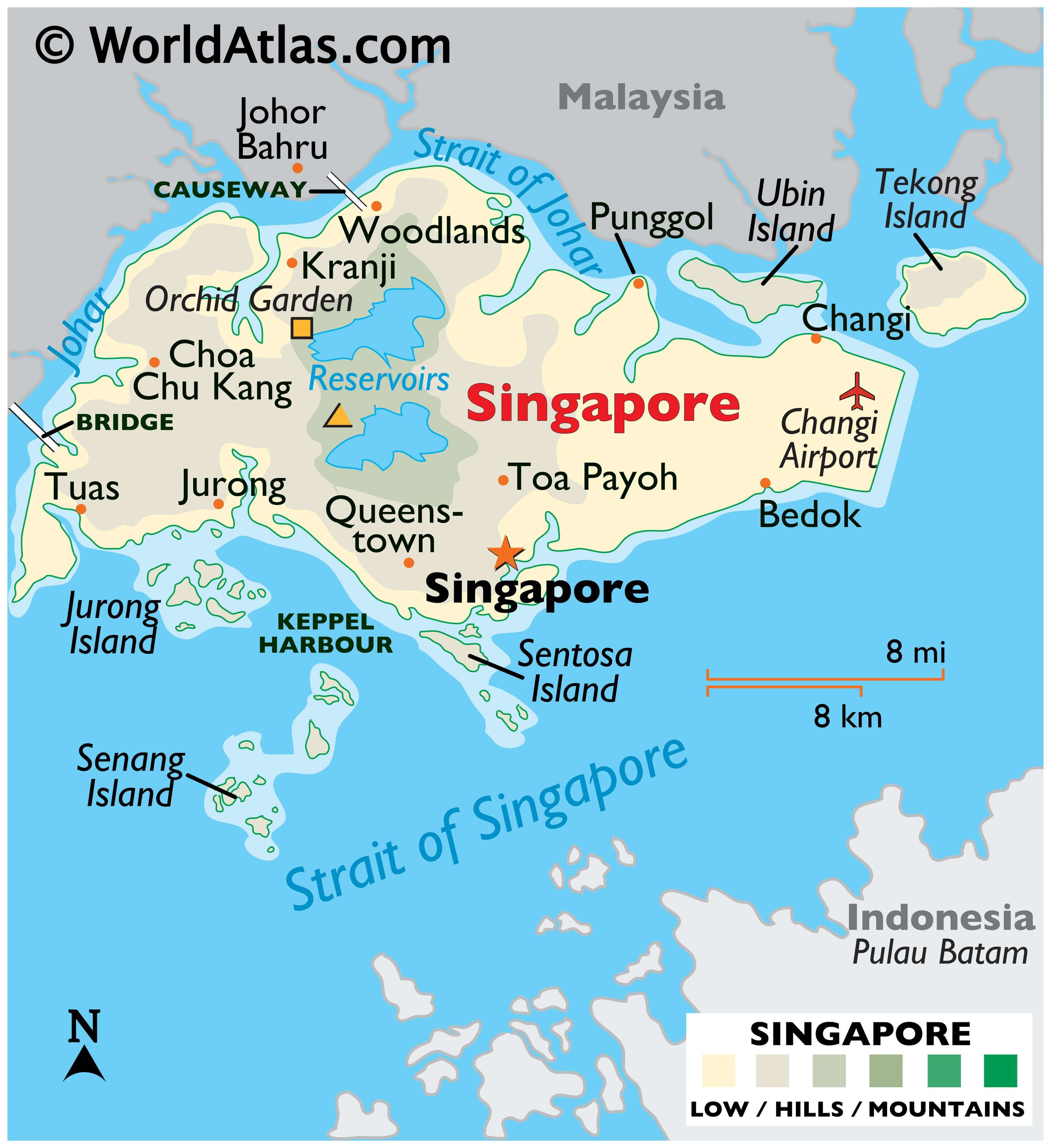
Explore Singapore’s diverse landscapes with this comprehensive collection of maps. Get a bird’s-eye view of the country’s highways, roads, neighborhoods, islands, and airports with the reference map and satellite imagery. Learn more about its topography with the physical map.
Online Interactive Political Map
Click on ![]() to view map in "full screen" mode.
to view map in "full screen" mode.
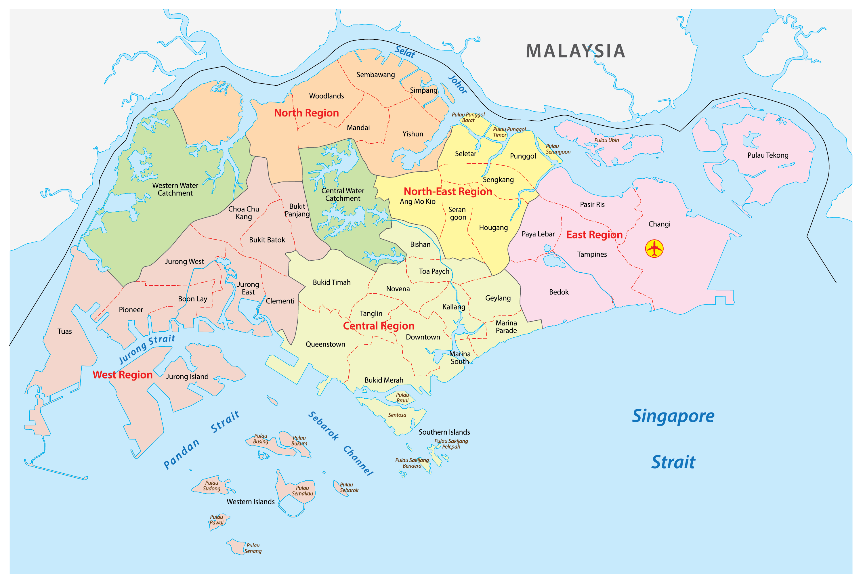
Singapore (officially, Republic of Singapore) is a unitary state and is divided into 5 Community Development Councils (CDCs). In alphabetical order, these councils are: Central Singapore CDC, North East CDC, North West CDC, South East CDC and South West CDC. Each Community Development Council has been further subdivided into electoral constituencies and town councils.
Singapore is the largest port in Southeast Asia and one of the busiest maritime ports in the world. With an area of only 725.7 sq. km, the country is home to a population of over 5 million residents. Singapore has the second greatest population density in the world. Singapore is the only true sovereign city state in the world.
Location Maps
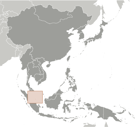
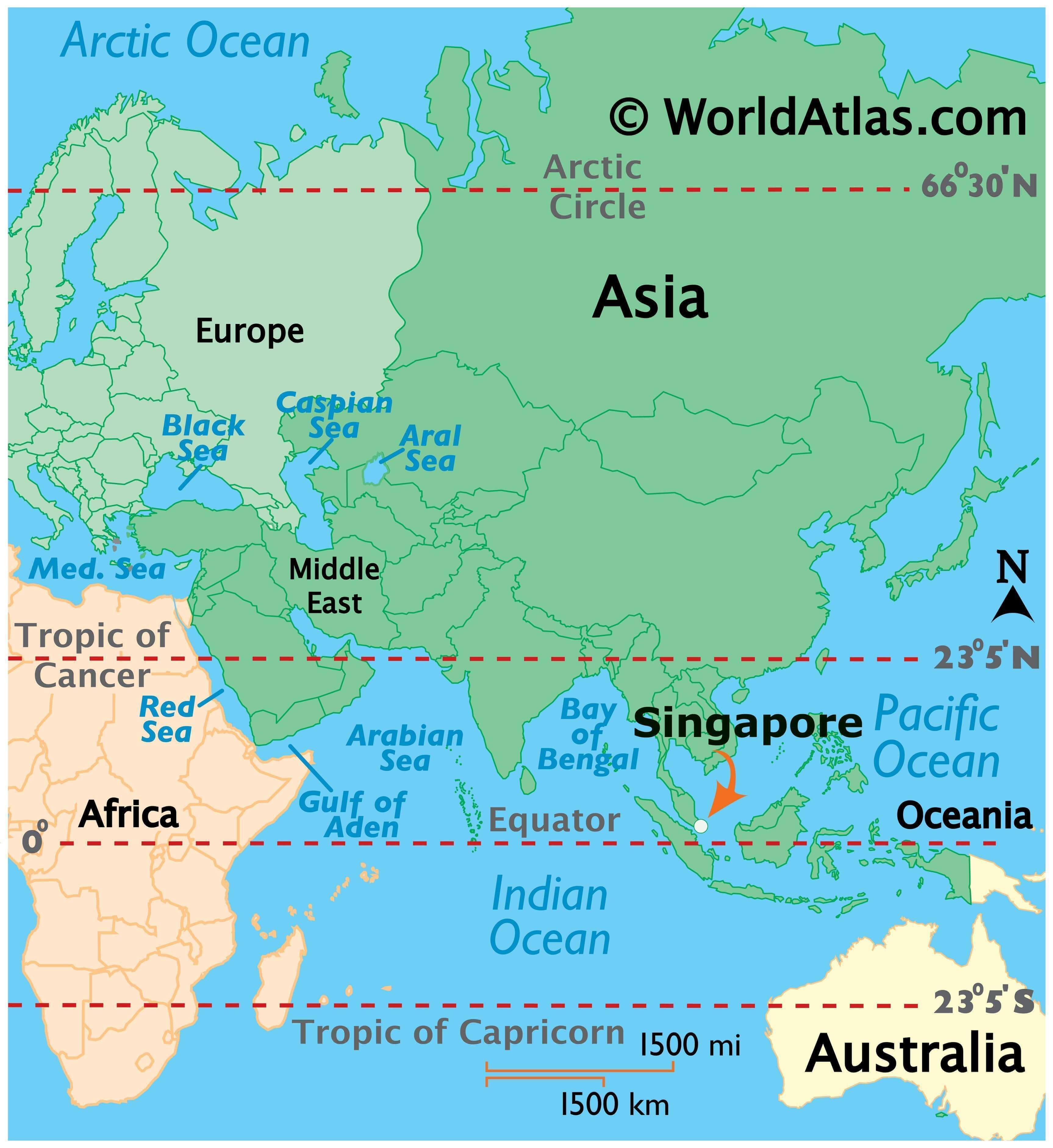
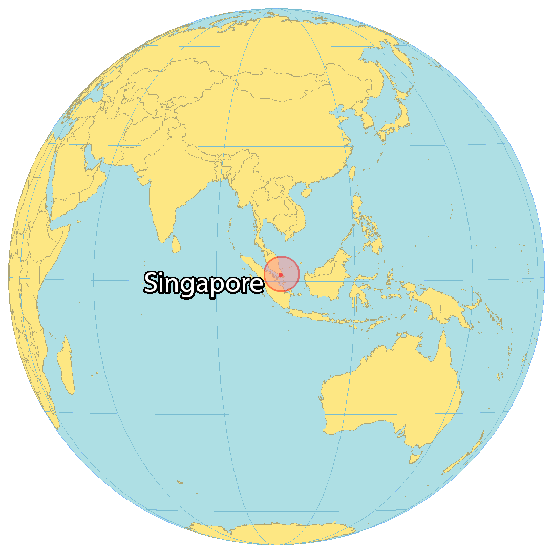
Where is Singapore?
Singapore is an island nation situated in Southeastern Asia between the Indian Ocean and the South China Sea. This small nation covers an area of 728.6 square kilometers (281.3 sq mi), roughly 4 times larger than Washington, DC. It is the world’s largest city-state despite its small size. The Johore Strait separates Singapore from Malaysia to the north and the Singapore Strait separates it from Indonesia to the south. Singapore is renowned for its multiculturalism, cleanliness, nature, safety, tourism and technology. The population of Singapore is concentrated in the center and along the southern coast. It is the third most densely populated country in the world, behind Monaco and Macau. Singapore is the capital of Singapore due to it being a city-state.
High Definition Political Map of Singapore
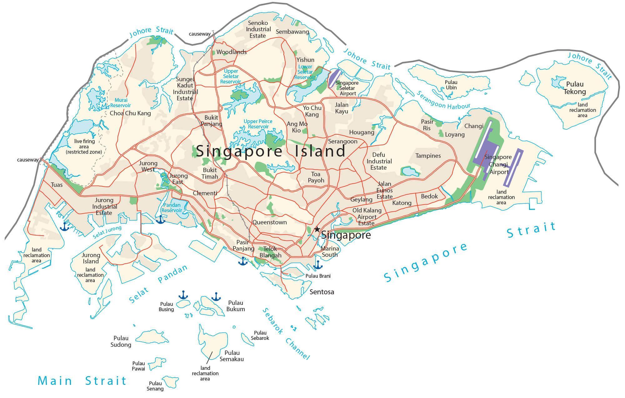
Physical Map of Singapore
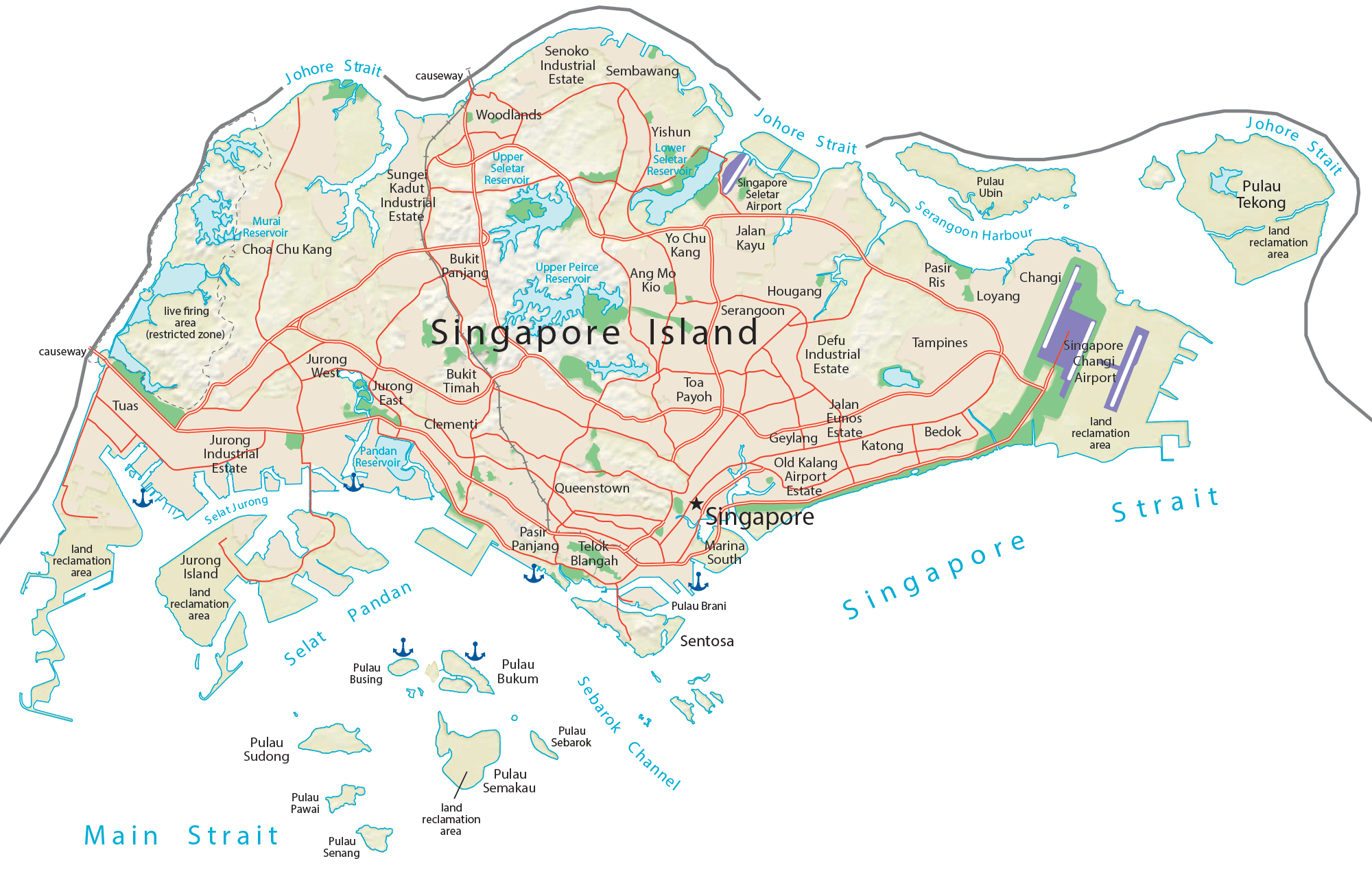
Transportation Map of Singapore
Singapore Satellite Map