Santa Cruz (Spanish for “Holy Cross”) is the largest city and the county seat of Santa Cruz County, in Northern California. As of the 2020 census, the city population was 62,956. Situated on the northern edge of Monterey Bay, Santa Cruz is a popular tourist destination, owing to its beaches, surf culture, and historic landmarks.
Santa Cruz was founded by the Spanish in 1791, when Fermín de Lasuén established Mission Santa Cruz. Soon after, a settlement grew up near the mission called Branciforte, which came to be known across Alta California for its lawlessness. With the Mexican secularization of the Californian missions in 1833, the former mission was divided and granted as rancho grants. Following the American Conquest of California, Santa Cruz eventually incorporated as a city in 1866. The creation of the Santa Cruz Beach Boardwalk in 1907 solidified the city’s status as a seaside resort community, while the establishment of the University of California, Santa Cruz in 1965 led to Santa Cruz’s emergence as a college town.
| Name: | Santa Cruz city |
|---|---|
| LSAD Code: | 25 |
| LSAD Description: | city (suffix) |
| State: | California |
| County: | Santa Cruz County |
| Incorporated: | March 31, 1866 |
| Elevation: | 36 ft (11 m) |
| Land Area: | 12.74 sq mi (33.00 km²) |
| Water Area: | 3.09 sq mi (8.00 km²) 19.51% |
| Population Density: | 4,000/sq mi (1,500/km²) |
| ZIP code: | 95060–95067 |
| Area code: | 831 |
| FIPS code: | 0669112 |
| Website: | www.cityofsantacruz.com |
Online Interactive Map
Click on ![]() to view map in "full screen" mode.
to view map in "full screen" mode.
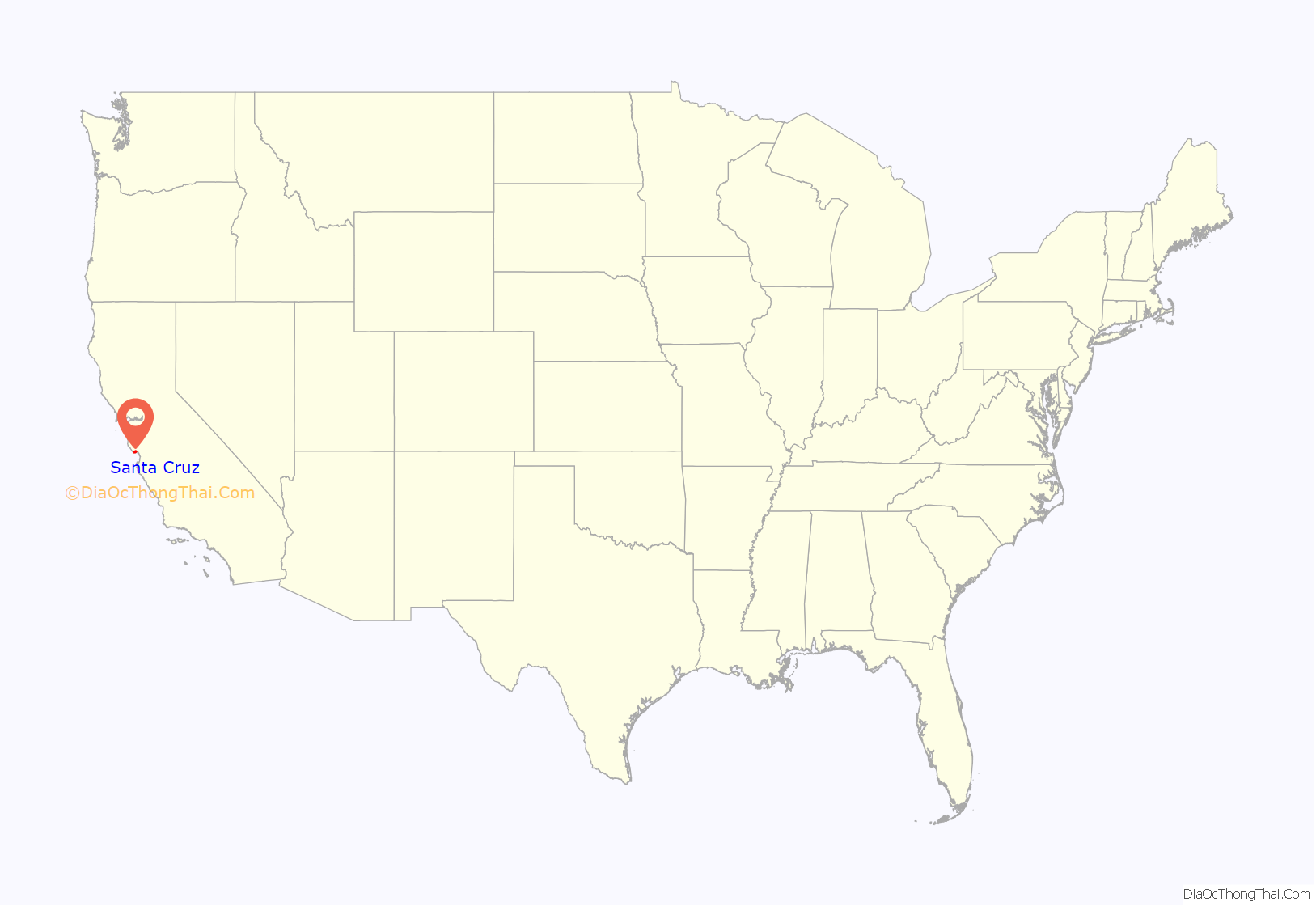
Santa Cruz location map. Where is Santa Cruz city?
History
Indigenous period
Indigenous people have been living in the Santa Cruz region for at least 12,000 years. Prior to the arrival of Spanish soldiers, missionaries and colonists in the late 18th century, the area was home to the Awaswas nation of Ohlone people, who lived in a territory stretching slightly north of Davenport to Rio Del Mar. The Awaswas tribe was made up of no more than one thousand people and their language is now extinct. The only remnants of their spoken language are three local place names: Aptos, Soquel and Zayante; and the name of a native shellfish – abalone. At the time of colonization, the Indigenous people belonged to the Uypi tribe of the Awaswas-speaking dialectical group. They called the area Aulinta.
Spanish period
The first European land exploration of Alta California, the Spanish Portolá expedition led by Gaspar de Portolá, passed through the area on its way north, still searching for the “port of Monterey” described by Sebastian Vizcaino in 1602. The party forded the river (probably near where the Soquel Avenue bridge now stands) and camped nearby on October 17, 1769. Franciscan missionary Juan Crespí, traveling with the expedition, noted in his diary that, “This river was named San Lorenzo.” (for Saint Lawrence).
Next morning, the expedition set out again, and Crespi noted that, “Five hundred steps after we started we crossed a good arroyo of running water which descends from some high hills where it rises. It was named “El Arroyo de la Santisima Cruz, which translates literally as “The Stream of the Most Holy Cross”.
In 1791, Father Fermín Lasuén continued the use of Crespi’s name when he declared the establishment of La Misión de la Exaltación de la Santa Cruz (also known as Mission Santa Cruz) for the conversion of the Awaswas of Chatu-Mu and surrounding Ohlone villages. Santa Cruz was the twelfth mission to be founded in California. The creek, however, later lost the name, and is known today as Laurel Creek because it parallels Laurel Street. It is the main feeder of Neary Lagoon.
In 1797, Governor Diego de Borica, by order of the Viceroy of New Spain, Miguel de la Grúa Talamanca y Branciforte, marqués de Branciforte, established the Villa de Branciforte, a town named in honor of the Viceroy. One of only three civilian towns established in California during the Spanish colonial period (the other two became Los Angeles and San Jose), the Villa was located across the San Lorenzo River, less than a mile from the Mission. Its original main street is now North Branciforte Avenue. Villa de Branciforte later lost its civic status, and in 1905 the area was annexed into the City of Santa Cruz.
Mexican period
In the 1820s, newly independent Mexico assumed control of the area. Following the secularization of the Mission in 1834, the government attempted to rename the community that had grown up around the Mission, to Pueblo de Figueroa (after a former governor). The pueblo designation was never made official, however. The new name didn’t catch on and Santa Cruz remained Santa Cruz. Mission farming and grazing lands, which once extended from the San Lorenzo River north along the coast to approximately today’s Santa Cruz County border, were taken away and broken up into large land grants called ranchos. The grants were made by several different governors between 1834 and 1845 (see List of Ranchos of California).
Two ranchos were totally within the boundaries of today’s city of Santa Cruz. Rancho Potrero Y Rincon de San Pedro Regalado consisted mostly of flat, river-bottom pasture land north of Mission Hill (“potrero” translates as “pasture”). Rancho Tres Ojos de Agua was on the west side. Three other rancho boundaries later became part of the modern city limits: Rancho Refugio on the west. Rancho Carbonera on the north, and Rancho Arroyo del Rodeo on the east.
After secularization put most California land into private hands, immigrants from the United States began to arrive in steadily increasing numbers, especially in the 1840s when overland routes like the California Trail were opened. In 1848, following the Mexican–American War, Mexico ceded the territory of Alta California to the U.S. in the Treaty of Guadalupe Hidalgo. California was the first portion of the territory to become a state, in 1850. Santa Cruz County was established the same year, and Santa Cruz was incorporated as a town in 1866.
The Santa Cruz mission, along with the other twenty-one Franciscan missions, was secularized within a few years after 1833. Even before secularization, the Indian population had declined, and the adobe buildings slowly began to fall apart from wet weather and lack of maintenance. The chapel tower fell in 1840 and the entire front wall was destroyed in the 1857 Fort Tejon earthquake. In 1858 a “modern” church was built next door to the remaining rear portion of the chapel. That remainder was demolished in 1889, when today’s Holy Cross church was built on the site, in a gothic style.
American period
Following the U.S. Conquest of California, Santa Cruz steadily grew with the arrival of immigrants from the eastern United States. Elihu Anthony (1818–1905) arrived in Santa Cruz in 1847 and opened many firsts for the city, including the first Protestant Church, the first blacksmith foundry, he built the first wharf and was the first postmaster. He developed the first commercial blocks in downtown Santa Cruz with his early blacksmith foundry located at the corner of Pacific Street and Mission Street. Anthony with Frederick A. Hihn, built the first private water supply network in the city and serving nearby communities. The establishment of railroad lines in Santa Cruz in 1876 until 1881 with the Santa Cruz Railroad, brought workers to Santa Cruz and provided market access for the city’s timber, leather and limestone industries.
California Powder Works began manufacturing blasting powder for California mining when normal supplies were interrupted by the American Civil War. A powder mill built on the San Lorenzo River upstream of Santa Cruz used charcoal and powder kegs manufactured from local forests. The mill later manufactured smokeless powder used in United States Army Krag-Jørgensen rifles and guns of the United States Navy Pacific and Asiatic fleets.
Santa Cruz was hard hit by the 1989 Loma Prieta earthquake that killed three people. It was also hit by ocean surges caused by the 2011 Tōhoku earthquake and tsunami, wherein the Santa Cruz Small Craft Harbor sustained an estimated $10 million of damage, with another $5 million of damage to docked boats there. It was again hit by ocean surges caused by 2022 Hunga Tonga–Hunga Ha’apai eruption and tsunami, that caused damages to the harbor.
Santa Cruz became one of the first cities to approve marijuana for medicinal uses. In 1992, residents overwhelmingly approved Measure A, which allowed for the medicinal uses of marijuana. Santa Cruz was home to the second above-ground medical marijuana club in the world when the Santa Cruz Cannabis Buyers Club opened its doors in April 1995. Santa Cruz also became one of the first cities in California to test the state’s medical marijuana laws in court after the arrest of Valerie Corral and Mike Corral, founders of the Wo/Men’s Alliance for Medical Marijuana, by the DEA. In January 2020, Santa Cruz became the third city in the US and second city in California to decriminalize psilocybin mushrooms in addition to a slew of other entheogenic plants on the Federal Schedule 1 Substance List.
In 1998, the Santa Cruz community declared itself a nuclear-free zone, and in 2003, the Santa Cruz City Council became the first city council in the U.S. to denounce the Iraq War. The City Council of Santa Cruz also issued a proclamation opposing the USA PATRIOT Act.
Notable feminist activists Nikki Craft and Ann Simonton resided in Santa Cruz, where they formed the “Praying Mantis Brigade”. This collection of activists organized the “Myth California Pageant” in the 1980s protesting the objectification of women. Myth California was staged concurrently with the Miss California pageant held in Santa Cruz since the 1920s. The protests ran for nine years and eventually contributed to the Miss California pageant leaving Santa Cruz.
Riots occurred on May 1, 2010, sparked when anarchist extremists threw paint at police cars and painted anarchist symbols and anti-capitalist phrases onto buildings, resulting in more than a dozen buildings being vandalized and numerous storefronts being damaged. Property damages are estimated to top roughly $100,000. Prior to the riot, a May Day rally was being held for worker and immigrant rights. According to police, the rally was infiltrated by a local anarchists group, who used the rally as a cover for attacking corporate premises.
Occupy Santa Cruz formed as an autonomous organization in solidarity with the worldwide Occupy movement, a broad-based protest against economic and social inequality. The organization gained most of its notoriety when members barricaded themselves in an empty bank building owned by Wells Fargo and occupied the building for 72 hours, causing $30,000 in damages. Eleven criminal charges were filed, at least seven of which have since been dropped.
Santa Cruz Road Map
Santa Cruz city Satellite Map
Geography
Santa Cruz is on the northern edge of Monterey Bay. The area is losing several feet of beach a year.
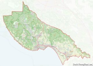
According to the United States Census Bureau, the city covers an area of 15.8 square miles (41 km), of which 12.7 square miles (33 km) is land, and 3.1 square miles (8.0 km) (19.51%s) is water. To Santa Cruz locals, the area is often discussed in terms of three distinct regions: east side, west side, and midtown.
Climate
Santa Cruz has mild weather throughout the year, experiencing a warm-summer Mediterranean climate characterized by mild, wet winters and warm, mostly dry summers. Due to its proximity to Monterey Bay, fog and low overcast are common during the night and morning hours, especially in the summer. Santa Cruz frequently experiences an Indian summer, with the year’s warmest temperatures often occurring in the autumn. Since the city faces south rather than west with mountains to its north, temperatures are usually several degrees warmer than in coastal areas to its northwest.
See also
Map of California State and its subdivision:- Alameda
- Alpine
- Amador
- Butte
- Calaveras
- Colusa
- Contra Costa
- Del Norte
- El Dorado
- Fresno
- Glenn
- Humboldt
- Imperial
- Inyo
- Kern
- Kings
- Lake
- Lassen
- Los Angeles
- Madera
- Marin
- Mariposa
- Mendocino
- Merced
- Modoc
- Mono
- Monterey
- Napa
- Nevada
- Orange
- Placer
- Plumas
- Riverside
- Sacramento
- San Benito
- San Bernardino
- San Diego
- San Francisco
- San Joaquin
- San Luis Obispo
- San Mateo
- Santa Barbara
- Santa Clara
- Santa Cruz
- Shasta
- Sierra
- Siskiyou
- Solano
- Sonoma
- Stanislaus
- Sutter
- Tehama
- Trinity
- Tulare
- Tuolumne
- Ventura
- Yolo
- Yuba
- Alabama
- Alaska
- Arizona
- Arkansas
- California
- Colorado
- Connecticut
- Delaware
- District of Columbia
- Florida
- Georgia
- Hawaii
- Idaho
- Illinois
- Indiana
- Iowa
- Kansas
- Kentucky
- Louisiana
- Maine
- Maryland
- Massachusetts
- Michigan
- Minnesota
- Mississippi
- Missouri
- Montana
- Nebraska
- Nevada
- New Hampshire
- New Jersey
- New Mexico
- New York
- North Carolina
- North Dakota
- Ohio
- Oklahoma
- Oregon
- Pennsylvania
- Rhode Island
- South Carolina
- South Dakota
- Tennessee
- Texas
- Utah
- Vermont
- Virginia
- Washington
- West Virginia
- Wisconsin
- Wyoming
