The Town of Bow Mar is a Statutory Town located in Arapahoe and Jefferson counties, Colorado, United States. The town population was 853 at the 2020 United States Census with 587 residing in Arapahoe County and 266 residing in Jefferson County. Bow Mar is a part of the Denver-Aurora-Lakewood, CO Metropolitan Statistical Area and the Front Range Urban Corridor. The current mayor of Bow Mar is Bryan Sperry.
| Name: | Bow Mar town |
|---|---|
| LSAD Code: | 43 |
| LSAD Description: | town (suffix) |
| State: | Colorado |
| County: | Arapahoe County, Jefferson County |
| Elevation: | 5,518 ft (1,682 m) |
| Total Area: | 0.812 sq mi (2.104 km²) |
| Land Area: | 0.662 sq mi (1.714 km²) |
| Water Area: | 0.151 sq mi (0.390 km²) |
| Total Population: | 853 |
| Population Density: | 1,289/sq mi (498/km²) |
| ZIP code: | 80123 |
| Area code: | Both 303 and 720 |
| FIPS code: | 0808070 |
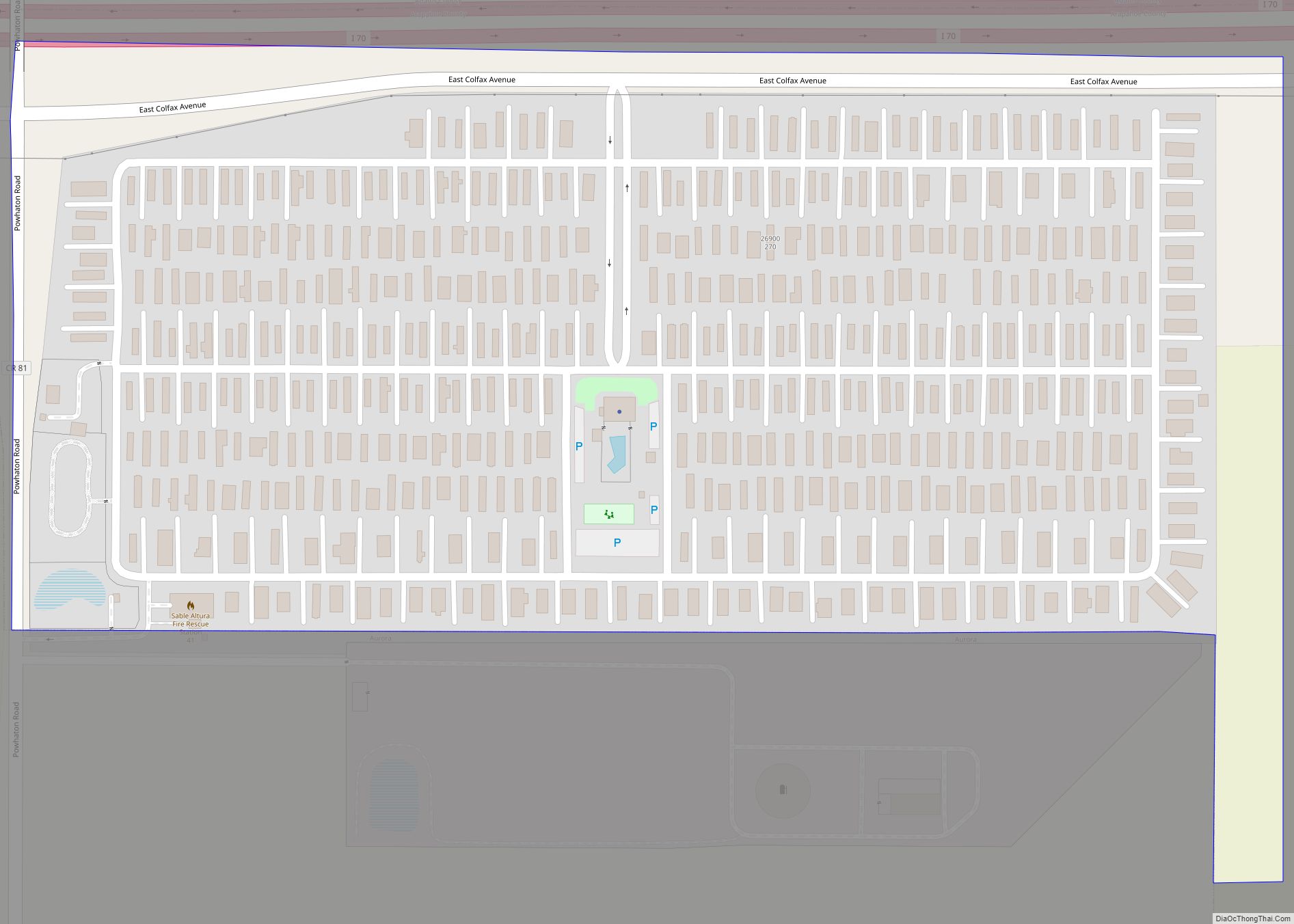
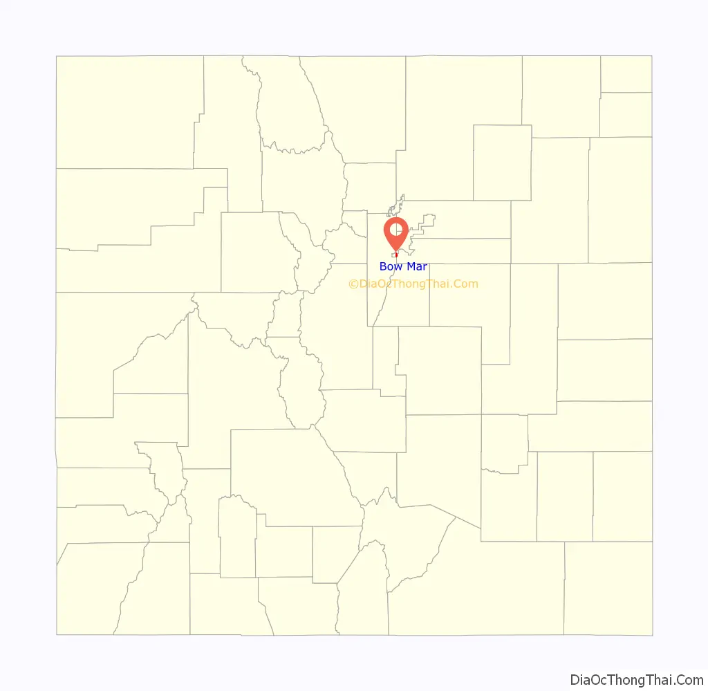
Online Interactive Map
Click on ![]() to view map in "full screen" mode.
to view map in "full screen" mode.
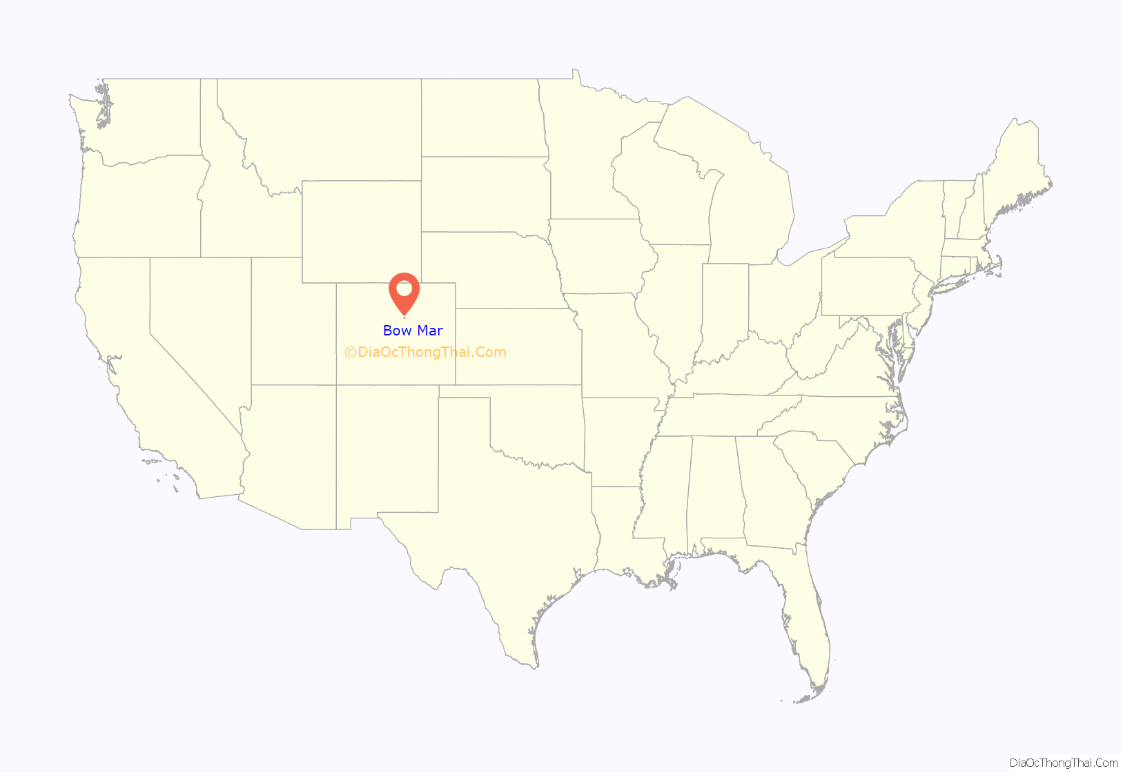
Bow Mar location map. Where is Bow Mar town?
History
As the Denver-area grew in the late 19th century, the area that is now known as Bow Mar was developed as an agricultural area. It was home to several large farms that provided for both Denver and nearby Littleton. The name Bow Mar is derived from combining the names of two nearby lakes, Bowles Lake and Marston Lake. The lakes were named for two pioneering farmers in the area, Joseph Bowles and John Marston. The Bowles family farmhouse and barn can today be found south of the town of Bow Mar.
As Denver grew in the post-World War II era, Bow Mar farmland was purchased to develop the area into single-family housing. Homes were first constructed in what is now Bow Mar in the late 1940s and early 1950s. In 1947, the first home was built in Bow Mar by land developed by Lloyd and Eleanor King. The neighborhood was largely built up by the end of the 1950s. Bow Mar was incorporated as a town in 1958 as a town that straddled both Arapahoe and Jefferson counties. When built, many homes in Bow Mar reflected Frank Lloyd Wright’s prairie-style architecture. Homes were constructed upon acre lots and were placed on wide streets, and were limited to being no more than one story tall. Today, many houses in the area are being updated or replaced with new construction.
Bow Mar maintains a public beach for residents that is utilized year-round for concerts, gatherings, or other neighborhood events. The Bow Mar Yacht Club hosts regattas during summer months on Bow Mar Lake.
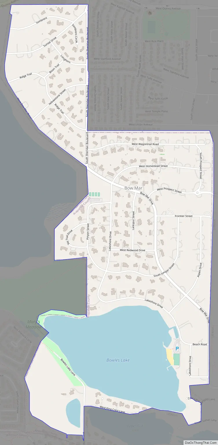
Bow Mar Road Map
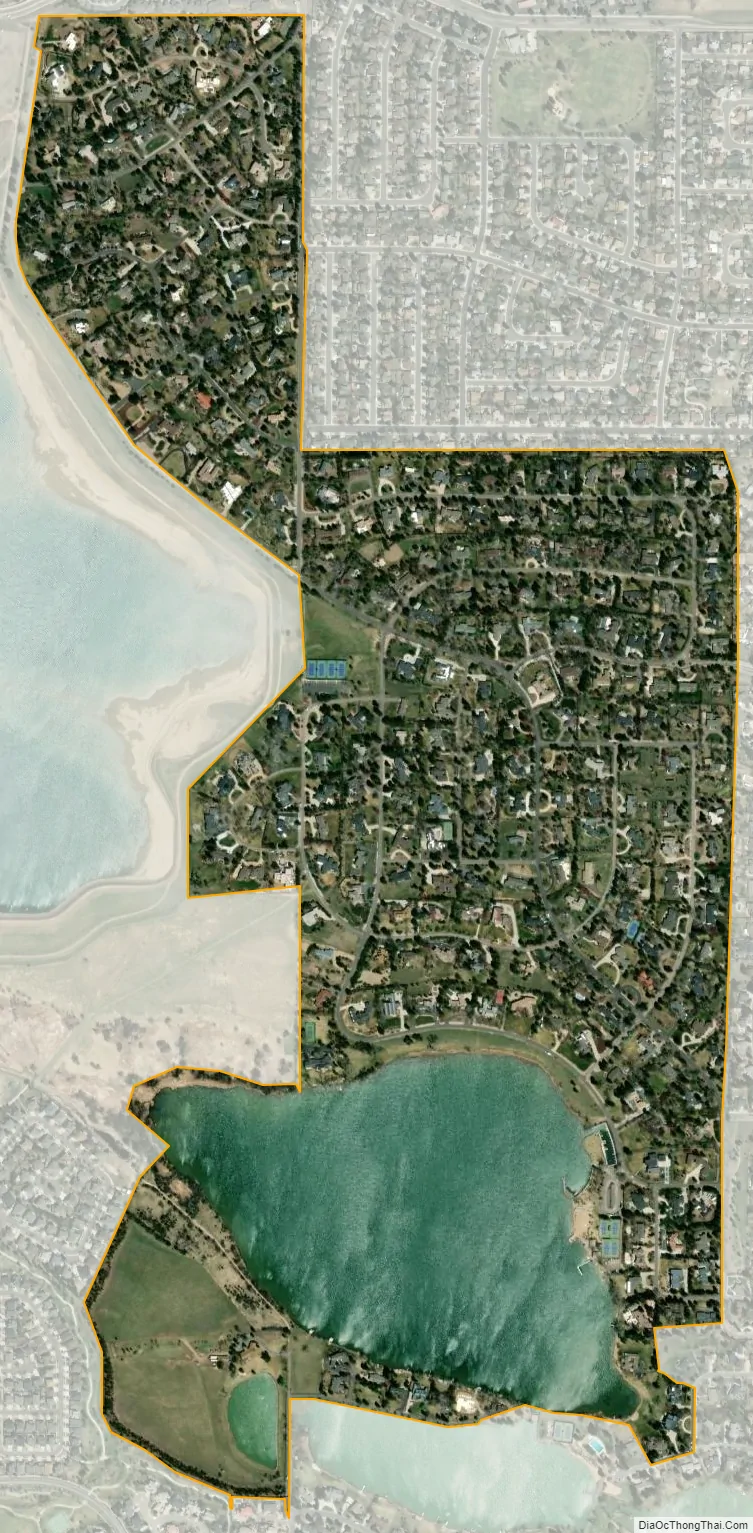
Bow Mar city Satellite Map
Geography
Bow Mar is located at 39°37′37″N 105°03′03″W / 39.626937°N 105.050767°W / 39.626937; -105.050767.
At the 2020 United States Census, the town had a total area of 520 acres (2.104 km) including 96 acres (0.390 km) of water.
See also
Map of Colorado State and its subdivision:- Adams
- Alamosa
- Arapahoe
- Archuleta
- Baca
- Bent
- Boulder
- Broomfield
- Chaffee
- Cheyenne
- Clear Creek
- Conejos
- Costilla
- Crowley
- Custer
- Delta
- Denver
- Dolores
- Douglas
- Eagle
- El Paso
- Elbert
- Fremont
- Garfield
- Gilpin
- Grand
- Gunnison
- Hinsdale
- Huerfano
- Jackson
- Jefferson
- Kiowa
- Kit Carson
- La Plata
- Lake
- Larimer
- Las Animas
- Lincoln
- Logan
- Mesa
- Mineral
- Moffat
- Montezuma
- Montrose
- Morgan
- Otero
- Ouray
- Park
- Phillips
- Pitkin
- Prowers
- Pueblo
- Rio Blanco
- Rio Grande
- Routt
- Saguache
- San Juan
- San Miguel
- Sedgwick
- Summit
- Teller
- Washington
- Weld
- Yuma
- Alabama
- Alaska
- Arizona
- Arkansas
- California
- Colorado
- Connecticut
- Delaware
- District of Columbia
- Florida
- Georgia
- Hawaii
- Idaho
- Illinois
- Indiana
- Iowa
- Kansas
- Kentucky
- Louisiana
- Maine
- Maryland
- Massachusetts
- Michigan
- Minnesota
- Mississippi
- Missouri
- Montana
- Nebraska
- Nevada
- New Hampshire
- New Jersey
- New Mexico
- New York
- North Carolina
- North Dakota
- Ohio
- Oklahoma
- Oregon
- Pennsylvania
- Rhode Island
- South Carolina
- South Dakota
- Tennessee
- Texas
- Utah
- Vermont
- Virginia
- Washington
- West Virginia
- Wisconsin
- Wyoming