The Town of Frederick is a Statutory Town located in Weld County, Colorado, United States. The town population was 14,513 at the 2020 United States Census, a +67.22% increase since the 2010 United States Census. Frederick is a part of the Greeley, CO Metropolitan Statistical Area and the Front Range Urban Corridor.
| Name: | Frederick town |
|---|---|
| LSAD Code: | 43 |
| LSAD Description: | town (suffix) |
| State: | Colorado |
| County: | Weld County |
| Elevation: | 4,984 ft (1,519 m) |
| Total Area: | 15.221 sq mi (39.423 km²) |
| Land Area: | 15.096 sq mi (39.099 km²) |
| Water Area: | 0.125 sq mi (0.324 km²) |
| Total Population: | 14,513 |
| Population Density: | 961/sq mi (371/km²) |
| ZIP code: | 80504 & 80516 & 80530 |
| Area code: | 303, 720 |
| FIPS code: | 0828360 |
| GNISfeature ID: | 0180839 |
| Website: | www.frederickco.gov |
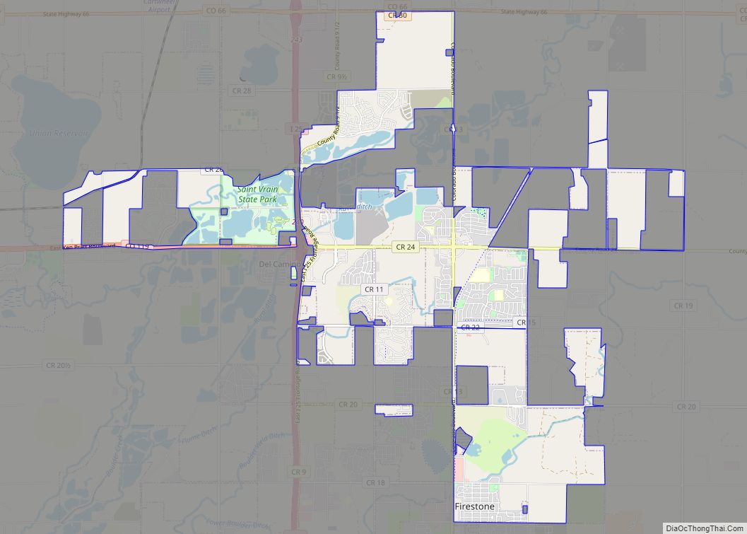
Online Interactive Map
Click on ![]() to view map in "full screen" mode.
to view map in "full screen" mode.
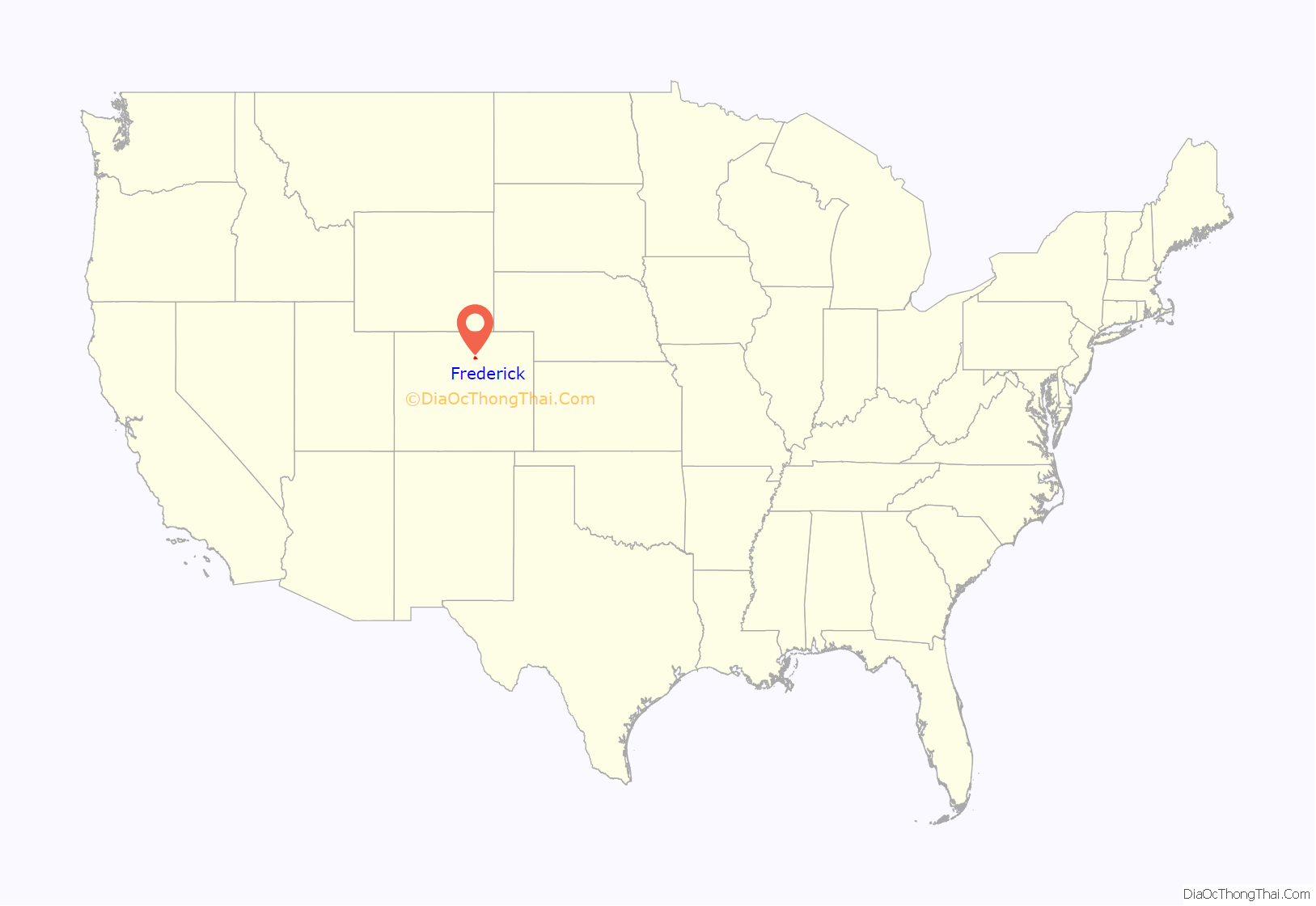
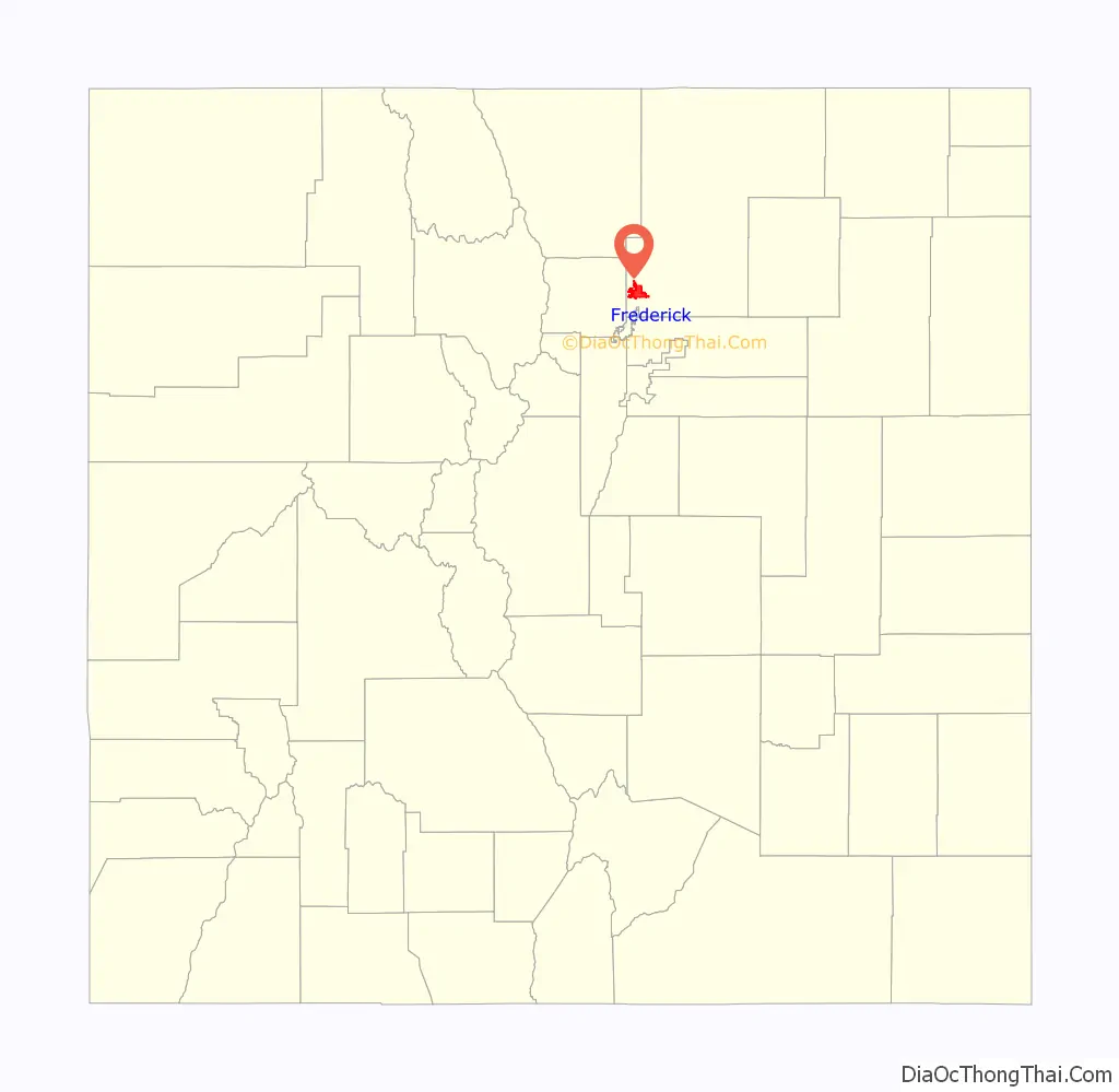
Frederick location map. Where is Frederick town?
History
Initially named McKissick for the mine owner, Frederick was renamed when the daughters of Frederick A. Clark, a land owner, laid out the town site in 1907 and named it for their father. Incorporated in 1907, the Town of Frederick began as a coal mining town attracting immigrants from Italy, France, Greece, Turkey, several Slavic countries and Latin America. The Frederick Coal mine closed in 1928.
In 2014 the town ‘re-branded’ by designing a logo that is a stylized gas lamp with a mountain range background, and adopting the tag line “Built on What Matters”. Prior to the re-branding the town primarily used the seal as a logo on town vehicles and letter head.
The town came to national media attention upon becoming the scene of a high-profile murder case in which resident Chris Watts killed his pregnant wife and their two daughters in August 2018.
Frederick Road Map
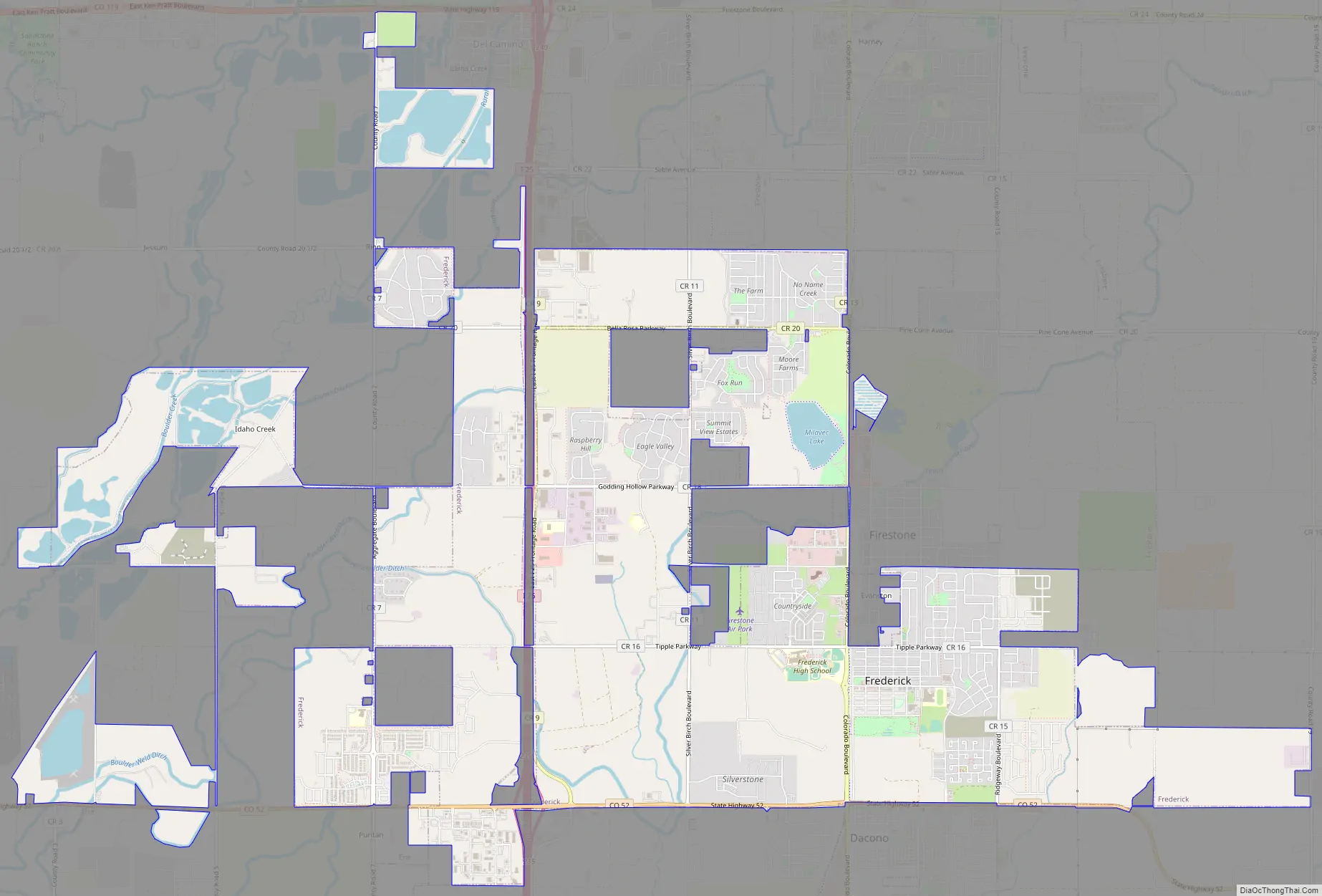
Frederick city Satellite Map
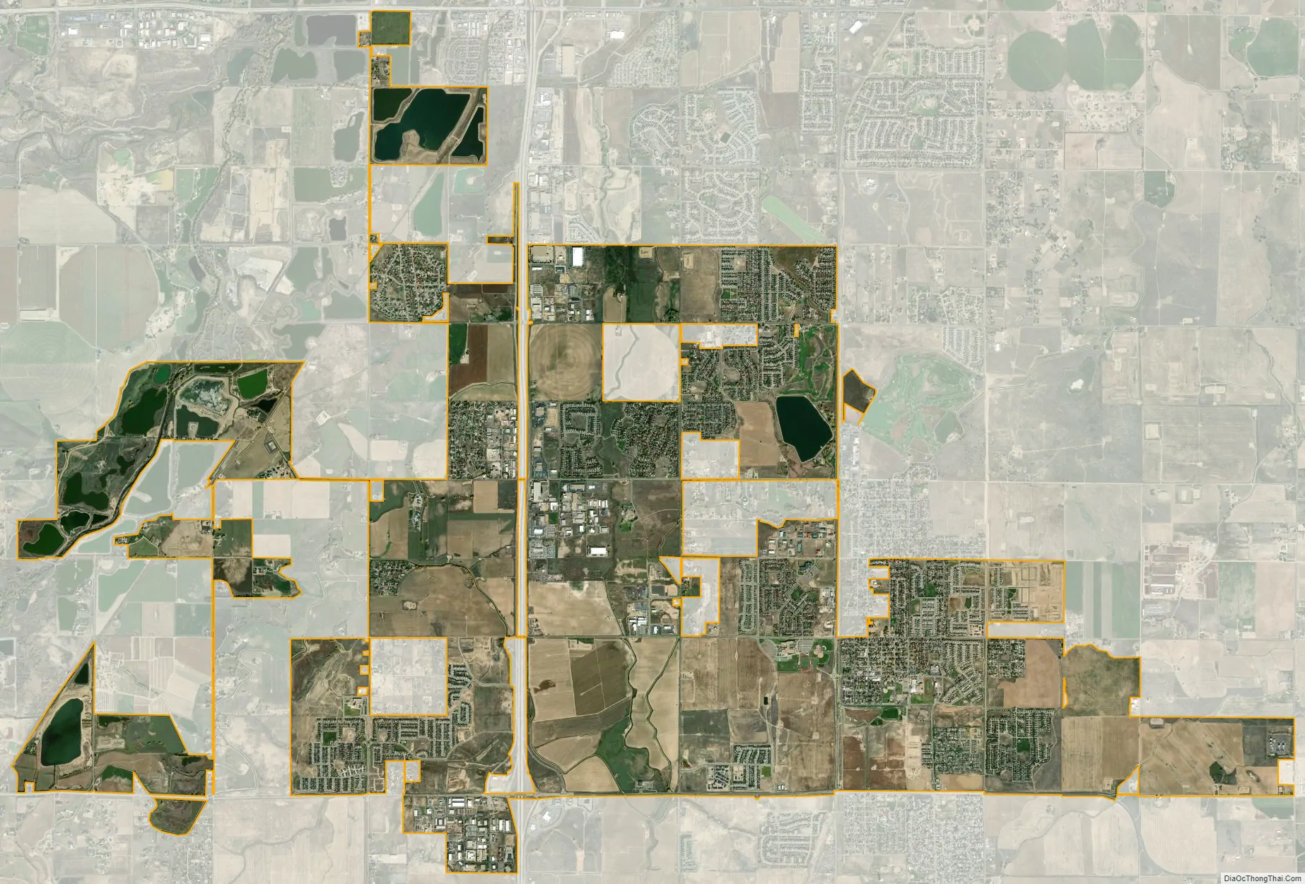
Geography
Frederick is located at 40°6′40″N 104°57′39″W / 40.11111°N 104.96083°W / 40.11111; -104.96083 (40.111175, −104.960967).
At the 2020 United States Census, the town had a total area of 9,742 acres (39.423 km) including 80 acres (0.324 km) of water.
Immediately adjacent communities to Frederick are Firestone to the North, and Dacono to the South. Frederick, Firestone, and Dacono generally being called the ‘Tri-Towns’ or the ‘Tri-Town area’, the area in general being called ‘Carbon Valley’. The next closest communities are Erie to the southwest, Longmont to the west, Fort Lupton to the east, and an unincorporated area of Weld County called DelCamino to the northwest. Within the incorporated area of the Town of Frederick is an unincorporated section called ‘Evanston’.
See also
Map of Colorado State and its subdivision:- Adams
- Alamosa
- Arapahoe
- Archuleta
- Baca
- Bent
- Boulder
- Broomfield
- Chaffee
- Cheyenne
- Clear Creek
- Conejos
- Costilla
- Crowley
- Custer
- Delta
- Denver
- Dolores
- Douglas
- Eagle
- El Paso
- Elbert
- Fremont
- Garfield
- Gilpin
- Grand
- Gunnison
- Hinsdale
- Huerfano
- Jackson
- Jefferson
- Kiowa
- Kit Carson
- La Plata
- Lake
- Larimer
- Las Animas
- Lincoln
- Logan
- Mesa
- Mineral
- Moffat
- Montezuma
- Montrose
- Morgan
- Otero
- Ouray
- Park
- Phillips
- Pitkin
- Prowers
- Pueblo
- Rio Blanco
- Rio Grande
- Routt
- Saguache
- San Juan
- San Miguel
- Sedgwick
- Summit
- Teller
- Washington
- Weld
- Yuma
- Alabama
- Alaska
- Arizona
- Arkansas
- California
- Colorado
- Connecticut
- Delaware
- District of Columbia
- Florida
- Georgia
- Hawaii
- Idaho
- Illinois
- Indiana
- Iowa
- Kansas
- Kentucky
- Louisiana
- Maine
- Maryland
- Massachusetts
- Michigan
- Minnesota
- Mississippi
- Missouri
- Montana
- Nebraska
- Nevada
- New Hampshire
- New Jersey
- New Mexico
- New York
- North Carolina
- North Dakota
- Ohio
- Oklahoma
- Oregon
- Pennsylvania
- Rhode Island
- South Carolina
- South Dakota
- Tennessee
- Texas
- Utah
- Vermont
- Virginia
- Washington
- West Virginia
- Wisconsin
- Wyoming