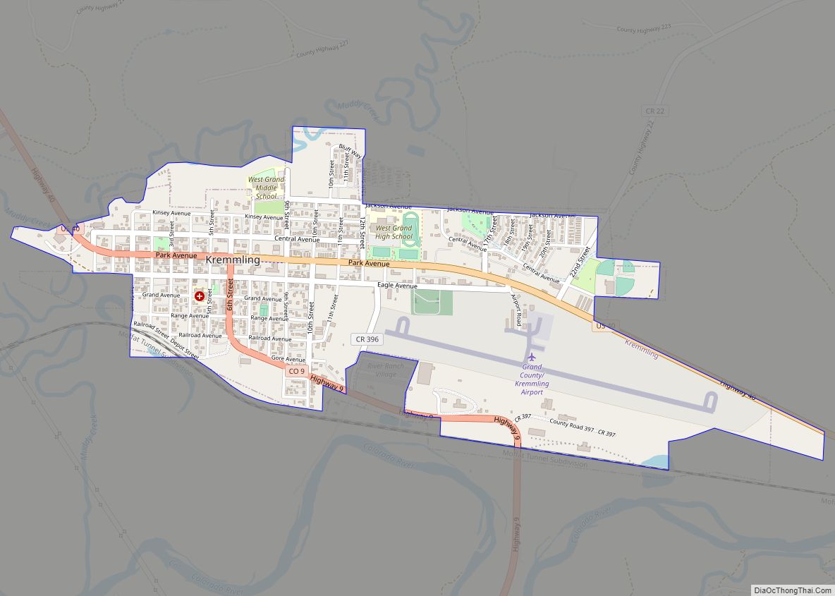
The Town of Kremmling is a Statutory Town in Grand County, Colorado, United States. The town population was 1,509 at the 2020 United States Census. The town sits along the upper Colorado River in the lower arid section of Middle Park between Byers Canyon and Gore Canyon. The town was founded in 1881 during the Colorado Silver Boom days, but the lack of mineral resources in the nearby mountains made the town grow very slowly in the early days.
| Name: | Kremmling town |
|---|---|
| LSAD Code: | 43 |
| LSAD Description: | town (suffix) |
| State: | Colorado |
| County: | Grand County |
| Founded: | 1881 |
| Elevation: | 7,313 ft (2,229 m) |
| Total Area: | 1.31 sq mi (3.39 km²) |
| Land Area: | 1.31 sq mi (3.39 km²) |
| Water Area: | 0.00 sq mi (0.00 km²) |
| Total Population: | 1,509 |
| Population Density: | 1,200/sq mi (450/km²) |
| ZIP code: | 80459 |
| Area code: | 970 |
| FIPS code: | 0841560 |
| GNISfeature ID: | 0204655 |
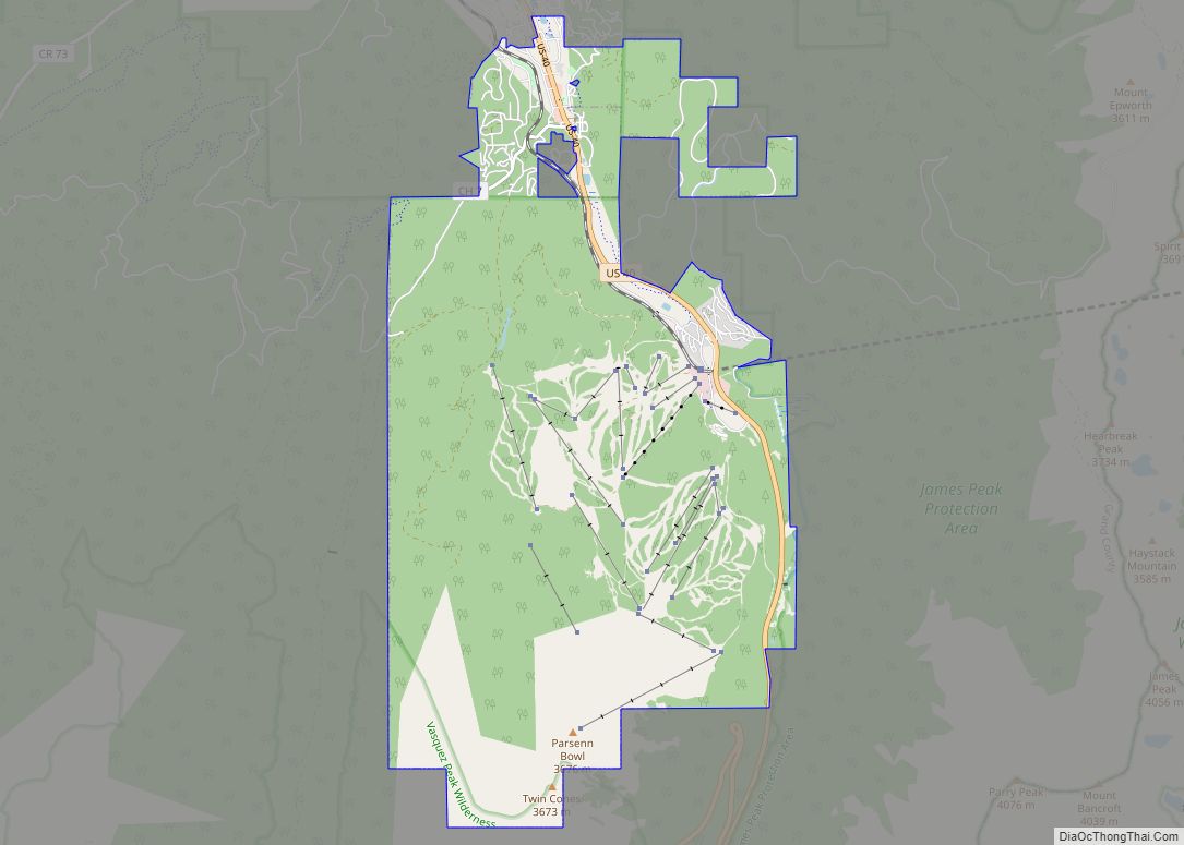
Online Interactive Map
Click on ![]() to view map in "full screen" mode.
to view map in "full screen" mode.
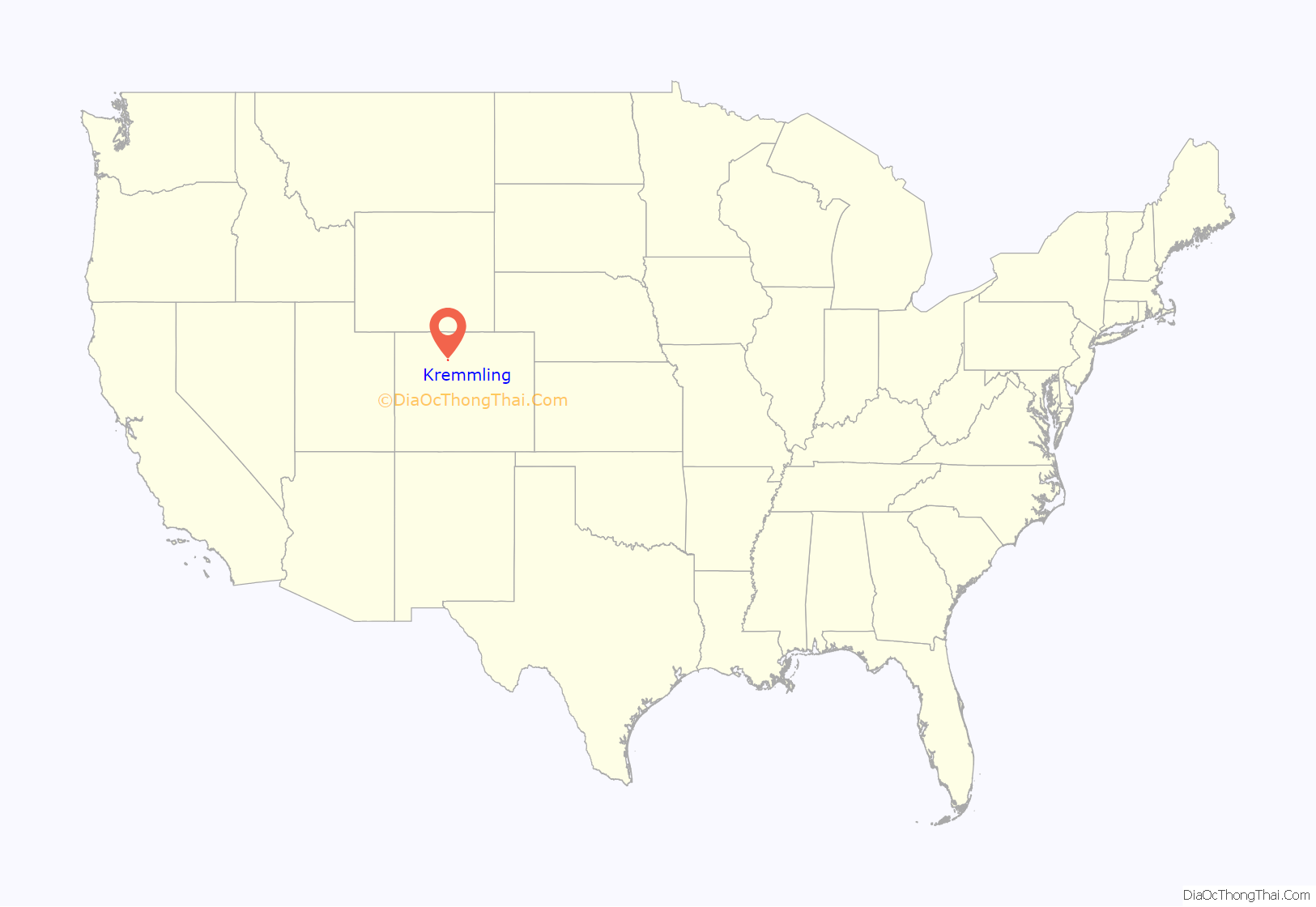
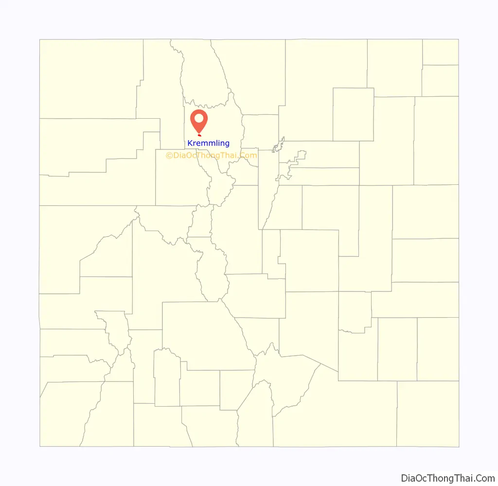
Kremmling location map. Where is Kremmling town?
History
The settlement started with only a general store, run by a man named Rudolph “Kare” Kremmling, built on the north side of Muddy Creek. In 1881, two brothers, Aaron and John Kinsey, made part of their ranch into a town and called it Kinsey City. Kare moved his store across the river to the new site and soon people were calling this place Kremmling. The original post office was called Kinsey City and ran from 1881 to 1885, with Kare Kremmling the first postmaster. The name Kremmling was not officially recognized until 1895. After the Moffat railroad—the Denver, Northwestern & Pacific Railway—arrived in July 1906, Kremmling became the county’s central shipping point. It was incorporated May 14, 1904. In the 20th century, ranching became the main industry in the valley in the vicinity of the town. In 1906, Kasper Schuler built the first brick building in town. The Schuler bottling works occupied the first floor, while the Schuler House, a boarding house run by Miss Kienholz, occupied the second. In 1933, the building became the Hotel Eastin.
Kremmling was featured in W. Eugene Smith’s photographic essay “Country Doctor” in the September 20, 1948 issue of LIFE.
Kremmling Road Map
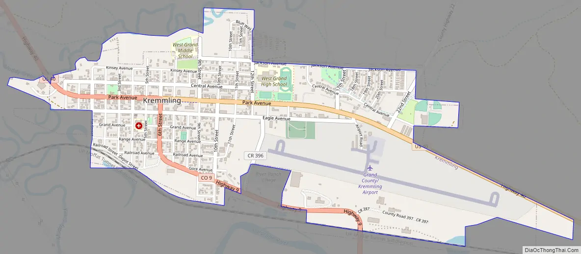
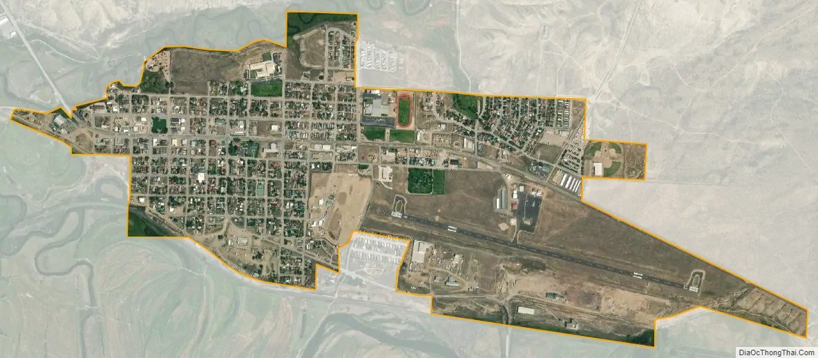
Kremmling city Satellite Map
Geography
Kremmling is located at 40°3′26″N 106°23′9″W / 40.05722°N 106.38583°W / 40.05722; -106.38583 (40.057240, -106.385896).
According to the United States Census Bureau, the town has a total area of 1.3 square miles (3.4 km), all of it land.
The town is located approximately at the mouth of both the Blue River, which descends from the south, and Muddy Creek, which descends from the north. This location provides valley access to Dillon, Colorado, and the ski resorts of Summit County, and Rabbit Ears Pass (renowned for world-class snowmobiling) at the Continental Divide, which then descends into Steamboat Springs.
See also
Map of Colorado State and its subdivision:- Adams
- Alamosa
- Arapahoe
- Archuleta
- Baca
- Bent
- Boulder
- Broomfield
- Chaffee
- Cheyenne
- Clear Creek
- Conejos
- Costilla
- Crowley
- Custer
- Delta
- Denver
- Dolores
- Douglas
- Eagle
- El Paso
- Elbert
- Fremont
- Garfield
- Gilpin
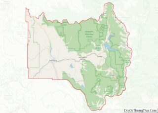
- Grand
- Gunnison
- Hinsdale
- Huerfano
- Jackson
- Jefferson
- Kiowa
- Kit Carson
- La Plata
- Lake
- Larimer
- Las Animas
- Lincoln
- Logan
- Mesa
- Mineral
- Moffat
- Montezuma
- Montrose
- Morgan
- Otero
- Ouray
- Park
- Phillips
- Pitkin
- Prowers
- Pueblo
- Rio Blanco
- Rio Grande
- Routt
- Saguache
- San Juan
- San Miguel
- Sedgwick
- Summit
- Teller
- Washington
- Weld
- Yuma
- Alabama
- Alaska
- Arizona
- Arkansas
- California
- Colorado
- Connecticut
- Delaware
- District of Columbia
- Florida
- Georgia
- Hawaii
- Idaho
- Illinois
- Indiana
- Iowa
- Kansas
- Kentucky
- Louisiana
- Maine
- Maryland
- Massachusetts
- Michigan
- Minnesota
- Mississippi
- Missouri
- Montana
- Nebraska
- Nevada
- New Hampshire
- New Jersey
- New Mexico
- New York
- North Carolina
- North Dakota
- Ohio
- Oklahoma
- Oregon
- Pennsylvania
- Rhode Island
- South Carolina
- South Dakota
- Tennessee
- Texas
- Utah
- Vermont
- Virginia
- Washington
- West Virginia
- Wisconsin
- Wyoming