The City of Lafayette (/ˌlɑːfiːˈɛt, ˌlæf-/) is a home rule municipality located in southeastern Boulder County, Colorado, United States. The city population was 30,411 at the 2020 United States Census.
| Name: | Lafayette city |
|---|---|
| LSAD Code: | 25 |
| LSAD Description: | city (suffix) |
| State: | Colorado |
| County: | Boulder County |
| Founded: | 1888 |
| Incorporated: | January 6, 1890 |
| Elevation: | 5,210 ft (1,588 m) |
| Total Area: | 9.41 sq mi (24.38 km²) |
| Land Area: | 9.21 sq mi (23.86 km²) |
| Water Area: | 0.20 sq mi (0.52 km²) |
| Total Population: | 30,411 |
| Population Density: | 3,200/sq mi (1,200/km²) |
| ZIP code: | 80026 |
| Area code: | Both 303 and 720 |
| FIPS code: | 0841835 |
| GNISfeature ID: | 0202813 |
| Website: | lafayetteco.gov |
Online Interactive Map
Click on ![]() to view map in "full screen" mode.
to view map in "full screen" mode.
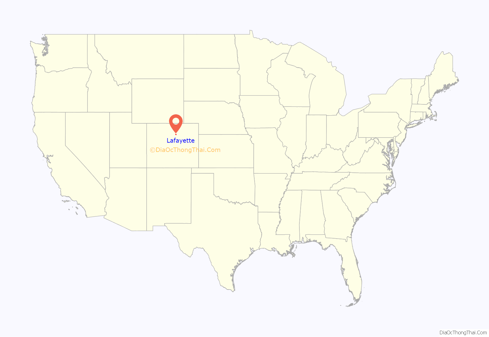
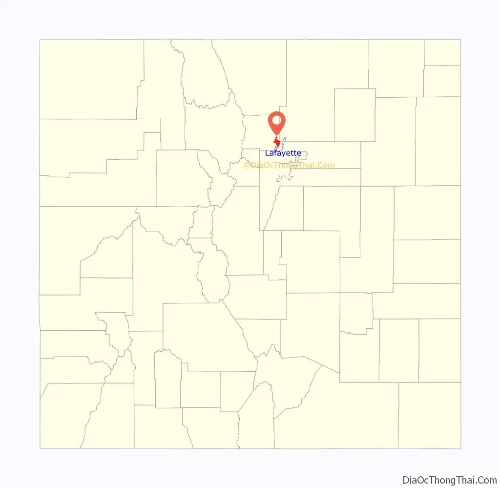
Lafayette location map. Where is Lafayette city?
History
Lafayette was founded in 1888 by Mary E. (Foote) Miller. She filed the original Town of Lafayette plat in January 1888 and sold the first residential lot – Lot 6, Block G, Town of Lafayette – in March 1888 to Hugh Hughes. In February 1889, the Town of Lafayette was incorporated.
Mary Miller and her husband, Lafayette Miller, had moved to the area to farm land they had purchased in March 1868 from Denver coal speculators Francis P. Heatly and Edward Chase. The farm also included land acquired by Mary’s brother, James B. Foote, and father, John B. Foote, via the Homestead Act in 1871. In 1874 the Millers moved to Boulder. Lafayette Miller ran a butcher shop and was a town trustee. Lafayette Miller died in Boulder in 1878, after which Mary Miller moved back to the farm with their six small children. In 1884 coal was discovered on the Miller farm, and in 1887 John H. Simpson acquired a coal lease from James B. Foote and sank the first Simpson Mine shaft, thereby starting the coal mining era. In 1888 Mary Miller designated 37 acres (0.15 km) of the farm for the town of Lafayette, which she named after her late husband. In July 1888 a second mine, the Cannon, went into operation and the first houses were built. Mary Miller submitted a revised 89 acres (0.36 km) plat for the town in 1889. Also in early 1889, Mary Miller leased the rights to mine coal for 12.5 cents per ton to Charles Spencer and John H. Simpson. The two commenced sinking the Spencer coal mine 200 yards west of the Simpson coal mine. On April 2, 1889, the town of Lafayette was incorporated. As stipulated in the original property deeds for the platting, no alcohol could be sold or distributed east of what is now known as Public Road. In 1904, the Lafayette Town Board mandated that the “alcohol clause” be added to all platted additions to Lafayette.
Lafayette quickly became a part of the coal-mining boom that all of eastern Boulder and southwestern Weld counties were experiencing, with the combined Spencer/Simpson mine being the largest and most productive. The Cannon floundered and failed to produce profitable quantities of coal. It closed in 1898. By 1914 Lafayette was a booming town with two banks and four hotels. Lafayette was also the location of one of the nation’s first distributed electrical grids powered by the Interurban Power Plant that served Louisville, Boulder, Longmont, and Fort Collins.
Mary Miller continued to be a leader in the community, especially in January 1900, when the town’s business district burned. She founded the Farmers’ & Miners’ State Bank with S.T. Hooper, C.C. Brown and G.C. Beaman in June 1892, which closed in August 1894. Mary Miller then formed the Lafayette Bank in 1900. She was elected president of the bank, and according to a Denver Post article reprinted in the Lafayette News and dated December 13, 1902, was “the only woman in the United States known to be president of a bank.” The bank closed in 1914 because of roughly $90,000 in bad loans to the striking United Mine Workers. Mary Miller remained devoted to the temperance movement and eventually ran on the 1913 Prohibition Party ticket for the U.S. Senate seat won by Gov. John F. Shafroth. She also ran for the state treasurer seat on the Prohibition Party ticket. Miller died in 1921 at her daughter-in-law’s home at 501 E. Cleveland Street.
Lafayette continued to thrive as a coal-mining town. Northern Coal Field miners, members of United Mine Workers, walked off the job in the aforementioned strike starting in April 1910. The United Mine Workers expanded the strike to all of Colorado in 1913. The Long Strike is nationally noted for the Ludlow Massacre of miners’ families by the National Guard in the Southern Coal Field near Trinidad, Colorado.
Until about 1915, residents of the city were largely caucasian Midwestern transplants and Western European coal miners who’d immigrated from England, Wales and Ireland. The 1900 and 1910 census show no families with Latino surnames residing in Lafayette. Coinciding with the start of the Long Strike of 1910–1914, the coal operators began recruiting strikebreaker workers who were immigrants from Eastern Europe and Mexico. United Mine Workers Lafayette Local 1388 meeting minutes show scant traces of Latino membership from 1903 until September 1913. Initially banned from membership, union locals realized during the Long Strike of 1910–1914 the necessity of forming labor alliances with native-born and immigrant Latinos. Entering their $10 annual Lafayette Local 1388 dues at the September 25, 1913, meeting were initiates Frank Gonzales, S. Gonzales, F.H. Gallegos, A. Dominguez, Guy Dominguez, Jesus Guzman, Gabriel Vigil, Teofila Tafoya, D. Romero, Ben Martinez, Juan Guerrero and Francisco Guerrero. After the strike, Rocky Mountain Fuel Company encouraged their employees in the Southern Coal Field, largely immigrants from Mexico and second- and third-generation residents of New Mexico and Colorado, to relocate to the Lafayette area. Those Latino families located in Serene initially then moved to Lafayette after the Columbine Mine closed. In the 1920s and 1930s sugar factories in surrounding counties also recruited Latino workers to harvest sugar beats. The 1920 census showed 1,800 Lafayette residents, with 25 individuals having Latino surnames.
In 1927, Lafayette’s coal miners walked off the job again, a strike nationally recognized as a great Wobbly (Industrial Workers of the World, a radical labor group) strike. The mining massacre resulted in the deaths of five Lafayette resident miners just northeast of town in the Columbine Mine massacre on November 27, 1927, in what is now the ghost town of Serene near Erie.
Another female financier came to the miners’ aid. Josephine Roche, the daughter of John J. Roche, the anti-labor president of the Rocky Mountain Fuel Company (RMFC) which owned many of the mines in the Lafayette area, used some shares of the company she had inherited from her father after his death in 1927, bought a controlling interest in the company, and immediately began the most labor-friendly mine operation in the United States. She became a top assistant to Franklin D. Roosevelt’s Secretary of Labor, Frances Perkins. Back in Lafayette, life became much better for the coal miners with the more labor-friendly management of the RMFC.
Coal mining declined as an industry from the 1930s through 1950s as natural gas replaced coal. The Black Diamond mine closed in 1956, and Lafayette became once more an agriculture-based community. As Denver and Boulder grew, residential growth in Lafayette increased. With the increase in residential growth, the farm-based economy changed and commercial, small industrial and manufacturing factors became more important. Lafayette’s ethnic diversity continued to expand with population growth. In 1940, 76 Hispanic or Latino adults were recorded as residing in Lafayette, with a total population of 2,062. By 2016, 4,400 (18 percent) of Lafayette’s 25,000 residents were Hispanic or Latino.
Industry
Not only did coal mined in Lafayette, Louisville, Marshall and Erie heat Denver’s growing number of households starting in the late 1880s, it also fueled Denver’s smelters, cotton mills, breweries, paper mills, shoe factories and power plants.
In 1899, the Colorado Inspector of Coal mines estimated that the 405-square-mile Northern Coal Field contained 2.56 billion tons of coal.
Up to the turn of the 20th century, Denver customers consumed most of the coal mined in the area as fast it could be hauled up from the tunnels. Lafayette coal mines were wired for telephones starting in 1891, almost 15 years before the rest of town, because the Denver coal dealers needed a quicker way to place orders.
The first recorded evidence of coal near Lafayette was made in the summer of 1864 by General Land Office surveyor Hiram Witter, who noted in his field survey notebook for Township 1 South, Range 69 West that “In the NE 1/4 of the NE 1/4 of Sec. 1 is an outcrop of coal 1 chain long (66 feet) and 4 ft. thick, extent unknown.” This is where Baseline Road crosses over Coal Creek east of Lafayette. Witter drew a line through a notation in his notebook that the “coal bank had been opened” and replaced it with “coal outcrop.” The notation “had been opened” may indicate that the coal was being “worked” by settlers.
Area pioneers gathered coal from surface outcrops to use for home heating. One outcropping of coal, mentioned by Mary Miller as being discovered in 1872, was located at about the center of the Foote-Miller Farm and mined by the Cambro / Pluto slope mine from 1917 to 1928.
Mary Miller and her brother, James B. Foote, leased some of their farm land north of the Cambro / Pluto coal outcrop first to John H. Simpson, who would sink two separate Lafayette coal mines – the Simpson in late 1887 and the Spencer in 1889 – then to James Cannon Jr. in 1888. The Standard mine, about a mile east of the Spencer-Simpson mines, was also sunk in 1887.
By the early 1880s, railroads were the largest consumer of Colorado coal, and Lafayette joined the coal mining bandwagon when Colorado & Southern Railway completed a 3-mile spur from Louisville in 1889, paid for by the newly formed Spencer-Simpson Coal Company. That spur eventually connected to Erie. The railroad links to Erie, Louisville, Lafayette and Marshall coal mines nurtured the industrialization of coal mining.
The coal under Lafayette and most of the area northwest of Denver known as the Northern Coal Field or Northern Field is sub-bituminous coal, a soft, friable coal that was highly suited for household heating stoves and for firing steam boilers. Sub-bituminous coal, also called lignite, could sometimes spontaneously combust when it came in contact with air.
A significant factor in Lafayette’s coal mining history were the three successive Denver-based coal conglomerates – United Coal Company, Northern Coal Co. and Rocky Mountain Fuel Company – that controlled coal production and employed thousands of local coal miners. From 1891, when United Coal was formed, to 1944, when Rocky Mountain Fuel Co. reorganized and closed most of its mines, the coal operators influenced not only how mass-scale coal was mined, marketed and sold, but how communities adjacent to the coal mines – Lafayette, Louisville, Erie, Canfield and Marshall developed.
In 1898, only 5 percent of coal mined in Lafayette was used for home heating, the rest went to Denver power plants, manufacturers and steam locomotives. From June 1, 1897, to May 31, 1898, over 680,000 tons of coal were shipped to Denver from Northern Field coal mines. In the 1920s and 1930s, Great Western Sugar in Longmont and the Valmont Generating Station in Boulder were primary coal consumers. By the mid-1940s, most of the coal mines had closed.
Most of the mines associated with the bankrupt Rocky Mountain Fuel Co., including the Columbine, were closed in 1946, after which area mines were owned and run by independent owners. Lafayette’s last mine, the Black Diamond, located at today’s U.S. 287 and Baseline Road, closed in 1956. The independently owned Hi-Way mine in Louisville and the Gorham in Superior closed in 1955. Erie’s Eagle mine was the last coal mine to operate in the Northern Coal Field. It closed in 1975.
Very little evidence of Lafayette’s coal mining past remains today. A few structures moved from the mine camps dot Old Town and the Lafayette Miner’s Museum retains some of the tools of the coal mining trade.
Labor
The extended and sometimes violent coal miner’s strike of 1910–1914, called “The Long Strike,” put Lafayette at the forefront of unionized labor’s struggle for fair wages. Union miners belonging to United Mine Workers of America were determined to get fair wages and safety improvements in a dangerous workplace, while coal mine operators wanted the mined coal to continue flowing.
In the Northern Field, the Long Strike started April 1, 1910. United Mine Workers of America miners wanted an increase of 3 cents per ton for machine mining, 4 cents for pick mining, a 5.55 percent increase for day wages and dead work, an 8-hour work day, selection of checkweighmen, union recognition and enforcement of state labor and mine safety laws.
At a convention in Trinidad in September 1913, United Mine Workers delegates from across the state endorsed a statewide strike, which became the greatest labor upheaval in Colorado history. Coal miners statewide accused operators of favoring profits over the safety of workers, and their demands included coal operators’ recognition of the union, an increase in wages of 10 percent, an eight-hour workday for all classes of labor in or around the coal mines, payment for deadwork, the right to have union-paid weigh bosses, the right of the miners to trade wherever they pleased (instead of company stores), the right to choose their own boarding place and their own doctor, the enforcement of the Colorado mining laws and “total abolition of the notorious and criminal guard system.”
During the strike, Rocky Mountain Fuel Co., owners of the Simpson and Vulcan mines in Lafayette, the Acme mine in Louisville and the Industrial mine in Superior, recruited and paid the railroad fare for nonunion coal miners from W. Virginia, Tennessee, Kentucky and Joplin, Missouri. Strikebreakers were labeled either “scabs” or “blacklegs.”
Those on strike, members of United Mine Workers, were called “rednecks” because they wore red handkerchiefs around their necks. After asking Boulder County Sheriff M.P. Capp to deputize up to 75 company men to help guard the mines, which he refused, Northern Coal and Coke Co. hired West Virginia-based Baldwin-Felts Detective Agency guards to protect the company’s assets. The Baldwin-Felts guards, known in southern coal states for protecting coal trains and payroll shipments, were hired to prevent trespassing on company property.
In September 1910 coal operators, including RM Fuel’s E.E. Shumway, asked Denver District Court Judge Greeley W. Whitford to issue an injunction to restrain striking miners from gathering in groups, posting notices or interfering with nonunion operation of the mines. Whitford agreed to the injunction and appointed Baldwin-Felts detectives as enforcers.
Elected in November 1912, Colorado Governor Elias M. Ammons sent the Colorado militia to Boulder County to quell the strike violence after a September 17, 1913, gun battle raged on the east side of Lafayette. Union sympathizers said that nonunion employees at the Simpson mine, “the Bulgarians,” fired indiscriminately at union members returning from work at an adjacent union mine. The nonunion workers claim that union sympathizers started the fight by throwing rocks through one of the company buildings in the Simpson compound.
All sides agreed that numerous volleys of gunshots, estimated at over 1,000 rounds, originated in both the stockade – shooting toward downtown Lafayette – and in downtown Lafayette shooting toward the stockade. One person inside the stockade was injured by a gunshot, and one horse was killed.
After U.S. troops brought in to referee the strike encamped near the Lafayette cemetery on October 28, 1913, they proceeded to confiscate all guns in Lafayette, even searching homes room-by-room. The following week, children of union men refused to go to school with two boys whose fathers had scabbed the previous summer.
The Long Strike was called off by the UMWA in late 1914. The large Colorado coal operators who’d refused all of the miners’ demands, Rocky Mountain Fuel Co. and Colorado Fuel and Iron, agreed only to rehire the miners that went on strike. The general consensus was that the UMWA’s 1913–1914 statewide strike didn’t accomplish much, and it was decades before the union regained its influence in Colorado.
Edward Lawrence Doyle (1886–1954), Lafayette resident from 1908 to 1912 and UMWA Dist. 15 secretary-treasurer based in Denver from 1912 to 1917, is better known for his involvement in the fateful 1914 Ludlow Massacre, where he played a key role in communicating to national media the union’s perspective of the killings. As part of that job, he corresponded regularly with labor activist Mother Jones and with author Upton Sinclair, who wrote “King Coal,” an exposé on the dangerous conditions Colorado coal miners faced. Doyle was entrusted by Sinclair to proofread “King Coal” for accuracy prior to its release in 1917.
In 1909, Doyle worked as a checkweighman at the Capitol mine east of Lafayette where he advocated for miners’ safety, including dogging the mine’s owner to remove snow and ice that regularly blocked the mine’s escape shaft after snow storms. Doyle worked his way into leadership of Lafayette Local 1388 during the first few years of the Long Strike, where he organized the group’s civil disobedience efforts. Doyle aggressively rooted out turncoat union members hired by coal operators to spy on the organization. He also planted two of his own union men, hired from out-of-state, who posed as scabs in each local coal mine.
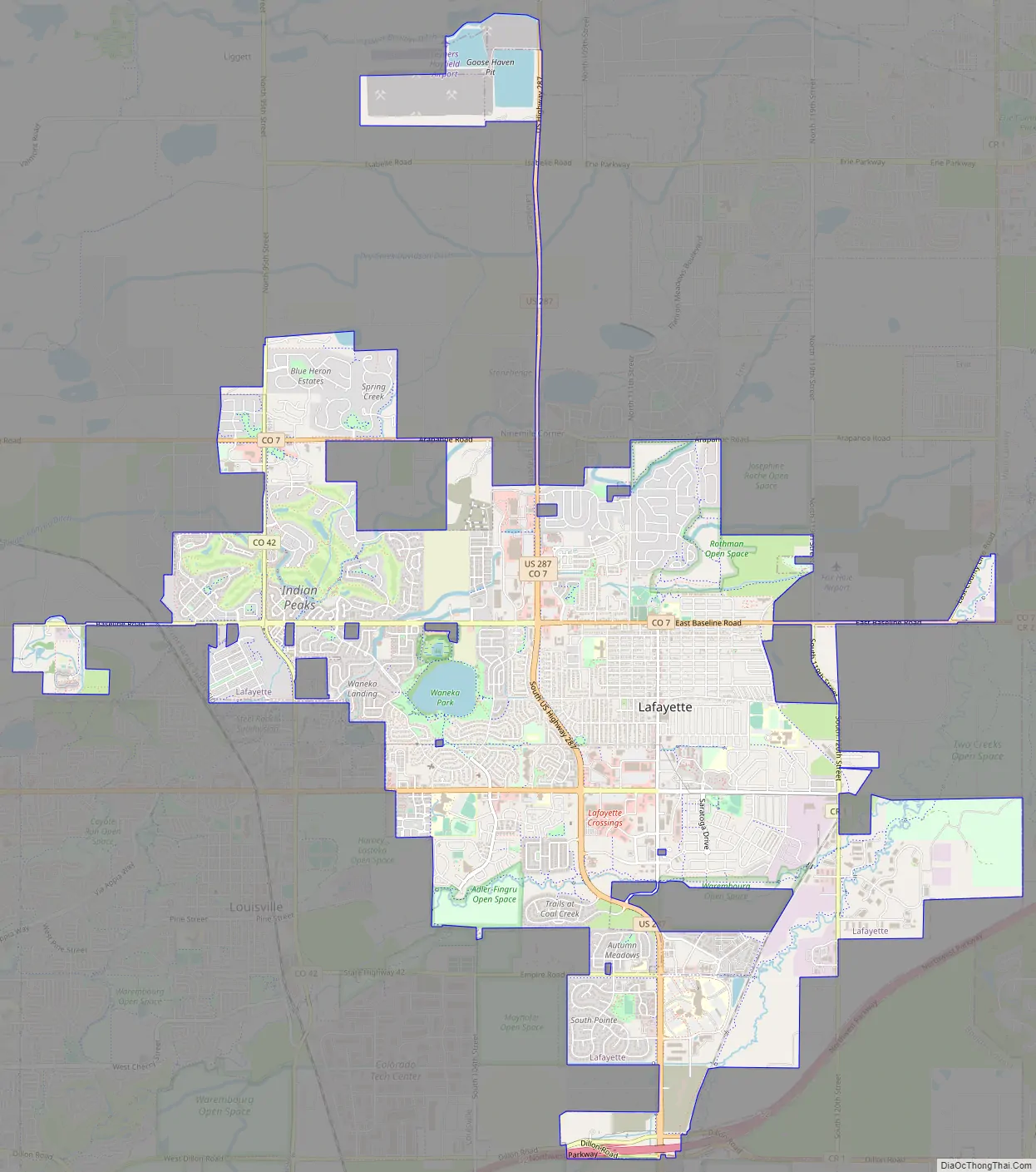
Lafayette Road Map
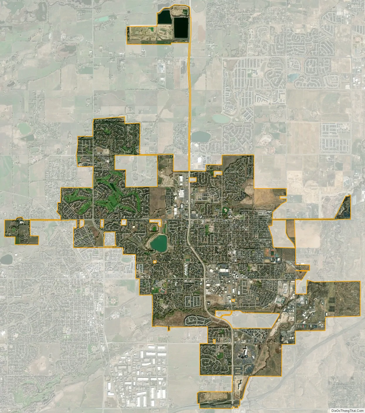
Lafayette city Satellite Map
Geography
Lafayette is located in southeastern Boulder County at 39°59′42″N 105°6′2″W / 39.99500°N 105.10056°W / 39.99500; -105.10056 (39.995, −105.100556). It is bordered by the town of Erie to the north and east, by the city of Broomfield to the east and south, and by Louisville to the southwest. U.S. Highway 287 is the main road through the city, leading north to Longmont and south to Broomfield and Denver. State Highway 7 leads east from Lafayette to Brighton and west to Boulder. There is also an exit off Interstate 25 to the city.
According to the United States Census Bureau, Lafayette has a total area of 9.3 square miles (24 km), of which 9.3 square miles (24 km) is land and 0.15 square miles (0.4 km), or 1.50%, is water.
See also
Map of Colorado State and its subdivision:- Adams
- Alamosa
- Arapahoe
- Archuleta
- Baca
- Bent
- Boulder
- Broomfield
- Chaffee
- Cheyenne
- Clear Creek
- Conejos
- Costilla
- Crowley
- Custer
- Delta
- Denver
- Dolores
- Douglas
- Eagle
- El Paso
- Elbert
- Fremont
- Garfield
- Gilpin
- Grand
- Gunnison
- Hinsdale
- Huerfano
- Jackson
- Jefferson
- Kiowa
- Kit Carson
- La Plata
- Lake
- Larimer
- Las Animas
- Lincoln
- Logan
- Mesa
- Mineral
- Moffat
- Montezuma
- Montrose
- Morgan
- Otero
- Ouray
- Park
- Phillips
- Pitkin
- Prowers
- Pueblo
- Rio Blanco
- Rio Grande
- Routt
- Saguache
- San Juan
- San Miguel
- Sedgwick
- Summit
- Teller
- Washington
- Weld
- Yuma
- Alabama
- Alaska
- Arizona
- Arkansas
- California
- Colorado
- Connecticut
- Delaware
- District of Columbia
- Florida
- Georgia
- Hawaii
- Idaho
- Illinois
- Indiana
- Iowa
- Kansas
- Kentucky
- Louisiana
- Maine
- Maryland
- Massachusetts
- Michigan
- Minnesota
- Mississippi
- Missouri
- Montana
- Nebraska
- Nevada
- New Hampshire
- New Jersey
- New Mexico
- New York
- North Carolina
- North Dakota
- Ohio
- Oklahoma
- Oregon
- Pennsylvania
- Rhode Island
- South Carolina
- South Dakota
- Tennessee
- Texas
- Utah
- Vermont
- Virginia
- Washington
- West Virginia
- Wisconsin
- Wyoming


