The City of Northglenn is a home rule municipality located in Adams and Weld counties, Colorado, United States. Northglenn is a part of the Denver–Aurora–Lakewood, CO Metropolitan Statistical Area. As of the 2020 census the city’s population was 38,131. It was built as a master planned community in 1959 by Jordon Perlmutter.
The city is directly connected to Downtown Denver via the Regional Transportation District N Line at the Northglenn/112th station.
| Name: | Northglenn city |
|---|---|
| LSAD Code: | 25 |
| LSAD Description: | city (suffix) |
| State: | Colorado |
| County: | Adams County, Weld County |
| Incorporated: | April 19, 1969 |
| Elevation: | 5,377 ft (1,639 m) |
| Total Area: | 7.44 sq mi (19.28 km²) |
| Land Area: | 7.35 sq mi (19.04 km²) |
| Water Area: | 0.09 sq mi (0.24 km²) |
| Total Population: | 38,131 |
| Population Density: | 5,100/sq mi (2,000/km²) |
| ZIP code: | 80233, 80234, 80241, 80260 |
| Area code: | Both 303 and 720 |
| FIPS code: | 0854330 |
| GNISfeature ID: | 0181266 |
| Website: | www.northglenn.org |
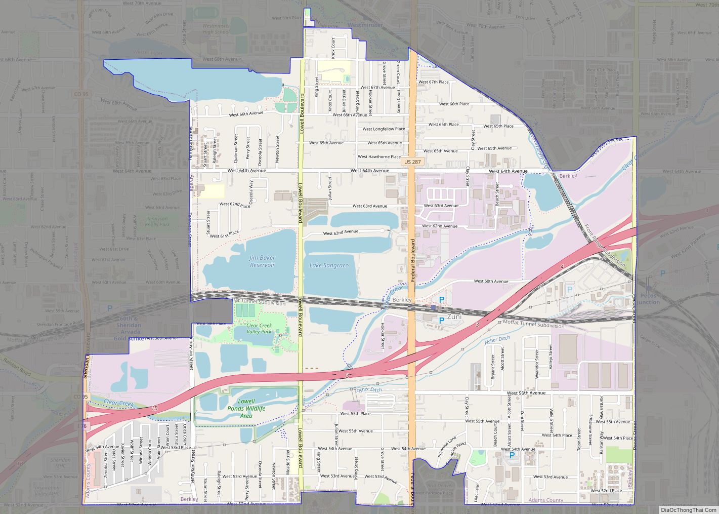
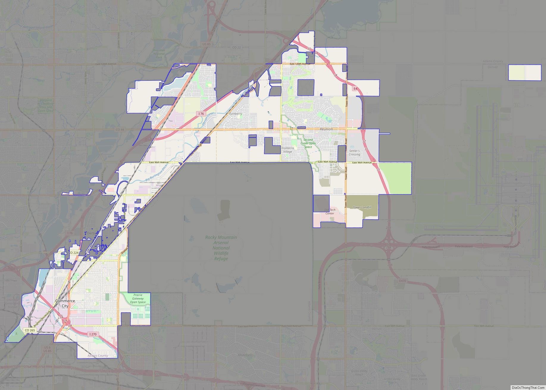
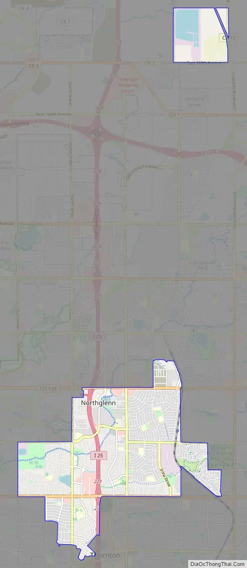
Online Interactive Map
Click on ![]() to view map in "full screen" mode.
to view map in "full screen" mode.
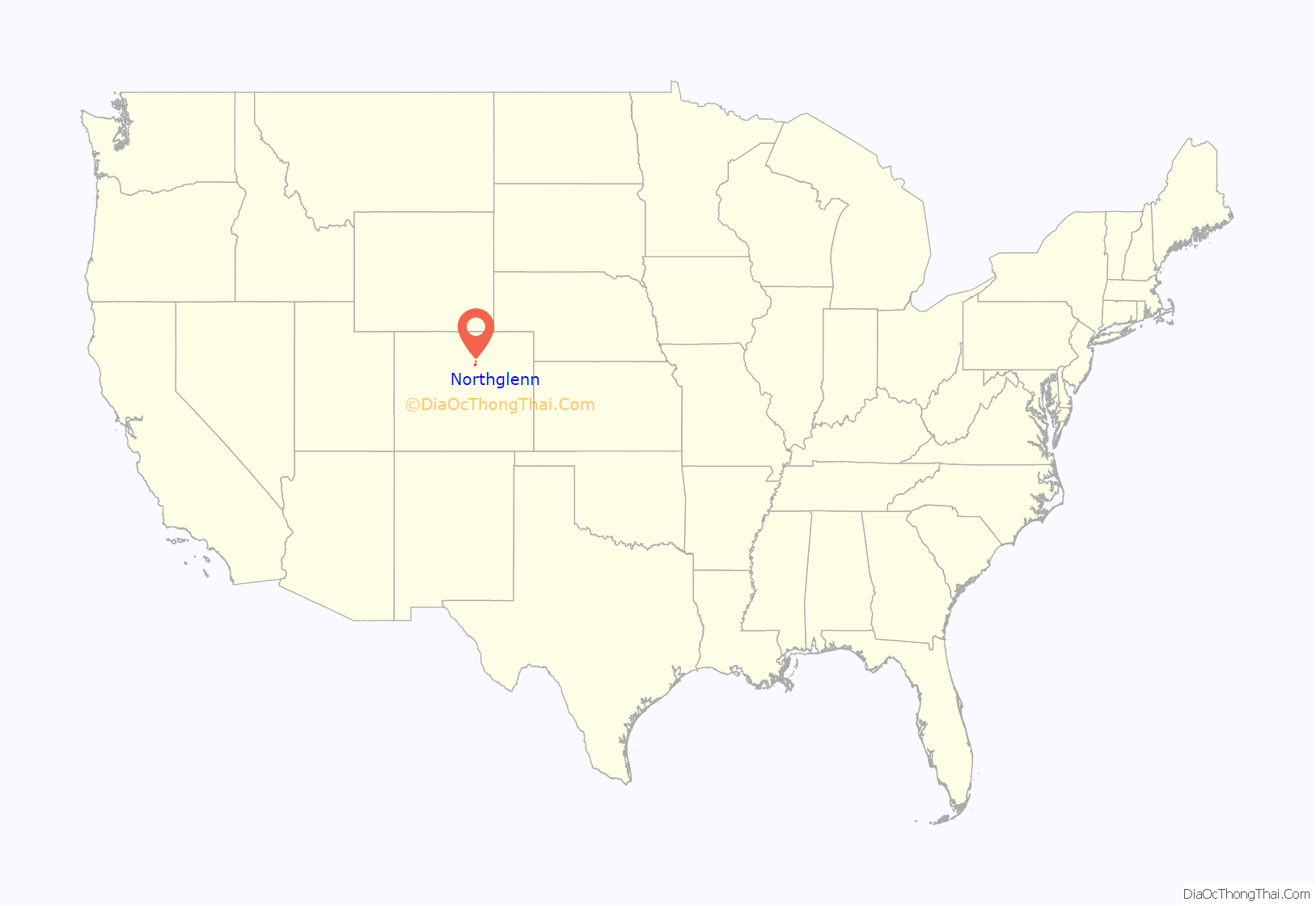
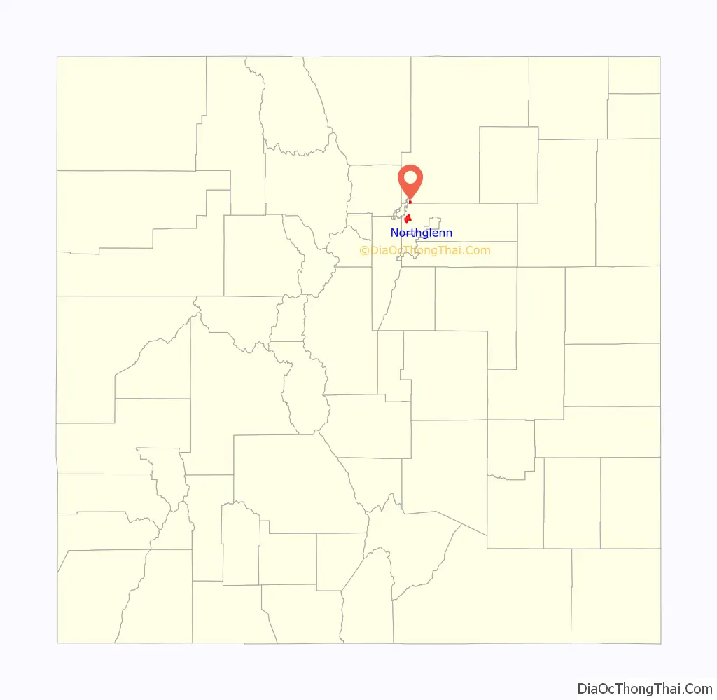
Northglenn location map. Where is Northglenn city?
Northglenn Road Map
Northglenn city Satellite Map
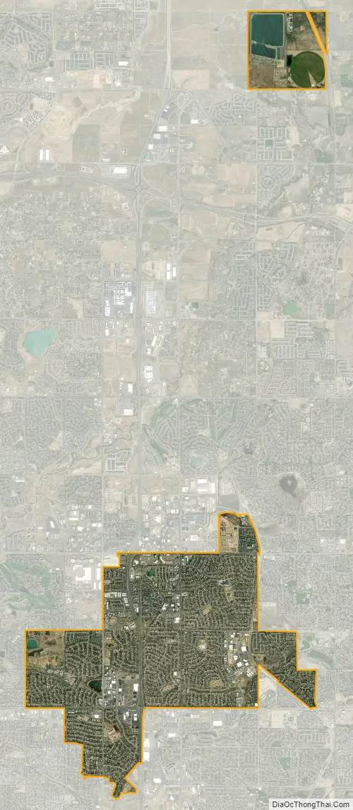
Geography
Northglenn is located at 39°53′51″N 104°58′55″W / 39.89750°N 104.98194°W / 39.89750; -104.98194 (39.897418, -104.981891).
According to the United States Census Bureau, the city has a total area of 7.5 square miles (19.4 km), of which 7.4 square miles (19.2 km) is land and 0.077 square miles (0.2 km), or 1.23%, is water.
Climate
According to the Köppen Climate Classification system, Northglenn has a humid subtropical climate, abbreviated “Cfa” on climate maps. The hottest temperature recorded in Northglenn was 108 °F (42 °C) on August 2, 2008, while the coldest temperature recorded was −24 °F (−31 °C) on December 22, 1990.
See also
Map of Colorado State and its subdivision:- Adams
- Alamosa
- Arapahoe
- Archuleta
- Baca
- Bent
- Boulder
- Broomfield
- Chaffee
- Cheyenne
- Clear Creek
- Conejos
- Costilla
- Crowley
- Custer
- Delta
- Denver
- Dolores
- Douglas
- Eagle
- El Paso
- Elbert
- Fremont
- Garfield
- Gilpin
- Grand
- Gunnison
- Hinsdale
- Huerfano
- Jackson
- Jefferson
- Kiowa
- Kit Carson
- La Plata
- Lake
- Larimer
- Las Animas
- Lincoln
- Logan
- Mesa
- Mineral
- Moffat
- Montezuma
- Montrose
- Morgan
- Otero
- Ouray
- Park
- Phillips
- Pitkin
- Prowers
- Pueblo
- Rio Blanco
- Rio Grande
- Routt
- Saguache
- San Juan
- San Miguel
- Sedgwick
- Summit
- Teller
- Washington
- Weld
- Yuma
- Alabama
- Alaska
- Arizona
- Arkansas
- California
- Colorado
- Connecticut
- Delaware
- District of Columbia
- Florida
- Georgia
- Hawaii
- Idaho
- Illinois
- Indiana
- Iowa
- Kansas
- Kentucky
- Louisiana
- Maine
- Maryland
- Massachusetts
- Michigan
- Minnesota
- Mississippi
- Missouri
- Montana
- Nebraska
- Nevada
- New Hampshire
- New Jersey
- New Mexico
- New York
- North Carolina
- North Dakota
- Ohio
- Oklahoma
- Oregon
- Pennsylvania
- Rhode Island
- South Carolina
- South Dakota
- Tennessee
- Texas
- Utah
- Vermont
- Virginia
- Washington
- West Virginia
- Wisconsin
- Wyoming