Severance is a Statutory Town in Weld County, Colorado, United States. The population was 7683 at the 2020 census. The town is located on the Colorado Eastern Plains, northwest of Greeley, a crossroads of county roads.
A post office in Severance has been in operation since 1894. The community was named after David Severance, a pioneer settler.
Rocky Mountain oysters, a regional dish, is served at Bruce’s Bar, a local landmark.
Severance is also the home of KRKA radio, an Air 1 station with a far-reaching signal which can be heard as far away as Denver.
| Name: | Severance town |
|---|---|
| LSAD Code: | 43 |
| LSAD Description: | town (suffix) |
| State: | Colorado |
| County: | Weld County |
| Incorporated: | November 20, 1920 |
| Elevation: | 4,888 ft (1,490 m) |
| Total Area: | 9.19 sq mi (23.79 km²) |
| Land Area: | 9.07 sq mi (23.49 km²) |
| Water Area: | 0.12 sq mi (0.31 km²) |
| Total Population: | 7,683 |
| Population Density: | 840/sq mi (320/km²) |
| ZIP code: | 80546 (PO Box) |
| Area code: | 970 |
| FIPS code: | 0869150 |
| GNISfeature ID: | 0180531 |
| Website: | townofseverance.org |
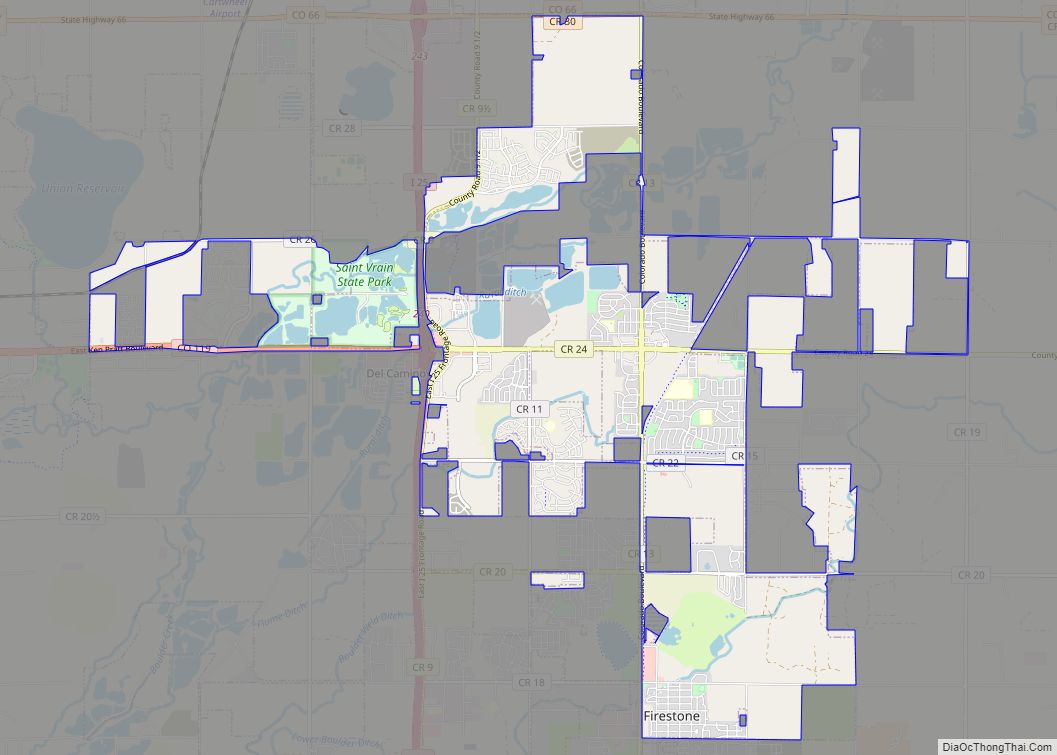
Online Interactive Map
Click on ![]() to view map in "full screen" mode.
to view map in "full screen" mode.
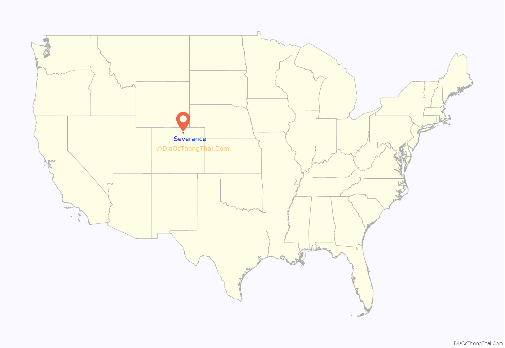
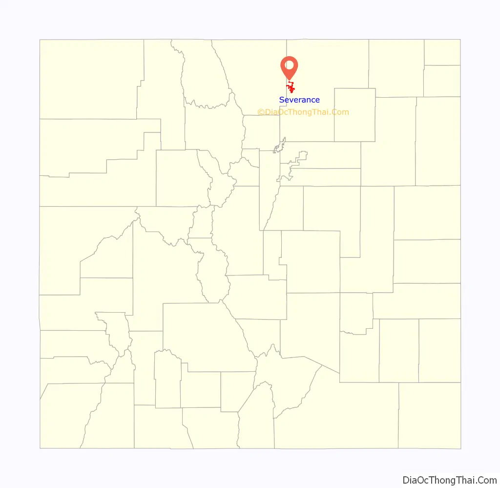
Severance location map. Where is Severance town?
Severance Road Map
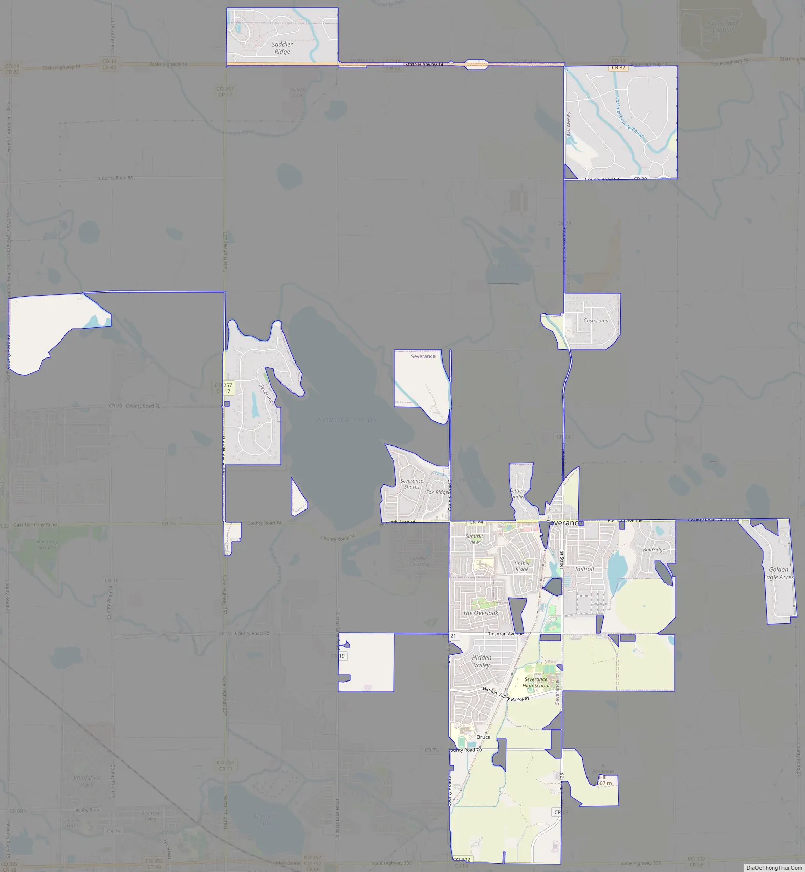
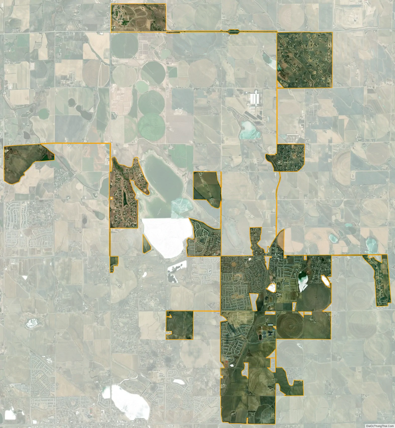
Severance city Satellite Map
Geography
Severance is located at 40°32′07″N 104°51′03″W / 40.535208°N 104.850761°W / 40.535208; -104.850761.
According to the United States Census Bureau, the town has a total area of 2.1 square miles (5.4 km), of which, 2 square miles (5.2 km) of it is land and 0.1 square miles (0.26 km) of it (3.27%) is water.
See also
Map of Colorado State and its subdivision:- Adams
- Alamosa
- Arapahoe
- Archuleta
- Baca
- Bent
- Boulder
- Broomfield
- Chaffee
- Cheyenne
- Clear Creek
- Conejos
- Costilla
- Crowley
- Custer
- Delta
- Denver
- Dolores
- Douglas
- Eagle
- El Paso
- Elbert
- Fremont
- Garfield
- Gilpin
- Grand
- Gunnison
- Hinsdale
- Huerfano
- Jackson
- Jefferson
- Kiowa
- Kit Carson
- La Plata
- Lake
- Larimer
- Las Animas
- Lincoln
- Logan
- Mesa
- Mineral
- Moffat
- Montezuma
- Montrose
- Morgan
- Otero
- Ouray
- Park
- Phillips
- Pitkin
- Prowers
- Pueblo
- Rio Blanco
- Rio Grande
- Routt
- Saguache
- San Juan
- San Miguel
- Sedgwick
- Summit
- Teller
- Washington
- Weld
- Yuma
- Alabama
- Alaska
- Arizona
- Arkansas
- California
- Colorado
- Connecticut
- Delaware
- District of Columbia
- Florida
- Georgia
- Hawaii
- Idaho
- Illinois
- Indiana
- Iowa
- Kansas
- Kentucky
- Louisiana
- Maine
- Maryland
- Massachusetts
- Michigan
- Minnesota
- Mississippi
- Missouri
- Montana
- Nebraska
- Nevada
- New Hampshire
- New Jersey
- New Mexico
- New York
- North Carolina
- North Dakota
- Ohio
- Oklahoma
- Oregon
- Pennsylvania
- Rhode Island
- South Carolina
- South Dakota
- Tennessee
- Texas
- Utah
- Vermont
- Virginia
- Washington
- West Virginia
- Wisconsin
- Wyoming