Windsor is a home rule municipality in Larimer and Weld counties in the U.S. state of Colorado. According to the 2020 census, the population of the town was 32,716. Windsor is located in the Northern Colorado region.
| Name: | Windsor town |
|---|---|
| LSAD Code: | 43 |
| LSAD Description: | town (suffix) |
| State: | Colorado |
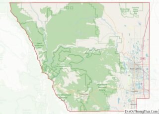
| County: | Larimer County, Weld County |
| Incorporated: | April 2, 1890 |
| Elevation: | 4,797 ft (1,462 m) |
| Total Area: | 26.26 sq mi (68.02 km²) |
| Land Area: | 25.08 sq mi (64.96 km²) |
| Water Area: | 1.18 sq mi (3.06 km²) |
| Total Population: | 32,716 |
| Population Density: | 1,276.5/sq mi (492.9/km²) |
| ZIP code: | 80528, 80550-80551 |
| Area code: | 970 |
| FIPS code: | 0885485 |
| GNISfeature ID: | 0204693 |
Online Interactive Map
Click on ![]() to view map in "full screen" mode.
to view map in "full screen" mode.
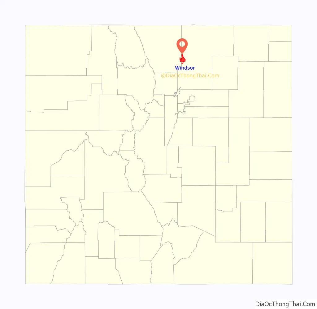
Windsor location map. Where is Windsor town?

History
In 1873, a settler named J.L. Hilton built a small house situated half-way between Greeley and Fort Collins. The “half-way” house, as it became known, directed travelers along a route, which was soon adopted by the Greeley, Salt Lake and Pacific railway. The railroad brought investors and farmers to Windsor in increasing numbers. Windsor’s rich alluvial plains lent themselves to extensive wheat production and the establishment of one of the town’s first commercial enterprises, a flour mill, which through a subsequent fire in 1899, was rebuilt and became the Windsor Milling and Elevator Company.
A rich wheat farming district, the area around Windsor first drew permanent residents in the early 1870s. Two factors were to play a critical role in stimulating Windsor’s early development: irrigation and the railroad. Irrigation increased crop variety and production and the railroad shipped this bounty to market. The town was platted in 1882, the same year the Windsor Railroad Depot was built, and incorporated in 1890. It was named for the Rev. Samuel Asa Windsor. By 1900, tariffs on foreign sugar had created a market for new sources of sugar. Research in the improved cultivation of sugar beets was taking place at Colorado Agricultural College in Fort Collins, and the capital to advance production and manufacture of beet sugar was coming together. In 1903 a factory for producing sugar from sugar beets was built in Windsor. Sugar beet cultivation required large numbers of “stoop laborers,” a need that was met by ethnic German immigrants from Russia. With large families and a strong work ethic, the German-Russians who settled in Windsor and other sugar beet areas would achieve financial success within one generation and own the highest producing beet farms. The Great Western Sugar Company fueled Windsor’s economy through the mid-1960s, when the Windsor factory closed. Plentiful water and land drew Kodak to Windsor where it opened a manufacturing plant on the heels of the sugar factory’s closing.
Kodak’s opening spurred economic development in the town, and a population surge as the sugar beet factory closed. Later in the 1980s Metal Container Corporation (MCC) opened a can factory and Deline Box Company opened a factory, which closed in December 2010, that primarily served the Budweiser facility in Fort Collins, Colorado.
In the last two decades, its central location among the population centers of northern Colorado, together with its proximity to Interstate 25, have made it the site of rapid urban growth, particularly on the western edge of town, as it grows towards the interchange on I-25. In the 1990s, the town limits were westward into Larimer County. The incorporated town limits west of Interstate 25 are now contiguous with Loveland, and are separated from southeast Fort Collins by the Fossil Creek Open Space public lands of Larimer County acquired through a county-wide vote-approved sales tax.
In this century, there has been significant industrial development on the southeast side of town. Vestas has a wind turbine factory, and several related companies, Hexcel and Ice Energy have headquarters in Windsor. Owens Illinois has a glass factory that primarily serves the Budweiser facility in Fort Collins, Colorado. Windsor has also attracted digital services providers in recent years, such as farm management software provider Agworld whose North American headquarters is based here.
2008 tornado
On May 22, 2008 at approximately 11:50 a.m., a tornado devastated the town and many areas of Weld County and Larimer County, killing one camper in his RV, and injuring 14 other people in its wake. The National Weather Service tornado damage assessments conducted on Friday May 23 and Saturday May 24 documented large areas of damage. On the Enhanced Fujita scale there were pockets of EF3 damage especially near the Missile Silo Park Campground west of Greeley and to homes and businesses in eastern Windsor. Wind estimates in the heavily damaged areas were as high as 130 to 150 mph. While the time of year and location of the tornado were not unusual, the west to northwest path of the tornado was highly unusual, and the tornado occurred earlier in the day than is typical for the area. The storm was preceded by golf-ball to baseball sized hail and heavy rain, with hail damaging a much larger area than the actual tornado.
In addition to the damages to homes, the tornado damaged many businesses and government buildings. The winds knocked over 15 railroad cars, vehicles, and semi trucks. The tornado hit the Windmill Daycare Center; the staff and children all survived, suffering only minor cuts and bruises. The tornado caused extensive damage to the Windsor Milling and Elevator Co. Building, a building on the National Register of Historic Places. It would take nearly 10 years for the damage to be repaired. The tornado devastated many of the town’s park and recreation facilities, including the cemetery, ball fields, swimming pool, the town’s main park, and a new arts and heritage center.
The Red Cross housed several hundred individuals and arranged for housing of livestock in the immediate aftermath of the tornado. Governor Bill Ritter visited the Windsor area and declared a local state of emergency. The Colorado National Guard was dispatched to assist and protect the town. On May 26, 2008, President George W. Bush designated the area as a Federal disaster area.
The tornado caused $193.5 million in damage from about 24,000 auto and homeowner claims. The U. S. Small Business Administration (SBA) approved more than $3 million in disaster loans to individuals and businesses in Weld County who suffered damage from the storm.
Windsor Road Map
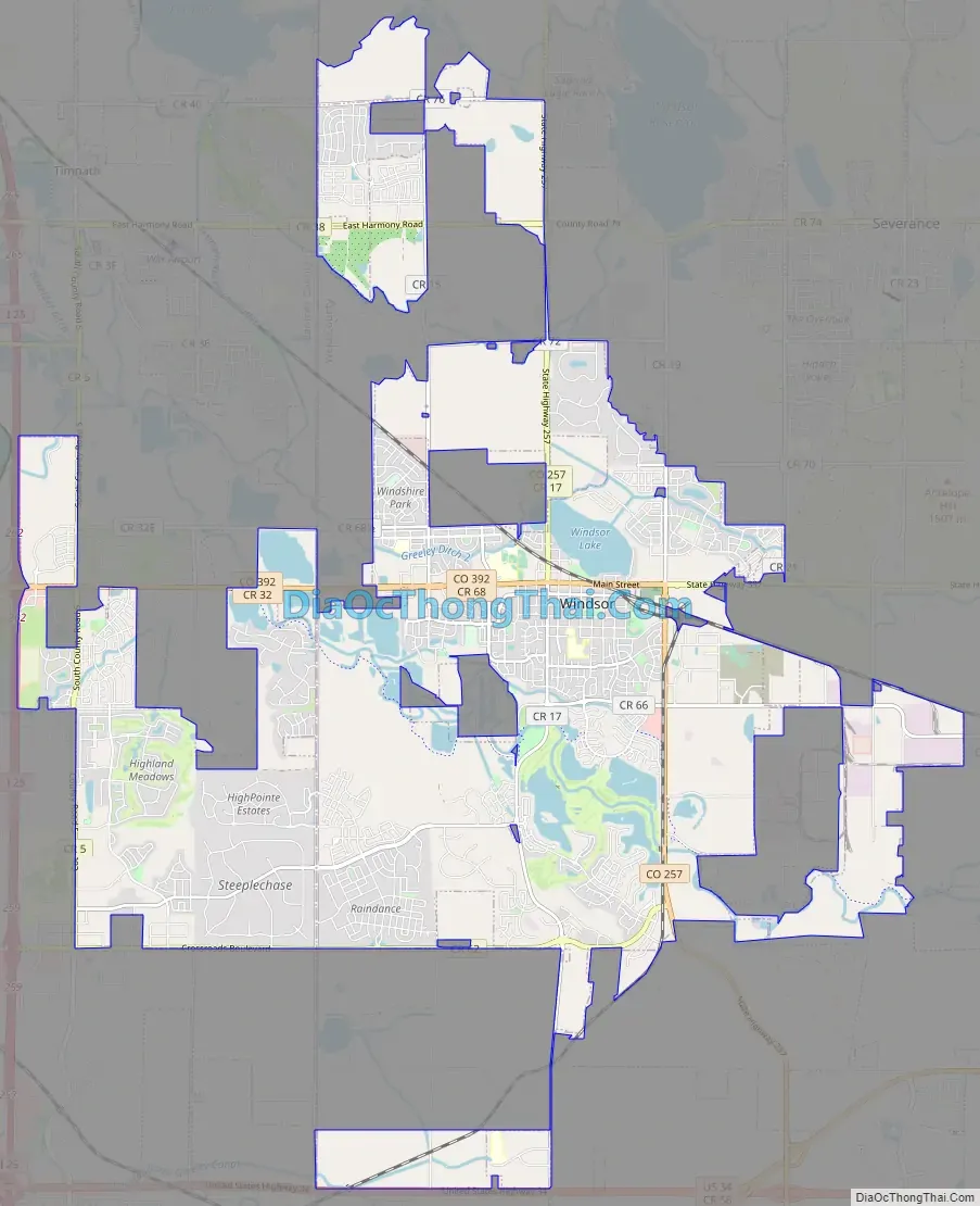
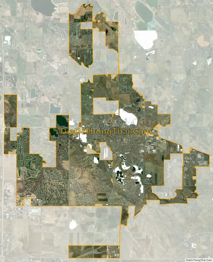
Windsor city Satellite Map
Geography
According to the United States Census Bureau, the city has a total area of 25.6 square miles (66 km), of which, 24.33 square miles (63.0 km) of it is land and 1.27 square miles (3.3 km) of it is water.
The Cache la Poudre River runs through the west and south sides of town.
The main business district of town is east-west, along State Highway 392, which also serves as Windsor’s Main Street. The BNSF line runs north of Main Street. The historic early grid of the town extends for roughly six blocks north and south of Main, and less than 10 blocks east and west, with a vibrant square green, called Main Park southeast of downtown. The park is surrounded by residences, and by the Town Hall (formerly Park School), at the north end.
Commercial development extends to the Water Valley development, along State Highway 257, near the intersection with Windsor Lake, a small reservoir in the irrigation system of Weld County, is one block north of the BNSF tracks. The lake is a popular spot for fishing. In the last decade, a 2.25 mile bike path was completed which circumscribes the lake. In addition to this reservoir, there are a number of other lakes and reservoirs that are former gravel mines along the Cache la Poudre river. These lakes have spurred housing developments and a golf course along their banks.
The Poudre Trail bicycle and pedestrian trail along the north bank of the Poudre includes a segment within the town of Windsor that connects the town with the City of Greeley.
Climate
Windsor experiences a semi-arid climate (Köppen BSk). High temperatures are generally around 85 °F (29 °C) in the summer and 42 °F (5 °C) in the winter, although there is significant variation. The hottest days generally occur in late July and the coldest in January. Nighttime lows are near 57 °F (14 °C) in the summer and around 15 °F (-9 °C) in the winter. Record high temperatures of 103 °F (39 °C) have been recorded, as have record low temperatures of -41 °F (-40 °C). The first freeze typically occurs around September 17, and the last often occurs in mid-May. The most precipitation typically occurs in May.
Extratropical cyclones which disrupt the weather for the eastern two-thirds of the US often originate in or near Colorado, which means Windsor does not experience many fully developed storm systems. Thunderstorms are frequent during summer afternoons. Windsor typically experience between 6 and 12 hail days per year and one of the highest concentrations of tornadic activity anywhere. The area where Colorado, Nebraska and Wyoming meet receives the most hail of any location in the United States.
Some days in the winter and spring can be warm and extremely dry, with Chinook winds often raising temperatures to near 70 °F (21 °C) in January and February, and sometimes to near 90 °F (32 °C) in April. Windsor’s elevation and low year-round humidity means that nighttime low temperatures are practically never above 68 °F (20 °C), even in the very hottest part of the summer. The diurnal temperature range is usually rather wide, with a 50-degree (Fahrenheit) difference between daytime high and nighttime low not uncommon, especially in the spring and fall months. Rapid fluctuation in temperature is also common – a sunny 80 °F (27 °C) October afternoon can easily give way to a 28 °F (-2 °C) blizzard within 12 hours.
See also
Map of Colorado State and its subdivision:- Adams
- Alamosa
- Arapahoe
- Archuleta
- Baca
- Bent
- Boulder
- Broomfield
- Chaffee
- Cheyenne
- Clear Creek
- Conejos
- Costilla
- Crowley
- Custer
- Delta
- Denver
- Dolores
- Douglas
- Eagle
- El Paso
- Elbert
- Fremont
- Garfield
- Gilpin
- Grand
- Gunnison
- Hinsdale
- Huerfano
- Jackson
- Jefferson
- Kiowa
- Kit Carson
- La Plata
- Lake
- Larimer
- Las Animas
- Lincoln
- Logan
- Mesa
- Mineral
- Moffat
- Montezuma
- Montrose
- Morgan
- Otero
- Ouray
- Park
- Phillips
- Pitkin
- Prowers
- Pueblo
- Rio Blanco
- Rio Grande
- Routt
- Saguache
- San Juan
- San Miguel
- Sedgwick
- Summit
- Teller
- Washington
- Weld
- Yuma
- Alabama
- Alaska
- Arizona
- Arkansas
- California
- Colorado
- Connecticut
- Delaware
- District of Columbia
- Florida
- Georgia
- Hawaii
- Idaho
- Illinois
- Indiana
- Iowa
- Kansas
- Kentucky
- Louisiana
- Maine
- Maryland
- Massachusetts
- Michigan
- Minnesota
- Mississippi
- Missouri
- Montana
- Nebraska
- Nevada
- New Hampshire
- New Jersey
- New Mexico
- New York
- North Carolina
- North Dakota
- Ohio
- Oklahoma
- Oregon
- Pennsylvania
- Rhode Island
- South Carolina
- South Dakota
- Tennessee
- Texas
- Utah
- Vermont
- Virginia
- Washington
- West Virginia
- Wisconsin
- Wyoming