Winter Park is a home rule municipality in Grand County, Colorado, United States. The permanent population was 1,033 at the 2020 census, although with 2,572 housing units within the town limits the seasonal population can be much higher.
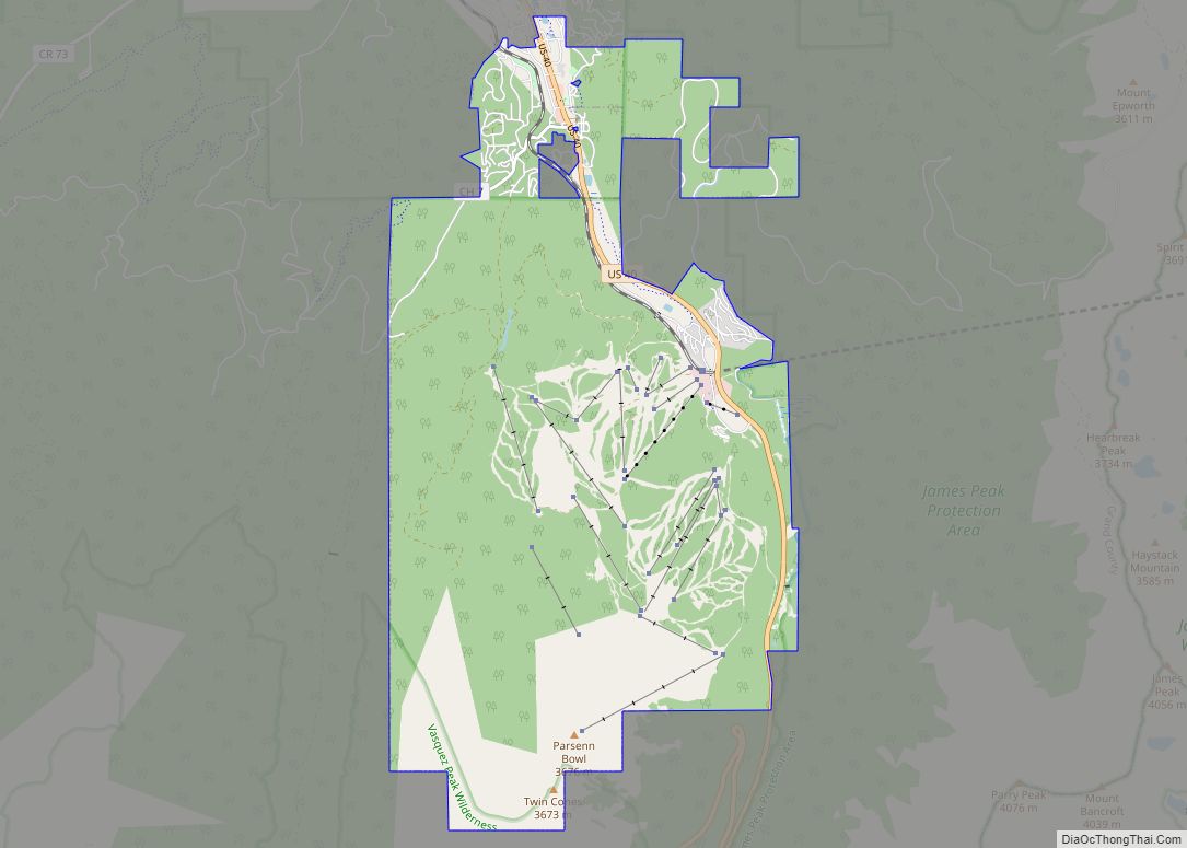
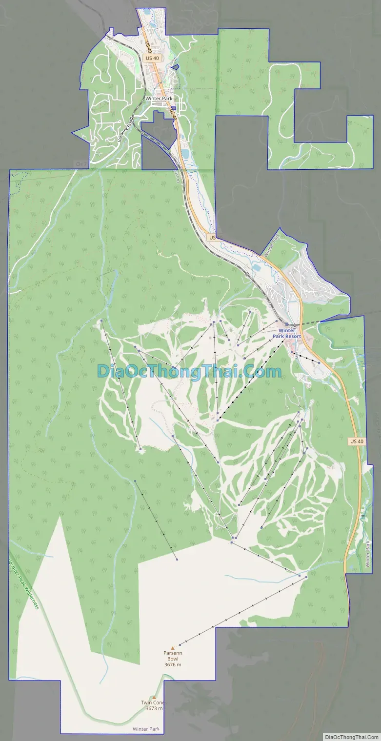
It is home to Winter Park Resort, a ski resort owned by the City of Denver and managed by Alterra Mountain Company. The town and resort are served by the Winter Park Express ski train run by Amtrak. The area also has cross-country skiing opportunities, including Devil’s Thumb Ranch. In the spring and summer, Winter Park is known for mountain biking, concerts, hiking, and fishing.
| Name: | Winter Park town |
|---|---|
| LSAD Code: | 43 |
| LSAD Description: | town (suffix) |
| State: | Colorado |
| County: | Grand County |
| Founded: | August 1, 1978 |
| Incorporated: | September 1, 1979 |
| Elevation: | 9,052 ft (2,780 m) |
| Total Area: | 16.89 sq mi (43.74 km²) |
| Land Area: | 16.89 sq mi (43.74 km²) |
| Water Area: | 0.00 sq mi (0.00 km²) |
| Total Population: | 1,033 |
| Population Density: | 61/sq mi (24/km²) |
| ZIP code: | 80482 (PO Box) |
| Area code: | 970 |
| FIPS code: | 0885705 |
| GNISfeature ID: | 0180960 |
| Website: | www.wpgov.com |
Online Interactive Map
Click on ![]() to view map in "full screen" mode.
to view map in "full screen" mode.
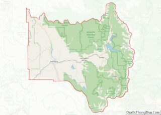
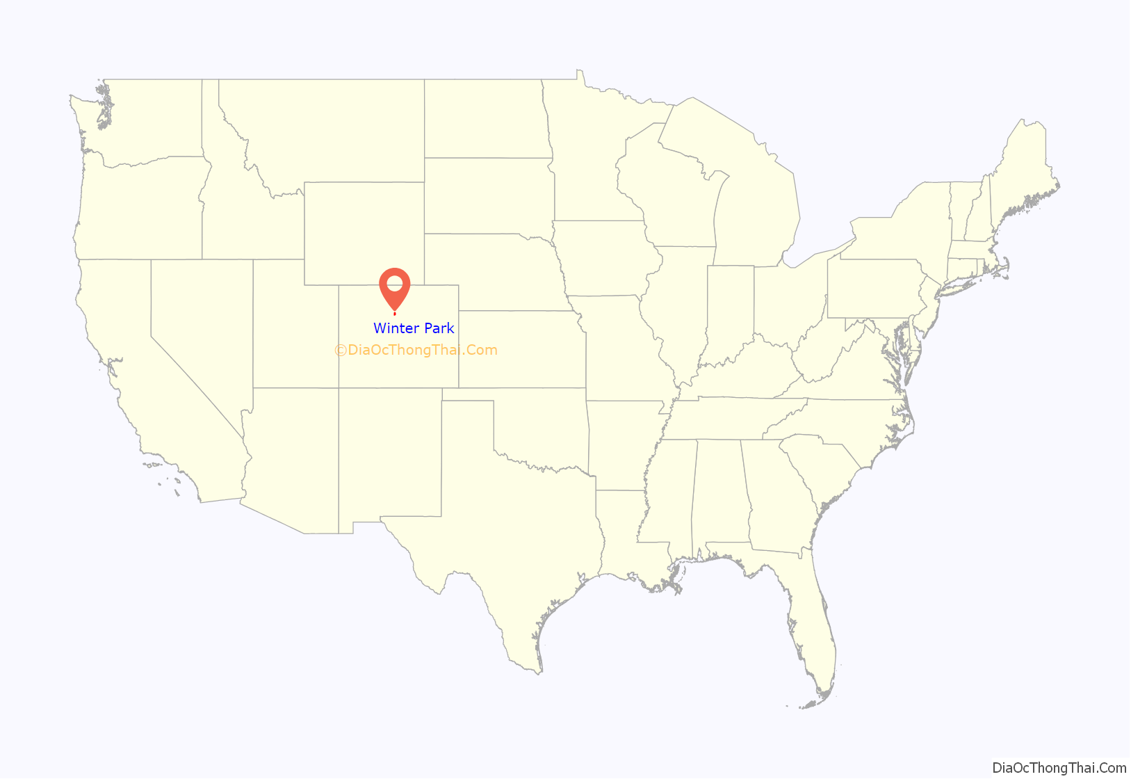
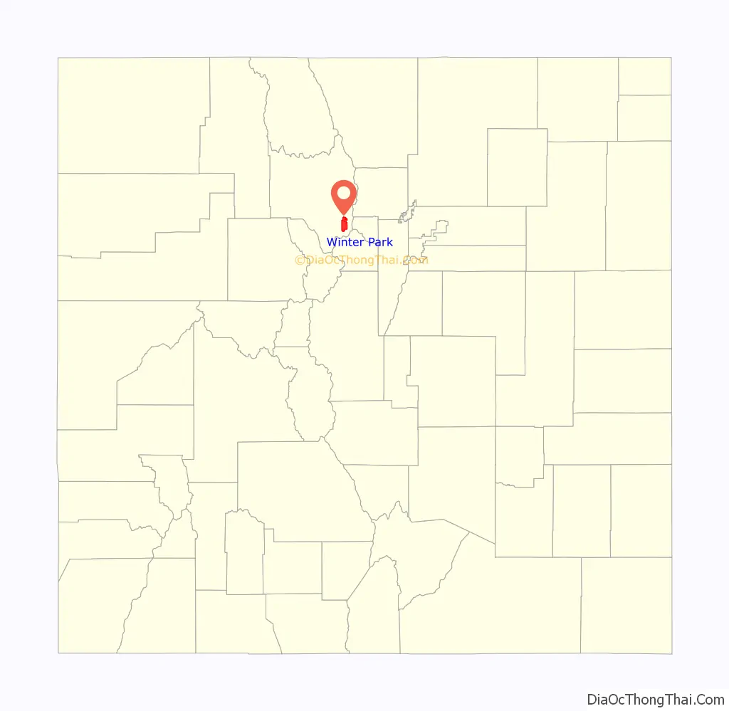
Winter Park location map. Where is Winter Park town?
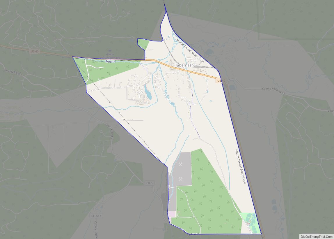
Winter Park Road Map
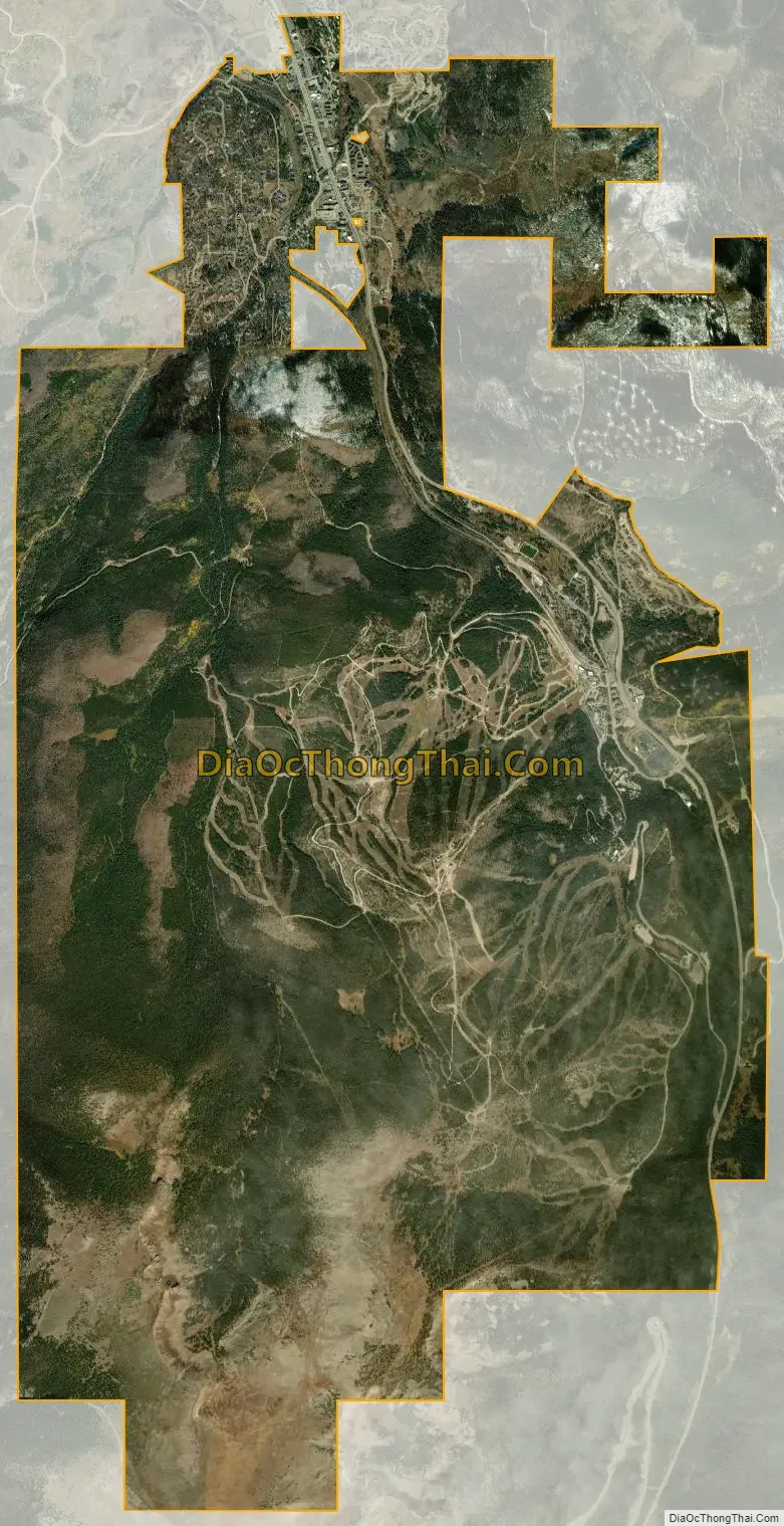
Winter Park city Satellite Map
Geography
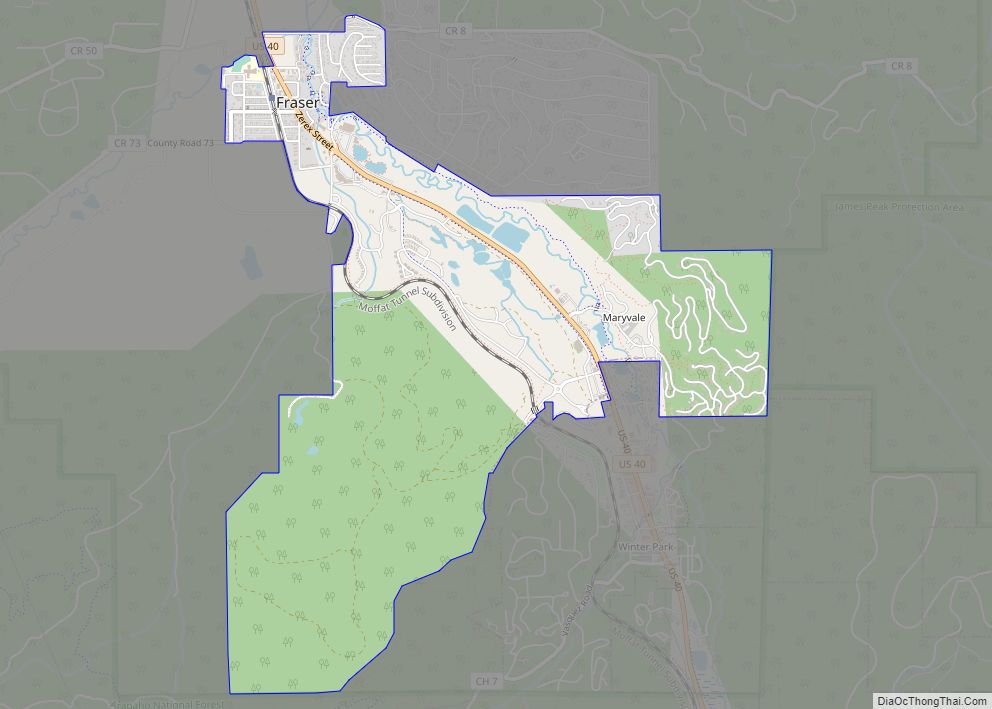
Winter Park is located in southeastern Grand County at 39°54′15″N 105°46′45″W / 39.904071°N 105.779198°W / 39.904071; -105.779198, at the southern end of the Fraser Valley. It is bordered to the north by the town of Fraser. U.S. Route 40 passes through the town, leading south and east over Berthoud Pass 66 miles (106 km) to Denver and northwest 20 miles (32 km) to Granby.
According to the United States Census Bureau, the town has a total area of 16.5 square miles (42.7 km).
Its elevation ranges from approximately 8,700 to 12,060 feet (2,650 to 3,680 m) above sea level, and is considered sub-alpine country. It is snow-covered for about six months a year. Although the town center is at about 9,000 feet (2,700 m) above sea level, Winter Park, using administrative boundaries as a measure, became the highest incorporated town in the United States after the July 2006 annexation of 5,214 acres (21.10 km) of Winter Park Resort to allow new on-mountain improvements. This claim is disputed since Winter Park has no residences above 9,550 feet (2,910 m), while contiguous residential neighborhoods in Leadville, Colorado, extend to 10,360 feet (3,160 m) and in Alma, Colorado, to 11,680 feet (3,560 m), and Alma’s town center is at 10,361 feet (3,158 m).
See also
Map of Colorado State and its subdivision:- Adams
- Alamosa
- Arapahoe
- Archuleta
- Baca
- Bent
- Boulder
- Broomfield
- Chaffee
- Cheyenne
- Clear Creek
- Conejos
- Costilla
- Crowley
- Custer
- Delta
- Denver
- Dolores
- Douglas
- Eagle
- El Paso
- Elbert
- Fremont
- Garfield
- Gilpin
- Grand
- Gunnison
- Hinsdale
- Huerfano
- Jackson
- Jefferson
- Kiowa
- Kit Carson
- La Plata
- Lake
- Larimer
- Las Animas
- Lincoln
- Logan
- Mesa
- Mineral
- Moffat
- Montezuma
- Montrose
- Morgan
- Otero
- Ouray
- Park
- Phillips
- Pitkin
- Prowers
- Pueblo
- Rio Blanco
- Rio Grande
- Routt
- Saguache
- San Juan
- San Miguel
- Sedgwick
- Summit
- Teller
- Washington
- Weld
- Yuma
- Alabama
- Alaska
- Arizona
- Arkansas
- California
- Colorado
- Connecticut
- Delaware
- District of Columbia
- Florida
- Georgia
- Hawaii
- Idaho
- Illinois
- Indiana
- Iowa
- Kansas
- Kentucky
- Louisiana
- Maine
- Maryland
- Massachusetts
- Michigan
- Minnesota
- Mississippi
- Missouri
- Montana
- Nebraska
- Nevada
- New Hampshire
- New Jersey
- New Mexico
- New York
- North Carolina
- North Dakota
- Ohio
- Oklahoma
- Oregon
- Pennsylvania
- Rhode Island
- South Carolina
- South Dakota
- Tennessee
- Texas
- Utah
- Vermont
- Virginia
- Washington
- West Virginia
- Wisconsin
- Wyoming