Baldwin City is a city in Douglas County, Kansas, United States, about 12 miles (19 km) south of Lawrence. As of the 2020 census, the population of the city was 4,826. The city is home to Baker University, the state’s oldest four-year university.
| Name: | Baldwin City city |
|---|---|
| LSAD Code: | 25 |
| LSAD Description: | city (suffix) |
| State: | Kansas |
| County: | Douglas County |
| Founded: | 1850s |
| Incorporated: | 1870 |
| Elevation: | 1,037 ft (316 m) |
| Total Area: | 2.69 sq mi (6.96 km²) |
| Land Area: | 2.67 sq mi (6.92 km²) |
| Water Area: | 0.02 sq mi (0.04 km²) |
| Total Population: | 4,826 |
| Population Density: | 1,800/sq mi (690/km²) |
| ZIP code: | 66006 |
| Area code: | 785 |
| FIPS code: | 2003900 |
| Website: | baldwincity.org |
Online Interactive Map
Click on ![]() to view map in "full screen" mode.
to view map in "full screen" mode.
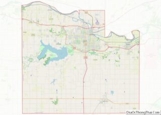
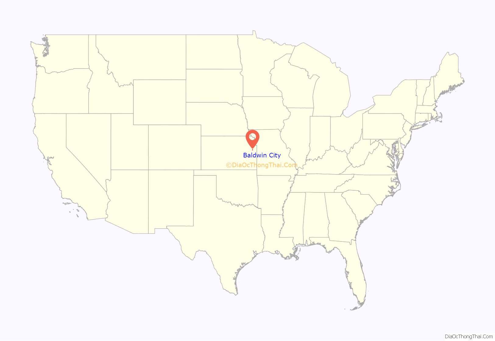
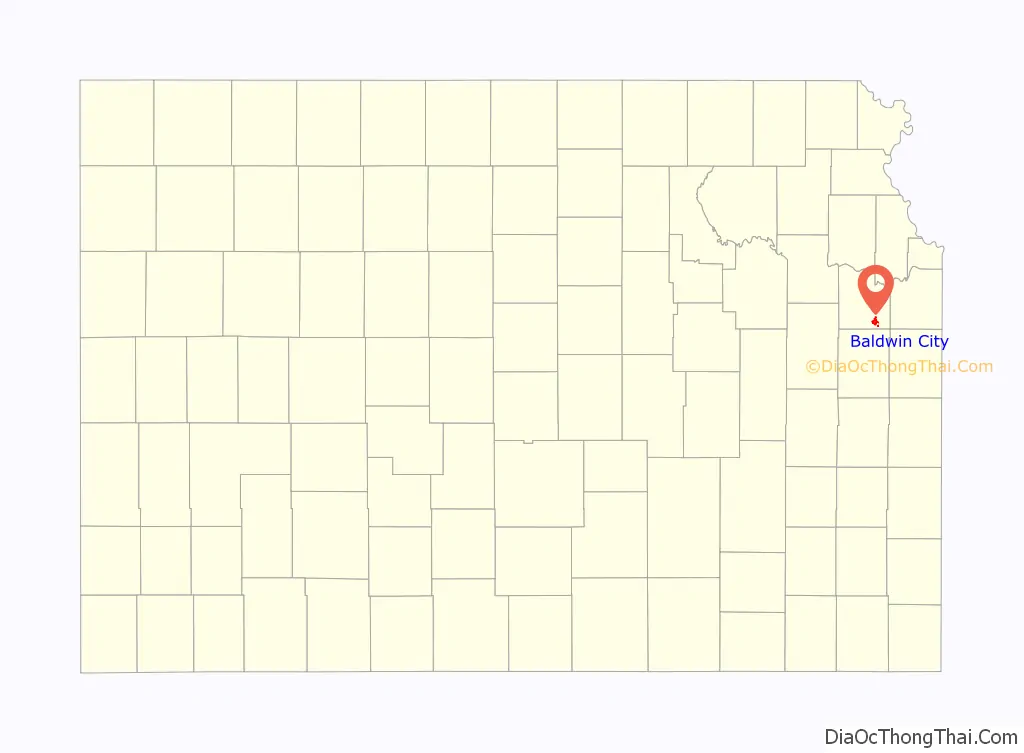
Baldwin City location map. Where is Baldwin City city?
History
Early history
Baldwin City began as a trail stop on the Santa Fe Trail named Palmyra. The small community consisted of a harness shop, blacksmith, hotel, lawyer, drug store, two doctors and a tavern. In 1858, a group of Methodist ministers gathered at Kibbee Cabin and founded Baker University. Palmyra bought land to the south for the university and surrounding city. The first post office was established in June, 1857.
A main benefactor of the community was John Baldwin and the town was named in his honor. Baldwin built a saw mill which was at present-day Fifth and Indiana Streets. Baldwin City was incorporated on September 22, 1870.
Baldwin City unwittingly found themselves surrounded by the events that led up to the American Civil War. Three miles east of Baldwin was the town site of Black Jack where the Battle of Black Jack took place on June 2, 1856. The night before that battle, John Brown stayed in Prairie City. In 1863, Quantrill’s raiders passed within three miles (5 km) of Baldwin after the burning of Lawrence.
Midland Railway
In 1867, the Leavenworth, Lawrence and Galveston Railroad laid tracks and became the first Kansas railroad south of the Kansas River. In 1906, the Santa Fe Depot was built and today the Midland Railway offers over 20-mile round trip excursion rides to Ottawa via “Nowhere” and Norwood. Midland’s Scout program is one of the few in the country to offer a railroading merit badge and Midland has hosted a Thomas the Tank Engine attraction the last few years.
Maple Leaf Festival
Every year since 1957, Baldwin City has hosted the Maple Leaf Festival during the third full weekend in October. It began as a way to celebrate a successful harvest and to view the fall foliage. Today, it is the largest fall family event in the area and features a parade, arts and crafts, quilt show, theatrical performances, history tours, train rides and live music. Annually it draws crowds of 30,000 or more.
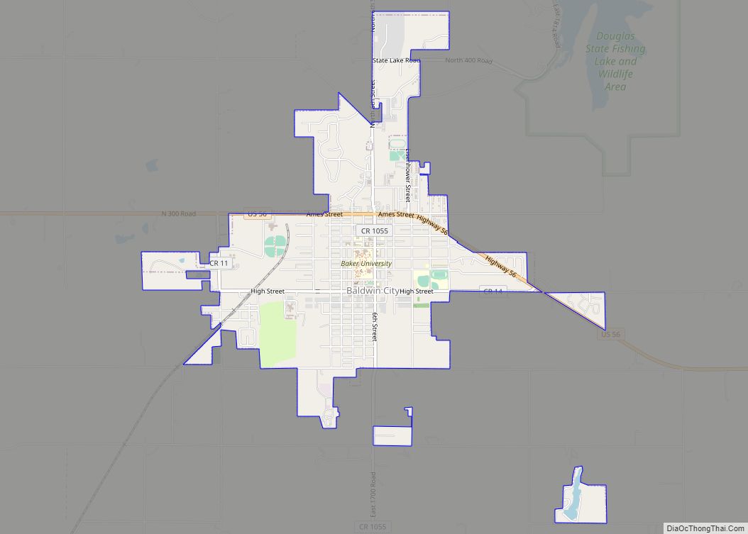
Baldwin City Road Map
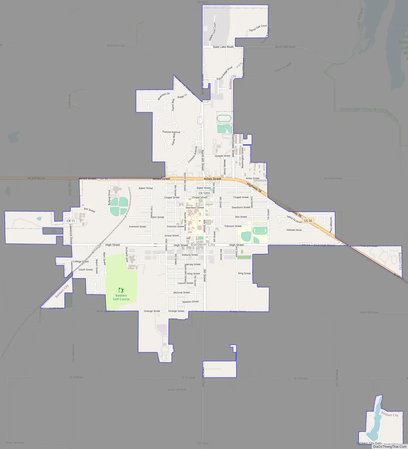
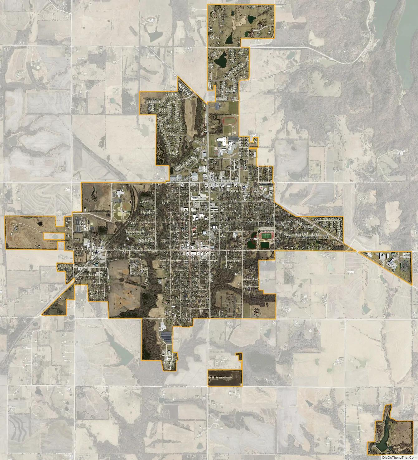
Baldwin City city Satellite Map
Geography
Baldwin City is located at 38°46′39″N 95°11′15″W / 38.77750°N 95.18750°W / 38.77750; -95.18750 (38.777597, -95.187418). According to the United States Census Bureau, the city has an area of 2.64 square miles (6.84 km), of which 2.62 square miles (6.79 km) is land and 0.02 square miles (0.05 km) is water.
Climate
The area’s climate is characterized by hot, humid summers and generally cool to cold winters. According to the Köppen Climate Classification system, Baldwin City has a humid subtropical climate, abbreviated “Cfa” on climate maps.
See also
Map of Kansas State and its subdivision:- Allen
- Anderson
- Atchison
- Barber
- Barton
- Bourbon
- Brown
- Butler
- Chase
- Chautauqua
- Cherokee
- Cheyenne
- Clark
- Clay
- Cloud
- Coffey
- Comanche
- Cowley
- Crawford
- Decatur
- Dickinson
- Doniphan
- Douglas
- Edwards
- Elk
- Ellis
- Ellsworth
- Finney
- Ford
- Franklin
- Geary
- Gove
- Graham
- Grant
- Gray
- Greeley
- Greenwood
- Hamilton
- Harper
- Harvey
- Haskell
- Hodgeman
- Jackson
- Jefferson
- Jewell
- Johnson
- Kearny
- Kingman
- Kiowa
- Labette
- Lane
- Leavenworth
- Lincoln
- Linn
- Logan
- Lyon
- Marion
- Marshall
- McPherson
- Meade
- Miami
- Mitchell
- Montgomery
- Morris
- Morton
- Nemaha
- Neosho
- Ness
- Norton
- Osage
- Osborne
- Ottawa
- Pawnee
- Phillips
- Pottawatomie
- Pratt
- Rawlins
- Reno
- Republic
- Rice
- Riley
- Rooks
- Rush
- Russell
- Saline
- Scott
- Sedgwick
- Seward
- Shawnee
- Sheridan
- Sherman
- Smith
- Stafford
- Stanton
- Stevens
- Sumner
- Thomas
- Trego
- Wabaunsee
- Wallace
- Washington
- Wichita
- Wilson
- Woodson
- Wyandotte
- Alabama
- Alaska
- Arizona
- Arkansas
- California
- Colorado
- Connecticut
- Delaware
- District of Columbia
- Florida
- Georgia
- Hawaii
- Idaho
- Illinois
- Indiana
- Iowa
- Kansas
- Kentucky
- Louisiana
- Maine
- Maryland
- Massachusetts
- Michigan
- Minnesota
- Mississippi
- Missouri
- Montana
- Nebraska
- Nevada
- New Hampshire
- New Jersey
- New Mexico
- New York
- North Carolina
- North Dakota
- Ohio
- Oklahoma
- Oregon
- Pennsylvania
- Rhode Island
- South Carolina
- South Dakota
- Tennessee
- Texas
- Utah
- Vermont
- Virginia
- Washington
- West Virginia
- Wisconsin
- Wyoming