Bendena is an unincorporated community in Doniphan County, Kansas, United States. As of the 2020 census, the population of the community and nearby areas was 117.
| Name: | Bendena CDP |
|---|---|
| LSAD Code: | 57 |
| LSAD Description: | CDP (suffix) |
| State: | Kansas |
| County: | Doniphan County |
| Founded: | 1886 |
| Elevation: | 1,112 ft (339 m) |
| Total Area: | 1.53 sq mi (3.96 km²) |
| Land Area: | 1.53 sq mi (3.96 km²) |
| Water Area: | 0.0 sq mi (0.0 km²) |
| Total Population: | 117 |
| Population Density: | 77/sq mi (30/km²) |
| ZIP code: | 66008 |
| Area code: | 785 |
| FIPS code: | 2005975 |
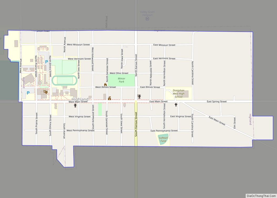
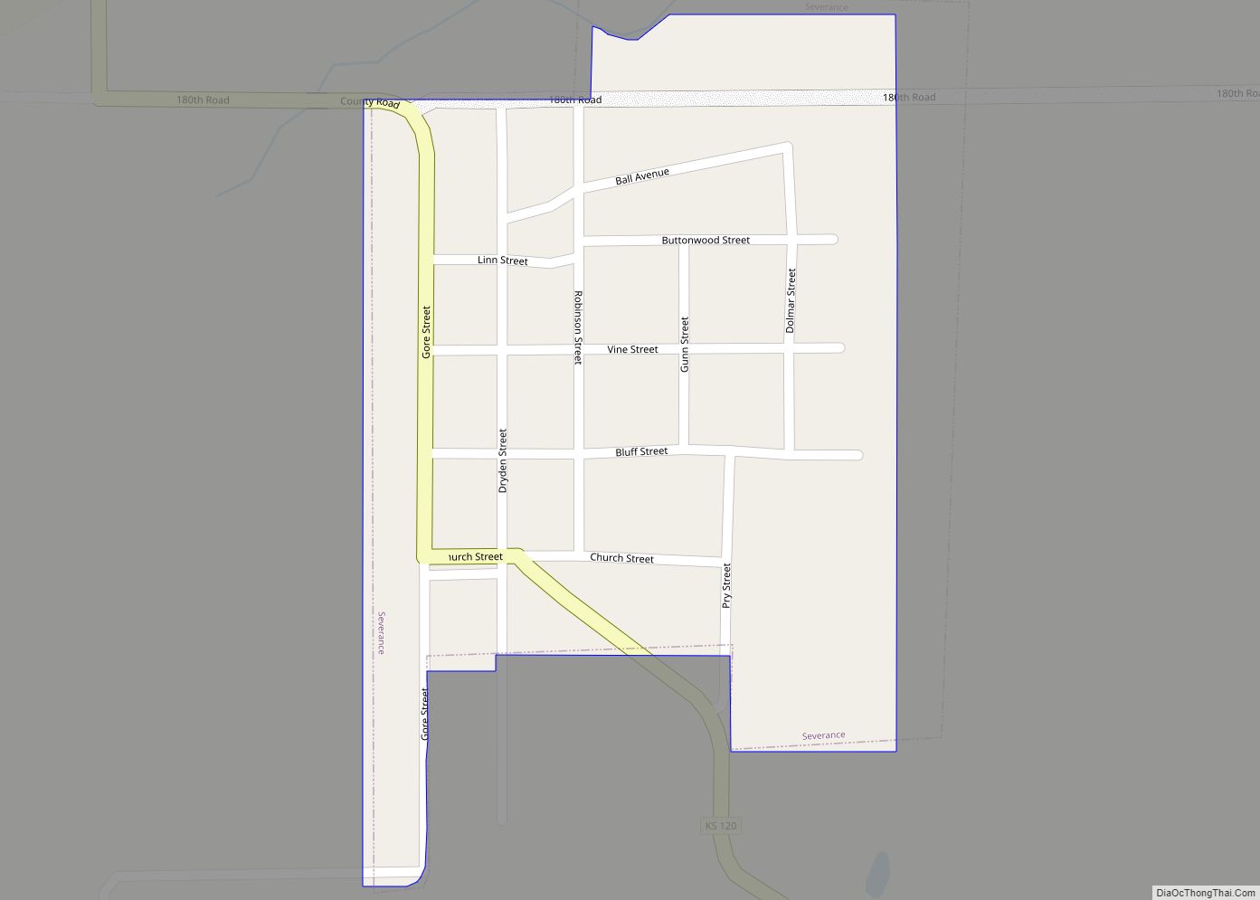
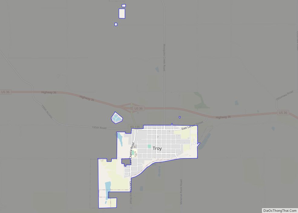
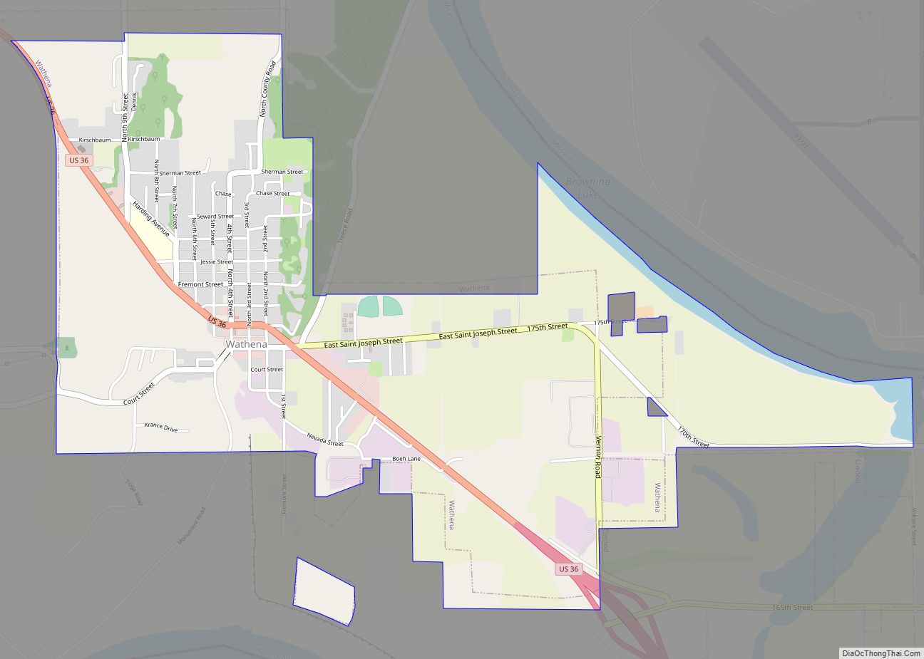
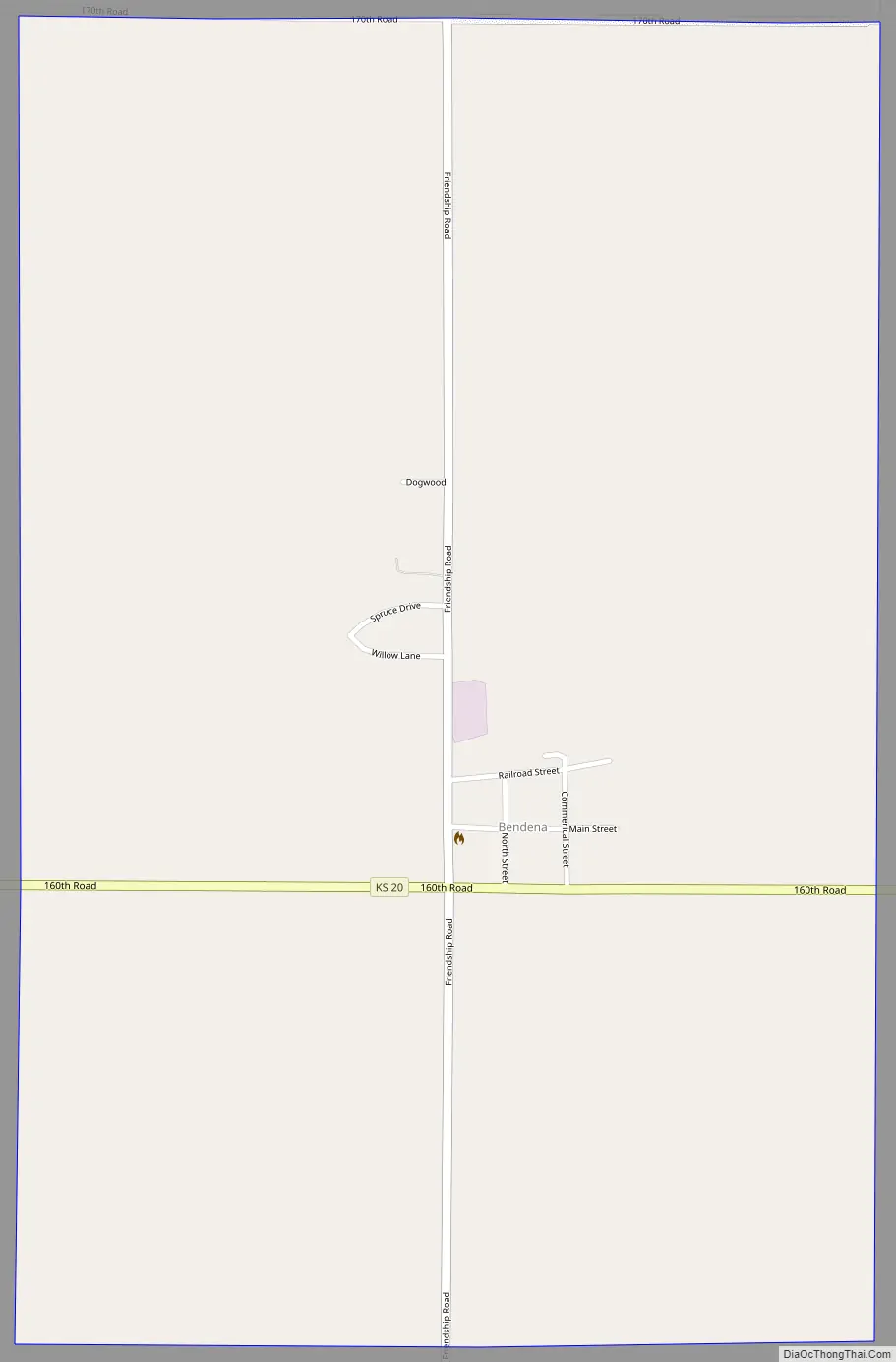
Online Interactive Map
Click on ![]() to view map in "full screen" mode.
to view map in "full screen" mode.
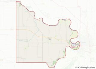
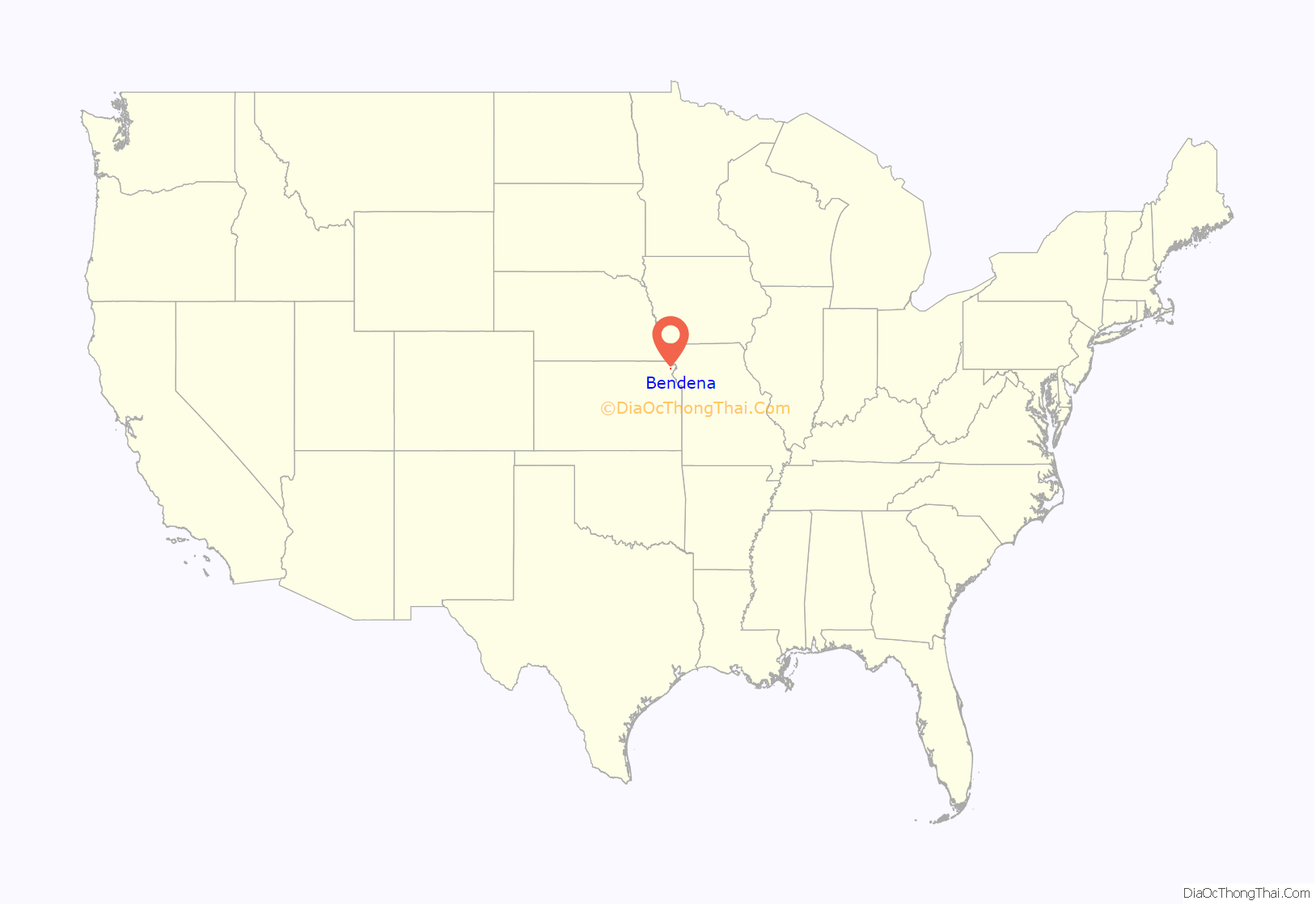
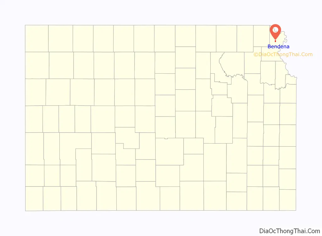
Bendena location map. Where is Bendena CDP?
History
Bendena was founded in 1886. It was originally given the name of Albers, after John Albers, who farmed on this land. But when the United States Postal Service established a post office there, they required a change of name because of similarities to other town names in Kansas. It was then named for the sweetheart of the first telegraph operator at the Chicago, Kansas and Nebraska railroad station.
The first post office in Bendena was established in January, 1888. Its ZIP Code is 66008.
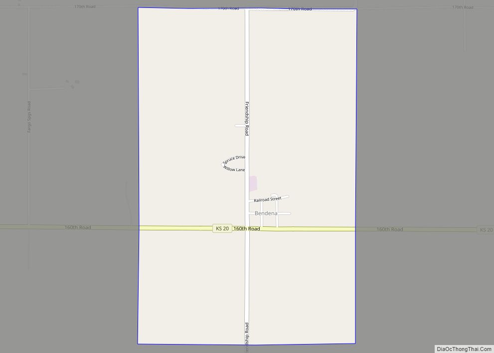
Bendena Road Map
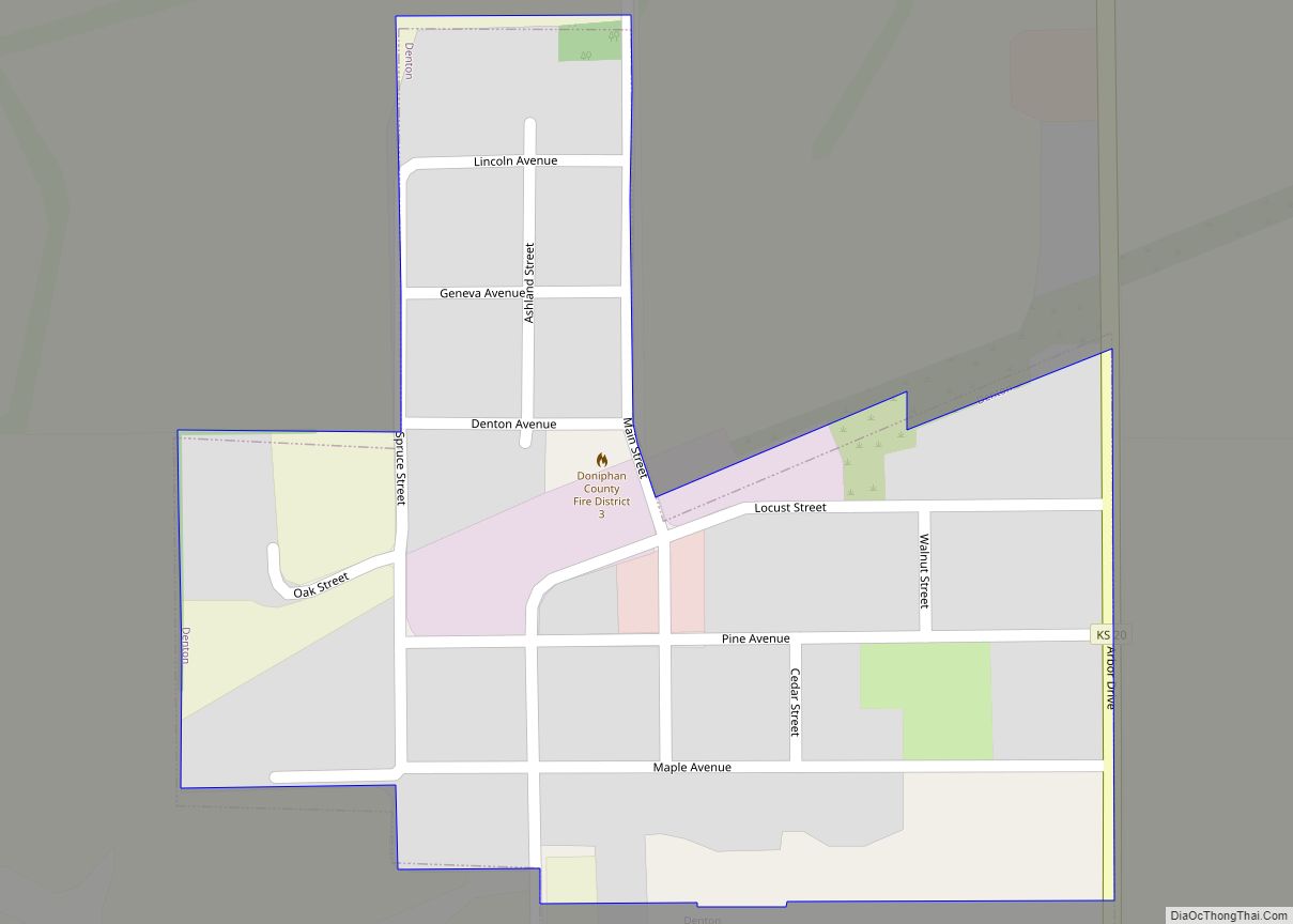
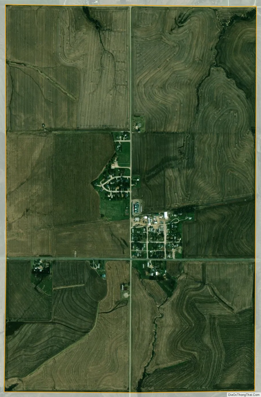
Bendena city Satellite Map
Geography
Bendena is located southwest of the center of Doniphan County, along highway K-20. It is 7 miles (11 km) southwest of Troy, the county seat, and 15 miles (24 km) north of Atchison.
According to the U.S. Census Bureau, the Bendena CDP has an area of 1.53 square miles (3.96 km), all of it land.
See also
Map of Kansas State and its subdivision:- Allen
- Anderson
- Atchison
- Barber
- Barton
- Bourbon
- Brown
- Butler
- Chase
- Chautauqua
- Cherokee
- Cheyenne
- Clark
- Clay
- Cloud
- Coffey
- Comanche
- Cowley
- Crawford
- Decatur
- Dickinson
- Doniphan
- Douglas
- Edwards
- Elk
- Ellis
- Ellsworth
- Finney
- Ford
- Franklin
- Geary
- Gove
- Graham
- Grant
- Gray
- Greeley
- Greenwood
- Hamilton
- Harper
- Harvey
- Haskell
- Hodgeman
- Jackson
- Jefferson
- Jewell
- Johnson
- Kearny
- Kingman
- Kiowa
- Labette
- Lane
- Leavenworth
- Lincoln
- Linn
- Logan
- Lyon
- Marion
- Marshall
- McPherson
- Meade
- Miami
- Mitchell
- Montgomery
- Morris
- Morton
- Nemaha
- Neosho
- Ness
- Norton
- Osage
- Osborne
- Ottawa
- Pawnee
- Phillips
- Pottawatomie
- Pratt
- Rawlins
- Reno
- Republic
- Rice
- Riley
- Rooks
- Rush
- Russell
- Saline
- Scott
- Sedgwick
- Seward
- Shawnee
- Sheridan
- Sherman
- Smith
- Stafford
- Stanton
- Stevens
- Sumner
- Thomas
- Trego
- Wabaunsee
- Wallace
- Washington
- Wichita
- Wilson
- Woodson
- Wyandotte
- Alabama
- Alaska
- Arizona
- Arkansas
- California
- Colorado
- Connecticut
- Delaware
- District of Columbia
- Florida
- Georgia
- Hawaii
- Idaho
- Illinois
- Indiana
- Iowa
- Kansas
- Kentucky
- Louisiana
- Maine
- Maryland
- Massachusetts
- Michigan
- Minnesota
- Mississippi
- Missouri
- Montana
- Nebraska
- Nevada
- New Hampshire
- New Jersey
- New Mexico
- New York
- North Carolina
- North Dakota
- Ohio
- Oklahoma
- Oregon
- Pennsylvania
- Rhode Island
- South Carolina
- South Dakota
- Tennessee
- Texas
- Utah
- Vermont
- Virginia
- Washington
- West Virginia
- Wisconsin
- Wyoming