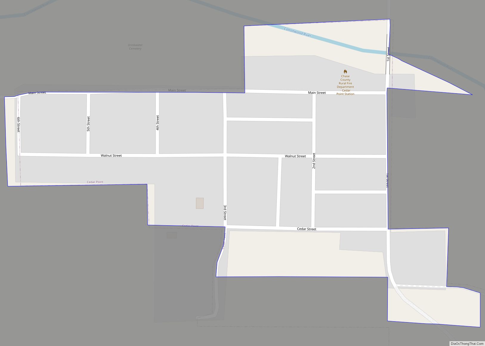
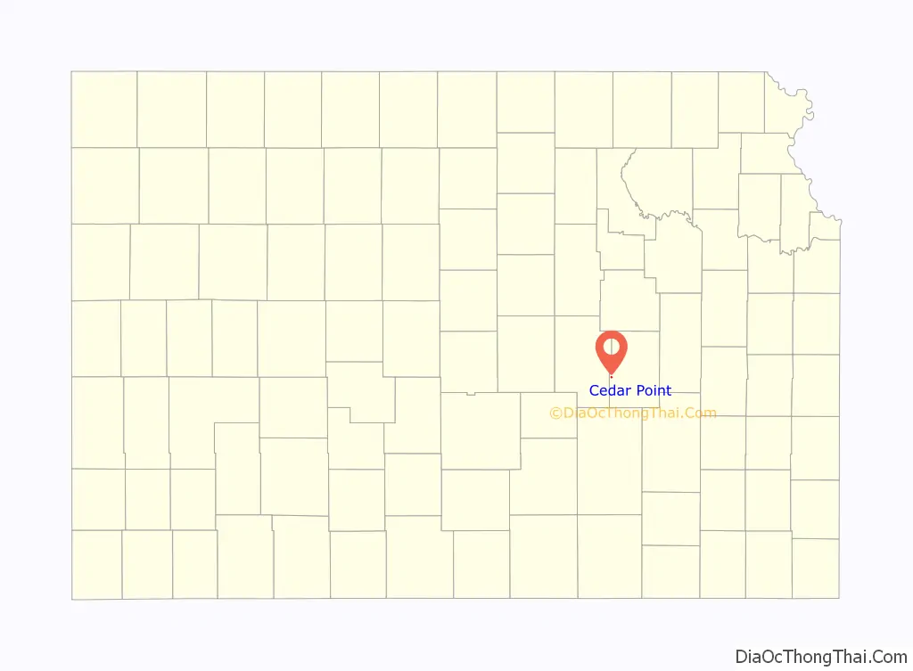
Cedar Point is a city in Chase County, Kansas, United States. As of the 2020 census, the population of the city was 22. It is about 5 miles east of Florence and 0.5 miles south of U.S. Route 50 highway.
| Name: | Cedar Point city |
|---|---|
| LSAD Code: | 25 |
| LSAD Description: | city (suffix) |
| State: | Kansas |
| County: | Chase County |
| Founded: | 1862 |
| Incorporated: | 1912 |
| Elevation: | 1,247 ft (380 m) |
| Total Area: | 0.07 sq mi (0.18 km²) |
| Land Area: | 0.07 sq mi (0.17 km²) |
| Water Area: | 0.00 sq mi (0.00 km²) |
| Total Population: | 22 |
| Population Density: | 310/sq mi (120/km²) |
| ZIP code: | 66843 |
| Area code: | 620 |
| FIPS code: | 2011425 |
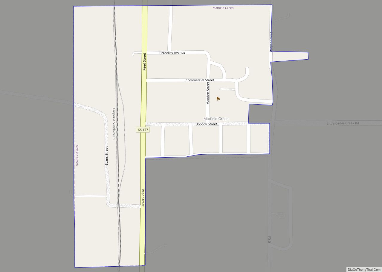
Online Interactive Map
Click on ![]() to view map in "full screen" mode.
to view map in "full screen" mode.
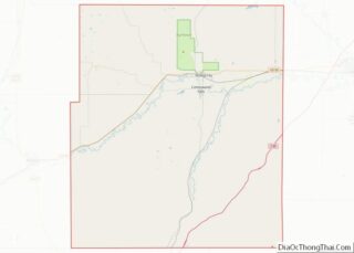
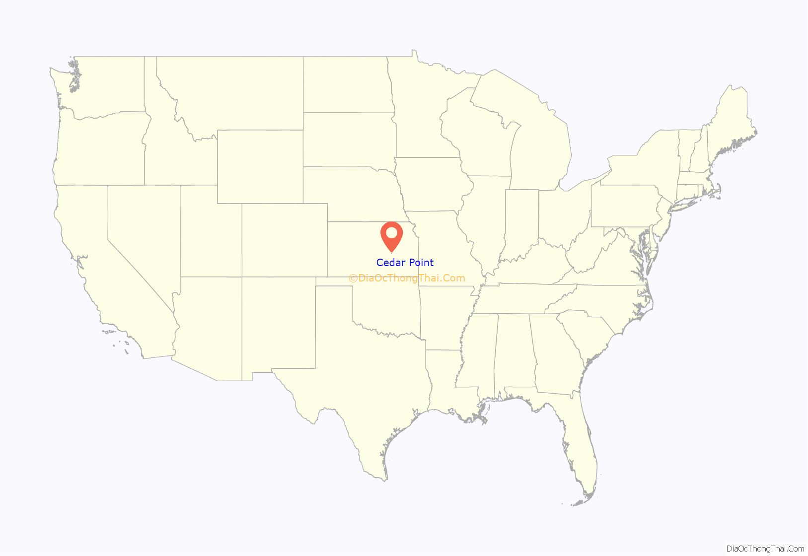
Cedar Point location map. Where is Cedar Point city?
History
Early history
For many millennia, the Great Plains of North America was inhabited by nomadic Native Americans. From the 16th century to 18th century, the Kingdom of France claimed ownership of large parts of North America. In 1762, after the French and Indian War, France secretly ceded New France to Spain, per the Treaty of Fontainebleau.
19th century
In 1802, Spain returned most of the land to France. In 1803, most of the land for modern day Kansas was acquired by the United States from France as part of the 828,000 square mile Louisiana Purchase for 2.83 cents per acre.
In 1806, Zebulon Pike led the Pike Expedition westward from St Louis, Missouri, of which part of their journey followed the Cottonwood River through Chase County near the current city of Cedar Point.
In 1854, the Kansas Territory was organized, then in 1861 Kansas became the 34th U.S. state. In 1855, Marion County was established within the Kansas Territory, which included the land for modern day Cedar Point.
In 1862, Cedar Point was founded. The first post office in Cedar Point was established in 1862.
In 1867, a log dam was built across the Cottonwood River, and a wooden-frame mill was constructed for sawing lumber. The following year (1868) it was converted to grind flour and named Cedar Point Mill. In 1870, the name was changed to Drinkwater & Schriver Mill. In 1871, construction of the current stone structure was started, then completed in 1875. In 1884, the log dam was replaced by a stone dam.
In 1871, the Atchison, Topeka and Santa Fe Railway built a main line east-west and built a nearby station named Cedar Grove in the valley north of Cedar Point. In 1996, it merged with Burlington Northern Railroad and renamed to the current BNSF Railway. Most locals still refer to this railroad as the “Santa Fe”.
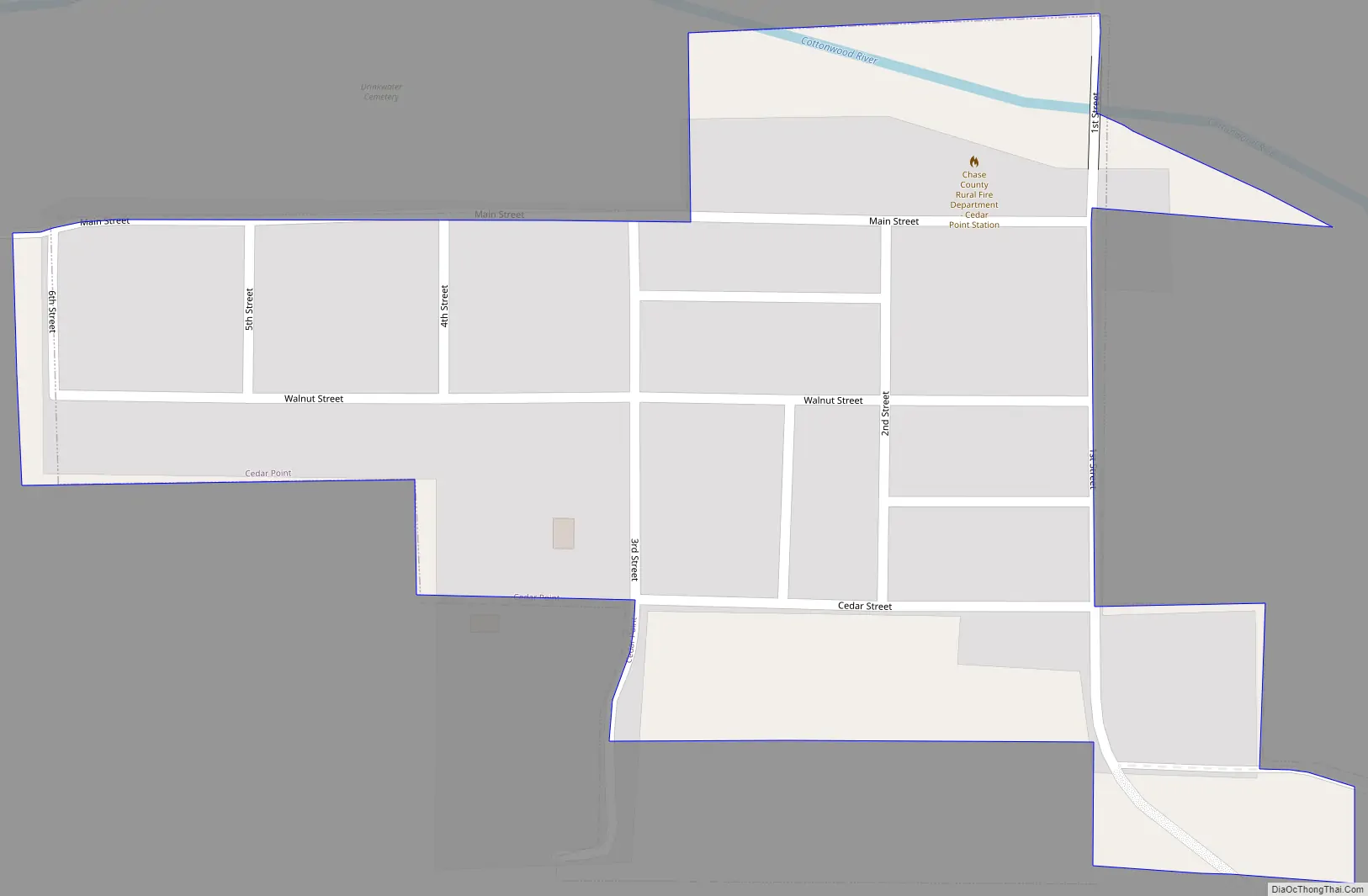
Cedar Point Road Map
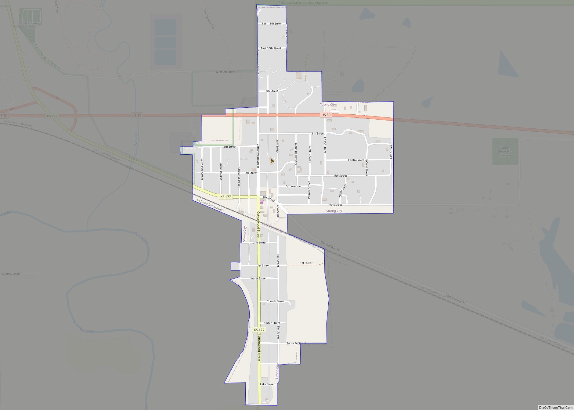
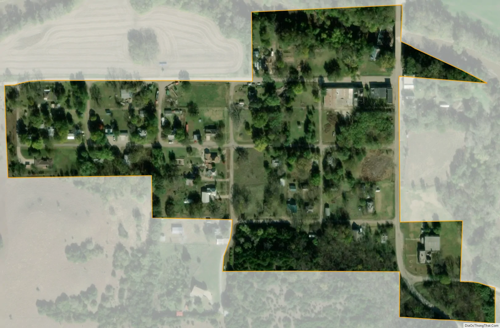
Cedar Point city Satellite Map
Geography
Cedar Point is located at 38°15′39″N 96°49′18″W / 38.260888°N 96.821662°W / 38.260888; -96.821662 (38.260888, -96.821662), in the scenic Flint Hills of the Great Plains. According to the United States Census Bureau, the city has a total area of 0.08 square miles (0.21 km), all of it land.
See also
Map of Kansas State and its subdivision:- Allen
- Anderson
- Atchison
- Barber
- Barton
- Bourbon
- Brown
- Butler
- Chase
- Chautauqua
- Cherokee
- Cheyenne
- Clark
- Clay
- Cloud
- Coffey
- Comanche
- Cowley
- Crawford
- Decatur
- Dickinson
- Doniphan
- Douglas
- Edwards
- Elk
- Ellis
- Ellsworth
- Finney
- Ford
- Franklin
- Geary
- Gove
- Graham
- Grant
- Gray
- Greeley
- Greenwood
- Hamilton
- Harper
- Harvey
- Haskell
- Hodgeman
- Jackson
- Jefferson
- Jewell
- Johnson
- Kearny
- Kingman
- Kiowa
- Labette
- Lane
- Leavenworth
- Lincoln
- Linn
- Logan
- Lyon
- Marion
- Marshall
- McPherson
- Meade
- Miami
- Mitchell
- Montgomery
- Morris
- Morton
- Nemaha
- Neosho
- Ness
- Norton
- Osage
- Osborne
- Ottawa
- Pawnee
- Phillips
- Pottawatomie
- Pratt
- Rawlins
- Reno
- Republic
- Rice
- Riley
- Rooks
- Rush
- Russell
- Saline
- Scott
- Sedgwick
- Seward
- Shawnee
- Sheridan
- Sherman
- Smith
- Stafford
- Stanton
- Stevens
- Sumner
- Thomas
- Trego
- Wabaunsee
- Wallace
- Washington
- Wichita
- Wilson
- Woodson
- Wyandotte
- Alabama
- Alaska
- Arizona
- Arkansas
- California
- Colorado
- Connecticut
- Delaware
- District of Columbia
- Florida
- Georgia
- Hawaii
- Idaho
- Illinois
- Indiana
- Iowa
- Kansas
- Kentucky
- Louisiana
- Maine
- Maryland
- Massachusetts
- Michigan
- Minnesota
- Mississippi
- Missouri
- Montana
- Nebraska
- Nevada
- New Hampshire
- New Jersey
- New Mexico
- New York
- North Carolina
- North Dakota
- Ohio
- Oklahoma
- Oregon
- Pennsylvania
- Rhode Island
- South Carolina
- South Dakota
- Tennessee
- Texas
- Utah
- Vermont
- Virginia
- Washington
- West Virginia
- Wisconsin
- Wyoming