Delphos is a city in Ottawa County, Kansas, United States. As of the 2020 census, the population of the city was 302. The community was named after Delphos, Ohio.
| Name: | Delphos city |
|---|---|
| LSAD Code: | 25 |
| LSAD Description: | city (suffix) |
| State: | Kansas |
| County: | Ottawa County |
| Founded: | 1867 |
| Incorporated: | 1884 |
| Elevation: | 1,303 ft (397 m) |
| Total Area: | 0.62 sq mi (1.60 km²) |
| Land Area: | 0.59 sq mi (1.53 km²) |
| Water Area: | 0.03 sq mi (0.07 km²) |
| Total Population: | 302 |
| Population Density: | 490/sq mi (190/km²) |
| ZIP code: | 67436 |
| Area code: | 785 |
| FIPS code: | 2017600 |
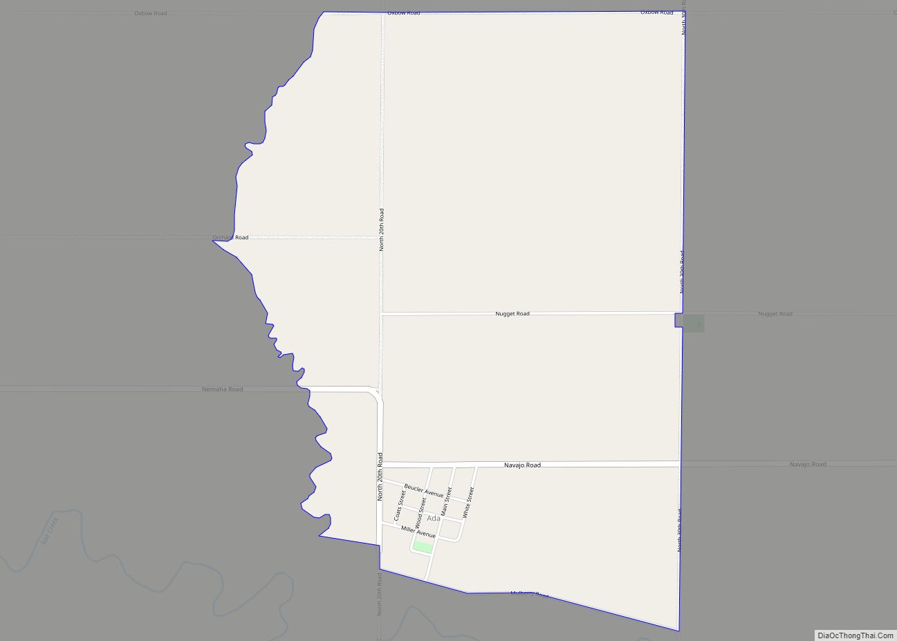
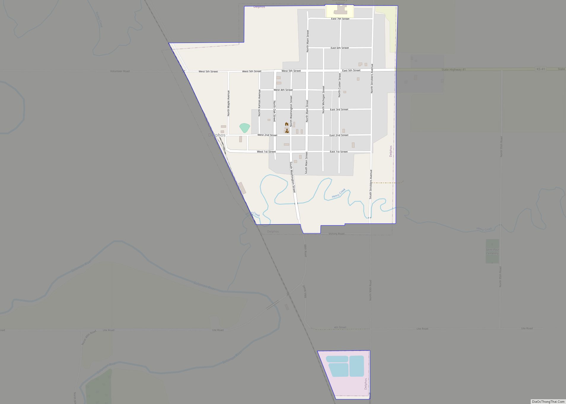
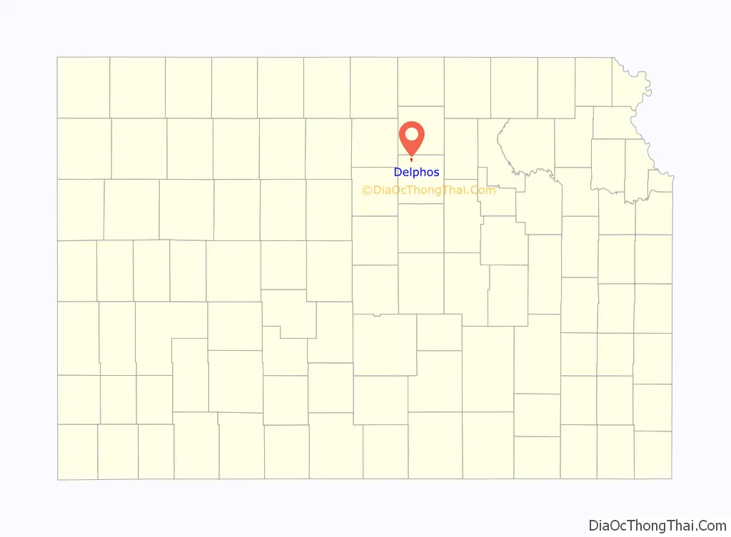
Online Interactive Map
Click on ![]() to view map in "full screen" mode.
to view map in "full screen" mode.
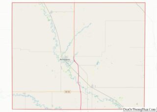
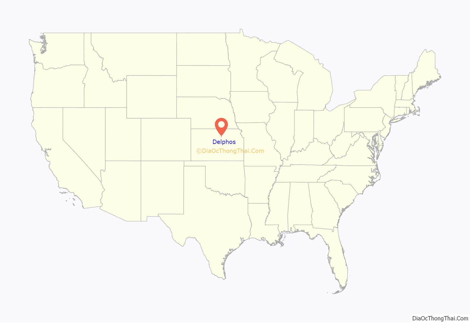
Delphos location map. Where is Delphos city?
History
Delphos was founded in 1867 by Levi and Dan Yockey. The two brothers moved to the area from Delphos, Ohio and named the new community for their hometown. Many settlers came to the area looking for a fresh start after the Civil War.
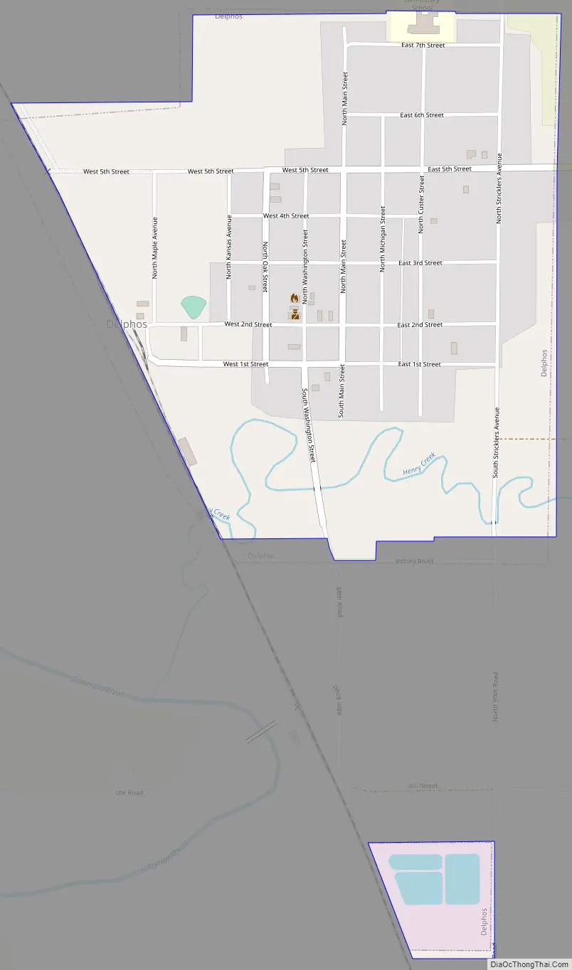
Delphos Road Map
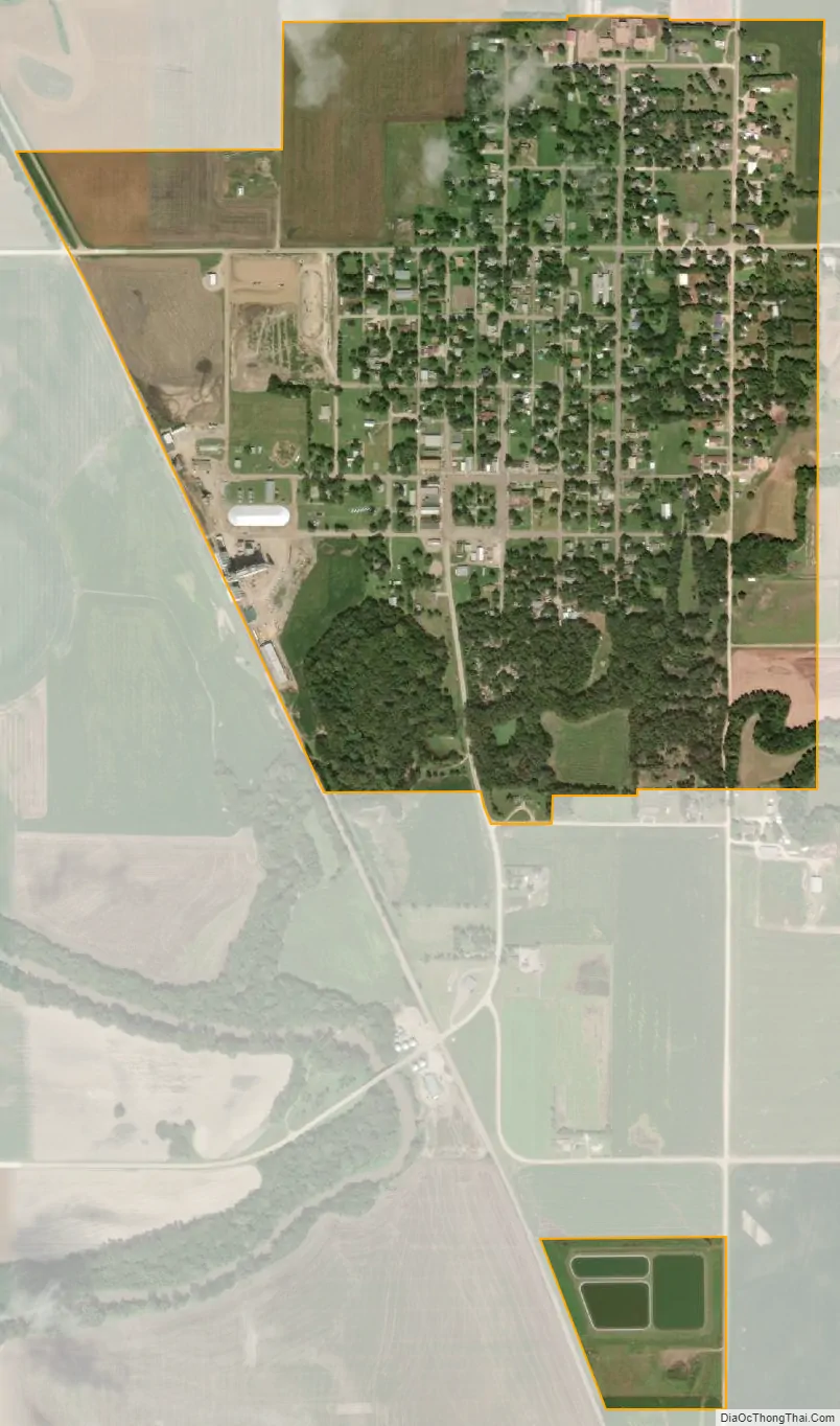
Delphos city Satellite Map
Geography
Delphos is located at 39°16′29″N 97°45′59″W / 39.27472°N 97.76639°W / 39.27472; -97.76639 (39.274770, -97.766377). According to the United States Census Bureau, the city has a total area of 0.64 square miles (1.66 km), of which, 0.62 square miles (1.61 km) is land, and 0.02 square miles (0.05 km) is water.
The city is located on the Solomon River and is five miles west of U.S. Route 81.
See also
Map of Kansas State and its subdivision:- Allen
- Anderson
- Atchison
- Barber
- Barton
- Bourbon
- Brown
- Butler
- Chase
- Chautauqua
- Cherokee
- Cheyenne
- Clark
- Clay
- Cloud
- Coffey
- Comanche
- Cowley
- Crawford
- Decatur
- Dickinson
- Doniphan
- Douglas
- Edwards
- Elk
- Ellis
- Ellsworth
- Finney
- Ford
- Franklin
- Geary
- Gove
- Graham
- Grant
- Gray
- Greeley
- Greenwood
- Hamilton
- Harper
- Harvey
- Haskell
- Hodgeman
- Jackson
- Jefferson
- Jewell
- Johnson
- Kearny
- Kingman
- Kiowa
- Labette
- Lane
- Leavenworth
- Lincoln
- Linn
- Logan
- Lyon
- Marion
- Marshall
- McPherson
- Meade
- Miami
- Mitchell
- Montgomery
- Morris
- Morton
- Nemaha
- Neosho
- Ness
- Norton
- Osage
- Osborne
- Ottawa
- Pawnee
- Phillips
- Pottawatomie
- Pratt
- Rawlins
- Reno
- Republic
- Rice
- Riley
- Rooks
- Rush
- Russell
- Saline
- Scott
- Sedgwick
- Seward
- Shawnee
- Sheridan
- Sherman
- Smith
- Stafford
- Stanton
- Stevens
- Sumner
- Thomas
- Trego
- Wabaunsee
- Wallace
- Washington
- Wichita
- Wilson
- Woodson
- Wyandotte
- Alabama
- Alaska
- Arizona
- Arkansas
- California
- Colorado
- Connecticut
- Delaware
- District of Columbia
- Florida
- Georgia
- Hawaii
- Idaho
- Illinois
- Indiana
- Iowa
- Kansas
- Kentucky
- Louisiana
- Maine
- Maryland
- Massachusetts
- Michigan
- Minnesota
- Mississippi
- Missouri
- Montana
- Nebraska
- Nevada
- New Hampshire
- New Jersey
- New Mexico
- New York
- North Carolina
- North Dakota
- Ohio
- Oklahoma
- Oregon
- Pennsylvania
- Rhode Island
- South Carolina
- South Dakota
- Tennessee
- Texas
- Utah
- Vermont
- Virginia
- Washington
- West Virginia
- Wisconsin
- Wyoming