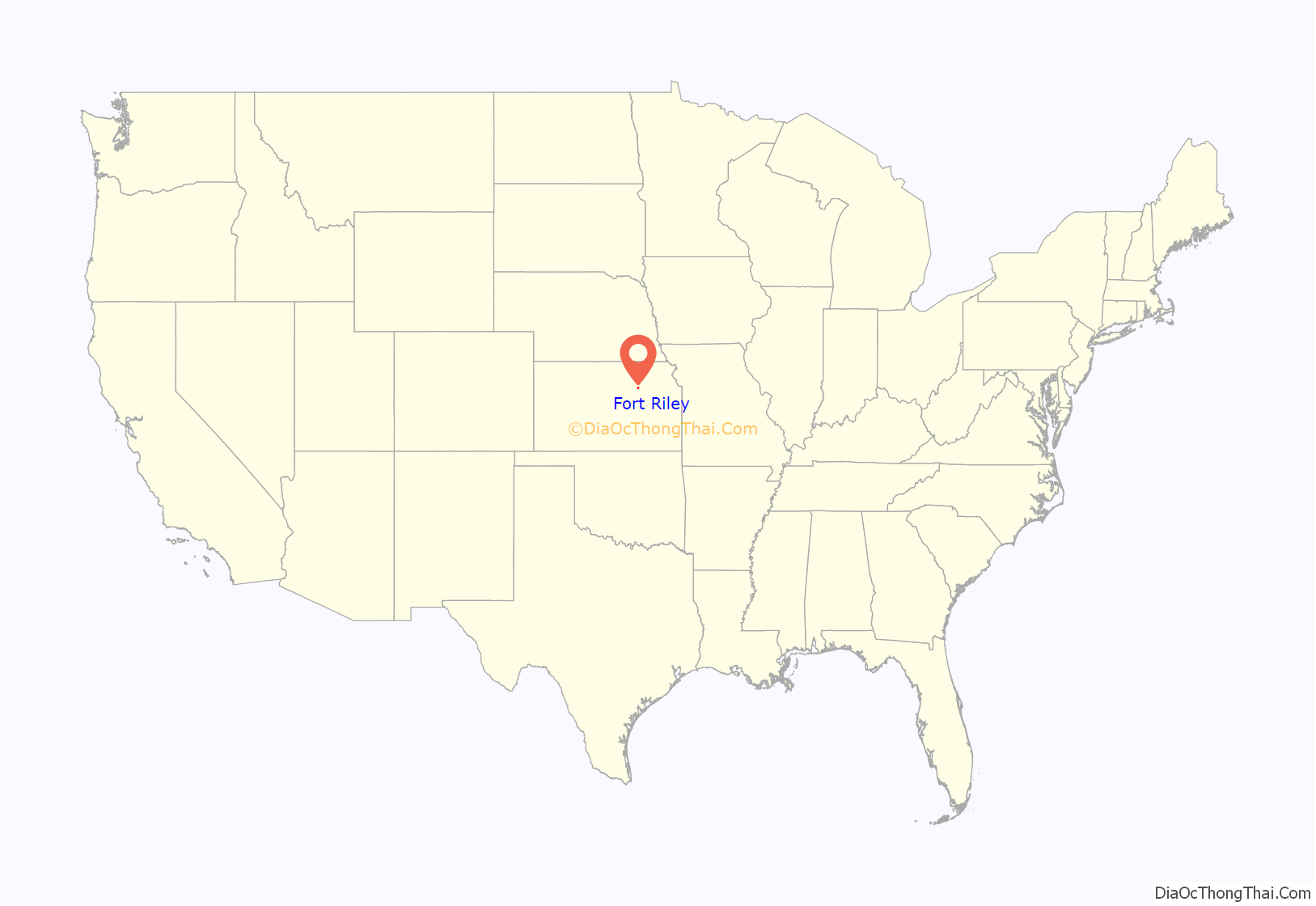
Fort Riley is a unincorporated community that covers part of Fort Riley, a US Army installation in Geary and Riley counties in the U.S. state of Kansas. As of the 2020 census, the population of the community and nearby areas was 9,230.
| Name: | Fort Riley CDP |
|---|---|
| LSAD Code: | 57 |
| LSAD Description: | CDP (suffix) |
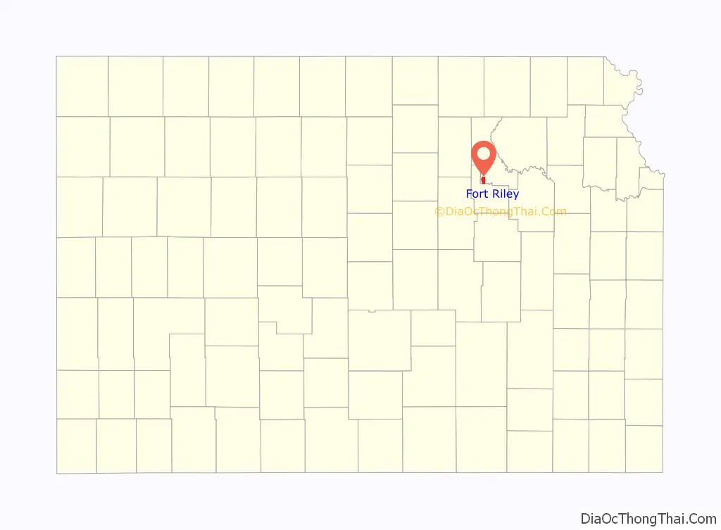
| State: | Kansas |
| County: | Geary County, Riley County |
| Elevation: | 1,309 ft (399 m) |
| Total Area: | 5.05 sq mi (13.07 km²) |
| Land Area: | 5.03 sq mi (13.04 km²) |
| Water Area: | 0.008 sq mi (0.02 km²) |
| Total Population: | 9,230 |
| Population Density: | 1,800/sq mi (710/km²) |
| Area code: | 785 |
| FIPS code: | 2023975 |
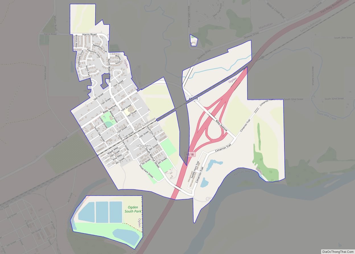
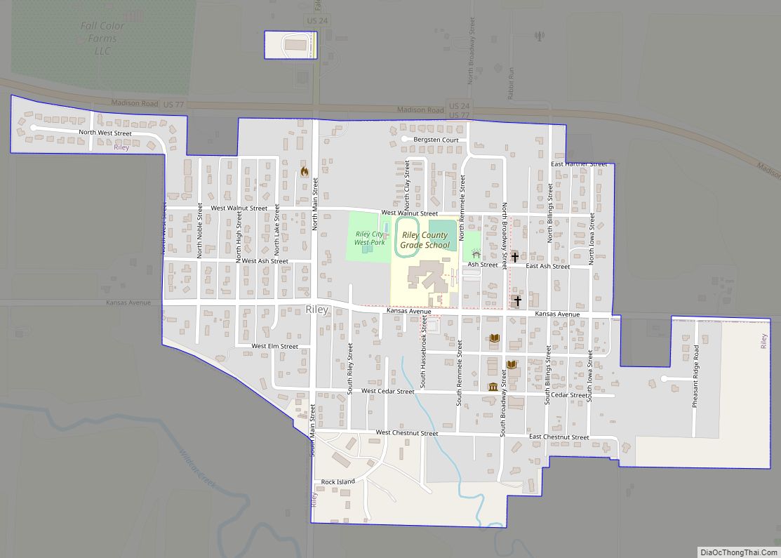
Online Interactive Map
Click on ![]() to view map in "full screen" mode.
to view map in "full screen" mode.
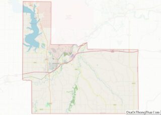
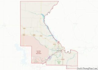
Fort Riley location map. Where is Fort Riley CDP?
History
Historically, the area is more commonly known as “Custer Hill”.
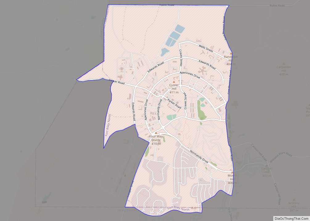
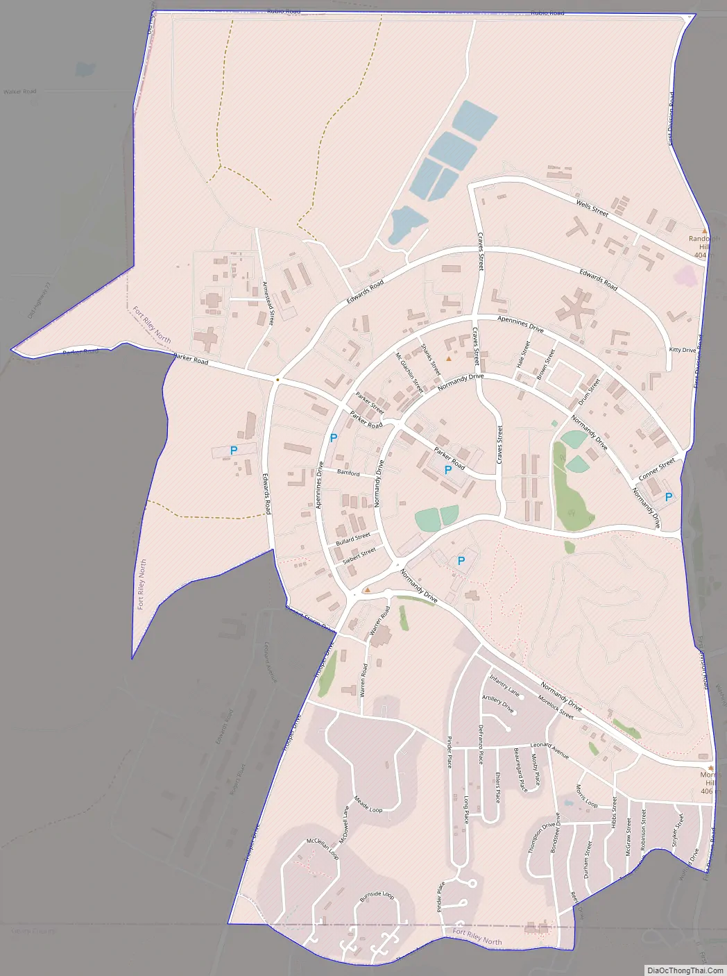
Fort Riley Road Map
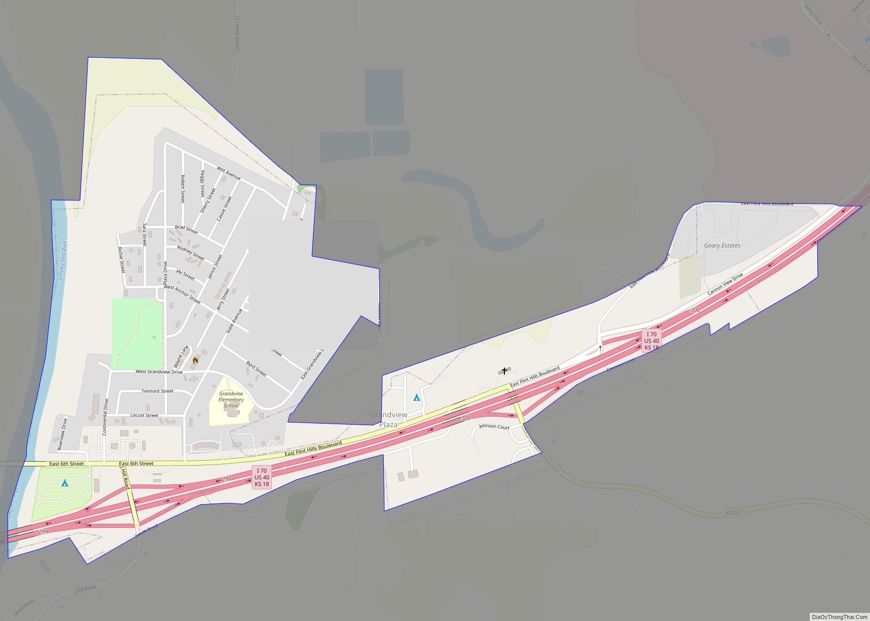
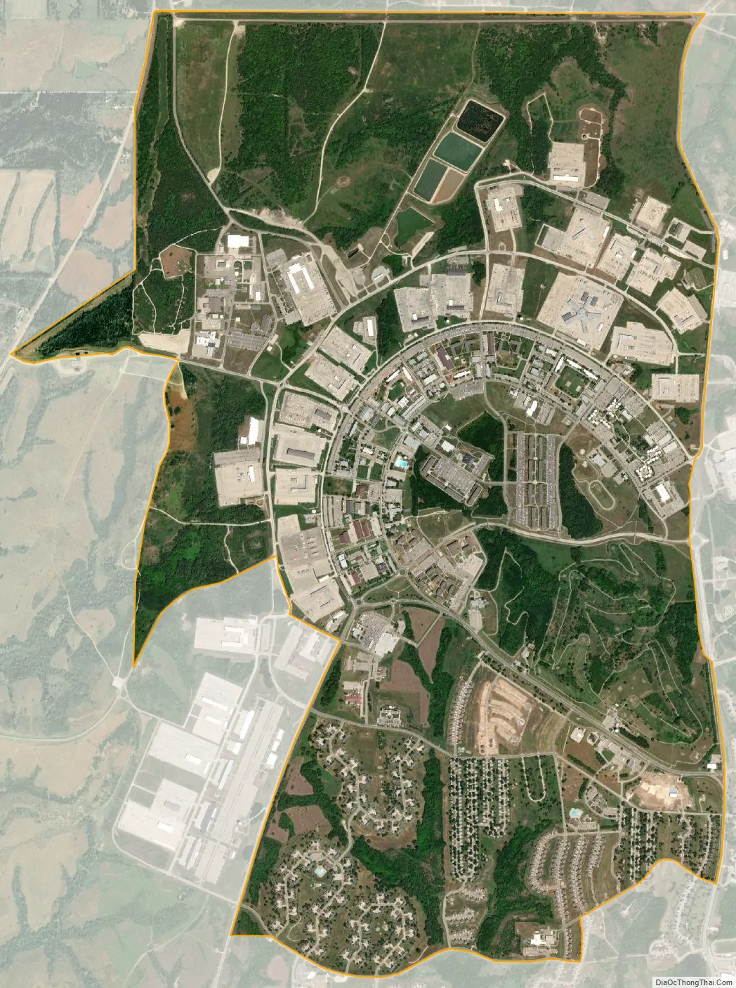
Fort Riley city Satellite Map
Geography
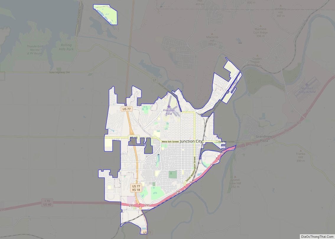
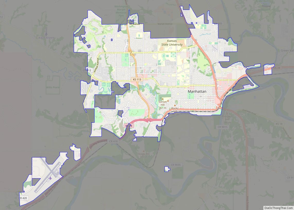
The Fort Riley CDP is located primarily in southern Riley County at 39°5′18″N 96°48′51″W / 39.08833°N 96.81417°W / 39.08833; -96.81417 (39.088222, -96.814092). A small portion of the CDP crosses the county line south into Geary County. According to the United States Census Bureau, the CDP has a total area of 5.1 square miles (13.1 km), of which 0.01 square miles (0.02 km), or 0.17%, is water. It is 6 miles (10 km) north of Junction City and 16 miles (26 km) southwest of Manhattan, Kansas.
See also
Map of Kansas State and its subdivision:- Allen
- Anderson
- Atchison
- Barber
- Barton
- Bourbon
- Brown
- Butler
- Chase
- Chautauqua
- Cherokee
- Cheyenne
- Clark
- Clay
- Cloud
- Coffey
- Comanche
- Cowley
- Crawford
- Decatur
- Dickinson
- Doniphan
- Douglas
- Edwards
- Elk
- Ellis
- Ellsworth
- Finney
- Ford
- Franklin
- Geary
- Gove
- Graham
- Grant
- Gray
- Greeley
- Greenwood
- Hamilton
- Harper
- Harvey
- Haskell
- Hodgeman
- Jackson
- Jefferson
- Jewell
- Johnson
- Kearny
- Kingman
- Kiowa
- Labette
- Lane
- Leavenworth
- Lincoln
- Linn
- Logan
- Lyon
- Marion
- Marshall
- McPherson
- Meade
- Miami
- Mitchell
- Montgomery
- Morris
- Morton
- Nemaha
- Neosho
- Ness
- Norton
- Osage
- Osborne
- Ottawa
- Pawnee
- Phillips
- Pottawatomie
- Pratt
- Rawlins
- Reno
- Republic
- Rice
- Riley
- Rooks
- Rush
- Russell
- Saline
- Scott
- Sedgwick
- Seward
- Shawnee
- Sheridan
- Sherman
- Smith
- Stafford
- Stanton
- Stevens
- Sumner
- Thomas
- Trego
- Wabaunsee
- Wallace
- Washington
- Wichita
- Wilson
- Woodson
- Wyandotte
- Alabama
- Alaska
- Arizona
- Arkansas
- California
- Colorado
- Connecticut
- Delaware
- District of Columbia
- Florida
- Georgia
- Hawaii
- Idaho
- Illinois
- Indiana
- Iowa
- Kansas
- Kentucky
- Louisiana
- Maine
- Maryland
- Massachusetts
- Michigan
- Minnesota
- Mississippi
- Missouri
- Montana
- Nebraska
- Nevada
- New Hampshire
- New Jersey
- New Mexico
- New York
- North Carolina
- North Dakota
- Ohio
- Oklahoma
- Oregon
- Pennsylvania
- Rhode Island
- South Carolina
- South Dakota
- Tennessee
- Texas
- Utah
- Vermont
- Virginia
- Washington
- West Virginia
- Wisconsin
- Wyoming