Greensburg is a city in, and the county seat of, Kiowa County, Kansas, United States. As of the 2020 United States census, the population of the city was 740. It is home to the world’s largest hand-dug well. On the evening of May 4, 2007, Greensburg was devastated by an EF5 tornado that leveled at least 95 percent of the city and killing eleven people between the ages of 46 and 84. Today, Greensburg stands as a model “green town”, often described as the greenest in America. The hospital, city hall, and school have all been built to the highest certification level issued by Leadership in Energy and Environmental Design (LEED).
| Name: | Greensburg city |
|---|---|
| LSAD Code: | 25 |
| LSAD Description: | city (suffix) |
| State: | Kansas |
| County: | Kiowa County |
| Founded: | 1885 |
| Incorporated: | 1886 |
| Elevation: | 2,238 ft (682 m) |
| Total Area: | 1.79 sq mi (4.63 km²) |
| Land Area: | 1.79 sq mi (4.63 km²) |
| Water Area: | 0.00 sq mi (0.00 km²) |
| Total Population: | 740 |
| Population Density: | 410/sq mi (160/km²) |
| ZIP code: | 67054 |
| Area code: | 620 |
| FIPS code: | 2028675 |
| Website: | greensburgks.org |
Online Interactive Map
Click on ![]() to view map in "full screen" mode.
to view map in "full screen" mode.
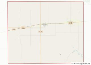
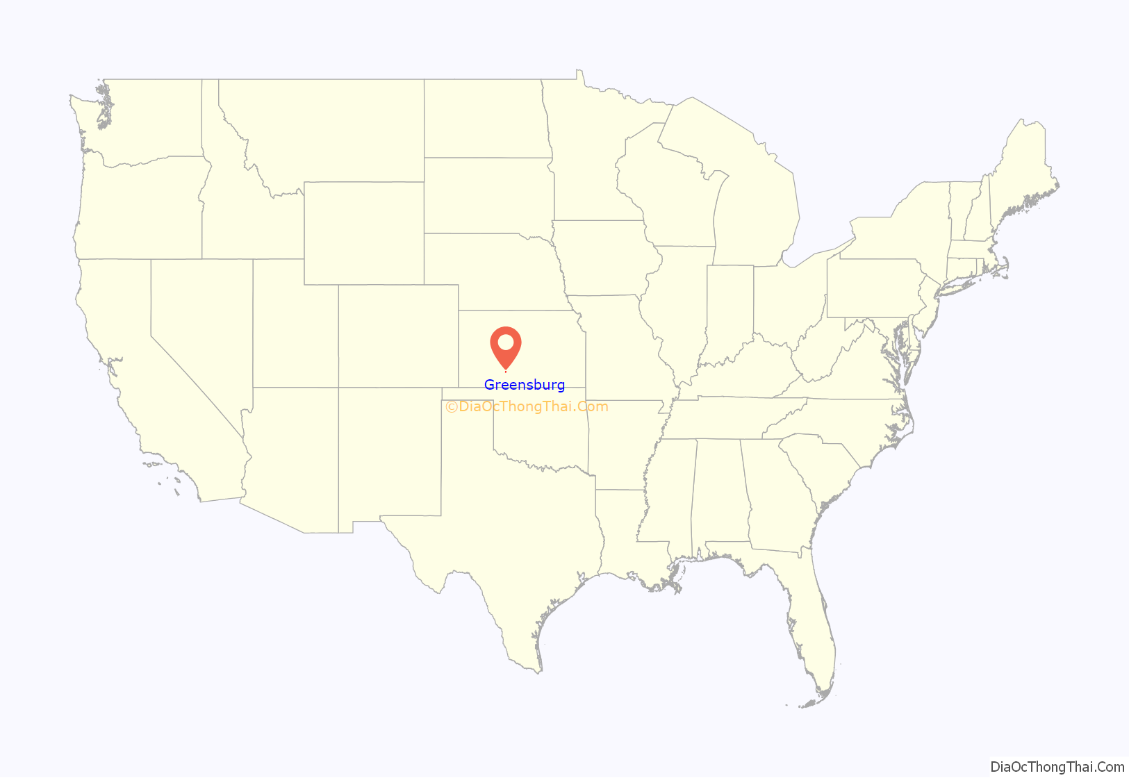
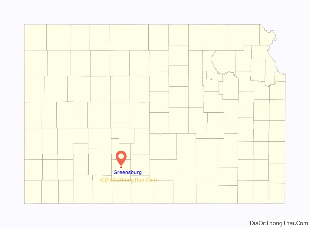
Greensburg location map. Where is Greensburg city?
History
Early history
For millennia, the Great Plains of North America were inhabited by nomadic Native Americans.
19th century
The first settlement was made at Greensburg in 1885. Greensburg was named for D.R. “Cannonball” Green, who owned a stagecoach company and who helped to form the city. In 1887, construction began on the Big Well, the largest hand-dug well in the world. In 1888, Greensburg was advertised as the “liveliest town in the state.” In the same year, the Big Well finished construction.
20th century
The Big Well stopped being a source of the city’s water in 1932.
One of the largest pallasite meteorites ever discovered was found near Greensburg in 1949, weighing over 1,000 pounds.
In 1972, the Big Well was declared a national museum.
21st century
At 9:45 p.m. CDT on May 4, 2007, during a deadly tornado outbreak, Greensburg was hit by an EF5 tornado. The tornado was estimated to be 1.7 miles (2.7 km) in width — wider than the city itself — and traveled for nearly 22 miles (35 km). Ninety-five percent of the city was confirmed to be destroyed, with the other five percent being severely damaged. The National Weather Service estimated winds of the tornado to reach 205 mph (330 km/h). This was the first tornado to be rated EF5 since the implementation of the Enhanced Fujita scale earlier that year and the first F5 or EF5 classification since May 3, 1999, when an F5 tornado ripped through Moore, Oklahoma, as part of the 1999 Oklahoma tornado outbreak. Tornado sirens sounded in the city twenty minutes before the tornado struck, and a tornado emergency was issued, which likely saved many lives. The tornado lasted for a total of one hour and five minutes and caused $250 million in damages.
Kansas Governor Kathleen Sebelius and President George W. Bush both declared Kiowa County a disaster area, which opened up the affected areas for national and international aid. The tornado took 10 lives in Greensburg and two more in neighboring towns. While some rebuilding was done, the population by 2010 was about 50% of what it was in 2000, as the 2000 census found 1,574 residents, while only 777 were recorded in the 2010 census.
After the tornado, the city council passed a resolution stating that all city buildings would be built to LEED — platinum standards, making it the first city in the nation to do so. Greensburg is rebuilding as a “green” town, with the help of Greensburg GreenTown, a non-profit organization created to help the residents learn about and implement the green living initiative. With extra help from the Federal Emergency Management Agency, Greensburg residents developed a long-term plan for Greensburg. The city’s power is supplied by ten 1.25 MW wind-turbines. Carbon offsets generated from the turbines are being managed by NativeEnergy, and have been purchased by charter supporters including Ben & Jerry’s, Clif Bar, Green Mountain Coffee Roasters, and Stonyfield Farm. Greensburg also has numerous electric vehicle charging stations and complimentary bikes.
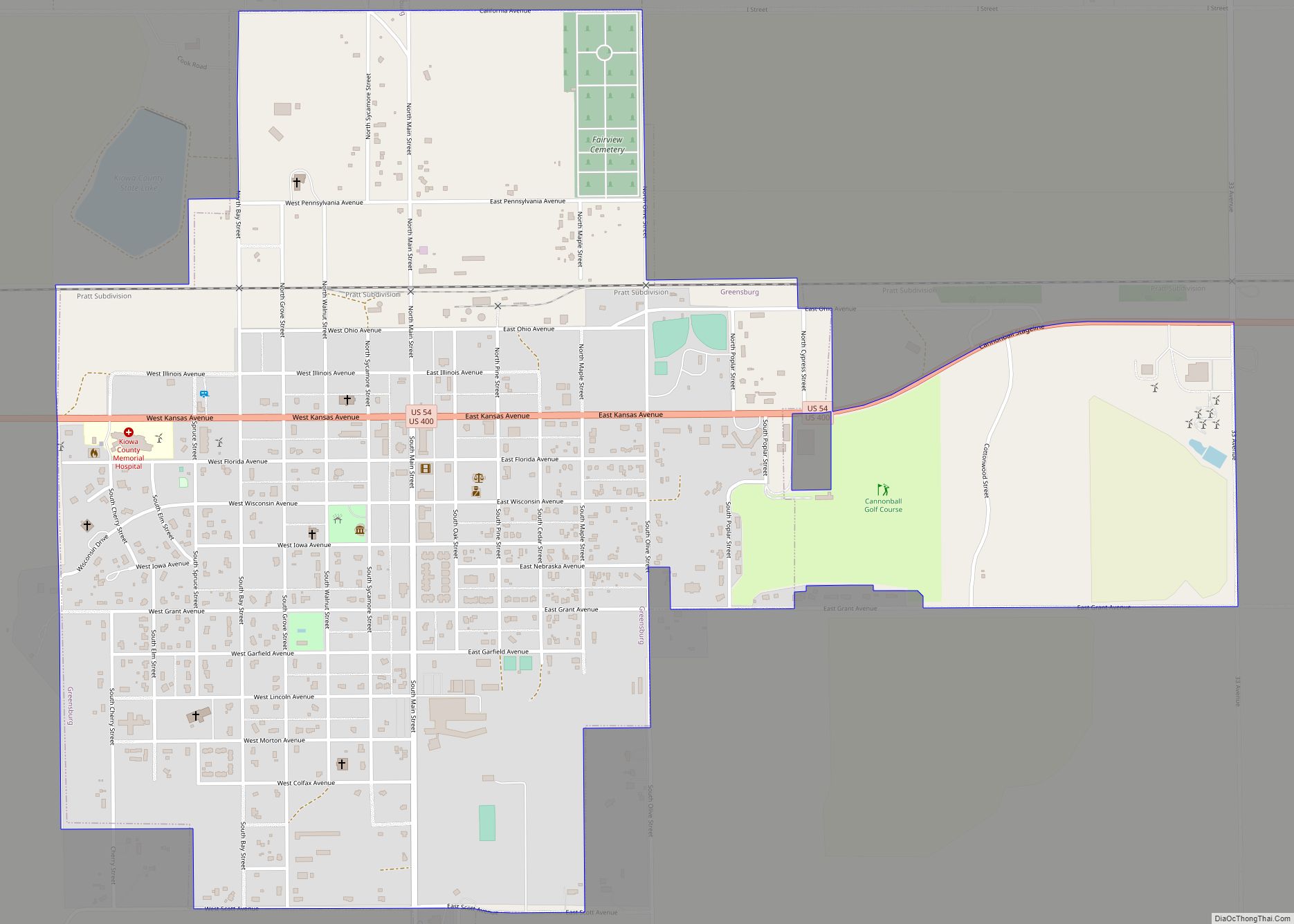
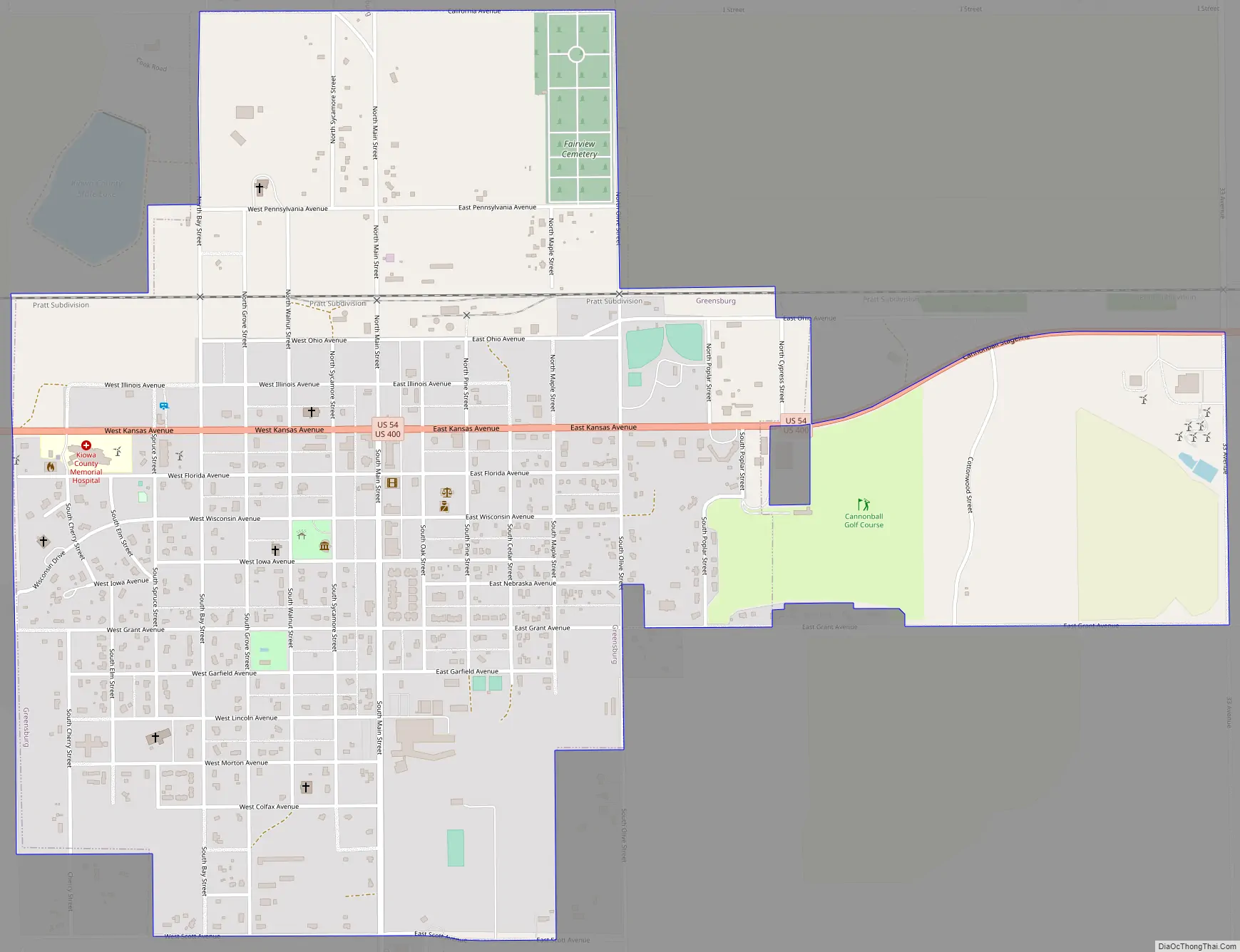
Greensburg Road Map
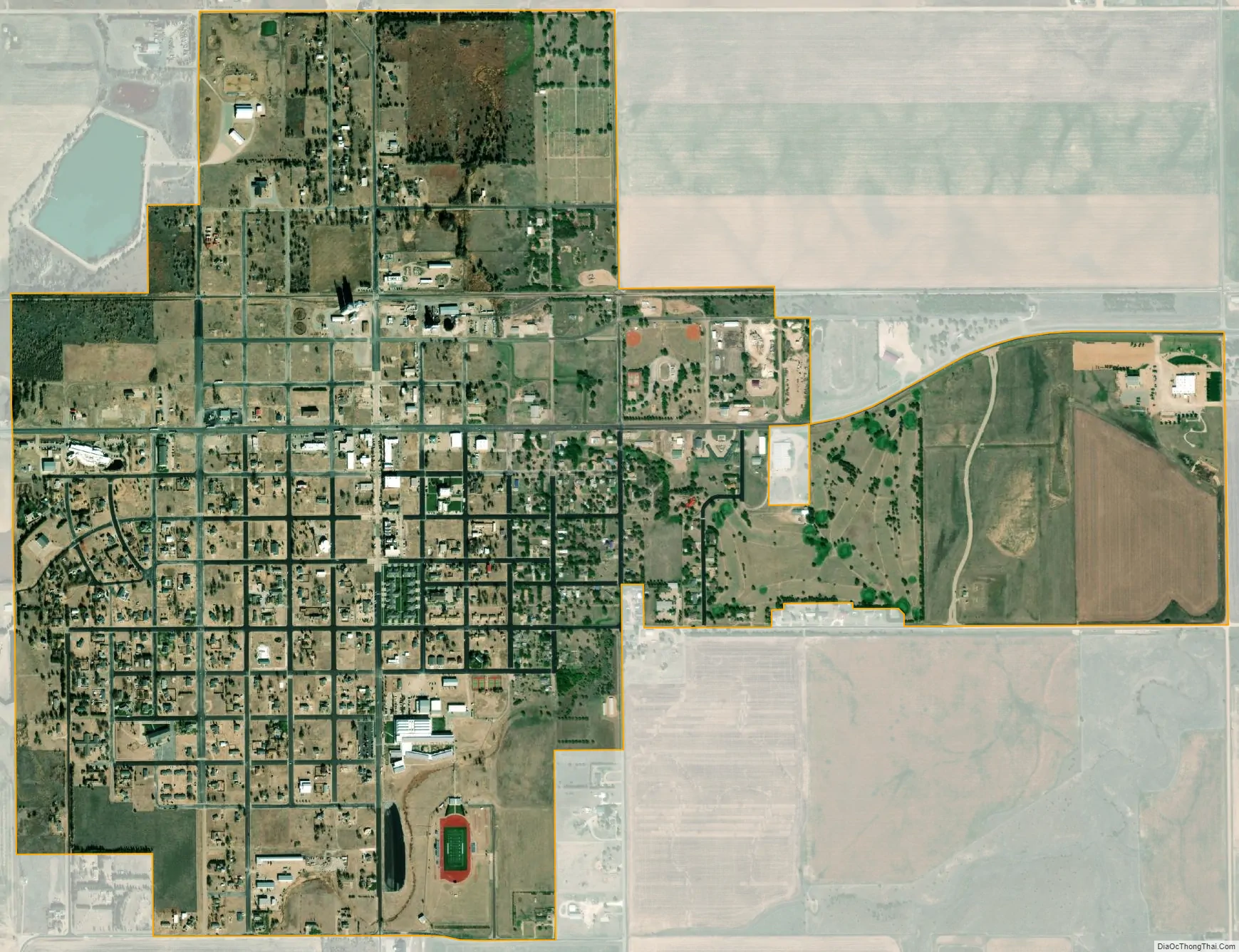
Greensburg city Satellite Map
Geography
Greensburg is located at coordinates 37°36′10″N 99°17′33″W / 37.6027963°N 99.2926131°W / 37.6027963; -99.2926131 (37.6027963, -99.2926131). According to the United States Census Bureau, the city has a total area of 1.48 square miles (3.83 km), all land.
Climate
The climate in this area is characterized by hot, humid summers and generally mild to cool winters. Under the Köppen Climate Classification system, Greensburg has a humid subtropical climate, abbreviated “CFA” on climate maps.
See also
Map of Kansas State and its subdivision:- Allen
- Anderson
- Atchison
- Barber
- Barton
- Bourbon
- Brown
- Butler
- Chase
- Chautauqua
- Cherokee
- Cheyenne
- Clark
- Clay
- Cloud
- Coffey
- Comanche
- Cowley
- Crawford
- Decatur
- Dickinson
- Doniphan
- Douglas
- Edwards
- Elk
- Ellis
- Ellsworth
- Finney
- Ford
- Franklin
- Geary
- Gove
- Graham
- Grant
- Gray
- Greeley
- Greenwood
- Hamilton
- Harper
- Harvey
- Haskell
- Hodgeman
- Jackson
- Jefferson
- Jewell
- Johnson
- Kearny
- Kingman
- Kiowa
- Labette
- Lane
- Leavenworth
- Lincoln
- Linn
- Logan
- Lyon
- Marion
- Marshall
- McPherson
- Meade
- Miami
- Mitchell
- Montgomery
- Morris
- Morton
- Nemaha
- Neosho
- Ness
- Norton
- Osage
- Osborne
- Ottawa
- Pawnee
- Phillips
- Pottawatomie
- Pratt
- Rawlins
- Reno
- Republic
- Rice
- Riley
- Rooks
- Rush
- Russell
- Saline
- Scott
- Sedgwick
- Seward
- Shawnee
- Sheridan
- Sherman
- Smith
- Stafford
- Stanton
- Stevens
- Sumner
- Thomas
- Trego
- Wabaunsee
- Wallace
- Washington
- Wichita
- Wilson
- Woodson
- Wyandotte
- Alabama
- Alaska
- Arizona
- Arkansas
- California
- Colorado
- Connecticut
- Delaware
- District of Columbia
- Florida
- Georgia
- Hawaii
- Idaho
- Illinois
- Indiana
- Iowa
- Kansas
- Kentucky
- Louisiana
- Maine
- Maryland
- Massachusetts
- Michigan
- Minnesota
- Mississippi
- Missouri
- Montana
- Nebraska
- Nevada
- New Hampshire
- New Jersey
- New Mexico
- New York
- North Carolina
- North Dakota
- Ohio
- Oklahoma
- Oregon
- Pennsylvania
- Rhode Island
- South Carolina
- South Dakota
- Tennessee
- Texas
- Utah
- Vermont
- Virginia
- Washington
- West Virginia
- Wisconsin
- Wyoming