Holton is a city in and the county seat of Jackson County, Kansas, United States. As of the 2020 census, the population of the city was 3,401.
| Name: | Holton city |
|---|---|
| LSAD Code: | 25 |
| LSAD Description: | city (suffix) |
| State: | Kansas |
| County: | Jackson County |
| Founded: | 1856 |
| Incorporated: | 1859 |
| Elevation: | 1,096 ft (334 m) |
| Total Area: | 2.76 sq mi (7.15 km²) |
| Land Area: | 2.68 sq mi (6.93 km²) |
| Water Area: | 0.08 sq mi (0.22 km²) |
| Total Population: | 3,401 |
| Population Density: | 1,200/sq mi (480/km²) |
| ZIP code: | 66436 |
| Area code: | 785 |
| FIPS code: | 2032825 |
| Website: | holtonkansas.org |
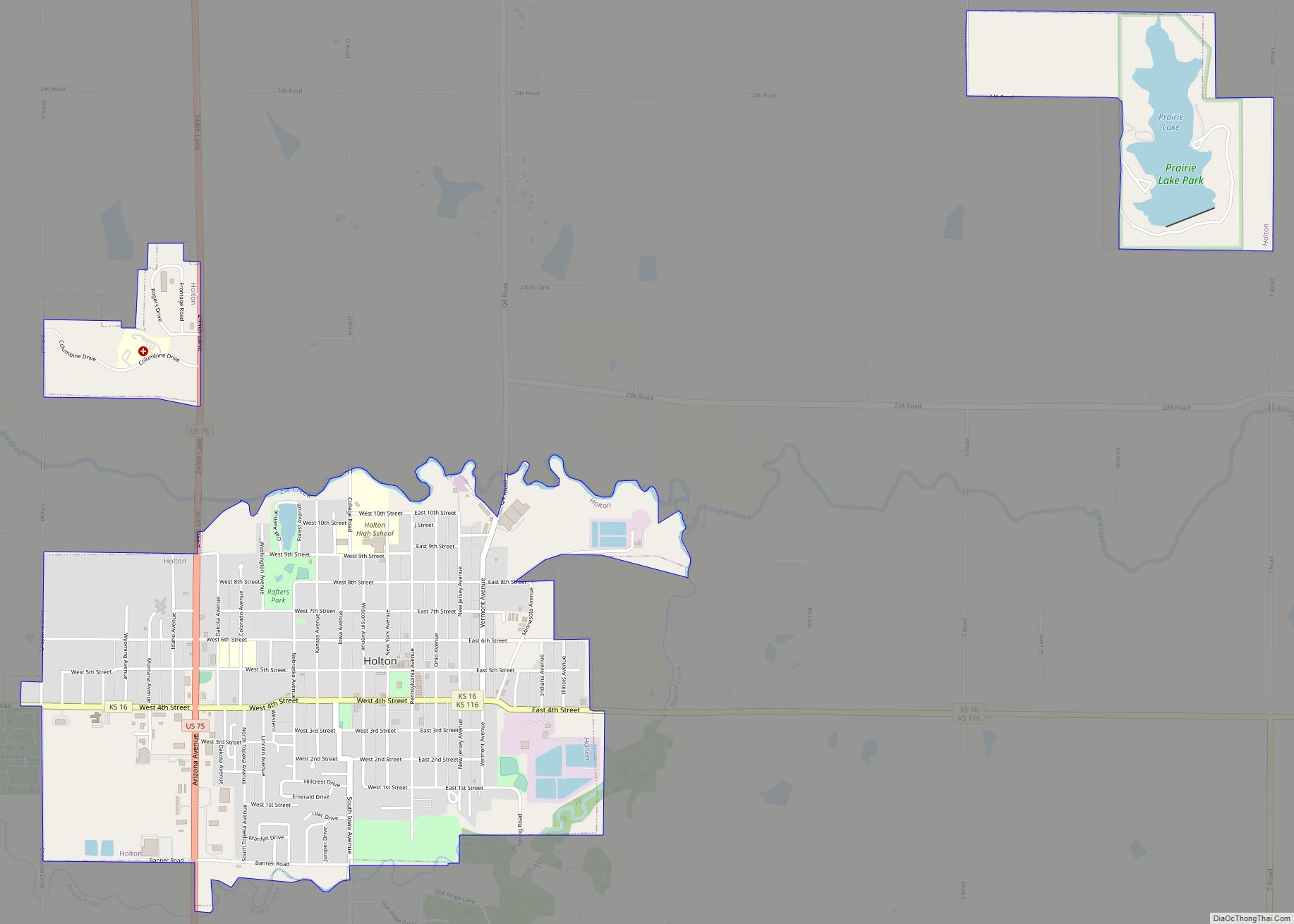
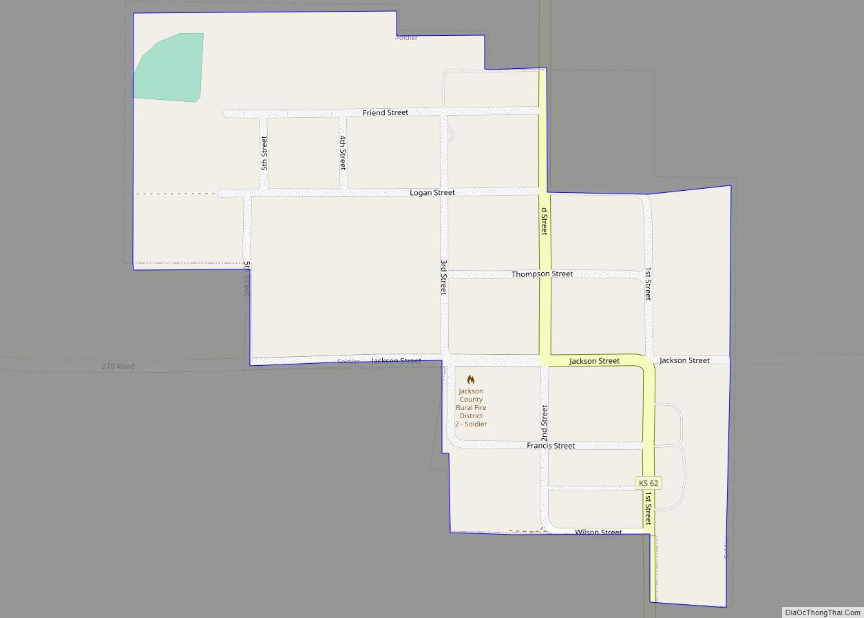
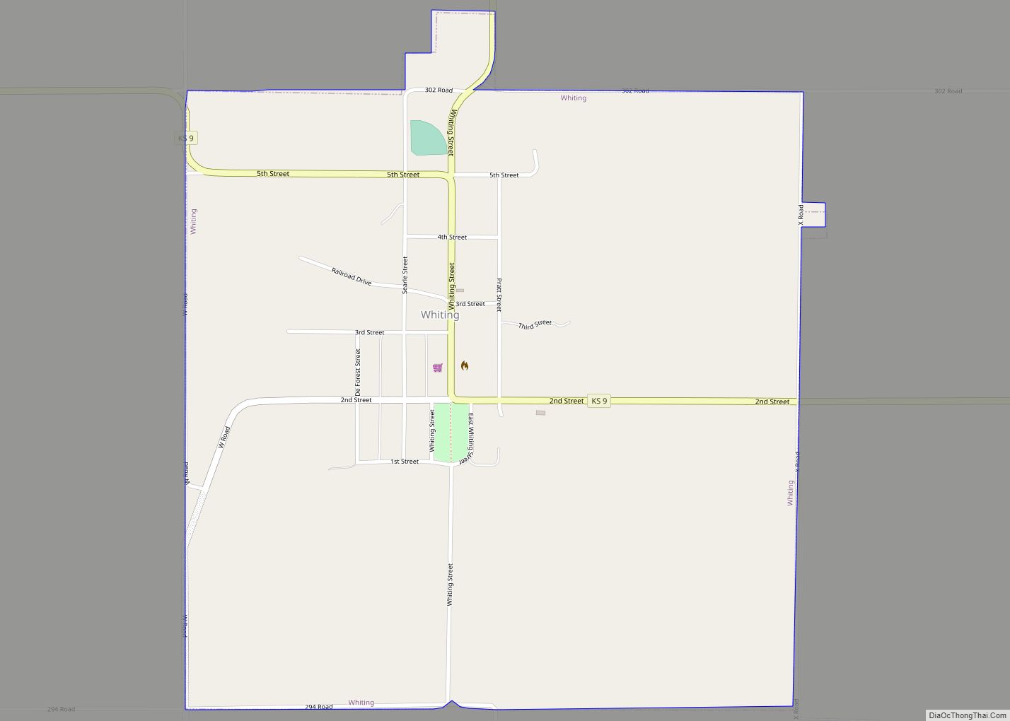
Online Interactive Map
Click on ![]() to view map in "full screen" mode.
to view map in "full screen" mode.
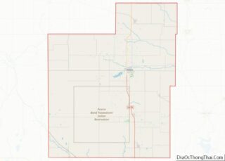
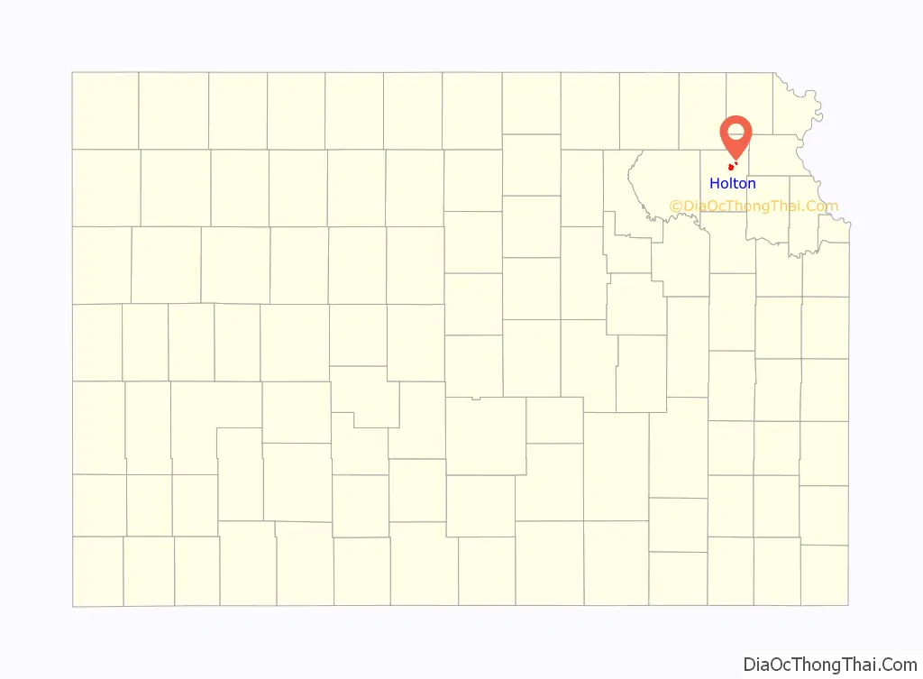
Holton location map. Where is Holton city?

History
The party that chose the site of Holton started at Milwaukee, Wisconsin, in May 1856. A train of six covered wagons, each drawn by two yoke of oxen, started the long trek to take Free State settlers to Kansas. They were financed by the Kansas Society of Milwaukee which was headed by Edward Dwight Holton, the Milwaukee abolitionist. They met General James H. Lane with two hundred men at Nebraska City, Nebraska, a rendezvous for Free State men. They followed the Jim Lane Road into Kansas approximately thirty miles. They came to Elk Creek, 2+1⁄2 miles west of Holton, where they cut timbers to make a bridge, crossed it and made camp where Central School now stands. They liked the two streams (later named Banner Creek and Elk Creek) and the pleasant grassy hills, so they decided to stay. A company was organized and a civil engineer who was with them commenced the survey. They named the new town in honor of Holton.
A log house 20 by 20 feet (6.1 m × 6.1 m) was erected; it was so planned that is could be used for a fort and was known as Jim Lane’s Fort. In the spring of 1857, J. B. Ingerson surveyed the townsite lots.
The county that contains Holton was previously named Calhoun County for the pro-slavery South Carolina Senator John C. Calhoun. In 1859 the name was changed to Jackson County. Holton was chosen as the county seat in 1858. A frame building served as the first courthouse on the east side of the square, near the middle of the block. The first courthouse was built in the center of the square in 1872. The present courthouse was completed in 1921.
In 1859, the abolitionist John Brown took a group of escaped slaves through Holton, leading to an incident known as the Battle of the Spurs.
In 1859, Holton had seven dwellings, one store, a blacksmith shop and a steam saw mill. The census taken in April, 1857, gave Holton 291 people; in 1860 the population was 1,936. In 1859 the city was incorporated.
In 1879, the residents of Jackson County, Kansas decided to form a university in Holton. It was funded by mining magnate, A. C. Campbell, a former resident who had moved to Utah, and thus named Campbell University. In 1902 it merged with Lane University and became Campbell College. In 1913, it merged with Kansas City University, then later closed in 1933. The former site of the college later became the location of Holton High School.
Holton Road Map
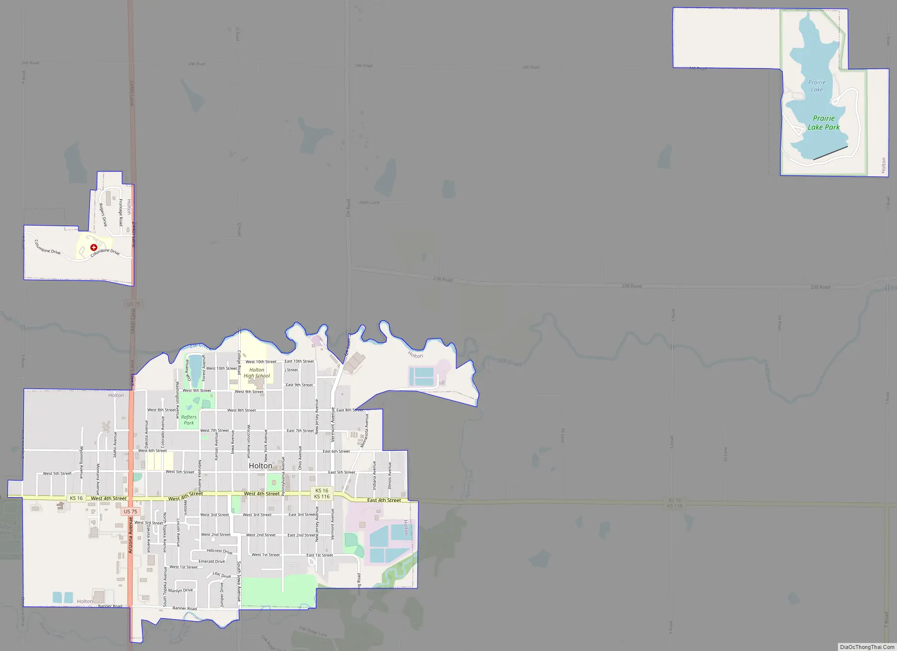
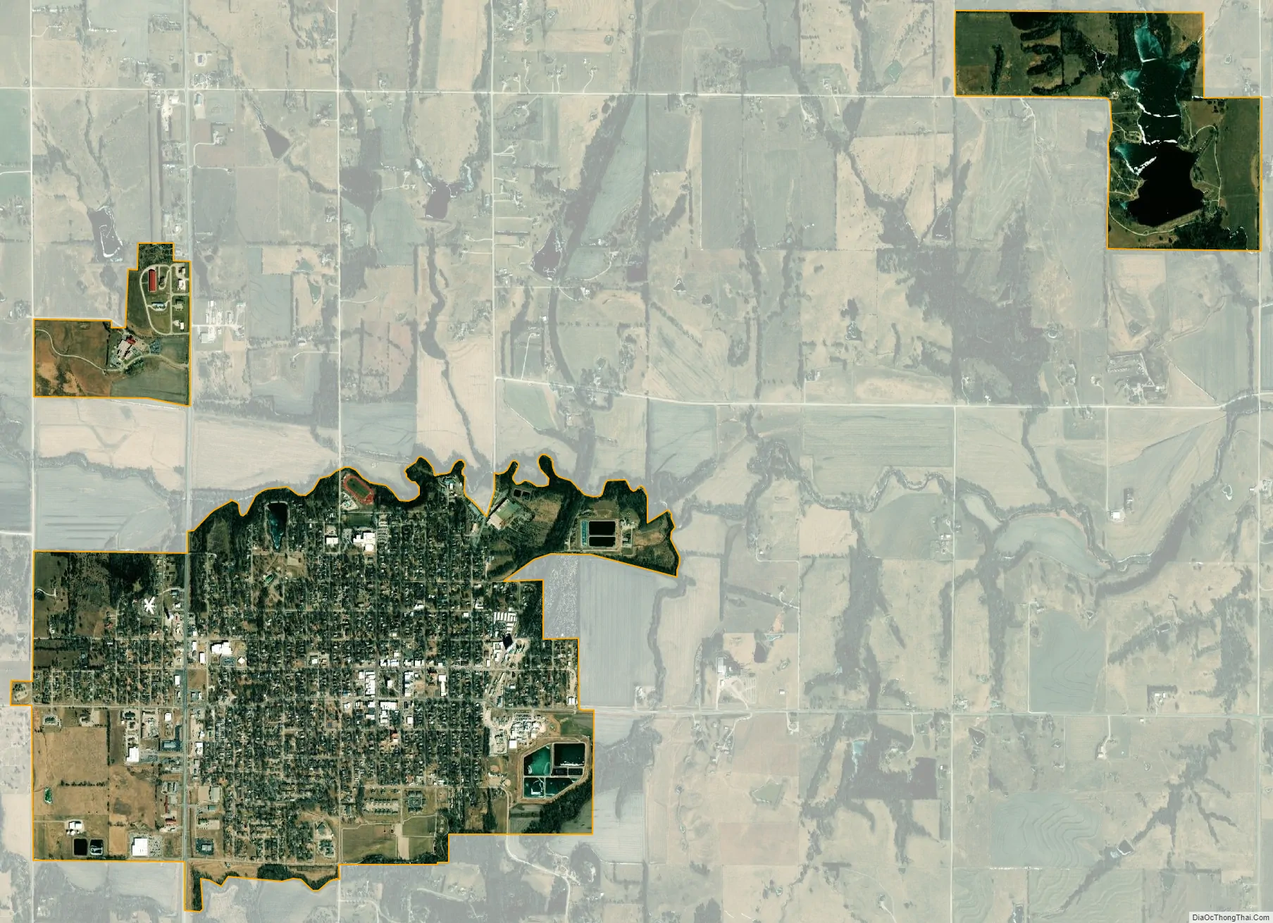
Holton city Satellite Map
Geography
Holton is located at 39°27′55″N 95°44′11″W / 39.46528°N 95.73639°W / 39.46528; -95.73639 (39.4652724, -95.7363723). According to the United States Census Bureau, the city has a total area of 2.78 square miles (7.20 km), of which, 2.70 square miles (6.99 km) is land and 0.08 square miles (0.21 km) is water.
Climate
The climate in this area is characterized by hot, humid summers and generally mild to cool winters. According to the Köppen Climate Classification system, Holton has a humid subtropical climate, abbreviated “Cfa” on climate maps.
See also
Map of Kansas State and its subdivision:- Allen
- Anderson
- Atchison
- Barber
- Barton
- Bourbon
- Brown
- Butler
- Chase
- Chautauqua
- Cherokee
- Cheyenne
- Clark
- Clay
- Cloud
- Coffey
- Comanche
- Cowley
- Crawford
- Decatur
- Dickinson
- Doniphan
- Douglas
- Edwards
- Elk
- Ellis
- Ellsworth
- Finney
- Ford
- Franklin
- Geary
- Gove
- Graham
- Grant
- Gray
- Greeley
- Greenwood
- Hamilton
- Harper
- Harvey
- Haskell
- Hodgeman
- Jackson
- Jefferson
- Jewell
- Johnson
- Kearny
- Kingman
- Kiowa
- Labette
- Lane
- Leavenworth
- Lincoln
- Linn
- Logan
- Lyon
- Marion
- Marshall
- McPherson
- Meade
- Miami
- Mitchell
- Montgomery
- Morris
- Morton
- Nemaha
- Neosho
- Ness
- Norton
- Osage
- Osborne
- Ottawa
- Pawnee
- Phillips
- Pottawatomie
- Pratt
- Rawlins
- Reno
- Republic
- Rice
- Riley
- Rooks
- Rush
- Russell
- Saline
- Scott
- Sedgwick
- Seward
- Shawnee
- Sheridan
- Sherman
- Smith
- Stafford
- Stanton
- Stevens
- Sumner
- Thomas
- Trego
- Wabaunsee
- Wallace
- Washington
- Wichita
- Wilson
- Woodson
- Wyandotte
- Alabama
- Alaska
- Arizona
- Arkansas
- California
- Colorado
- Connecticut
- Delaware
- District of Columbia
- Florida
- Georgia
- Hawaii
- Idaho
- Illinois
- Indiana
- Iowa
- Kansas
- Kentucky
- Louisiana
- Maine
- Maryland
- Massachusetts
- Michigan
- Minnesota
- Mississippi
- Missouri
- Montana
- Nebraska
- Nevada
- New Hampshire
- New Jersey
- New Mexico
- New York
- North Carolina
- North Dakota
- Ohio
- Oklahoma
- Oregon
- Pennsylvania
- Rhode Island
- South Carolina
- South Dakota
- Tennessee
- Texas
- Utah
- Vermont
- Virginia
- Washington
- West Virginia
- Wisconsin
- Wyoming