Lincoln Center, more commonly known as Lincoln, is a city in and the county seat of Lincoln County, Kansas, United States. As of the 2020 census, the population of the city was 1,171.
| Name: | Lincoln Center city |
|---|---|
| LSAD Code: | 25 |
| LSAD Description: | city (suffix) |
| State: | Kansas |
| County: | Lincoln County |
| Founded: | 1870 |
| Incorporated: | 1879 |
| Elevation: | 1,417 ft (432 m) |
| Total Area: | 1.25 sq mi (3.24 km²) |
| Land Area: | 1.25 sq mi (3.24 km²) |
| Water Area: | 0.00 sq mi (0.00 km²) |
| Total Population: | 1,171 |
| Population Density: | 940/sq mi (360/km²) |
| ZIP code: | 67455 |
| Area code: | 785 |
| FIPS code: | 2041300 |
| Website: | lincolnks.org |
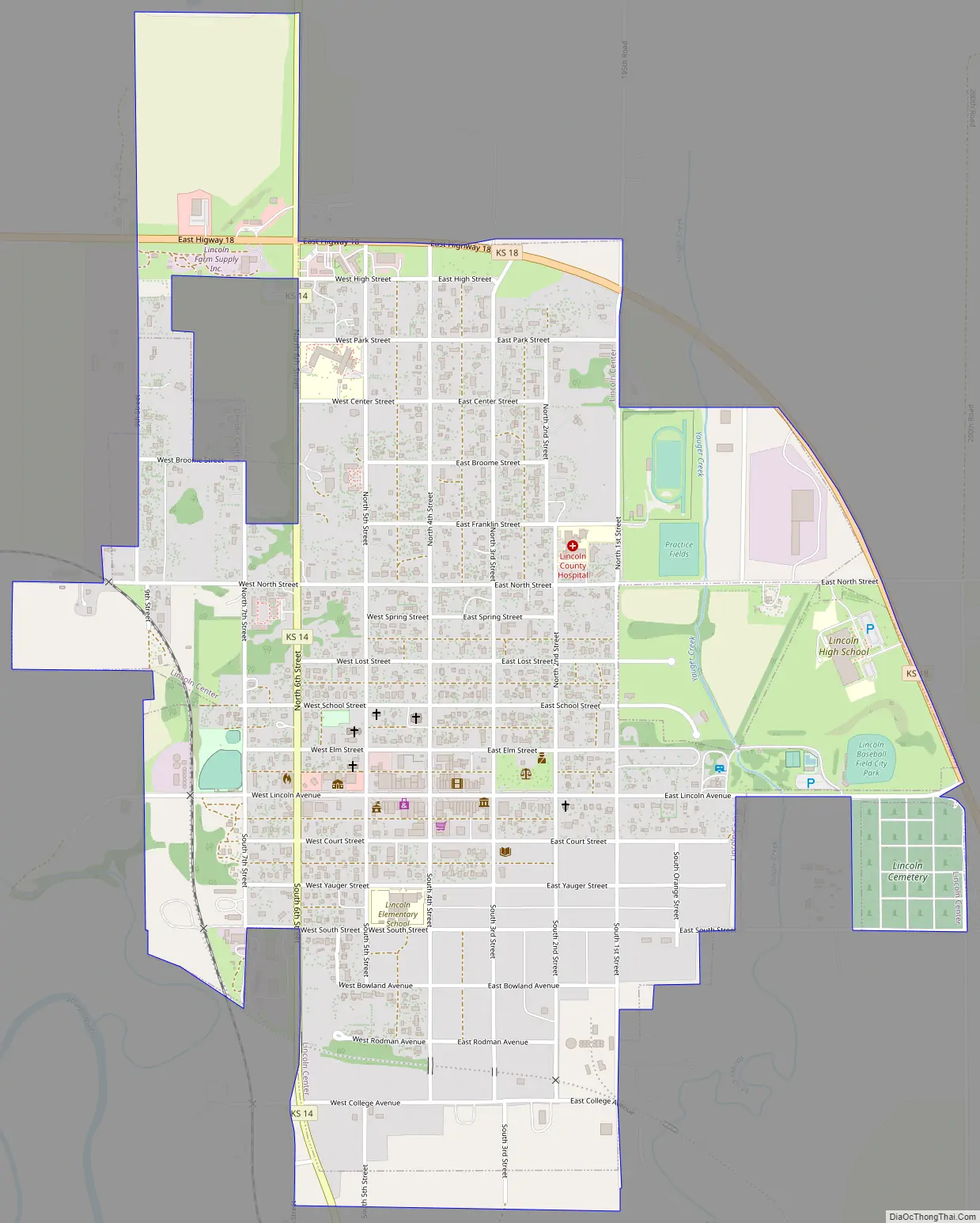
Online Interactive Map
Click on ![]() to view map in "full screen" mode.
to view map in "full screen" mode.
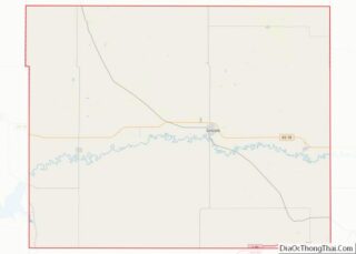
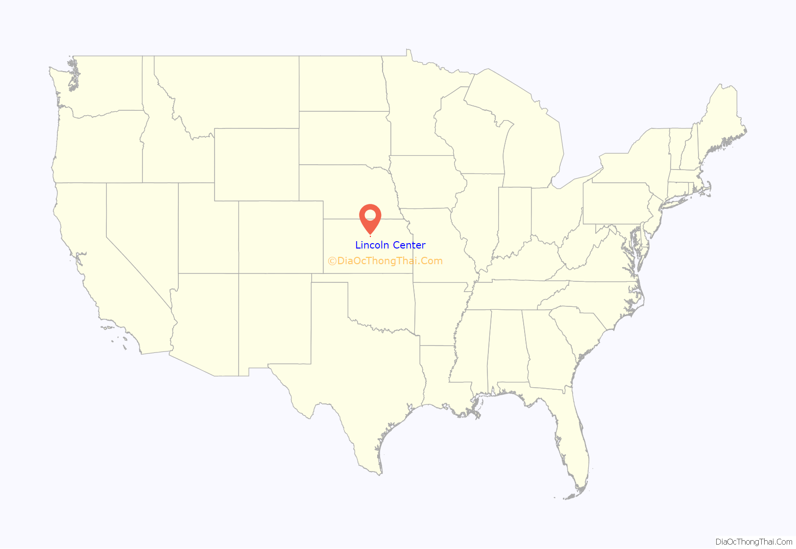
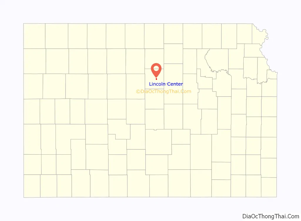
Lincoln Center location map. Where is Lincoln Center city?
History
Settler George Green founded the town of Lincoln in 1870, naming it after the county. “Center” was added to its name to indicate its location in the central part of the county. County residents initially voted to place the county seat in Lincoln Center. Elections in November 1870 resulted in the seat relocating to nearby Abram, sparking a county seat war. Another vote in February 1872 reversed the switch, and Lincoln Center again became the county seat. Residents relocated all the buildings in Abram to Lincoln, merging the two communities. The town was incorporated as the city of Lincoln Center in 1879, and is officially referred to as such in the United States Census. Both the city government and local chamber of commerce refer to the city as Lincoln, and it appears as such on state maps and signs.
Lincoln grew rapidly over the following decade, more than doubling in size, and the city gradually modernized. Kansas Christian College opened in Lincoln in 1885. The Union Pacific Railroad opened a branch line through the city in 1886, bringing mail service. In 1900, after the previous courthouse burned down, a new one was built out of native limestone known locally as post rock. Rural mail delivery began in 1904, and telephony service began in 1905. In 1906, the city’s first power plant opened, providing electric power. Beginning in the 1920s, the mechanization of agriculture reduced the need for farm work and gradually commercial farming operations consolidated family farms resulting in a reduction in the population. By 1950, the state highway commission had completed K-14 and K-18 through Lincoln.
In 1989, given the widespread, long-standing use of post rock limestone in local building construction, the Kansas Legislature named Lincoln County as “The Post Rock Capital of Kansas”.
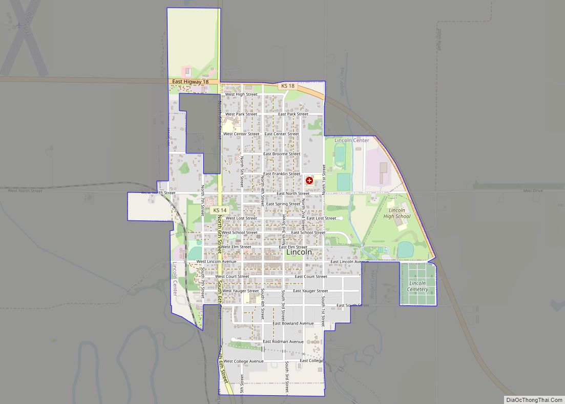
Lincoln Center Road Map
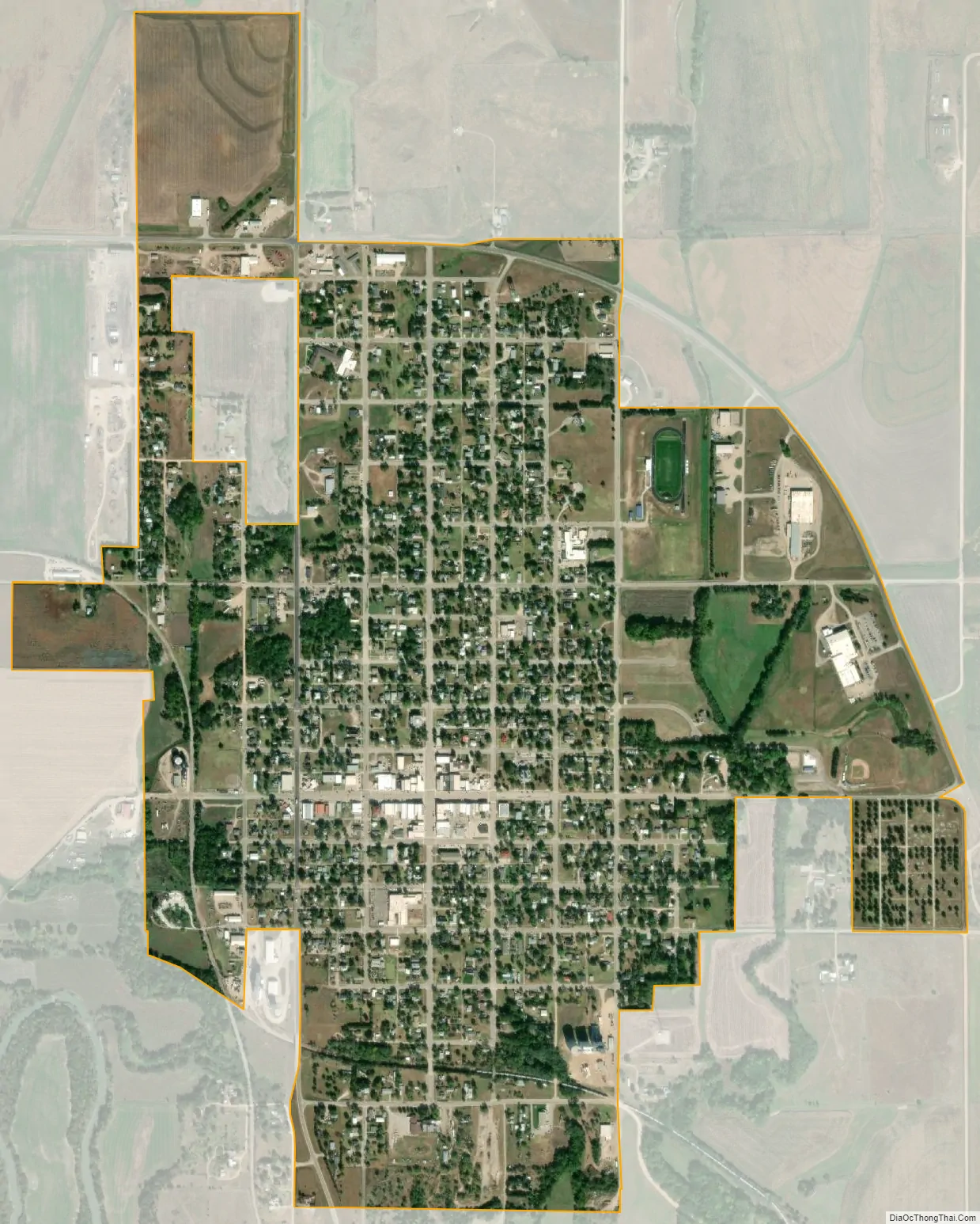
Lincoln Center city Satellite Map
Geography
Lincoln is located at 39°2′30″N 98°8′48″W / 39.04167°N 98.14667°W / 39.04167; -98.14667 (39.041744, -98.146760) at an elevation of 1,417 feet (432 m). The city lies on the north side of the Saline River in the Smoky Hills region of the Great Plains. Yauger Creek, a tributary of the Saline River, flows south along the eastern edge of the city to its confluence with the Saline immediately south of the city. The confluence of the Saline and Lost Creek, another of the river’s tributaries, is located immediately southwest of the city. Located at the intersection of Kansas Highway 14 (K-14) and Kansas Highway 18 (K-18) in north-central Kansas, Lincoln is 101 miles (163 km) northwest of Wichita, 190 miles (310 km) west of Kansas City, and 371 miles (597 km) east-southeast of Denver.
According to the United States Census Bureau, the city has a total area of 1.24 square miles (3.21 km), all of it land.
Climate
Lying in the southern periphery of North America’s humid continental climate (Köppen Dfa), Lincoln experiences hot, humid summers and cold, dry winters. The average temperature is 55.1 °F (12 °C), and the average yearly precipitation is 27.4 inches (69 cm). Snowfall averages 19.3 inches (49 cm) per year. On average, July is the warmest month, January is the coldest month, and May is the wettest month. The hottest temperature recorded in Lincoln was 117 °F (47 °C) in 1947; the coldest temperature recorded was -27 °F (-33 °C) in 1989.
See also
Map of Kansas State and its subdivision:- Allen
- Anderson
- Atchison
- Barber
- Barton
- Bourbon
- Brown
- Butler
- Chase
- Chautauqua
- Cherokee
- Cheyenne
- Clark
- Clay
- Cloud
- Coffey
- Comanche
- Cowley
- Crawford
- Decatur
- Dickinson
- Doniphan
- Douglas
- Edwards
- Elk
- Ellis
- Ellsworth
- Finney
- Ford
- Franklin
- Geary
- Gove
- Graham
- Grant
- Gray
- Greeley
- Greenwood
- Hamilton
- Harper
- Harvey
- Haskell
- Hodgeman
- Jackson
- Jefferson
- Jewell
- Johnson
- Kearny
- Kingman
- Kiowa
- Labette
- Lane
- Leavenworth
- Lincoln
- Linn
- Logan
- Lyon
- Marion
- Marshall
- McPherson
- Meade
- Miami
- Mitchell
- Montgomery
- Morris
- Morton
- Nemaha
- Neosho
- Ness
- Norton
- Osage
- Osborne
- Ottawa
- Pawnee
- Phillips
- Pottawatomie
- Pratt
- Rawlins
- Reno
- Republic
- Rice
- Riley
- Rooks
- Rush
- Russell
- Saline
- Scott
- Sedgwick
- Seward
- Shawnee
- Sheridan
- Sherman
- Smith
- Stafford
- Stanton
- Stevens
- Sumner
- Thomas
- Trego
- Wabaunsee
- Wallace
- Washington
- Wichita
- Wilson
- Woodson
- Wyandotte
- Alabama
- Alaska
- Arizona
- Arkansas
- California
- Colorado
- Connecticut
- Delaware
- District of Columbia
- Florida
- Georgia
- Hawaii
- Idaho
- Illinois
- Indiana
- Iowa
- Kansas
- Kentucky
- Louisiana
- Maine
- Maryland
- Massachusetts
- Michigan
- Minnesota
- Mississippi
- Missouri
- Montana
- Nebraska
- Nevada
- New Hampshire
- New Jersey
- New Mexico
- New York
- North Carolina
- North Dakota
- Ohio
- Oklahoma
- Oregon
- Pennsylvania
- Rhode Island
- South Carolina
- South Dakota
- Tennessee
- Texas
- Utah
- Vermont
- Virginia
- Washington
- West Virginia
- Wisconsin
- Wyoming