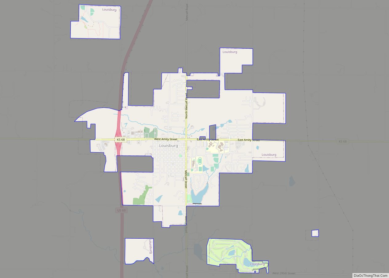
Louisburg is a city in Miami County, Kansas, United States. As of the 2020 census, the population of the city was 4,969.
| Name: | Louisburg city |
|---|---|
| LSAD Code: | 25 |
| LSAD Description: | city (suffix) |
| State: | Kansas |
| County: | Miami County |
| Elevation: | 1,083 ft (330 m) |
| Total Area: | 5.01 sq mi (12.98 km²) |
| Land Area: | 4.89 sq mi (12.66 km²) |
| Water Area: | 0.12 sq mi (0.32 km²) |
| Total Population: | 4,969 |
| Population Density: | 1,021.3/sq mi (394.3/km²) |
| ZIP code: | 66053 |
| Area code: | 913 |
| FIPS code: | 2042875 |
| Website: | louisburgkansas.gov |
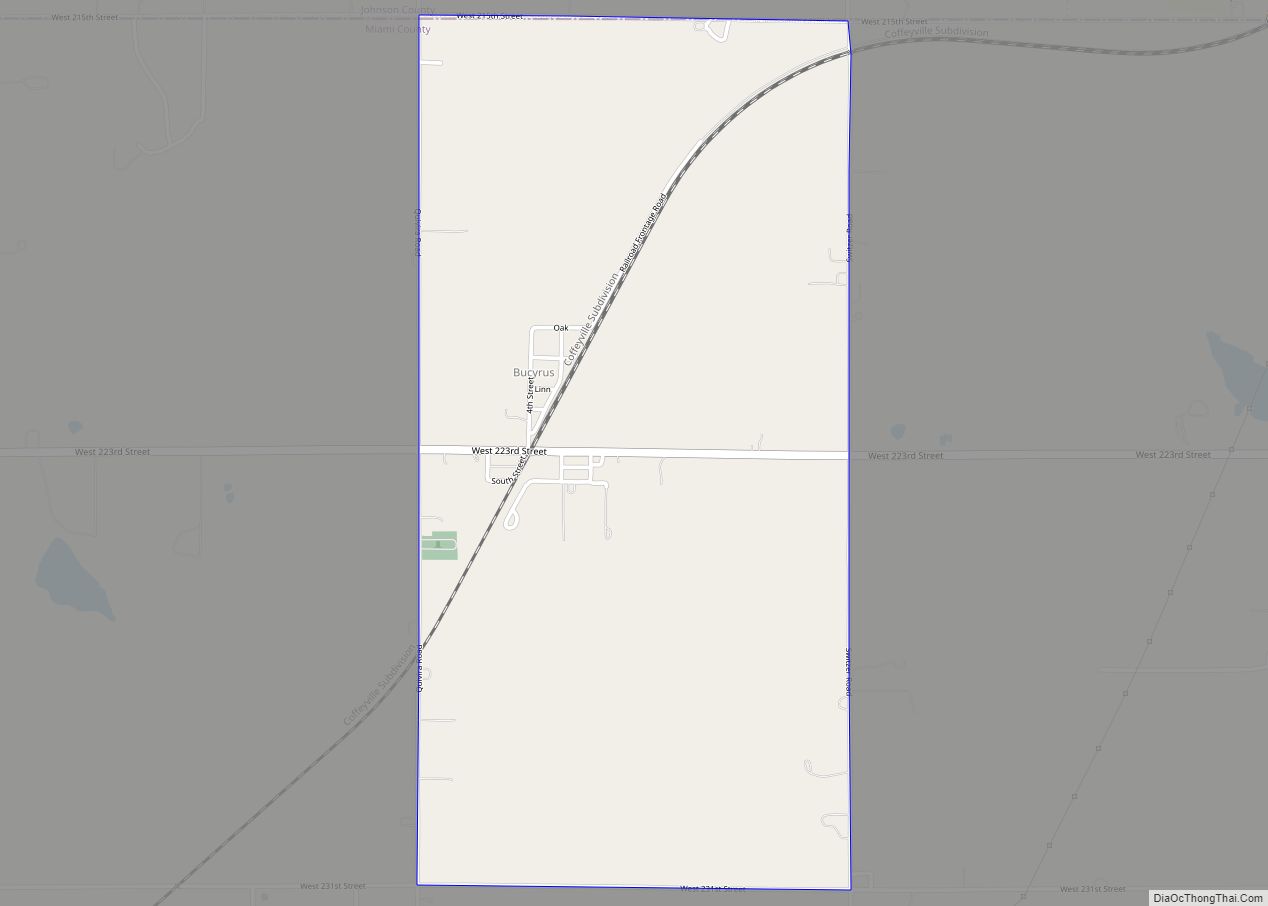
Online Interactive Map
Click on ![]() to view map in "full screen" mode.
to view map in "full screen" mode.
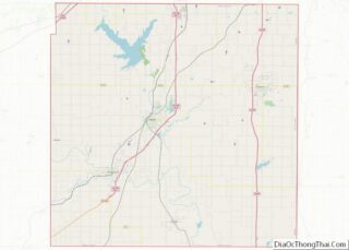
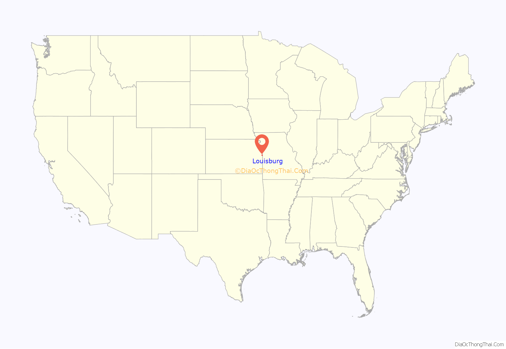
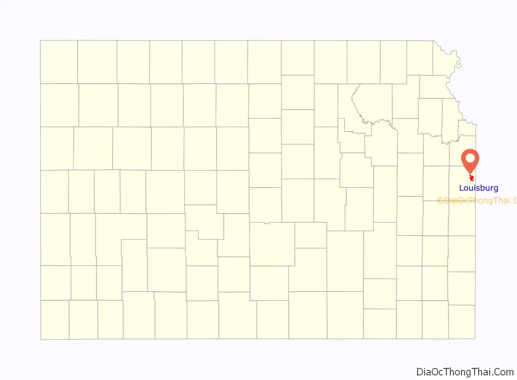
Louisburg location map. Where is Louisburg city?
History
19th century
Prior to the American Civil War, the land of what is now called Louisburg was part of an area reserved for members of various tribes of Native Americans who were ceding their lands in Missouri, Illinois, and Indiana. Settling there were the Peoria, Wea, Piankeshaw, and Kaskaskia tribes which together eventually became the Confederated Tribe of Peoria. Traders and missionaries often visited the area, and by 1854 Euro-American farmers began moving nearby, establishing homes. Upon the organization of the state of Kansas in 1861, the Confederated Tribes were being charged with taxes, and the new state laws conflicted with their own. By 1866, following the Civil War, the government moved the Confederated Tribe of Peoria to Oklahoma, and the land they once occupied was sold to settlers. A community of homes resulted by 1867, and was called St. Louis. Soon, it was often referred to as New St. Louis or Little St. Louis in an effort to distinguish it from St. Louis.
From 1868 to 1870, the settlement of Little St. Louis grew to include businesses and churches, and a railroad depot was to be completed. Because the Missouri, Kansas, and Texas Railroad (MKT Railroad) would be coming to serve the community, and to avoid additional confusion, Little St. Louis was renamed Louisburg in 1870. The railroad depot was completed by 1871, and Louisburg’s first school opened the same year. The community had some disorder during this time. As a town near the border, there remained conflicts between Kansas Jayhawkers and Missouri Raiders. In addition, the railroad tracks running through the community divided it into north and south areas. Circa 1875, many businesses and homes were moved from north of the railroad to the south, and formed what was to become downtown Louisburg.
Louisburg was incorporated as a city of the third class November 3, 1882, and held its first city election two weeks later on November 17, 1882. The population was listed as 400, and 141 of those residents voted in the first election.
20th century
In the early 1900s, Louisburg’s downtown had a variety of businesses such as retail stores, supply stores, livery stables, a hotel, and large nurseries. By 1910 the population was 603, and Louisburg was known as a good supply town for agricultural districts. By the 1920s, the town also had a gas station, an automobile ownership and traffic through town had increased. By the late 1950s the MKT Railroad ended its service to Louisburg, but because K-68 went through town and US Highway 69 and K-68 intersected near town, growth continued.
In October 1912, an unsolved murder in the community took place as the town’s postmaster at the time, George McElheny, was shot twice by a 12-gauge shotgun at his home. Several people were accused of the murder, including his wife, after she admitted an affair with one of the accused, but after intense trials and no hard evidence the case was dropped, and no one ever admitted to the murder. In later years, the murder was almost forgotten until Joe Towne, one of the community leaders, grew interested in the subject and studied it and interviewed those who remembered the tragic situation and wrote true crime novel, “Tongues on Fire”.
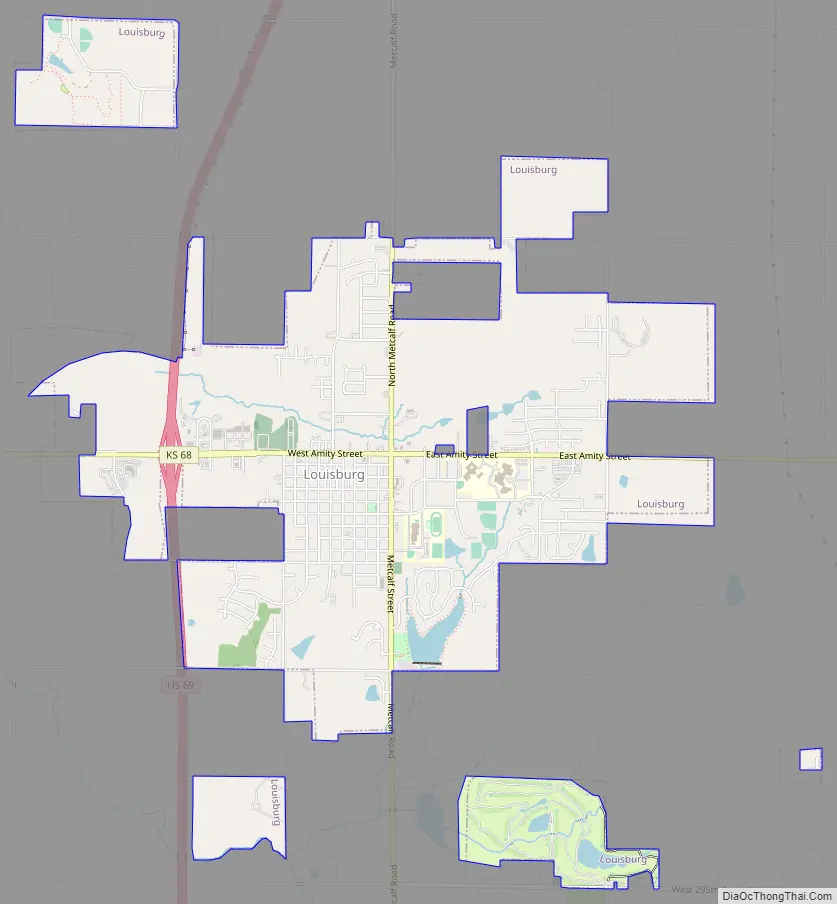
Louisburg Road Map
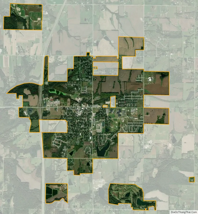
Louisburg city Satellite Map
Geography
According to the United States Census Bureau, the city has a total area of 6.12 square miles (15.85 km), of which 5.57 square miles (14.43 km) is land and 0.55 square miles (1.42 km) is water.
See also
Map of Kansas State and its subdivision:- Allen
- Anderson
- Atchison
- Barber
- Barton
- Bourbon
- Brown
- Butler
- Chase
- Chautauqua
- Cherokee
- Cheyenne
- Clark
- Clay
- Cloud
- Coffey
- Comanche
- Cowley
- Crawford
- Decatur
- Dickinson
- Doniphan
- Douglas
- Edwards
- Elk
- Ellis
- Ellsworth
- Finney
- Ford
- Franklin
- Geary
- Gove
- Graham
- Grant
- Gray
- Greeley
- Greenwood
- Hamilton
- Harper
- Harvey
- Haskell
- Hodgeman
- Jackson
- Jefferson
- Jewell
- Johnson
- Kearny
- Kingman
- Kiowa
- Labette
- Lane
- Leavenworth
- Lincoln
- Linn
- Logan
- Lyon
- Marion
- Marshall
- McPherson
- Meade
- Miami
- Mitchell
- Montgomery
- Morris
- Morton
- Nemaha
- Neosho
- Ness
- Norton
- Osage
- Osborne
- Ottawa
- Pawnee
- Phillips
- Pottawatomie
- Pratt
- Rawlins
- Reno
- Republic
- Rice
- Riley
- Rooks
- Rush
- Russell
- Saline
- Scott
- Sedgwick
- Seward
- Shawnee
- Sheridan
- Sherman
- Smith
- Stafford
- Stanton
- Stevens
- Sumner
- Thomas
- Trego
- Wabaunsee
- Wallace
- Washington
- Wichita
- Wilson
- Woodson
- Wyandotte
- Alabama
- Alaska
- Arizona
- Arkansas
- California
- Colorado
- Connecticut
- Delaware
- District of Columbia
- Florida
- Georgia
- Hawaii
- Idaho
- Illinois
- Indiana
- Iowa
- Kansas
- Kentucky
- Louisiana
- Maine
- Maryland
- Massachusetts
- Michigan
- Minnesota
- Mississippi
- Missouri
- Montana
- Nebraska
- Nevada
- New Hampshire
- New Jersey
- New Mexico
- New York
- North Carolina
- North Dakota
- Ohio
- Oklahoma
- Oregon
- Pennsylvania
- Rhode Island
- South Carolina
- South Dakota
- Tennessee
- Texas
- Utah
- Vermont
- Virginia
- Washington
- West Virginia
- Wisconsin
- Wyoming