Matfield Green is a city in Chase County, Kansas, United States. As of the 2020 census, the population of the city was 49. It is located along K-177 highway.
| Name: | Matfield Green city |
|---|---|
| LSAD Code: | 25 |
| LSAD Description: | city (suffix) |
| State: | Kansas |
| County: | Chase County |
| Incorporated: | 1924 |
| Elevation: | 1,306 ft (398 m) |
| Total Area: | 0.14 sq mi (0.37 km²) |
| Land Area: | 0.14 sq mi (0.37 km²) |
| Water Area: | 0.00 sq mi (0.00 km²) |
| Total Population: | 49 |
| Population Density: | 350/sq mi (130/km²) |
| ZIP code: | 66862 |
| Area code: | 620 |
| FIPS code: | 2045150 |
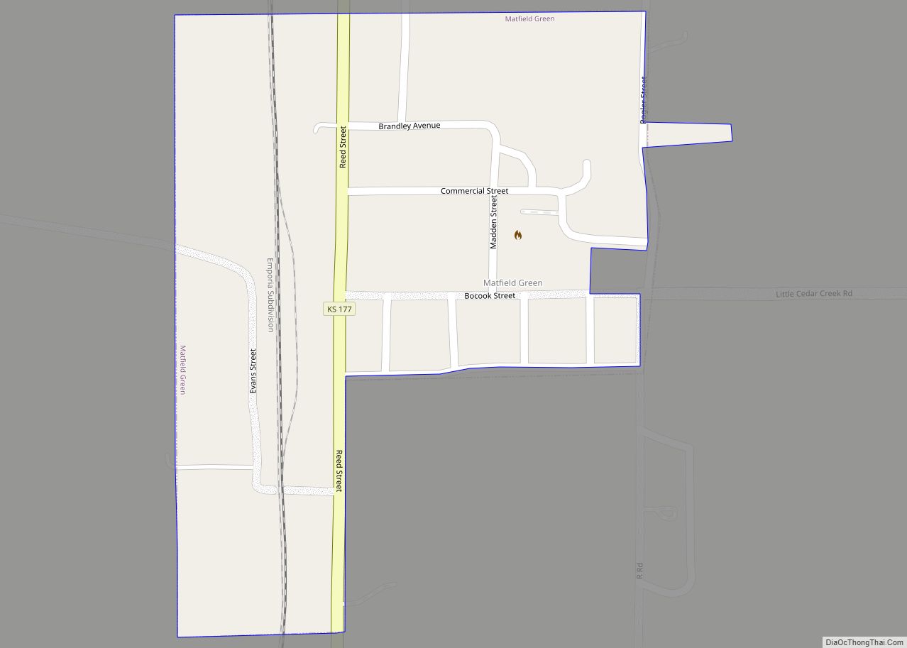
Online Interactive Map
Click on ![]() to view map in "full screen" mode.
to view map in "full screen" mode.
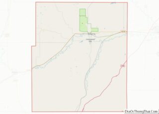
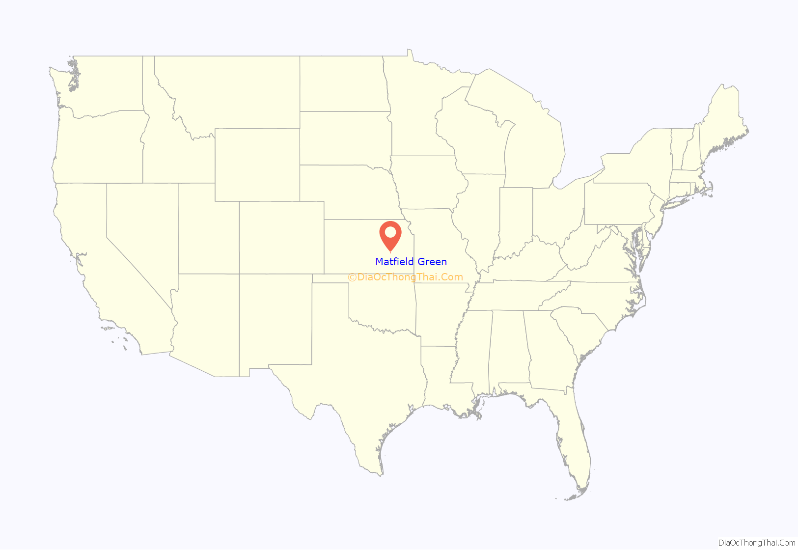
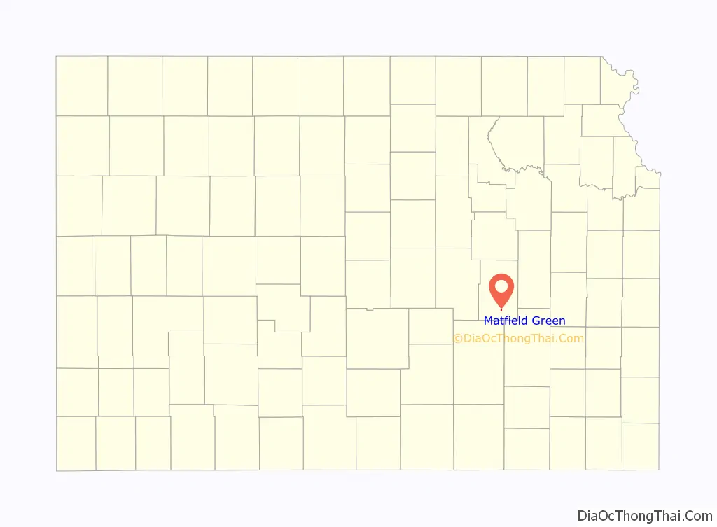
Matfield Green location map. Where is Matfield Green city?
History
Early history
For many millennia, the Great Plains of North America was inhabited by nomadic Native Americans. The historic Native American tribes of Kansas are many, including the Kansa, or “Wind People,” from whom the name of the state is derived. Also included are the related Osage, Pawnee, and Wichita. From the west and north ranged the Comanche and Apache, as well as the Kiowa, Cheyenne and Arapaho.
From the 16th century to 18th century, the Kingdom of France claimed ownership of large parts of North America. In 1762, after the French and Indian War, France secretly ceded New France to Spain, per the Treaty of Fontainebleau.
19th century
In 1802, Spain returned most of the land to France. In 1803, most of the land for modern day Kansas was acquired by the United States from France as part of the 828,000 square mile Louisiana Purchase for 2.83 cents per acre.
In 1854, the Kansas Territory was organized, then in 1861 Kansas became the 34th U.S. state. In 1859, Chase County was established within the Kansas Territory, which included the land for modern day Matfield Green.
Matfield Green was named after Matfield, in England.
In 1870, Bazaar Township, Chase County, Kansas which includes Matfield Green had a population of 376, growing to 1,096 by 1880. In its heyday, at the beginning of the 20th century, Matfield Green grew to about 350 residents and possessed a bank, grocery store, livery and blacksmith, hardware, flour mill and lumberyard, and even a hotel for visitors. It also had its own schools. A post office existed in Matfield Green from January 11, 1867 to September 30, 1995.
Present
Like many small towns in Kansas, Matfield Green struggles to maintain its existence. It is helped by a small colony of artists and writers who work to preserve the community, along with the nearby historic Pioneer Bluffs ranch headquarters. Additionally great conservation efforts have been made by both private individuals such as Texas billionaire Ed Bass and non profit organizations Nature Conservancy to combat development and preserve the Flint Hills, which is one of the most threatened ecosystems in the world.
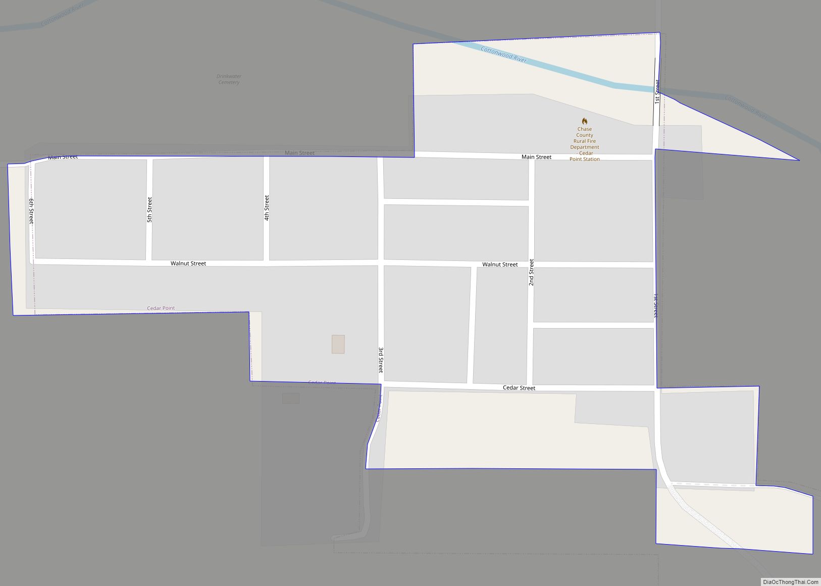
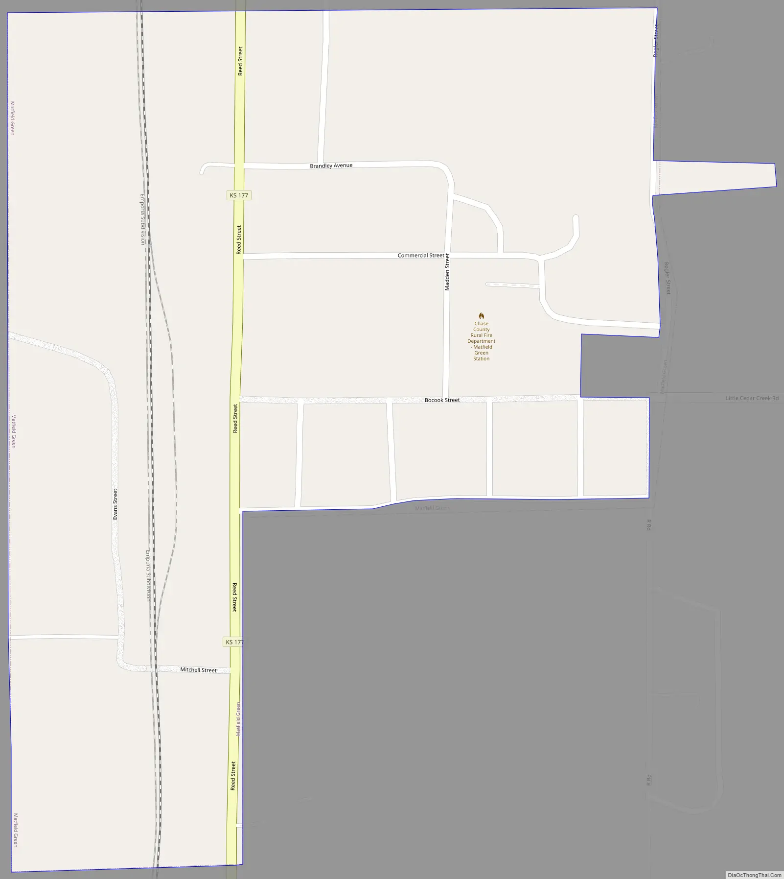
Matfield Green Road Map
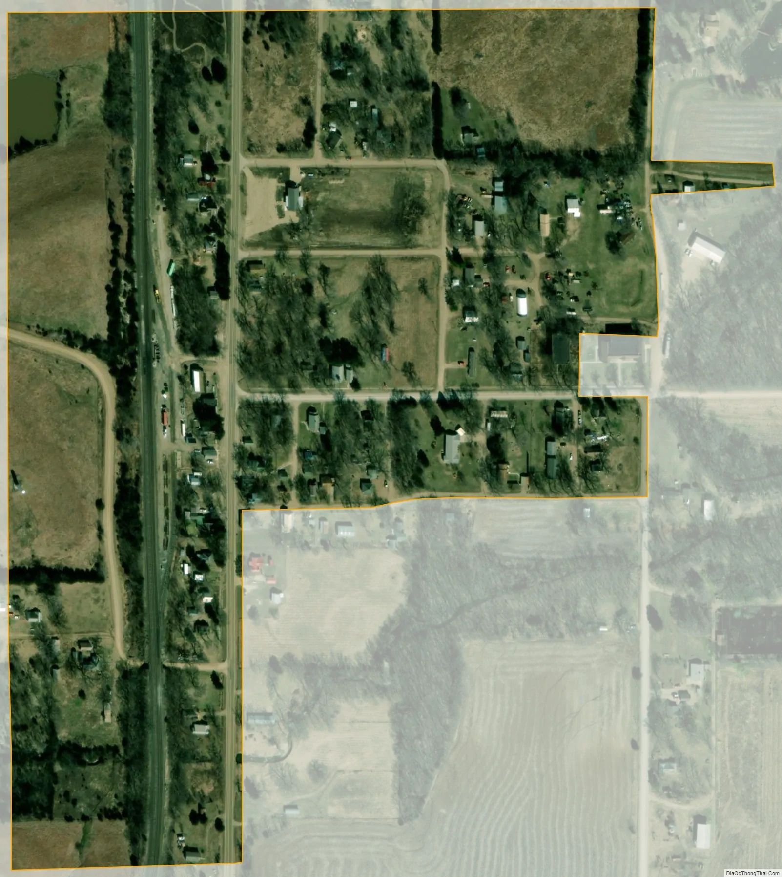
Matfield Green city Satellite Map
Geography
Matfield Green is located at 38°09′35″N 96°33′43″W / 38.159609°N 96.562013°W / 38.159609; -96.562013 (38.159609, -96.562013)., in the scenic Flint Hills of the Great Plains. According to the United States Census Bureau, the city has a total area of 0.14 square miles (0.36 km), all of it land.
Climate
The climate in this area is characterized by hot, humid summers and generally mild to cool winters. According to the Köppen Climate Classification system, Matfield Green has a humid subtropical climate, abbreviated “Cfa” on climate maps.
See also
Map of Kansas State and its subdivision:- Allen
- Anderson
- Atchison
- Barber
- Barton
- Bourbon
- Brown
- Butler
- Chase
- Chautauqua
- Cherokee
- Cheyenne
- Clark
- Clay
- Cloud
- Coffey
- Comanche
- Cowley
- Crawford
- Decatur
- Dickinson
- Doniphan
- Douglas
- Edwards
- Elk
- Ellis
- Ellsworth
- Finney
- Ford
- Franklin
- Geary
- Gove
- Graham
- Grant
- Gray
- Greeley
- Greenwood
- Hamilton
- Harper
- Harvey
- Haskell
- Hodgeman
- Jackson
- Jefferson
- Jewell
- Johnson
- Kearny
- Kingman
- Kiowa
- Labette
- Lane
- Leavenworth
- Lincoln
- Linn
- Logan
- Lyon
- Marion
- Marshall
- McPherson
- Meade
- Miami
- Mitchell
- Montgomery
- Morris
- Morton
- Nemaha
- Neosho
- Ness
- Norton
- Osage
- Osborne
- Ottawa
- Pawnee
- Phillips
- Pottawatomie
- Pratt
- Rawlins
- Reno
- Republic
- Rice
- Riley
- Rooks
- Rush
- Russell
- Saline
- Scott
- Sedgwick
- Seward
- Shawnee
- Sheridan
- Sherman
- Smith
- Stafford
- Stanton
- Stevens
- Sumner
- Thomas
- Trego
- Wabaunsee
- Wallace
- Washington
- Wichita
- Wilson
- Woodson
- Wyandotte
- Alabama
- Alaska
- Arizona
- Arkansas
- California
- Colorado
- Connecticut
- Delaware
- District of Columbia
- Florida
- Georgia
- Hawaii
- Idaho
- Illinois
- Indiana
- Iowa
- Kansas
- Kentucky
- Louisiana
- Maine
- Maryland
- Massachusetts
- Michigan
- Minnesota
- Mississippi
- Missouri
- Montana
- Nebraska
- Nevada
- New Hampshire
- New Jersey
- New Mexico
- New York
- North Carolina
- North Dakota
- Ohio
- Oklahoma
- Oregon
- Pennsylvania
- Rhode Island
- South Carolina
- South Dakota
- Tennessee
- Texas
- Utah
- Vermont
- Virginia
- Washington
- West Virginia
- Wisconsin
- Wyoming