Reading is a city in Lyon County, Kansas, United States. As of the 2020 census, the population of the city was 181.
| Name: | Reading city |
|---|---|
| LSAD Code: | 25 |
| LSAD Description: | city (suffix) |
| State: | Kansas |
| County: | Lyon County |
| Founded: | 1870 |
| Incorporated: | 1890 |
| Elevation: | 1,096 ft (334 m) |
| Total Area: | 0.21 sq mi (0.55 km²) |
| Land Area: | 0.21 sq mi (0.55 km²) |
| Water Area: | 0.00 sq mi (0.00 km²) |
| Total Population: | 181 |
| Population Density: | 860/sq mi (330/km²) |
| ZIP code: | 66868 |
| Area code: | 620 |
| FIPS code: | 2058600 |
| Website: | readingks.com |
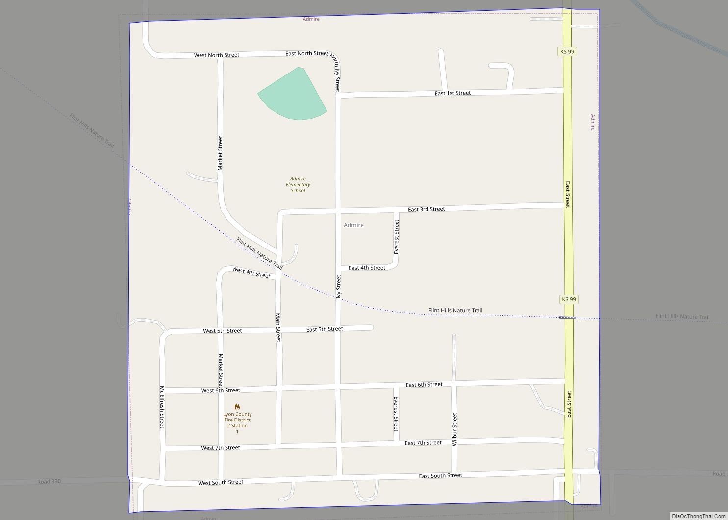
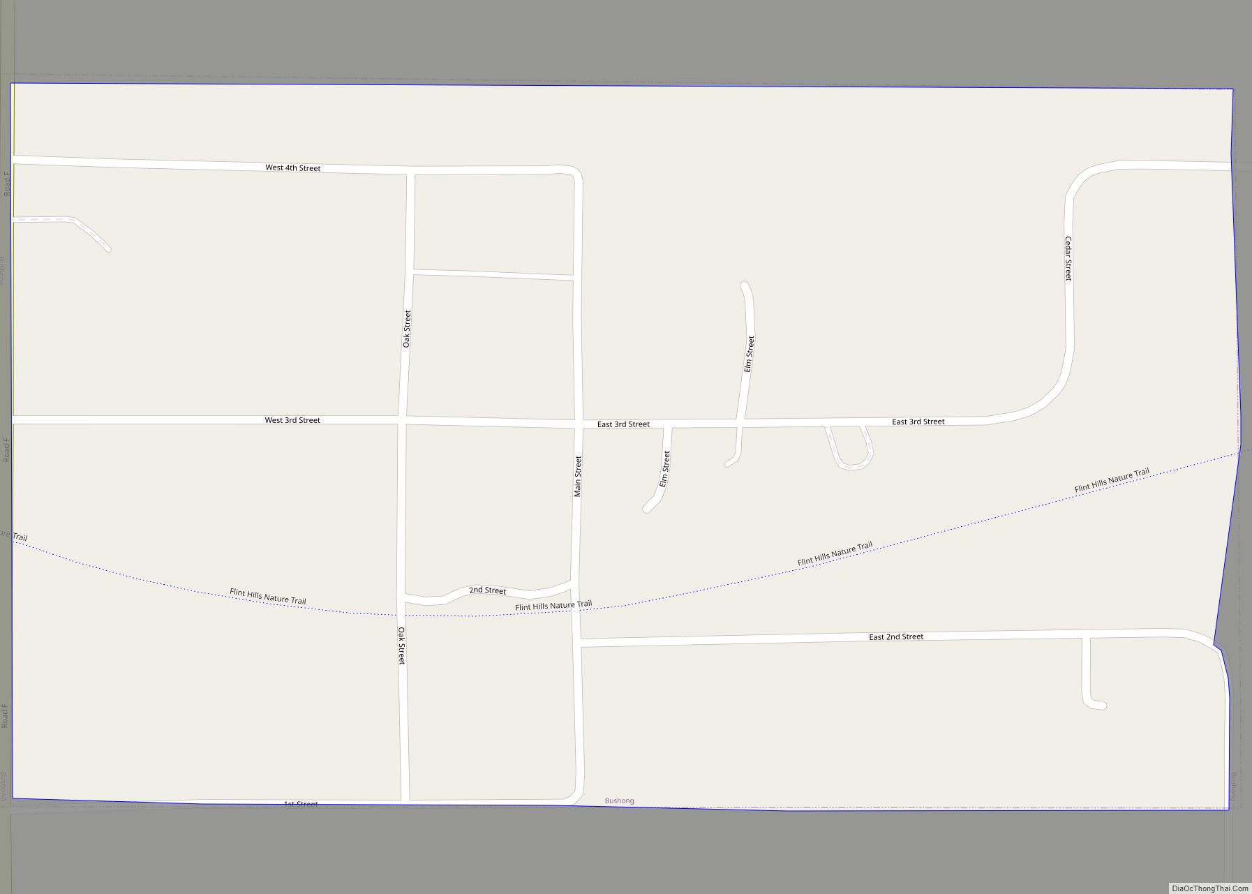
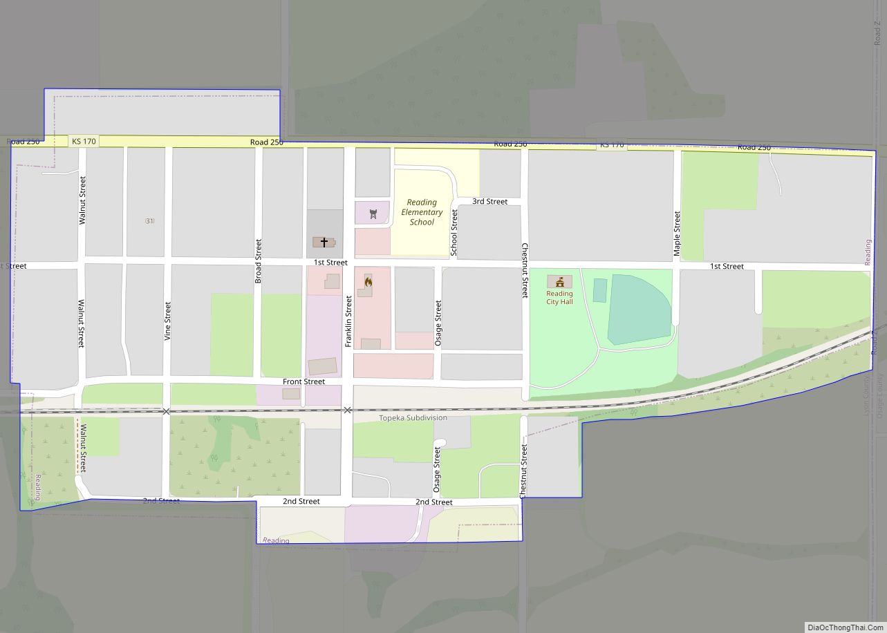
Online Interactive Map
Click on ![]() to view map in "full screen" mode.
to view map in "full screen" mode.
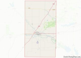
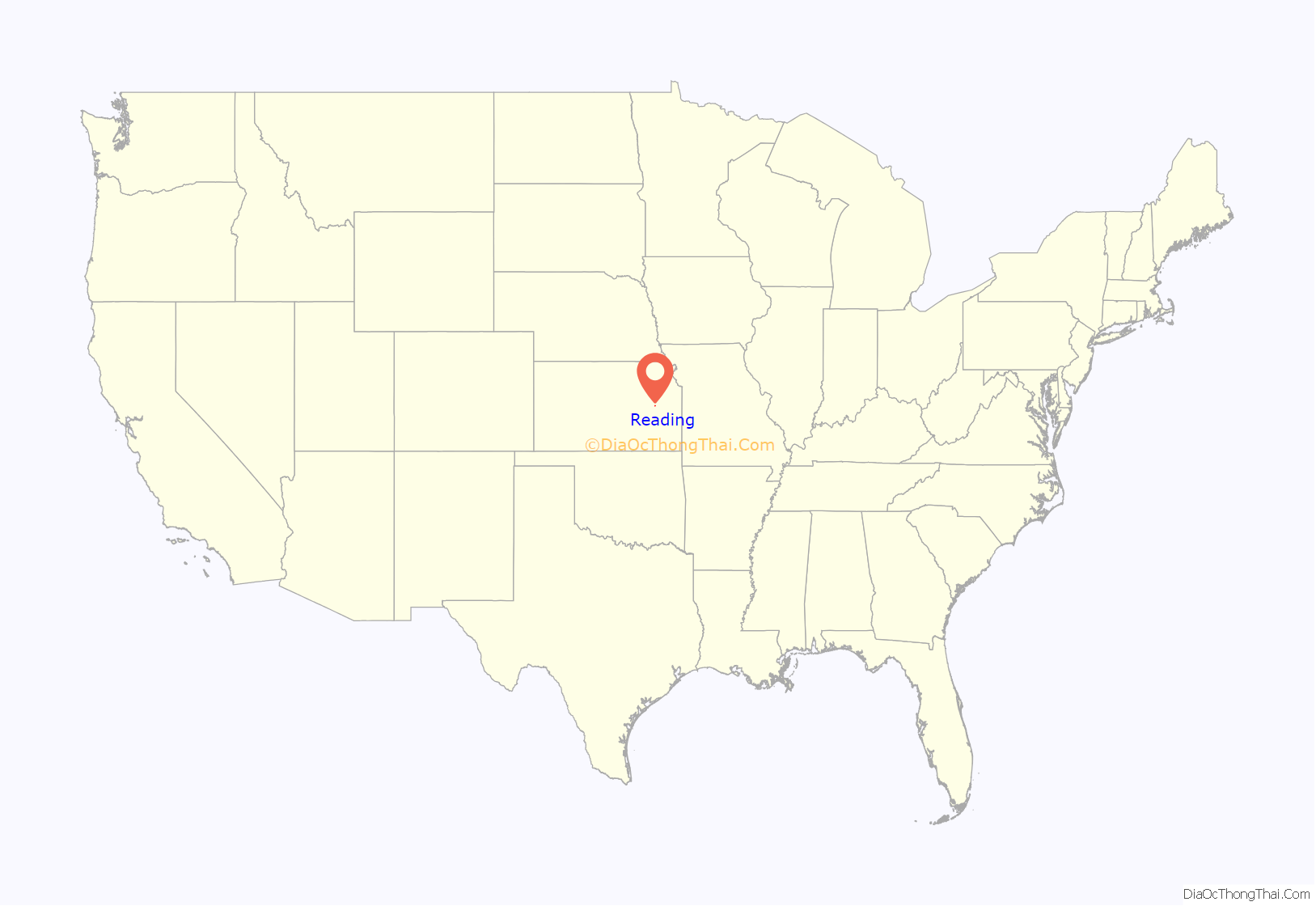
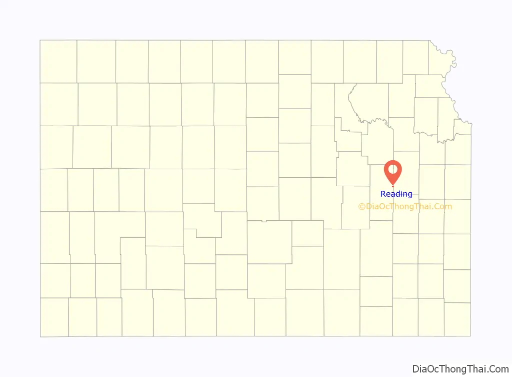
Reading location map. Where is Reading city?
History
For millennia, the land that is currently Kansas was inhabited by Native Americans. In 1803, the United States secured most of modern Kansas as part of the Louisiana Purchase. In 1854, Congress organized the Kansas Territory and in 1861, Kansas became the 34th state.
In 1863, by Act of Congress and similarly by an act of the State of Kansas, the Atchison, Topeka and Santa Fe Railway was granted 3,000,000 acres of Kansas land on the condition that it would build a continuous line to the western border of Kansas by March 1, 1873. On Oct. 30, 1868, construction began at Topeka. By Sept. 14, 1870, the first Santa Fe train reached Emporia, fifteen miles past the present site of Reading. James Fagan, agent for the railroad lands, and T. J. Peter and M. S. Sargent, who represented the railroad interest, organized a town company, with James Fagan as president. The land was owned by McMann & Co., of Reading, Pennsylvania. The town was platted on sixty acres of Section 3, Township 18, Range 13, and called it Reading, after Reading, Pennsylvania. In summer 1870, the town site was surveyed.
The first post office in Reading was established in August 1870. Reading was incorporated as a city in September 1890.
2011 tornado
On May 21, 2011 around 9:15PM, an EF3 tornado hit Reading. It was three blocks wide and stayed on the ground for about four miles. The tornado destroyed at least 56 of 110 homes and 14 of 21 businesses. The post office and fire station suffered major damage. One person died and two were hospitalized. Early damage estimates topped $2.2 million.
In just over a year, the community rebuilt itself with some help of the Federal Emergency Management Agency. The grain elevator destroyed in the tornado has been rebuilt, houses have been repaired, destroyed trees removed, and once again Reading has become a quiet place to live.
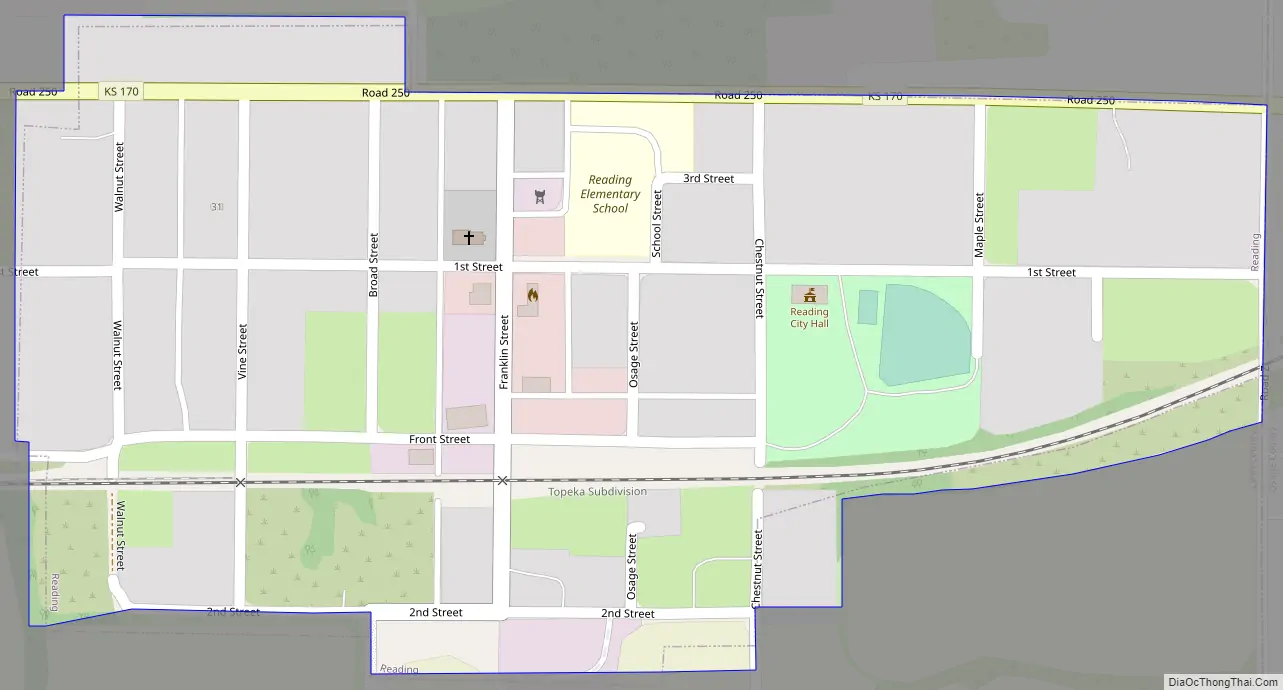
Reading Road Map
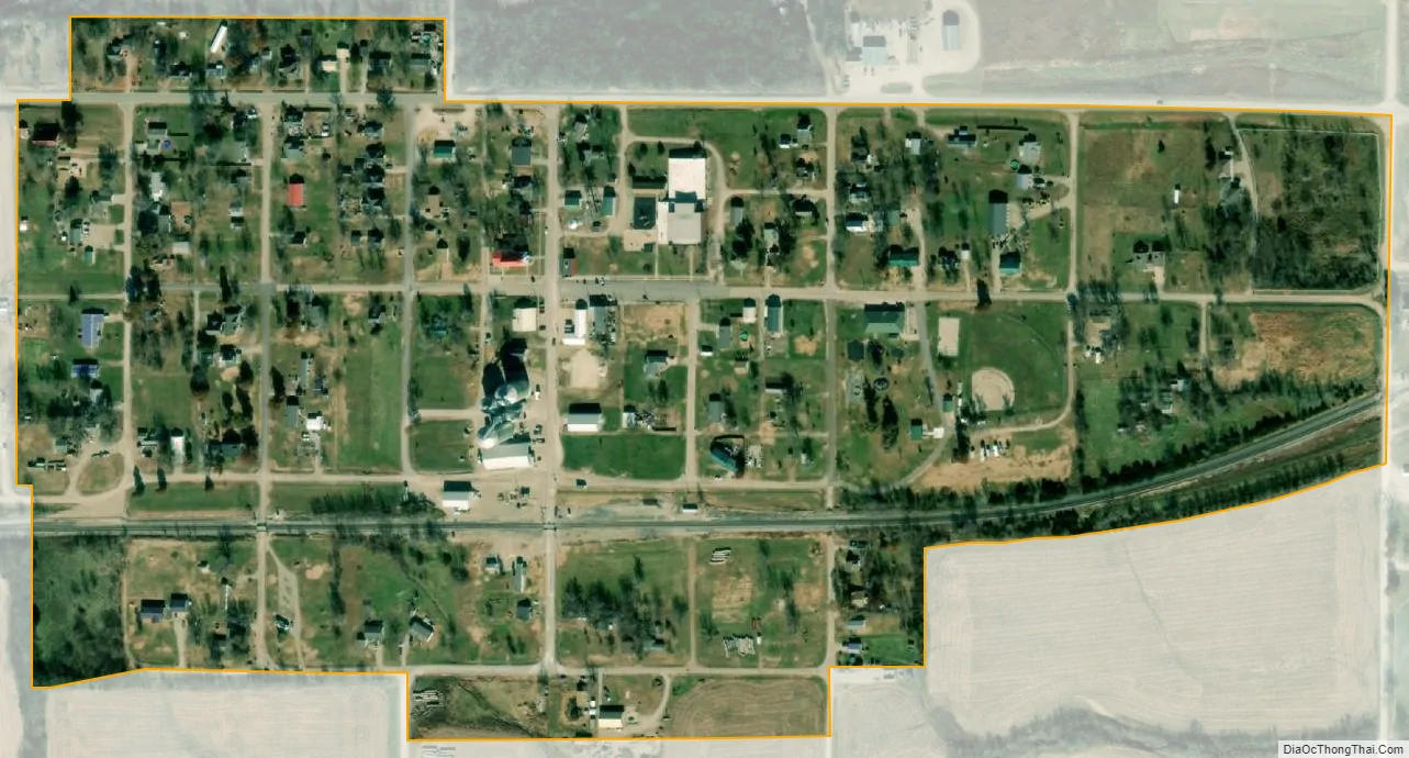
Reading city Satellite Map
Geography
Reading is located at 38°31′09″N 95°57′33″W / 38.519102°N 95.959091°W / 38.519102; -95.959091 (38.519102, -95.959091) at the eastern edge of Lyon County. It is fifteen miles northeast of Emporia and fourteen miles southwest of Osage City along Highway 170. According to the United States Census Bureau, the city has a total area of 0.20 square miles (0.52 km), all of it land.
Climate
The climate in this area is characterized by hot, humid summers and generally mild to cool winters. According to the Köppen Climate Classification system, Reading has a humid subtropical climate, abbreviated “Cfa” on climate maps.
See also
Map of Kansas State and its subdivision:- Allen
- Anderson
- Atchison
- Barber
- Barton
- Bourbon
- Brown
- Butler
- Chase
- Chautauqua
- Cherokee
- Cheyenne
- Clark
- Clay
- Cloud
- Coffey
- Comanche
- Cowley
- Crawford
- Decatur
- Dickinson
- Doniphan
- Douglas
- Edwards
- Elk
- Ellis
- Ellsworth
- Finney
- Ford
- Franklin
- Geary
- Gove
- Graham
- Grant
- Gray
- Greeley
- Greenwood
- Hamilton
- Harper
- Harvey
- Haskell
- Hodgeman
- Jackson
- Jefferson
- Jewell
- Johnson
- Kearny
- Kingman
- Kiowa
- Labette
- Lane
- Leavenworth
- Lincoln
- Linn
- Logan
- Lyon
- Marion
- Marshall
- McPherson
- Meade
- Miami
- Mitchell
- Montgomery
- Morris
- Morton
- Nemaha
- Neosho
- Ness
- Norton
- Osage
- Osborne
- Ottawa
- Pawnee
- Phillips
- Pottawatomie
- Pratt
- Rawlins
- Reno
- Republic
- Rice
- Riley
- Rooks
- Rush
- Russell
- Saline
- Scott
- Sedgwick
- Seward
- Shawnee
- Sheridan
- Sherman
- Smith
- Stafford
- Stanton
- Stevens
- Sumner
- Thomas
- Trego
- Wabaunsee
- Wallace
- Washington
- Wichita
- Wilson
- Woodson
- Wyandotte
- Alabama
- Alaska
- Arizona
- Arkansas
- California
- Colorado
- Connecticut
- Delaware
- District of Columbia
- Florida
- Georgia
- Hawaii
- Idaho
- Illinois
- Indiana
- Iowa
- Kansas
- Kentucky
- Louisiana
- Maine
- Maryland
- Massachusetts
- Michigan
- Minnesota
- Mississippi
- Missouri
- Montana
- Nebraska
- Nevada
- New Hampshire
- New Jersey
- New Mexico
- New York
- North Carolina
- North Dakota
- Ohio
- Oklahoma
- Oregon
- Pennsylvania
- Rhode Island
- South Carolina
- South Dakota
- Tennessee
- Texas
- Utah
- Vermont
- Virginia
- Washington
- West Virginia
- Wisconsin
- Wyoming