Scott City is a city in and the county seat of Scott County, Kansas, United States. As of the 2020 census, the population of the city was 4,113.
| Name: | Scott City city |
|---|---|
| LSAD Code: | 25 |
| LSAD Description: | city (suffix) |
| State: | Kansas |
| County: | Scott County |
| Founded: | 1885 |
| Incorporated: | 1887 |
| Elevation: | 2,979 ft (908 m) |
| Total Area: | 2.71 sq mi (7.03 km²) |
| Land Area: | 2.71 sq mi (7.03 km²) |
| Water Area: | 0.00 sq mi (0.00 km²) |
| Total Population: | 4,113 |
| Population Density: | 1,500/sq mi (590/km²) |
| ZIP code: | 67871 |
| Area code: | 620 |
| FIPS code: | 2063600 |
| Website: | scottcityks.org |
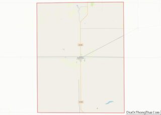
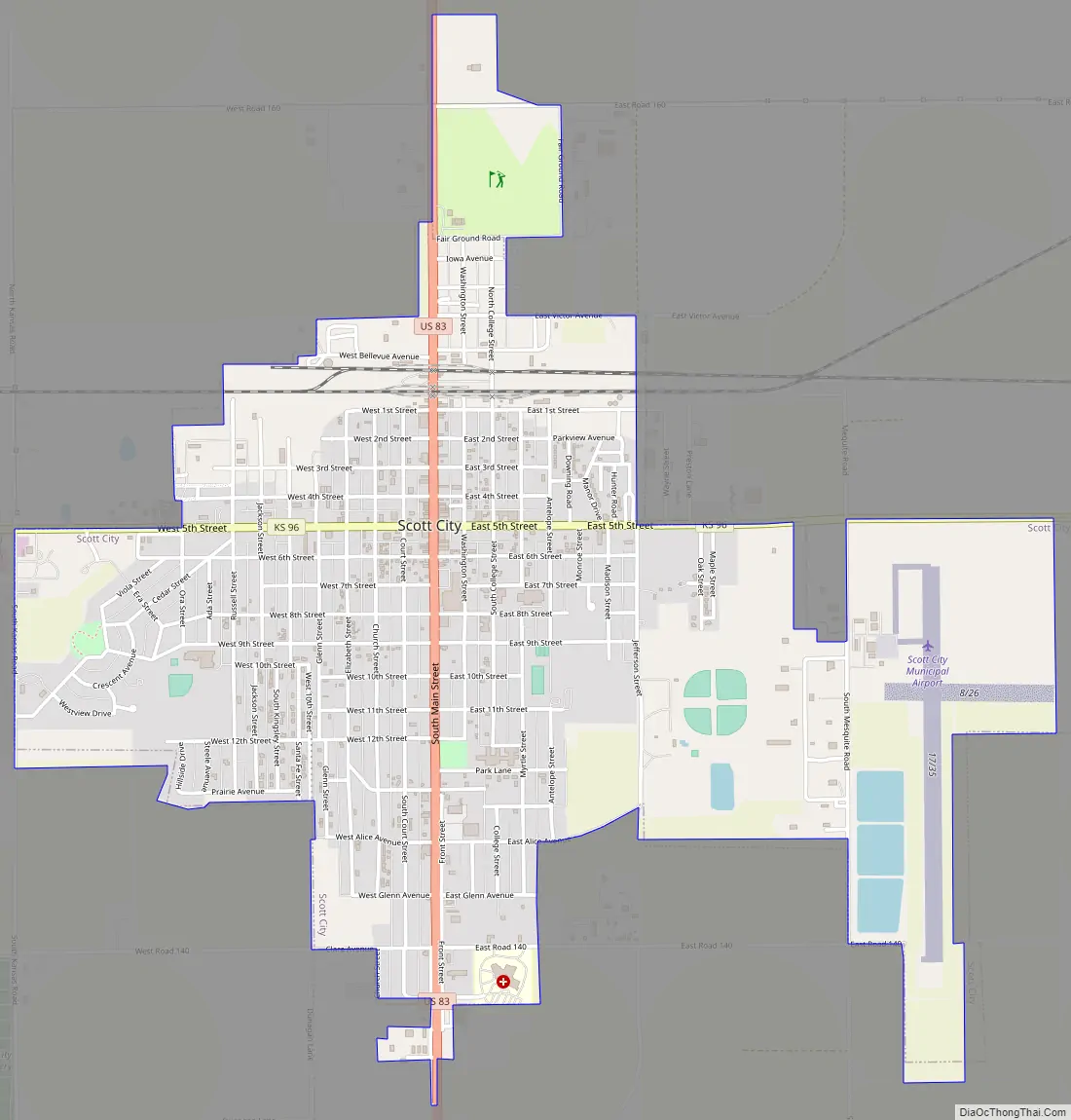
Online Interactive Map
Click on ![]() to view map in "full screen" mode.
to view map in "full screen" mode.
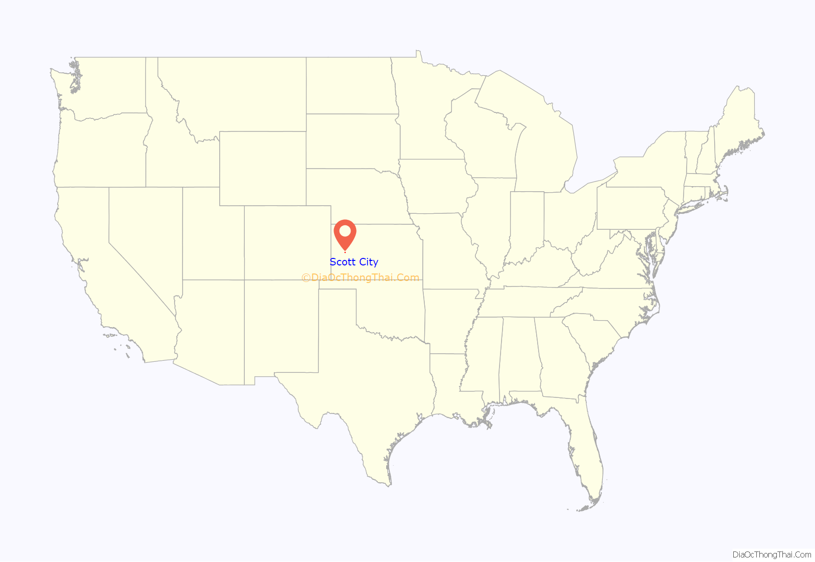
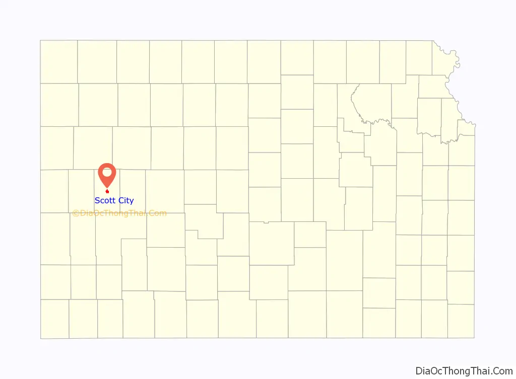
Scott City location map. Where is Scott City city?
History
Early history
For millennia, the Great Plains of North America were inhabited by nomadic Native Americans. From the 16th to 18th centuries, the Kingdom of France claimed ownership of large parts of North America. In 1762, after the French and Indian War, France secretly ceded New France to Spain, by the Treaty of Fontainebleau.
19th century
In 1802, Spain returned most of the land to France, keeping title to about 7,500 square miles. In 1803, most of the land for modern day Kansas was acquired by the United States from France as part of the 828,000 square mile Louisiana Purchase. In 1854, the Kansas Territory was organized under the provisions of the Kansas–Nebraska Act, then in 1861 Kansas became the 34th U.S. state. In 1873, Scott County was established, which included the land for modern day Scott City.
Scott City was founded in 1885. Like Scott County, the city is named in recognition of a United States General, Winfield Scott. In October 1884, two women from Chicago, Illinois claimed the land that Scott City is on and built a cabin. The following February, two men from Chicago came to the cabin and settled. Soon after, many people started arriving in the county and Scott City was then founded in 1885. Before being founded, Mrs. M.E. De Geer, one of the women that came from Chicago, started a newspaper called the Western Times in March 1885. The county then started to fill rapidly.
Scott County was legally instituted in 1873 by an act of legislature. At this time it was named in honor of General Winfield Scott. Since it was such a small town with a small population, there was no need for a local government. Therefore, it was connected to Ford County for judicial matters.
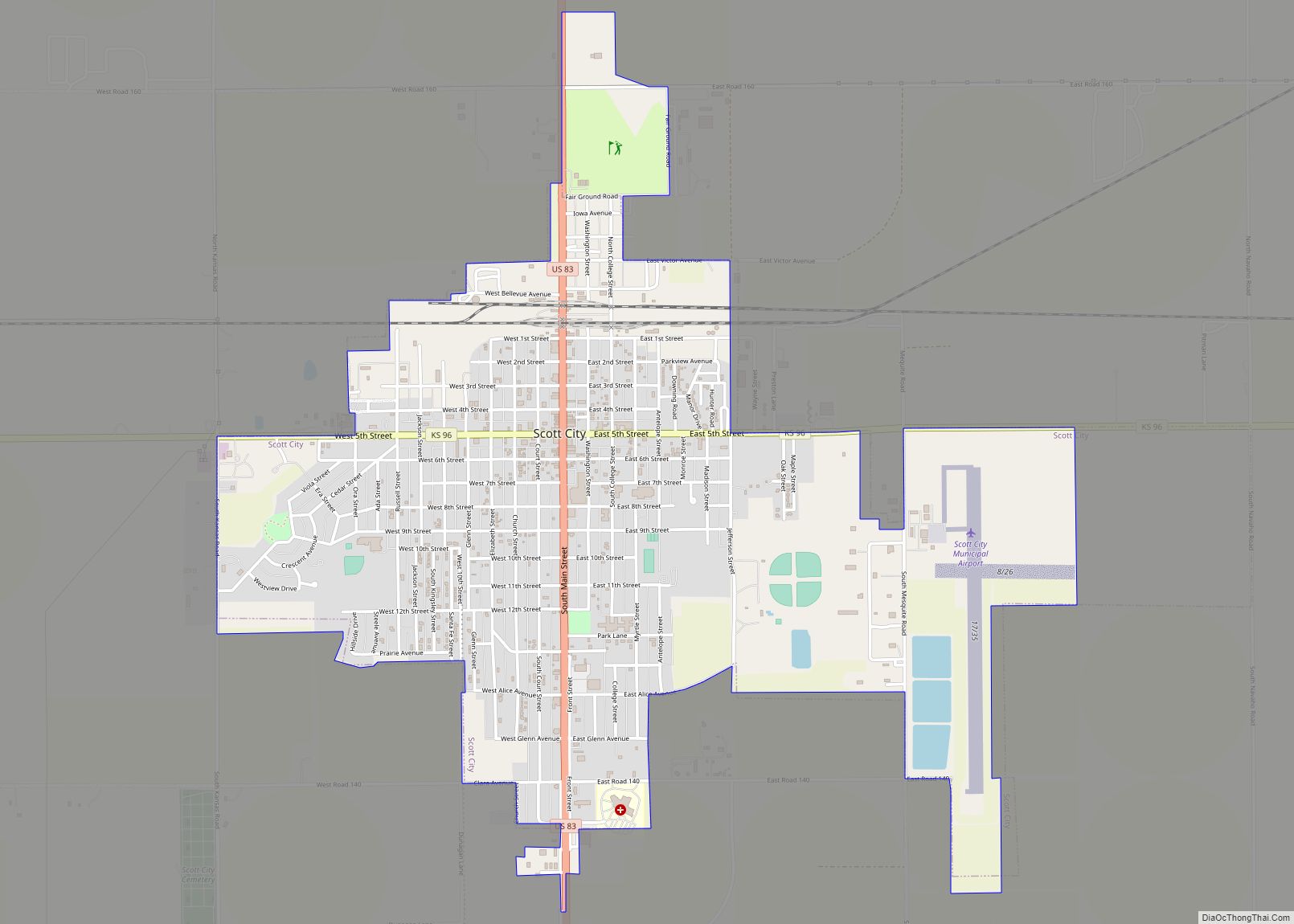
Scott City Road Map
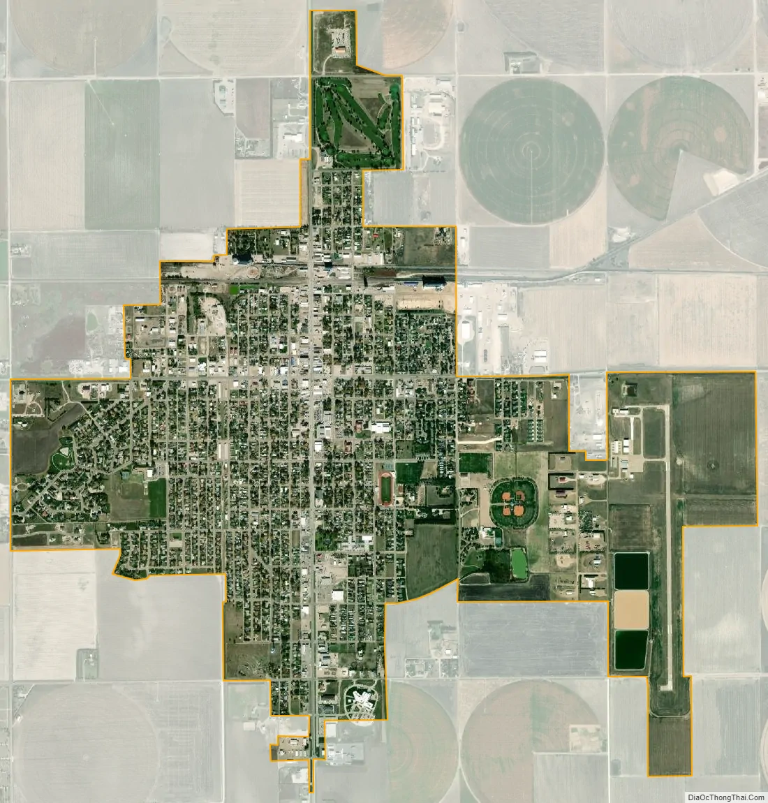
Scott City city Satellite Map
Geography
According to the United States Census Bureau, the city has a total area of 2.63 square miles (6.81 km), all land. It is located in the Great Plains and at the elevation of 2979 ft.
Climate
According to the Köppen Climate Classification system, Scott City has a semi-arid climate, abbreviated “BSk” on climate maps. The average temperature is 52.4 °F (11.34 °C) and has an average rain fall of 20.16 inches a year. The average snow fall for a year is 23 in. (.58 m).
See also
Map of Kansas State and its subdivision:- Allen
- Anderson
- Atchison
- Barber
- Barton
- Bourbon
- Brown
- Butler
- Chase
- Chautauqua
- Cherokee
- Cheyenne
- Clark
- Clay
- Cloud
- Coffey
- Comanche
- Cowley
- Crawford
- Decatur
- Dickinson
- Doniphan
- Douglas
- Edwards
- Elk
- Ellis
- Ellsworth
- Finney
- Ford
- Franklin
- Geary
- Gove
- Graham
- Grant
- Gray
- Greeley
- Greenwood
- Hamilton
- Harper
- Harvey
- Haskell
- Hodgeman
- Jackson
- Jefferson
- Jewell
- Johnson
- Kearny
- Kingman
- Kiowa
- Labette
- Lane
- Leavenworth
- Lincoln
- Linn
- Logan
- Lyon
- Marion
- Marshall
- McPherson
- Meade
- Miami
- Mitchell
- Montgomery
- Morris
- Morton
- Nemaha
- Neosho
- Ness
- Norton
- Osage
- Osborne
- Ottawa
- Pawnee
- Phillips
- Pottawatomie
- Pratt
- Rawlins
- Reno
- Republic
- Rice
- Riley
- Rooks
- Rush
- Russell
- Saline
- Scott
- Sedgwick
- Seward
- Shawnee
- Sheridan
- Sherman
- Smith
- Stafford
- Stanton
- Stevens
- Sumner
- Thomas
- Trego
- Wabaunsee
- Wallace
- Washington
- Wichita
- Wilson
- Woodson
- Wyandotte
- Alabama
- Alaska
- Arizona
- Arkansas
- California
- Colorado
- Connecticut
- Delaware
- District of Columbia
- Florida
- Georgia
- Hawaii
- Idaho
- Illinois
- Indiana
- Iowa
- Kansas
- Kentucky
- Louisiana
- Maine
- Maryland
- Massachusetts
- Michigan
- Minnesota
- Mississippi
- Missouri
- Montana
- Nebraska
- Nevada
- New Hampshire
- New Jersey
- New Mexico
- New York
- North Carolina
- North Dakota
- Ohio
- Oklahoma
- Oregon
- Pennsylvania
- Rhode Island
- South Carolina
- South Dakota
- Tennessee
- Texas
- Utah
- Vermont
- Virginia
- Washington
- West Virginia
- Wisconsin
- Wyoming